


A relatively gentle hike with no major technical challenges along a tree-protected trail leads to one of the most aesthetically pleasing summits in the Whites.
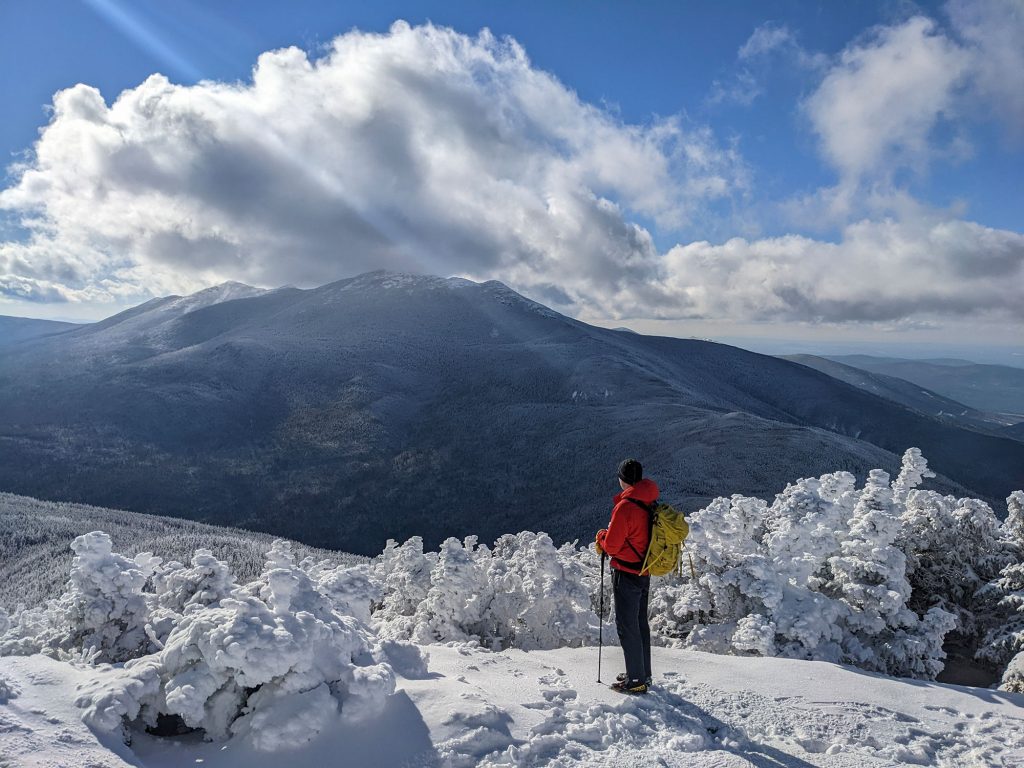
Mount Garfield belongs on every hiker’s winter to-do list thanks to its easy accessibility, done-in-a-day mileage, lack of technical obstacles, and above-treeline summit. From Garfield’s peak, hikers can take in stellar views of Franconia Ridge, the Twins, and the Bonds in the foreground, and Mount Washington and Kilkenny Ridge looming in the distance. If winter weather is uncooperative, the foundation of an old summit fire tower provides a reprieve.
Quick Facts
Distance: 12.4 miles, round-trip
Time to Complete: Full day for most
Difficulty: ★★★
Scenery:★★★★
Fees/Permits: None
Contact: https://www.fs.usda.gov/recarea/whitemountain/recarea/?recid=74637
Getting There
Since the Gale River Loop Road is typically closed from late November through April, the winter trailhead for Garfield is a small parking lot at the intersection of Route 3 and the western terminus of the Gale River Loop Road. Getting there from I-93 is easy: take Exit 35 and follow Route 3 for several miles. A minute or two of driving after the Mount Cleveland picnic area, look for the pull-off for the Gale River Loop Road on your right. (If the gate at the end of the parking lot is open and the road appears passable, follow the Gale River Loop Road for 1.2 miles to the summer trailhead for the Garfield Trail.)
Turn-By-Turn
Assuming you are starting at the winter trailhead, the first step to get up Garfield is to hike along the Gale River Loop Road for 1.2 miles. The road is flat and the hiking is easy, although depending on the snowpack, microspikes are often useful.
Almost a half-mile down the Loop Road, another fire road branches off to the left. Stay straight. The Loop Road makes a sharp left just as it approaches Garfield’s summer trailhead, crossing a bridge over the South Branch of the Gale River. The signed trailhead for the Garfield Trail will be on your right just after the bridge. If you continue too far, you’ll end up in Garfield’s summer parking lot.
Some Mellow Miles
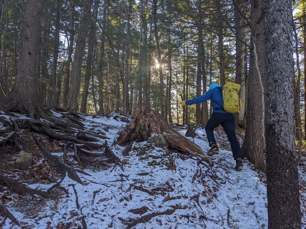
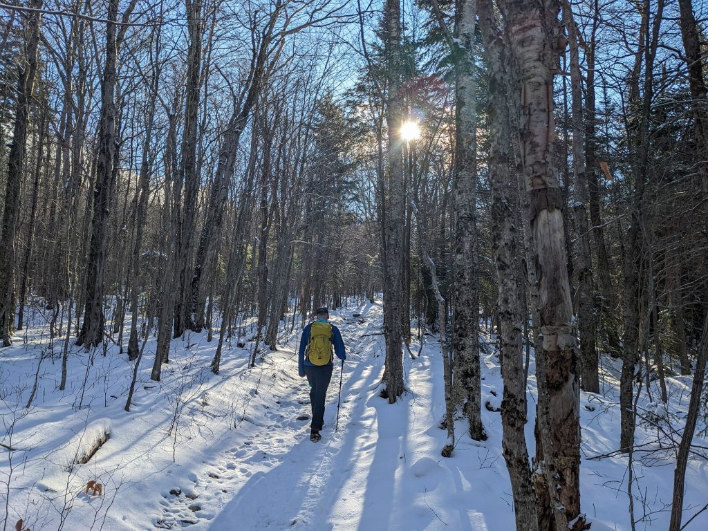
From the summer trailhead, the Garfield Trail climbs a small incline, then traverses along a high embankment, with the South Branch of the Gale River audible below. Follow the Garfield Trail’s blue rectangle blazes as it climbs imperceptibly through this mature open forest.
This early section of the Garfield Trail is fairly straightforward, with only two sections that warrant a mention. One is where the Garfield Trail crosses a small brook three times in quick succession. The water here is usually quite low and trekking poles help on the icy rock crossings. The other is when the Garfield Trail intersects with a snow machine trail. Stay straight at the intersection, following the Garfield Trail’s blue blazes.
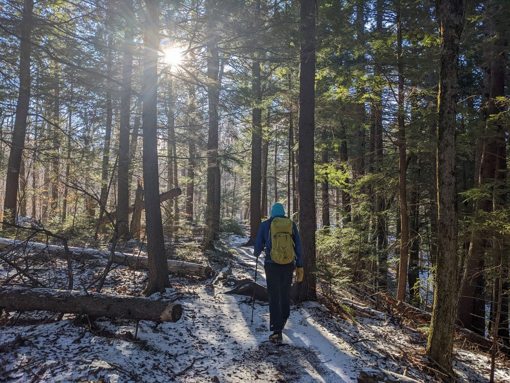
Through the early miles, the Garfield Trail is almost double-wide, following the remnants of an old road that used to access a now-removed fire tower atop Garfield.
The Vertical Begins
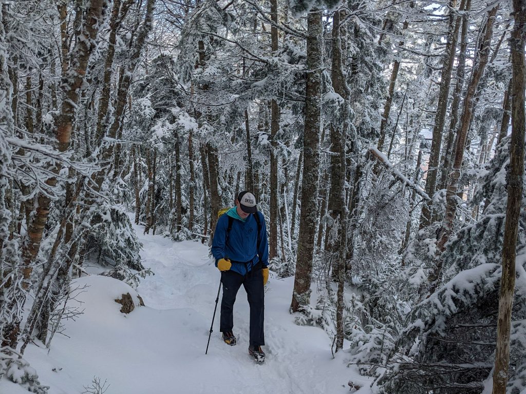
About one mile from the summer trailhead (near the 2,200-foot contour line), the Garfield Trail makes a sharp dogleg left. From here, the incline increases marginally, climbing at a gradual but consistent rate for the next three-plus miles to a col as the trail starts to narrow, with nature reclaiming the outer portions of the old access road.
Along the way, the trail is pleasant—meandering uphill through a winter wonderland. The snow-covered trees occasionally open up, offering views of, among other things, Flat Top Mountain to the east (hikers’ left) and Garfield itself (ahead and to hikers’ right).
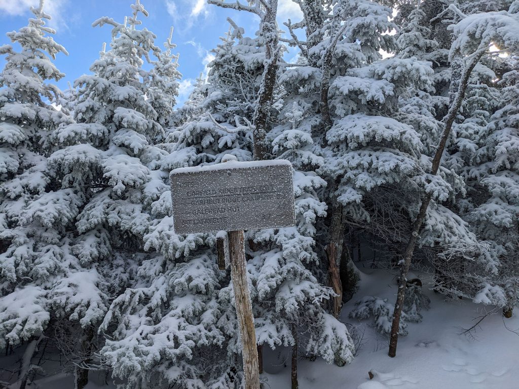
After a series of mellow switchbacks, the Garfield Trail wraps around the east side of the summit proper. At the 4.8-mile mark from the summer trailhead (six miles from the winter lot), the Garfield Trail spills out into the col at the junction of the Garfield Ridge Trail and Garfield Trail.
Since the trees surrounding the col provide a natural weather break, the trail junction is a great place to pause, have a snack, and don some extra layers for the final summit push. From the col, it’s just a short but steep 0.2 miles to the summit.
The Final Push
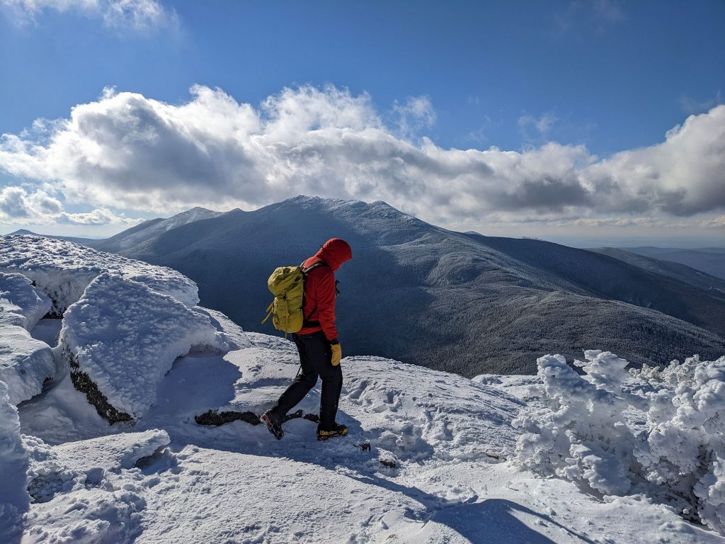
For hikers accustomed to the pleasant grades and easy footing of the Garfield Trail, the Garfield Ridge Trail (GRT) will be a rude awakening. Steep, rocky, and narrow, the GRT climbs 0.2 miles from the col, popping out of the trees just below Garfield’s summit. From here, scramble up the summit slabs to Garfield’s open summit.
The 360-degree views from Garfield’s summit are among the best in the Whites. To the south, the Pemigewasset Wilderness spills out, hemmed in on the east by the Bonds and the west by Franconia Ridge (a wonderful winter challenge in its own right). Looking east, Galehead sits in the foreground, with the Twins looming behind it. Further east, the Presidential range occupies the horizon. When your gaze turns north, the many summits along the Kilkenny Ridge are easy to pick out.
In addition to having great views, Garfield’s summit is notoriously windy. Fortunately, the summit has a windbreak of sorts—the rectangular foundation of the fire tower that used to stand atop the summit. Just hop inside and hide from the wind!
The Descent
While the hike itself is long, getting off Garfield is pretty easy. Just retrace your steps along the GRT to the col, then follow the Garfield Trail to the summer trailhead and the Gale River Loop Road back to your vehicle.
For those interested in overnighting on Garfield, the Garfield Ridge Shelter and Campsite is 0.2 miles east along the GRT from the col. Although this is a popular shoulder-season overnight trip, just remember to pack accordingly—the campsite is up pretty high (near 4,000 feet) and the nights can be chilly.
The Kit
- Conditions on Mount Garfield can be icy right from the car and continue all the way to the summit—a set of spikes, like EMS Ice Talons, provide valuable traction and pack small so as to not take up much pack space when not needed.
- Above-treeline winter objectives, like Mount Garfield, call for warm footwear—La Sportiva Nepal Cubes (men’s/women’s) are a long-standing favorite of White Mountain hikers, climbers, and mountaineers.
- A puffy coat, like the EMS Feather Pack Jacket (men’s/women’s), is the fixture of a four-season hiking kit and can deliver a warm embrace while doing everything from getting ready at the car to grabbing a mid-hike snack to taking in stellar summit views.
- It can get frigid on Mount Garfield, especially when standing on its exposed summit in winter—a collection of cold-weather accessories can help keep cold at bay. Consider carrying a warm set of mittens (EMS men’s and women’s Ascent Summit Mittens), winter hat (Turtle Fur Chelonia 150 Double Layer Fleece Hat), neck gaiter (Turtle Fur Chelonia 150 Double Layer Neck Warmer), and balaclava (Outdoor Research Tundra Aerogel Balaclava).
- Pack a thermos, like the Hydro Flask 24 oz. Standard Mouth, of something warm to sip on the summit while you take in the magnificent 360-degree view.
- The sun sets early in winter and a headlamp, such as the Black Diamond Spot 400, is an easy and affordable precaution if you get benighted.
- Accidents happen and it’s important to prepare for them. Consider adding an AMK Sol Thermal Bivy to your kit, just in case you need to wait for a rescue, help a fellow hiker, or spend an unplanned evening out.
Keys to the Trip
- Gale River Loop Road is usually closed in winter. For wintry conditions without the extra slog, go in November when the road is still open but the conditions up high are already snowy.
- Garfield’s summit views are among the best in the Whites, but also among the chilliest. Don your warmest gear in the trees so you can comfortably enjoy the summit.
- Fuel up for your hike with a breakfast sandwich and steaming-hot brew from Moon Bakery and Cafe, one of the best coffee shops in the Whites.
- A 12-mile winter hike is guaranteed to burn lots of calories. Stop by Wayne’s Market in nearby Woodstock to refuel on some of the best sandwiches around. (Pro tip: Their beer selection is top-notch, too!)
- The weather app on your phone and local news are poor sources for mountain weather; rather, check out the higher summits forecast from the Mount Washington Observatory for a better idea of what kind of conditions to expect.
Current Conditions
Have you hiked Garfield recently? Post about your experience and any tips you have in the comments for others!
Related Posts


