


Three high peaks and arguably the best view in the Catskills make a winter traverse of the Burroughs Range one of the finest day hikes in the Northeast.
Alongside the Devil’s Path and the Escarpment Trail, the Burroughs Range Trail (also known as the Wittenberg–Cornell–Slide Trail) is one of the most enjoyable—and justifiably popular—routes in the Catskills. Over its 9.8 miles, it traces the highest ridgeline in the 47,500-acre Slide Mountain Wilderness—the Catskills’ largest wilderness area—traversing three distinct high peaks in the process: the Wittenberg (locally known known as the Wittenberg, with no “Mount” or “Mountain” required) with it’s steep upper reaches and sweeping summit views; Cornell Mountain, a viewless summit accessed by a fun, semi-technical rock formation known as the Cornell Crack, and; Slide Mountain, the highest peak—and one of only two 4,000-footers—in the region.
While each mountain has its own, individual charm, the trail is invariably, characteristically Catskills—rugged terrain, steep ascents, and a wilderness feel beyond what you’d expect for somewhere so close to New York City.
Quick Facts
Distance: 9.8 miles, one-way
Time to Complete: Full day for most.
Difficulty: ★★★★
Scenery:★★★★★
Fees/Permits: None*
Contact: https://www.dec.ny.gov/lands/9150.html
*While there are no fees or permits in winter, day-use fees are applicable from mid-May to Mid October, when the campground is open.
Turn-By-Turn
This is a one-way ticket, so the first thing you’ll need to do is post a shuttle car at the Slide Mountain parking area on CR-47. From the Thruway, take exit 19 for Kingston/Rhinecliff Bridge. Follow the exit ramp to a rotary and bear right onto NY–28 west. After 30.7 miles, take a left onto CR-47 and continue for 15 miles. The Slide Mountain parking area (42.00889, -74.42756) will be on the left, just 2.0 miles after the hairpin turn.
From here, getting to the start of the trail is as simple as backtracking to NY-28, taking a right, and heading east for 7.7 miles. Take a right at Woodland Valley Road, and continue for 5.0 miles to the Woodland Valley trailhead parking area, just before the Woodland Valley State Campground’s main entrance. Find the trailhead by crossing the road and heading back east, following the red blazes to where the trail departs the campground (42.03600, -74.35665) between sites 45 and 46.
The Wittenberg
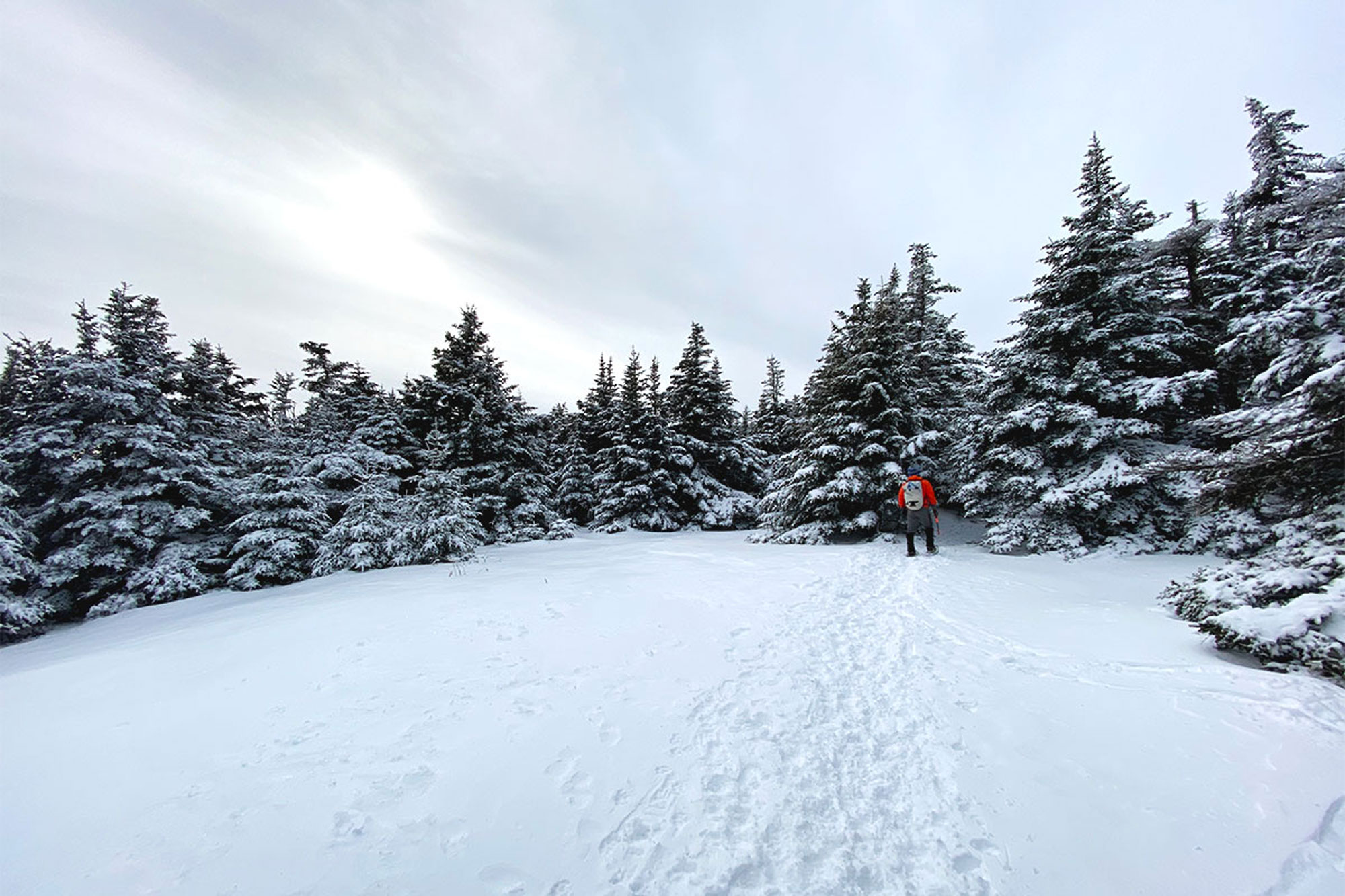
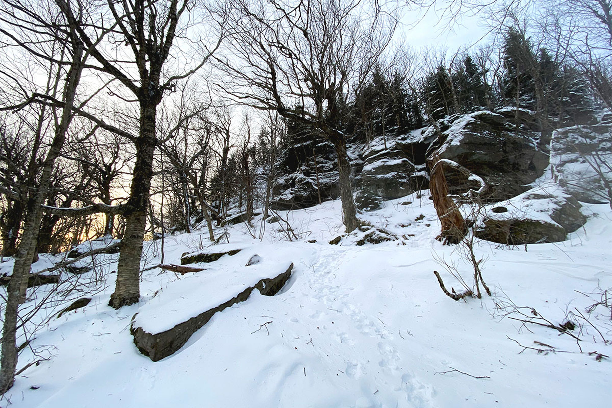
As it exits the campground, the red-blazed Burroughs Range Trail—also known as the Slide–Cornell–Wittenberg Trail—crosses a brook on a wooden footbridge and immediately begins climbing at a moderate grade, passing a trail register. This is a popular route, so unless there’s been a recent snowfall of significance, you’ll likely have a well-established snowshoe trail to follow. After 1.3 miles of moderately steep climbing through mixed hardwood forest, the grade eases a bit and the trail starts to bear left (southeast), skirting the rim of a deep ravine to the north. Giant Ledge and Panther Mountain are visible through the leafless trees.
At mile 2.6, the yellow-blazed Terrace Mountain Trail breaks off to the left (42.01869, -74.34056) as the Burroughs Range Trail takes a right. Just 0.2 miles later, the recently-constructed, blue-blazed leg of the Phoenicia–East Branch splits off the left as well.
From here, the ascent becomes steep, and the trail winds its way up and over three, successively steeper ledges, steadily gaining the Wittenberg’s upper reaches. Eventually, the grade eases slightly, and the mountain runs out of ledges to throw at you as the trees change over from mixed hardwood to densely packed pine.
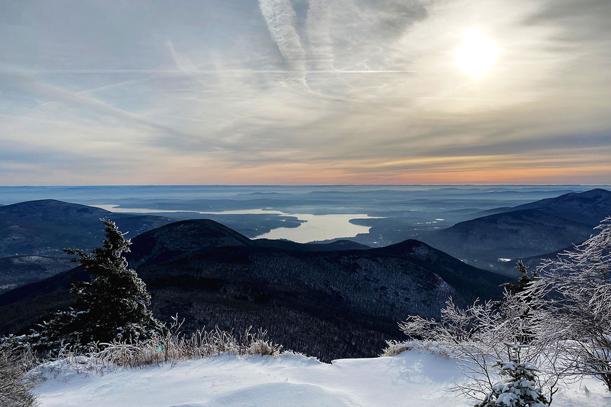
At mile 3.9, the trees give way to an open ledge (42.00839, -74.34692) and the summit of Wittenberg (3,780 feet). An extraordinary easterly view, including the mountains of the Devil’s Path and the Blackhead Range to the north, the high peaks of Friday, Balsam Cap, Peekamoose, and Table Mountains to the south, and the distinct figure of the Ashokan Reservoir front-and-center.
With a good chunk of elevation gain behind you, the open summit area is a great spot to grab a breather. Get in the lee of the wind and enjoy one of the best views in the Catskills.
Cornell
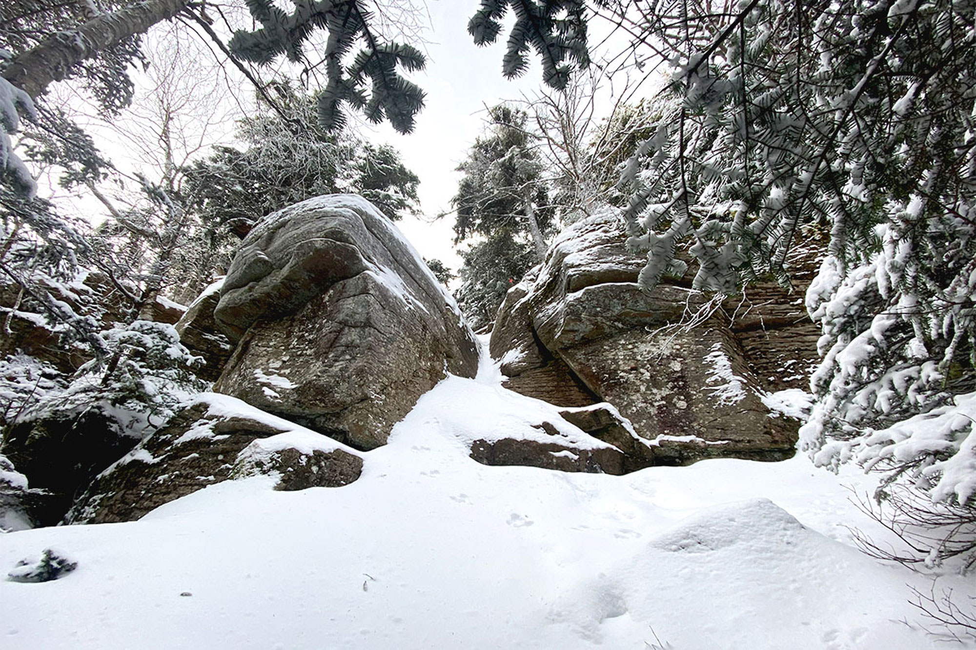
Head west across the open summit to continue on the red-blazed Burroughs Range Trail. Very quickly, the trail descends over a few icy ledges before flattening—This short but pleasant little col is commonly referred to as Bruin Causeway. At mile 4.5 the trail starts to climb again, steeply in places, until it reaches a formidable cleft in the rock known as the Cornell Crack (42.00256, -74.35564). This obstacle is tricky in the summer, but even more so in winter, when it fills with snow and ice. If you’re willing to carry them, a pair of front-point crampons and an ice axe make this a breeze.
Past the crack, at mile 4.7 the wooded summit of Cornell (3,860 feet) waits, indicated by a short spur trail to the left (42.00146, -74.35666) that offers limited views. Just beyond though, before the trail starts to descend, an open, west-facing ledge offers a preview of what’s up next: Slide.
Slide
Begin descending Cornell’s slope by continuing west, passing several excellent viewpoints. At mile 5.5 the grade eases, marking the low point of the saddle. The trail is relatively flat in this area and several designated campsites make it a great place to set-up camp for anyone looking to spend the night. The trail begins climbing again past the campsite to another good view to the northeast, gained via a short spur trail that diverges to the left. The grade increases, climbing over snow-covered wooden stairways and stone steps until the summit ledge is finally reached at mile 7.0.
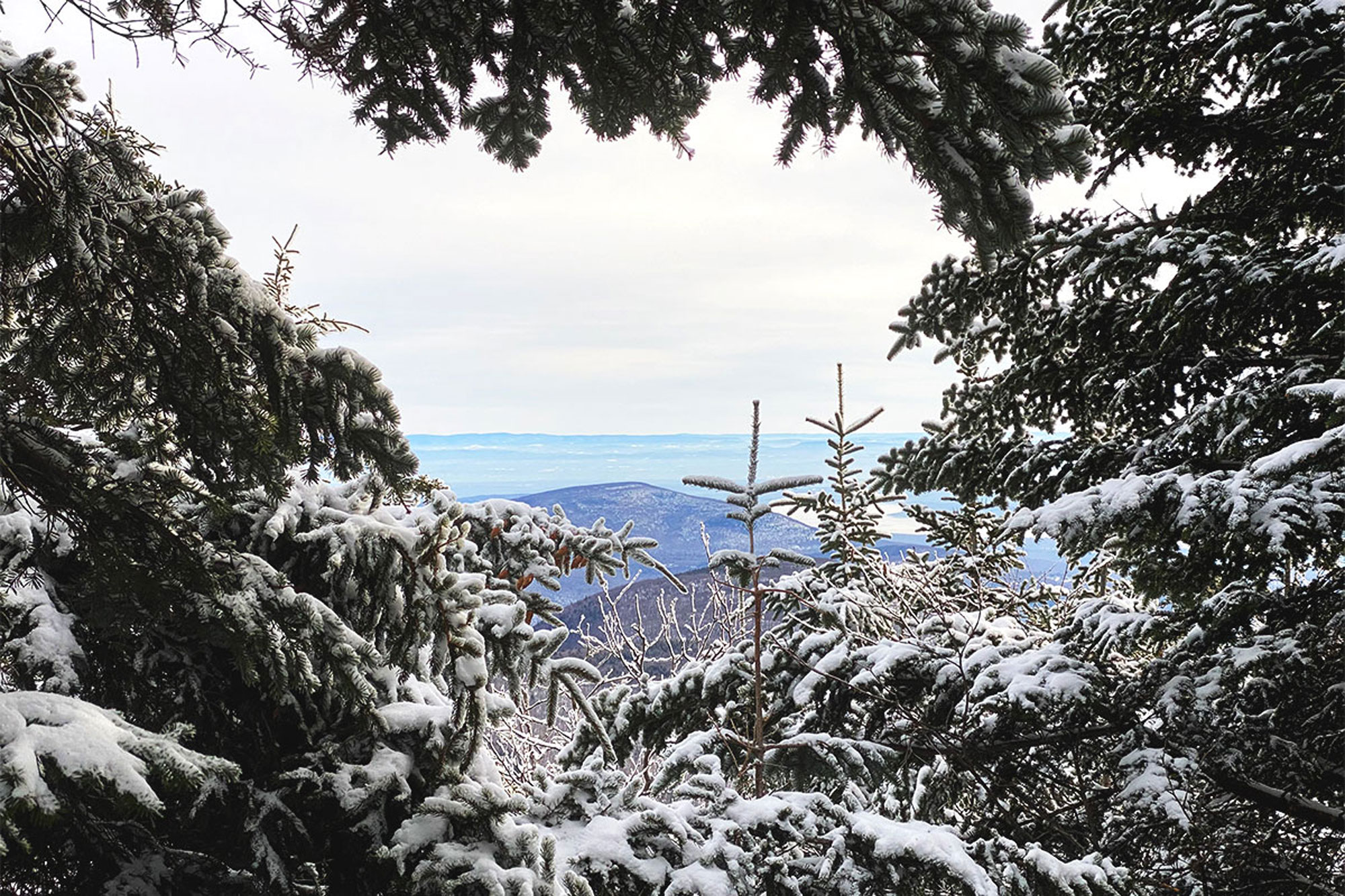
A bronze plaque celebrating the memory of the naturalist John Burroughs, for whom the range is named, marks the occasion. The summit of Slide (4,180 feet) is broad and open but with limited views (42.99892, -74.38578). Crossing the summit of Slide, the Burroughs Range Trail begins to descend very gently until another extensive view opens up to the north. Several more Catskill High Peaks are visible, including Hunter (the region’s only other 4000-footer), the Devil’s Path, the Blackhead Range, and Kaaterskill High Peak, which was at one point thought to be the highest in the region (until Slide was properly surveyed, of course).
The grade is easy and the trail is wide here, following the track of an old woods road built to service an erstwhile fire tower. At 7.7 miles, the Curtis-Ormsbee Trail—a beautiful way to climb Slide from the west—splits to the left (42.00117, -74.39668). Keep on following the red blazes of the Burroughs Range Trail until, at mile 9.1, it reaches its confluence with the yellow-blazed Phoenicia–East Branch Trail. Head right, following the Phoenicia–East Branch trail as it continues to descend another 0.7 miles in before reaching a water crossing—easy if iced-over, a bit of rock hopping if not—and the Slide Mountain parking area on CR-47 (42.00889, -74.42756).
The Kit
- The Catskills can get very cold in the winter and traversing the Burroughs Range makes for a long day in freezing temperatures. The EMS Feather Pack Hooded Jacket (men’s|women’s) is an ideal insulating layer for a trip like this—warm enough to keep the body heat up when you’re resting, packable enough to stash in the bag when you’re not.
- Some hot coffee, tea, or water in insulated thermos—like the Camelbak 20oz Hot Cap Water Bottle—won’t take up a ton of room in your pack and will make a big difference on a frigid day in the Cats.
- The upper reaches of Wittenberg and the Cornell Crack require some handwork, so bring a good pair of gloves like the Black Diamond Arc. If it’s really cold or really wet, throw some hand warmers in an extra pair of liners and toss them in your pack for later.
- Heavy annual snowfall, steep terrain, and local trail etiquette make a pair of snowshoes with climbing bars, like the MSR Lightning Ascent Snowshoes, a necessity.
- Cell service is sketchy in the Catskills at best, so a compass and a paper map are essential. The Catskill Mountains Trail Map from the Appalachian Mountain Club is waterproof and covers the whole region in detail.
Keys to the Trip
- The Slide Mountain Wilderness Area is incredibly popular with both day hikers and backpackers year-round. The crowds are a little less of an issue in winter, but—with the exception of the remote col between Cornell and Slide—it’s unlikely you’ll be on your own all that much. Please help mitigate the human impact on this area by hiking responsibly, signing in at the trail registers, and following Leave No Trace principles.
- Provided you’re comfortable starting and finishing a hike by headlamp, the Burroughs Range in winter is totally doable as a long, single day hike. Some folks do, however, opt to split this into a two-day affair, which is not a bad idea since backcountry camping above 3,500 feet is only permitted in the Catskills in winter (December 21–March 21). Be prepared to set up camp in the snow and always adhere to New York State DEC rules and guidelines.
- The range and trail are named for John Burroughs, a naturalist and advocate for the region. His 1910 essay In the Heart of the Southern Catskills details his first experiences exploring the area now known as the Slide Mountain Wilderness. It’s an interesting historical perspective and a great read to build the pre-hike excitement or to reflect maintain the buzz long after the aprés.
- Warm up after a long day in the cold with a post-hike bite at the perpetually hopping Phoenicia Diner. Think classic diner meets modern weekender. Breakfast served all day.
Current Conditions
Have you hiked the Burroughs Range Trail recently? Post your experience and the trail conditions (with the date of your hike) in the comments for others!
Related Posts


