

Rough terrain, remote locations, and harsh weather make tackling any of the Northeast’s peak-bagging lists a difficult achievement. Whether it’s the high peaks of the Adirondack 46’ers, the 4,000-footers of New England, or the summits of the Catskill 3500 Club, membership is hard-earned.
Unlike the stewards of New England and the Adirondacks, however, the Catskill Club challenges its aspirants in a different way, by requiring that four of its 35 listed peaks be gained twice—once in winter—for a total of 39 climbs. It’s a wrinkle that ups the ante and affords hikers two unique experiences on some of the region’s finest summits.
As with any winter outing, be prepared for frigid temperatures, shorter days, and potentially nasty weather. Always be sure to check the forecast and trail conditions before heading out. If you’re new to winter hiking, start here.
So which are the must-do winter climbs in New York’s southern range?
Slide Mountain
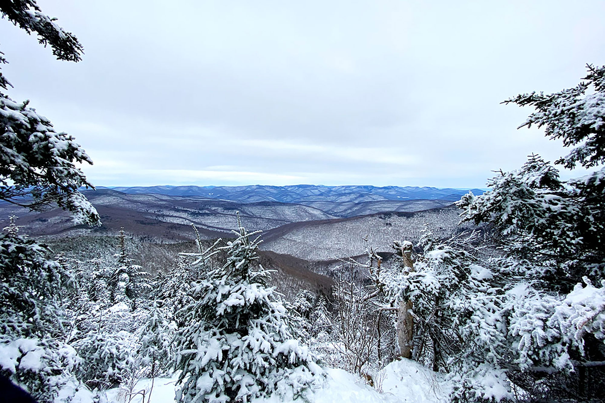
At 4,190 feet, Slide Mountain is the tallest peak in the Catskills and, together with Hunter Mountain, complete the region’s contribution to the NE115 list. It’s Slide’s superlative status that makes it a mega-popular place to be at any time of year, so be prepared to negotiate the crowds on the weekend.
On a bluebird winter weekday though, it’s about as good as it gets. The Curtis–Ormsbee Trail, though neither the most direct nor the easiest route to the top—but decidedly less crowded than the alternative—is an outstanding bit of hiking. Those willing to take on the extra effort though are rewarded with two stellar, sweeping viewpoints, from which several of the Catskills’ higher peaks are visible.
The allure of ticking another 4,000 footer—and a winter one to boot—is also hard to deny. There are a good lot of harder hikes in the Catskills, but Slide definitely has that 4,000 footer-vibe about it.
A 6.6-mile loop hike linking the Curtis–Ormsbee and Wittenberg–Cornell–Slide Trails is one of the best short hikes in the Catskills. For the more ambitious, a full traverse of the Burroughs Range—one of the region’s premier hikes—is an awesome longer (9.8 miles as a shuttle, 14.5 miles as a loop) option.
Blackhead Mountain
High and rugged, the peaks of the Blackhead Range loom large over the northeastern Catskills. From west to east, Thomas Cole, Black Dome, and the eponymous Blackhead account for the fourth-, third-, and fifth-highest mountains in the region, respectively, and are traversed by a network of well-signed, well-maintained trails.
It’s easy to see why the architects of the Catskill 3500 Club’s bylaws chose this place—and specifically Blackhead Mountain (3,940 feet)—for one of their four required winter hikes: the ice.
As winter lays siege to Blackhead’s upper reaches, the steep eastern ledges grow dense with thick, accumulated ice, making an approach from this direction substantially more challenging. In fact, the hardness of the ice and the steepness of the terrain often demand that hikers ditch the light traction for real-deal crampons—a pretty unique requirement for a day hike in the Northeast.
The most popular way to bag Blackhead is by way of a 4.3-mile loop from the parking area at the end of Big Hollow Road on the Batavia Kill, Escarpment, Blackhead Mountain and Black Dome Range Trails. Doing it clockwise will have you ascending the heavy ice and descending on gentler ground with prolific views of Black Dome, the best on the hike.
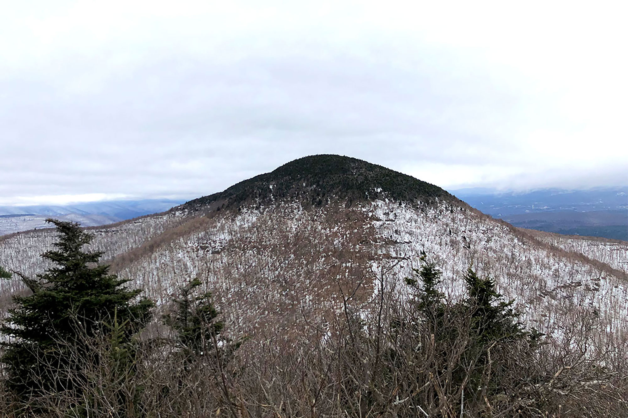
Panther Mountain
Panther Mountain (3,730 feet) and its north–south running ridgeline are best known for offering some of the best views in the Catskills. For better or worse, this is a widely known fact, and a nice weekend day can draw a crowd, particularly at Giant Ledge, a bit south of Panther’s summit.
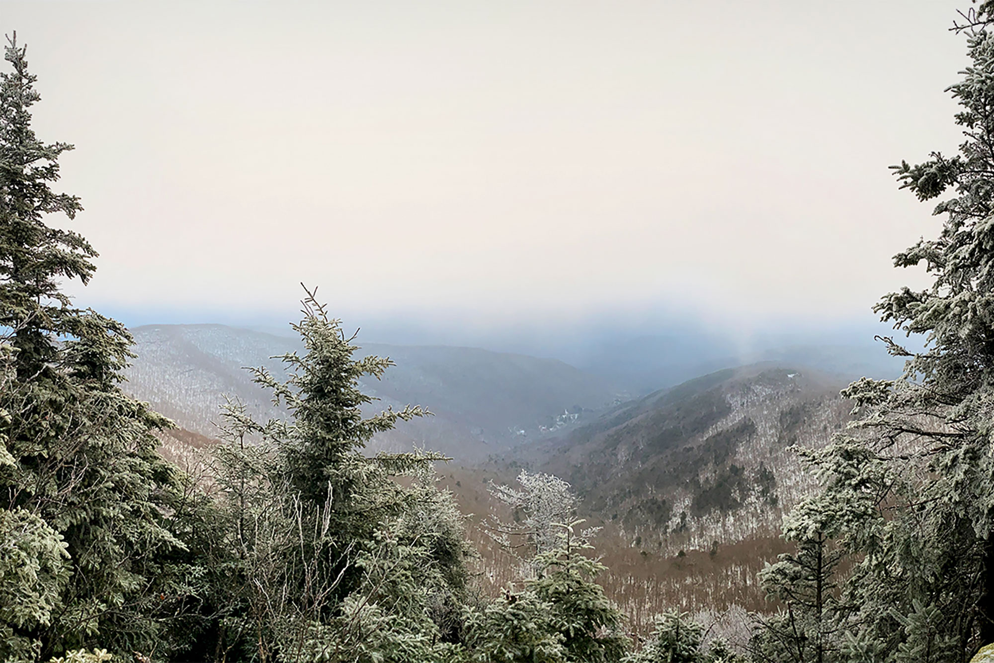
The snow and ice of winter will thin the crowds a bit, especially past Giant Ledge where the higher-precip years, snow can really pile up enough in the col that even the most intrepid post-holer will turn back (hint: bring snowshoes). Beyond, the moderate ascent is made easier with a good snowpack. Some ledge work will still need to be negotiated and switching between spikes and snowshoes will add some time to the trip, but that’s winter hiking for you.
The terrain is generally moderate and enjoyable, but this hike is all about the views—views that are magnified with winter’s absence of leaves. Unlike in leaf-out season you can really feel the scale of the place the whole time—not just at the viewpoints.
The most direct route up Panther—a 6.4 mile out-and-back on the Phoenicia–East Branch and Giant Ledge–Panther–Fox Hollow Trails—can be made from the south, starting at the hairpin turn on CR-47. A northern approach from Fox Hollow, with a substantial view just before the summit offers a longer (8.8-mile), far-less-traveled option for those looking to avoid the crowds.
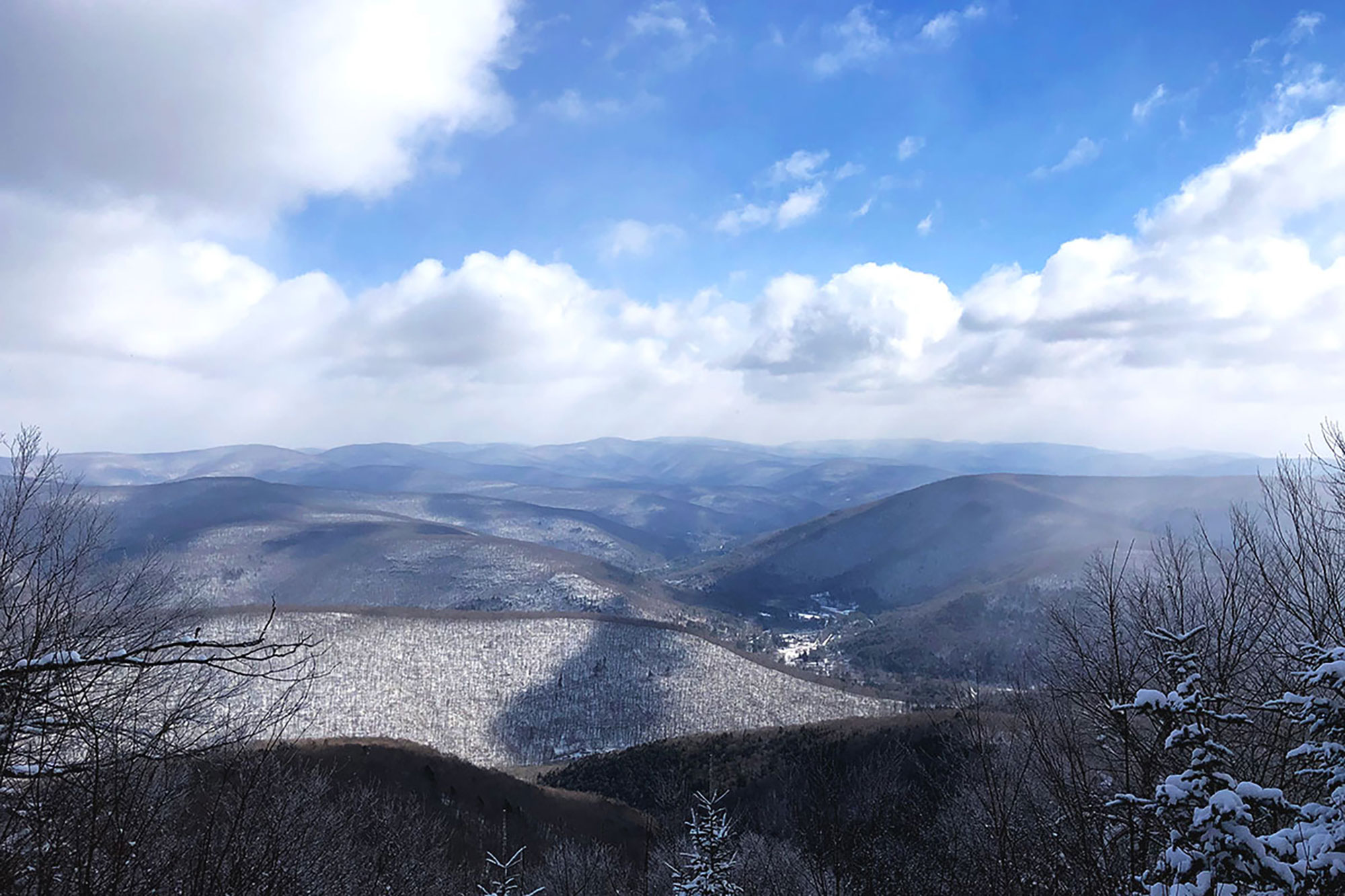
Balsam Mountain
Balsam Mountain (3,600 feet), in the Catskills’ Big Indian Wilderness Area is the shortest and most westerly of the required winter 35’ers. Though the summit itself is viewless, a little ledge just to the north offers an outstanding easterly view, and the broad, flat character of the ridge makes for a pleasant, relaxing stroll—all the better with a good snowpack.
The main attraction of Balsam, however, is its location. Proximity to easily accessible trailheads, shelters, and other high peaks make it a great mountain to revisit: alone, as a day hike, or as a longer, overnight trip by linking up with the semi-trailed Eagle and Big Indian Mountains to the south.
Despite its generally moderate grades, winter on Balsam presents would-be summiteers with yet another unique seasonal challenge: water crossings. Climate change certainly hasn’t made mountain weather any more predictable and unseasonable thaws can cause high water, making even the simplest of brook crossings a challenge. Be adequately prepared and know when to turn around.
Beginning at the Rider Hollow Road trailhead and linking the Mine Hollow, Pine Hill–West Branch, and Olivrea–Mapledale Trails makes for an excellent 4.9-mile loop up and down Balsam’s western flank.
Related Posts


