


This Northeast classic is one of the region’s most sought-after trips, and for good reason.
The Presidential Traverse is one of the most challenging and beautiful point-to-point hikes in the Whites, and the Northeast at large. It summits up to eight of New Hampshire’s 48 4,000-footers, including the five tallest in New England—the most notable being the iconic Mount Washington. Most of the route travels above treeline and hikers can expect a day full of incredible views (if the weather holds, that is).
Quick Facts
Distance: 21.7-mile thru-hike
Time to complete: 1 day (but with overnight options)
Difficulty: ★★★★★
Scenery: ★★★★★
Fees/Permits: $5/day for parking at the Appalachia Trailhead and/or Crawford Path Trailhead
Contact: https://www.fs.usda.gov/whitemountain
Turn-By-Turn
Most hikers begin the Presidential Traverse at the Appalachia Trailhead and end at the AMC’s Highland Center Lodge in Crawford Notch. Doing the Presidential Traverse from north to south is the easier option, as it gets the bulk of the elevation gain out of the way early in the trip while leaving smoother, easier trails for the end.
If you have two cars, leave one at each trailhead. If not, take advantage of the shuttle service provided by the Appalachian Mountain Club.
Getting to the Appalachia Trailhead from I-93 is straightforward. Follow I-93 to Exit 35 for US 3 North. Stay on US 3 North for 12 miles to NH 115 North. After roughly 10 miles, turn right onto US 2 East, follow it for a little over 7 miles, and the Appalachia Trailhead will be on your right.
If you’re coming from Route 16, follow Route 2 West for 5 miles after its juncture with 16, and look for the trailhead on your left.
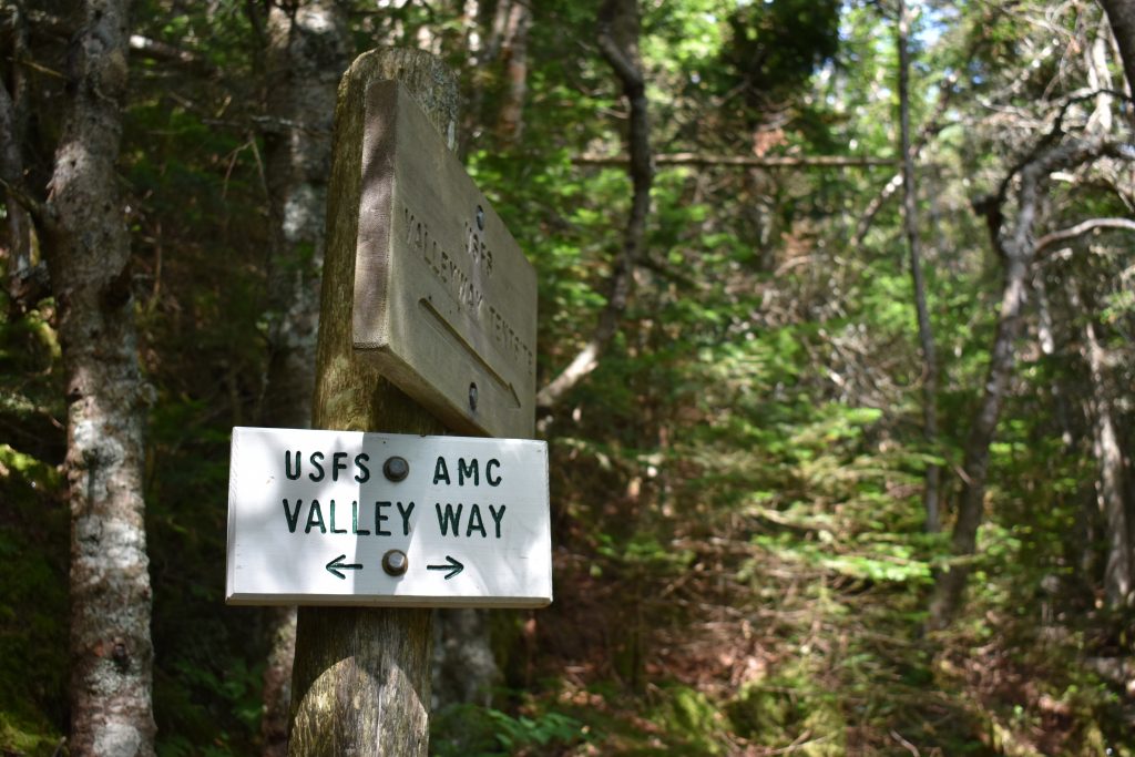
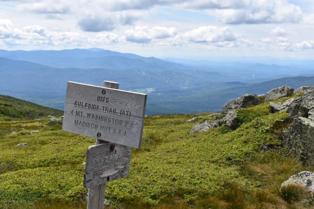
Climbing Up Valley Way
Depart Appalachia on the Valley Way Trail. The trail is easy to find, however, an early morning start and the maze of trails leaving Appalachia can make beginning (and staying) on the Valley Way Trail a tricky task. Make sure to get it right or you’ll spend the morning trying to get back on track.
The Valley Way Trail is initially moderate but gets progressively steeper as you approach Madison Spring Hut (44.328037, -71.283569). Throughout the trail’s 3.8 miles, there are numerous trail junctions, but they’re all well-marked. After 3.1 miles, you will pass the Valley Way Tentsite, one of the few designated camping areas along the Traverse. Above the tentsite, you will get occasional glimpses of Mount Madison looming above on your left as you close in on the AMC’s Madison Spring Hut.
The Valley Way Trail gains 3,500 feet of elevation—more than a third of the trip’s total—over its 3.8 miles. Equally important, it stays below treeline until the hut, allowing you to get in some miles without being too concerned about the weather.
The Summits Begin
From Madison Spring Hut, make the one-mile round-trip dash on the Osgood Trail to the summit of Mount Madison (44.328846, -71.276688). Don’t let the relatively short distance to the summit and back fool you; the Osgood Trail gains 550 feet of elevation on rugged and steep terrain. On top of Madison—the Traverse’s first 4,000-footer—take in the inspiring 360-degree views, highlighted by Mount Washington to the south, and your next objective, Mount Adams. Don’t linger too long before heading back the way you came to the hut, there’s still a long way to go.
Back at the Madison Hut, you can refill your water, scrounge for leftover breakfast, or buy baked goods. On a big trip like the Presidential Traverse (especially if you’re doing it in a day), every minute and ounce counts. After the hut, the route stays above treeline for the next 12 miles, making the hut a good place to reassess the weather. If it is deteriorating, consider bailing here before the turnaround logistics get too complicated.
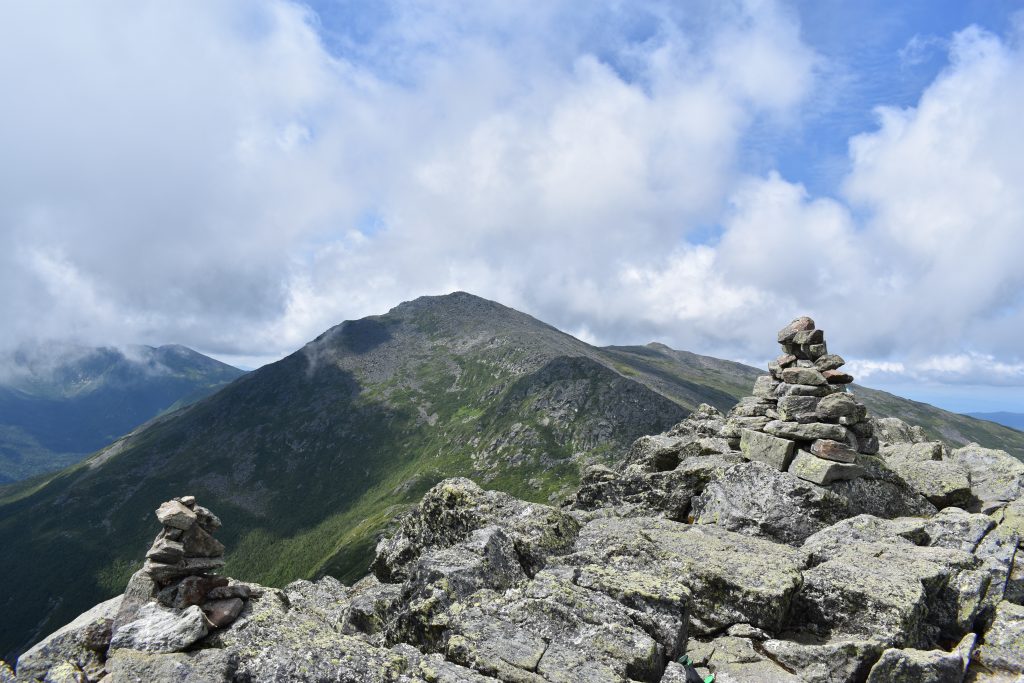
Mount Adams
Mount Adams (44.3203, -71.2909) is the next summit on the Traverse. To get there from the hut, follow the Gulfside Trail to the Airline Trail. It’s a 0.9-mile trip, gaining 950 feet of elevation up rough, rocky terrain to the sign marking the top of the peak. From Adams—the second-highest mountain in New England—enjoy dazzling 360-degree views of Mount Madison and Star Lake behind you, and Mounts Jefferson and Washington before you.
The summit of Adams provides another opportunity to reassess the weather and your progress. From here, a handful of trails lead back to the Appalachia Trailhead, including the historic Lowe’s Path, and bailing off the traverse becomes exponentially more complicated after this point.
Mount Jefferson
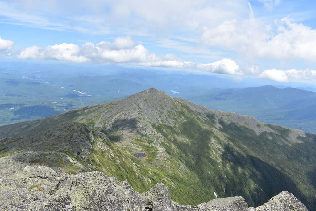
From Adams, drop down 0.3 miles through a boulder field to Thunderstorm Junction and rejoin the Gulfside Trail. After 1.2 more miles hiking alongside the Great Gulf, you’ll be longing for a smooth trail by the time Gulfside reaches Edmunds Col. Unfortunately, the 0.6-mile hike on the Jefferson Loop Trail across Jefferson’s summit (44.304237, -71.316597) is anything but smooth. Rather, it climbs 800 vertical feet over some of the most challenging hiking yet on the Traverse. Warning: False summits abound on the way to the actual summit.
Jefferson—the third-highest mountain in New England—doesn’t disappoint with views. Take a moment to enjoy them, with Mount Adams behind you and Mount Clay and Mount Washington towering before you. Once you’ve had your fill, continue south along the Jefferson Summit Loop until it rejoins the Gulfside Trail. Before leaving the summit, evaluate the weather, being mindful of the considerable amount of exposed hiking left.
If you have any doubts, from here there are numerous trail options that will bring you back to your car at the Appalachia Trailhead, albeit with some difficulty. One way back is to backtrack the Jefferson Summit Loop Trail and connect with the Gulfside Trail. Follow the Gulfside Trail for 0.7 miles to the Israel Ridge Path, which you will take for 0.8 miles to the Perch Path. Hikers will want to follow the Perch Path for a short distance—passing the Randolph Mountain Club Perch Shelter—before connecting with the Randolph Path.
Backpackers might want to stay the night at the Perch Shelter to wait out unfavorable weather or give themselves an extra day before making the long 6.1-mile trek along the Randolph Path as they drop 3,700 feet in elevation to the Appalachia Trailhead. The Perch Shelter costs $15 for Randolph Mountain Club (RMC) members to stay the night and has a spring to fill your water bottles. For non-RMC members, staying at The Perch costs $20 a night.
To Clay or Not to Clay?
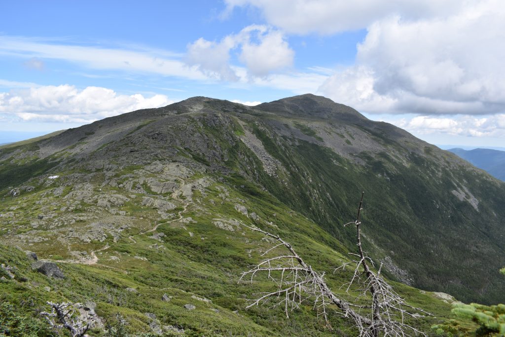
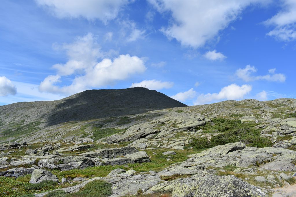
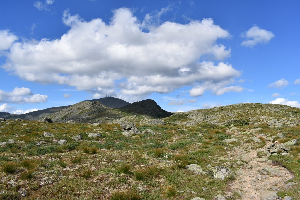
Following the Gulfside Trail 0.5 miles from Mount Jefferson to Sphinx Col, hikers encounter the first “optional” summit of the trip: 5,533-foot Mount Clay. Since Clay is a sub-peak of Washington (and thus not one of the 48 official New Hampshire 4,000-footers) peak baggers sometimes choose to bypass its summit along with the extra 0.3 miles and a few hundred feet of elevation by continuing on the Gulfside Trail for 1.4 miles to the summit of Mount Washington.
For others, the great views of the Northern Presidentials found from the summit of Mount Clay make the short detour a worthwhile endeavor. After all, what’s a little over an extra quarter-mile when tackling one of the White’s most challenging hikes?
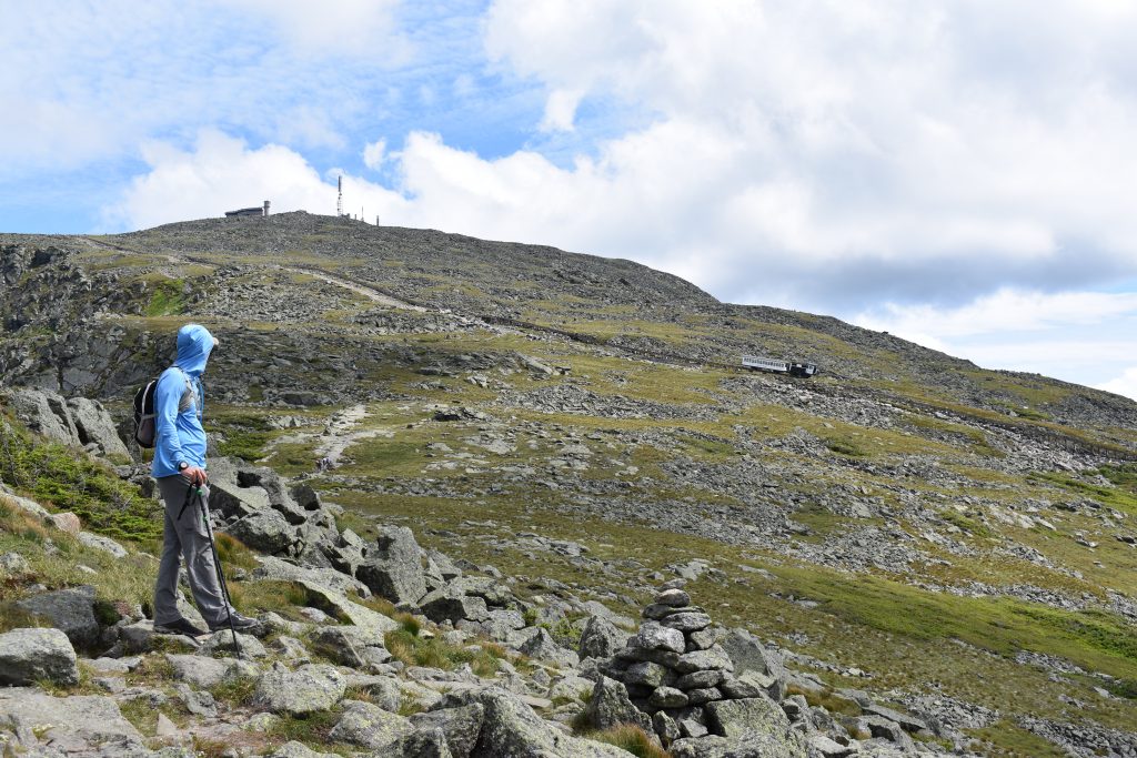
Once past Clay, the hike up Washington on the Gulfside often feels like the longest part of the Traverse. Although the summit looks just minutes away, appearances are deceiving and you’ve still got more than a mile to go. The trail also remains unrelenting and rough. Thankfully, you’ll have great views of Burt’s Ravine, the Great Gulf, Mount Washington, and the Cog Railway to motivate your climb. Turn around and look back and you can admire the distance you’ve already traveled with Jefferson, Adams, and Madison laid out behind you.
The Worst Weather in the World and Busiest Summit of the Day
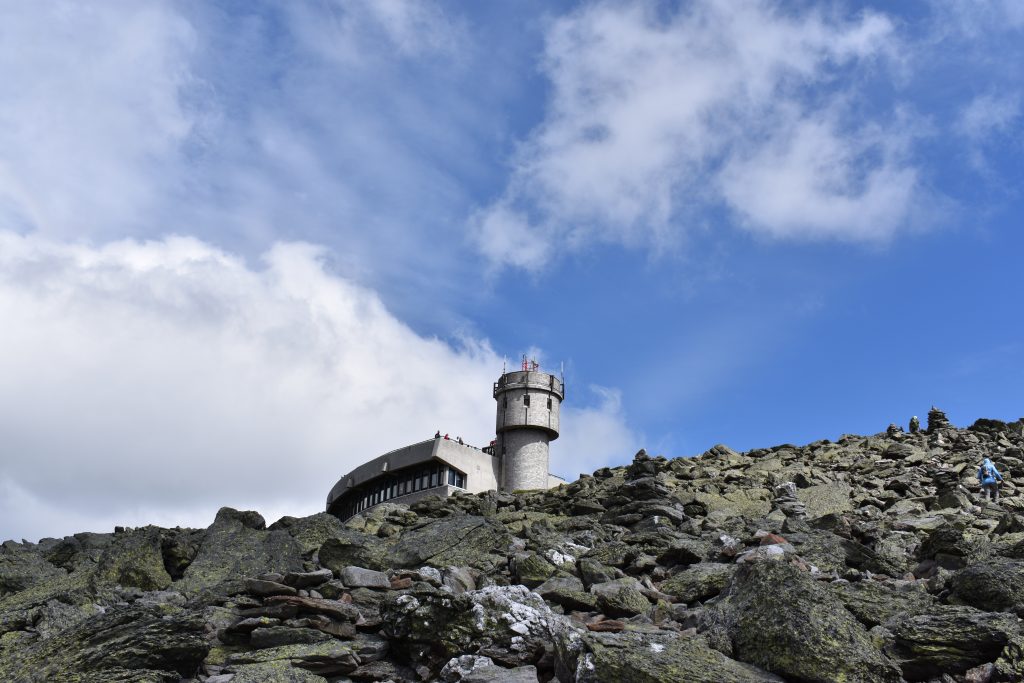
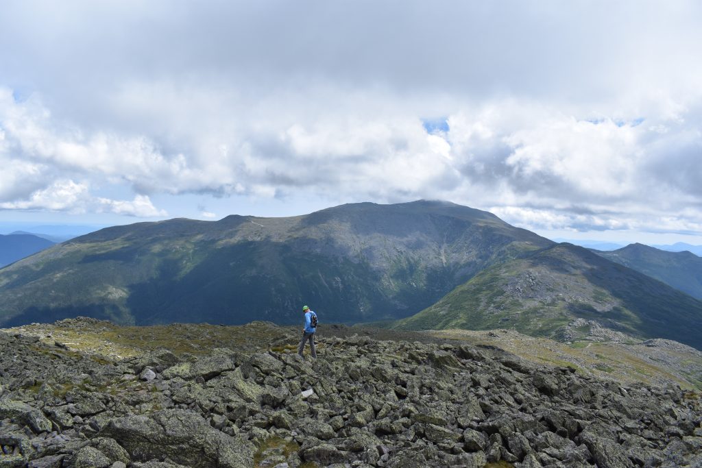
The summit view from New England’s highest peak (44.270584, -71.303551) certainly doesn’t disappoint. To the east, the Carters and Wildcats dominate the foreground. On a clear day, the Atlantic Ocean is visible in the distance. Looking north, Madison, Adams, Jefferson, and Clay fill the skyline. To the west is the Bretton Woods ski area and the peaks of the Pemigewasset Wilderness. Finally, to the south, the remainder of the Traverse is laid out before you: Monroe, Eisenhower, Pierce, and Jackson.
Mount Washington is notoriously home to the “world’s worst weather” and on some days doesn’t offer views from its summit. However, even on rainy, cool, or cloudy days, you’ll likely encounter more people on the top of Washington than you will on the entirety of the Traverse thanks to the mountain’s popularity, the Mt. Washington Auto Road, and the Cog Railway.
Civilization isn’t all bad though if you brought your wallet, as the cafeteria in the Sherman Adams building on the summit offers the opportunity to eat and drink something different from regular hiking fare. More than once, a Coke or slice of pizza has boosted morale, busted a bonk, and been key to a successful traverse. Additionally, this is also a great place for hikers to refill water bottles and hydration packs. Don’t let the warm food, places to sit, and gorgeous views lure you into lingering too long on the summit—there are still 7.7 miles and several hours of hiking left.
The summit of Mount Washington provides another opportunity to evaluate your progress and physical condition. Bailing from here provides a logistical challenge of getting back to Appalachia Trailhead, however, it’s not uncommon for hikers to retreat from the Traverse on the Cog Railway. You can purchase tickets down the mountain (if they’re available) at the summit post office.
The Crawford Path
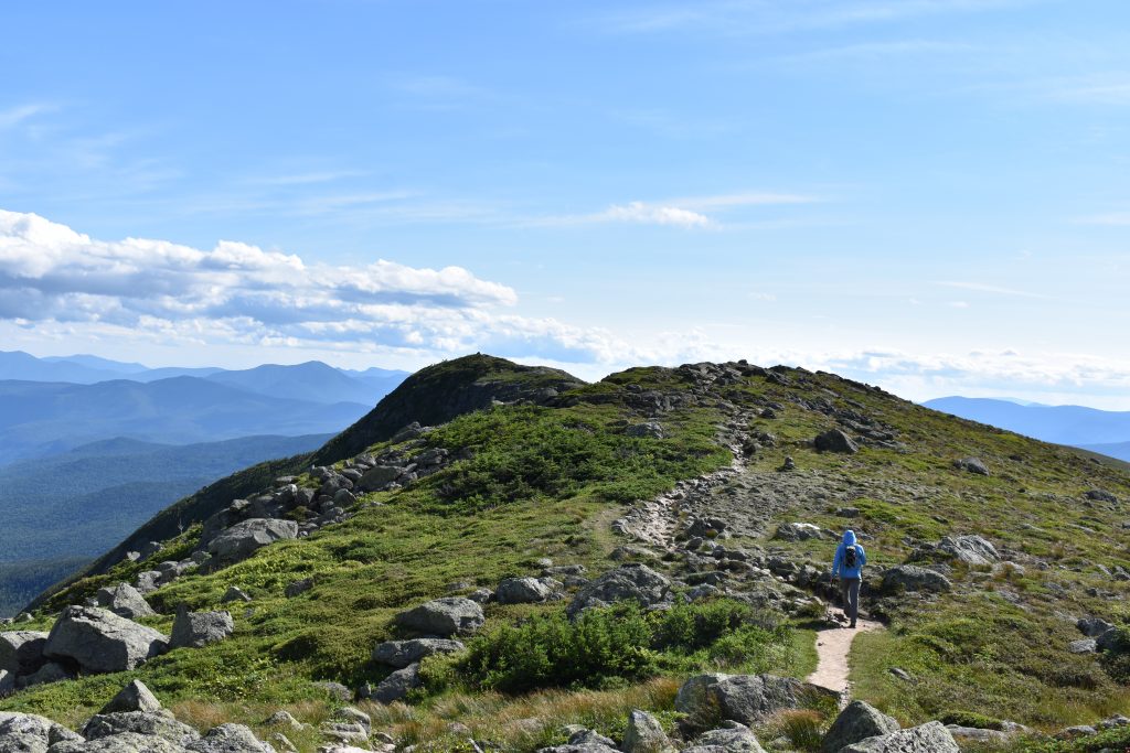
The character of the Traverse changes after Mount Washington, as you leave the rugged Gulfside Trail and continue for the duration of the trip on the more gentle Crawford Path. Almost 200 years old, the Crawford Path is the oldest hiking trail in the contiguous U.S., and at one time was used to guide tourists to the summit of Mount Washington on horseback. Even better, despite some small climbs, the majority of the trip is downhill from here.
This is especially true of the 1.5-mile descent to AMC’s Lakes of the Clouds Hut (44.258831, -71.318817), the highest and largest hut in the White Mountains. Views of the Southern Presidentials dominate this portion of the hike. As you approach the hut, look for Lakes of the Clouds, a set of small ponds, on your left.
The hut provides another chance to refill your water and is a good alternative for those looking to avoid the lines often found at Mount Washington’s summit—making it a faster and easier option. But again, don’t linger too long, unless they’re serving fresh-baked desserts or you’re planning to spend the night here as part of a multi-day traverse.
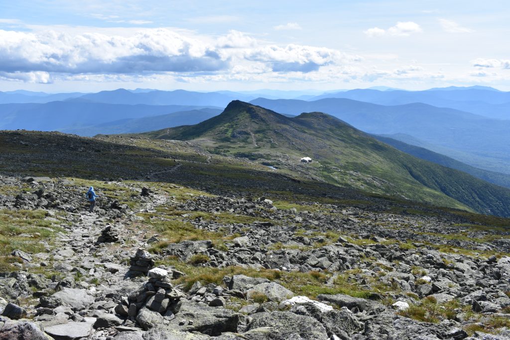
Mount Monroe
From the hut, continue on the Crawford Path for 0.3 miles before connecting with the Mount Monroe Loop Trail. The Mount Monroe Loop trail climbs 350 feet to the open summit of Mount Monroe (44.255089, -71.321373), the fifth 4,000-footer of the Traverse.
From here, you get a striking view of Washington and Lakes of the Clouds behind you. If you look closely, you may even spot the original Crawford Path—a section of the iconic trail between Mount Monroe and the Westside Trail that was rerouted to take a course more sheltered from the elements. Ahead, the Crawford Path snakes its way to your next objective: Mount Eisenhower. Before departing, look east, down Monroe’s sheer cliffs, and toward Oakes Gulf.
Mount Eisenhower
Dropping off Monroe, connect again with Crawford Path and begin working your way across the 2.1 miles and the 500-foot climb up Eisenhower. Along this stretch, you’ll encounter some of the most gentle terrain of the trip, and most likely not a moment too soon for your tired legs. It’s also here that you might begin to feel the effects of a day spent above treeline, as the sun and the wind can start to test your resolve.
After a steep-but-quick climb up Eisenhower’s flanks, you’ll encounter a giant cairn marking its summit (44.240688, -71.350342) and the sixth 4,000-footer of the trip. Take a moment to look back, take in the view, and appreciate the enormous distance the Traverse has covered so far. Then, if you have the energy, turn south and try to pick out the summits ahead: Mount Pierce (your next objective) and, if you continue further, Mount Jackson and Mount Webster.
Mount Pierce
Leaving Eisenhower, rejoin the Crawford Path heading south toward Mount Pierce. Follow the Crawford Path for 1.3 miles to the split with the Webster Cliff Trail. Continue on the Webster Cliff Trail 0.1 miles to the summit of Mount Pierce (44.227802, -71.364769), the trip’s seventh 4,000-footer.
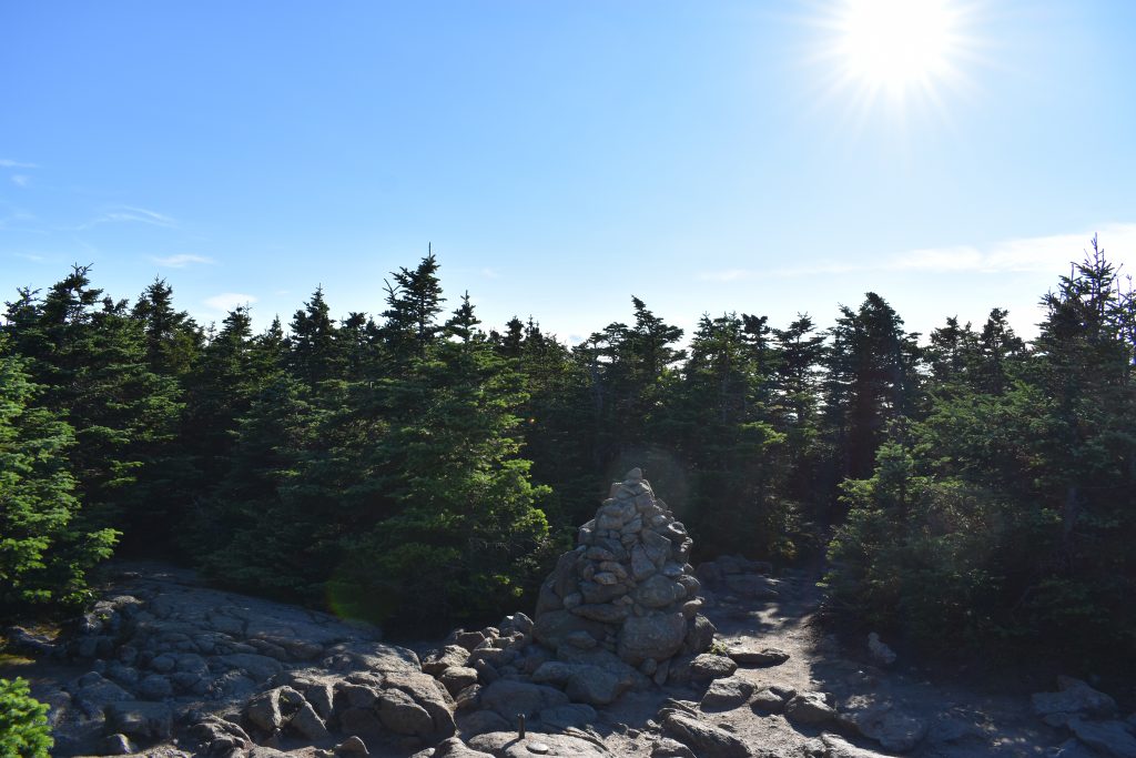
On the 1.4 miles between Eisenhower and Pierce, you’ll begin to dip in and out of the trees, the first section of below-treeline hiking since your ascent of Madison. While only picking up nominal elevation, the rolling nature of this part of the Crawford Path will have your legs feeling weary with the Traverse’s 8,700 feet of elevation gain. The summit of Mount Pierce also signals an exit from the high mountains, as it’s the day’s only peak that doesn’t offer views in every direction.
Decision Time
Traditionally, the Presidential Traverse “ends” at Pierce. If this is your final summit, follow the Webster Cliff Trail back to the Crawford Path. The beginning of the 3.2-mile descent to the Highland Center in Crawford Notch is surprisingly challenging thanks to the combination of rocks, roots, and weary legs. After a short time, the trail becomes significantly more gentle. As you get closer to Route 302, the sound of traffic is oddly comforting, letting you know that you’re almost there.
If you’re not ready to be done, extend the Presidential Traverse by hiking south on the Webster Trail for 2.4 miles to Mount Jackson (44.2031, -71.3742), the eighth 4,000-footer of the trip. On the way, you will pass the Mizpah Hut, giving you the opportunity to refill water, buy dessert, or even stay for the night—either in the hut or at the Nauman Shelter Tentsite.
Although Jackson’s summit delivers great views to the north, west, and south, the 2.4-mile trail is rough in parts and is rarely a quick trip—this is especially true when you have almost 20 miles under your belt already. Except for an open rocky section near the top, the 2.5-mile descent to Crawford Notch from the summit of Jackson on the Webster-Jackson trail is moderate and a little bit shorter than the descent from Pierce.
The Kit for the Presidential Traverse
Light is right on the Presidential Traverse. If you have a good weather window and you’re trying to do the Traverse in a day, here are a few tips for trimming your kit.
- A super lightweight wind shell, like Mountain Hardwear’s Kor AirShell, is indispensable on a trip like the Presi that covers so much ground above treeline.
- If you picked the “right” day to do the Presidential Traverse, plan on getting a lot of sun, especially when hiking north to south. A sun hoody, hat with a brim, and sunglasses are great ways to protect your skin and eyes.
- Even if the forecast is favorable, the Presidentials are notorious for bad weather. Be prepared for it with a lightweight puffy coat like the EMS Feather Pack Hooded Jacket (men’s/women’s) and a rain shell such as the EMS Thunderhead.
- The weather changes fast in Presidentials; make sure you’re ready for it with a winter hat and gloves.
- The Traverse crosses some of the most rugged terrain the White Mountains have to offer. Give your legs some support when they eventually get wobbly with a pair of collapsible trekking poles like the Black Diamond Trail Trekking Poles (unisex/women’s).
- Boots are great, but trail runners like the Brooks Cascadia 16 (men’s/women’s) are key when trying to quickly cover 20+ miles.
Keys to the Presidential Traverse
- Hiking the Presidential Traverse is a big day in itself. Consider shuttling cars the night before to ease logistical challenges and ensure your vehicle has a spot in the lot.
- If doing the full Presidential Traverse in a day seems like too much, there are three AMC Huts along the route (Madison, Lakes of the Clouds, and Mizpah). Using the AMC huts allows you to stay lightweight and savor the Traverse over multiple days. However, don’t expect to find much camping on route due to alpine zone restrictions.
- Because this hike is almost entirely above treeline, it’s not one to do in bad weather, so check the Mt. Washington Observatory Forecast before you go.
- Getting an early start is a great tactic to both avoid late-afternoon thunderstorms and ensure maximum daylight.
- Even though the route is well marked, it’s a good idea to bring a map to keep informed of route mileage and monitor your progress.
- If you’re looking to refuel post-hike, check out Celli’s Pizzeria in Twin Mountain on the way back toward I-93. If your phone has reception, call in your order ahead of time to make sure dinner is waiting for you. If you feel like you deserve a drink after a long day on the trail, rek’-lis Brewing in Bethlehem serves up delicious beer as well as tasty pub grub.
Current Conditions
Have you done the entire Traverse or even a piece of it recently? Post your experience and the trail conditions (with the date of your hike) in the comments for others!
Related Posts


wait, was this whole article just a veiled advertisement for a pizza place?? I guess a writer has to make some $$ somehow..
The writer even got it wrong….do a North bound traverse and then go to Mountain Fire Pizza in Gorham, get the Maple and Bacon pizza and you will understand the meaning of life!
[…] piecing together what happened as Matrosova attempted to complete the northern section of the Presidential Traverse (from Madison to Washington) in one day, by herself. Throughout, Gagne tells Matrosova’s story […]
[…] get turned around, it’s also perfect for getting stoked before your trip and scheming up the next traverse once you’ve checked the Carter Range Traverse from your […]