


Ascend the oldest trail up the Northern Presidentials to a stellar above-treeline position atop the second-tallest peak in the White Mountains.
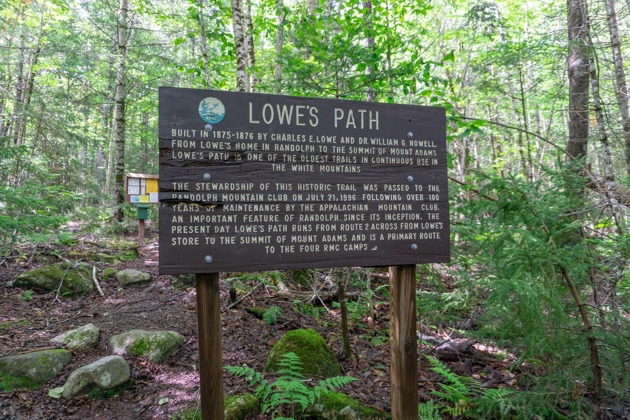
Ushering in what authors Guy and Laura Waterman called the “modern era of trail building,” Lowe’s Path, built by Charles E. Lowe and Dr. William G. Nowell in 1875-1876, was an instant classic. At the time of completion, it was considered one of the best hikes in the White Mountains, with early hikers even charged a toll to use it. Today, Lowe’s Path remains a popular route to the summit of Mount Adams, the Whites’ second-highest summit.
Quick Facts
Distance: 9.6 miles, 4,450 feet of elevation gain
Time to complete: 1 day
Difficulty: ★★★
Scenery: ★★★★★
Getting There
Lowe’s Path begins its ascent of Mount Adams from a trailhead just off Route 2, almost directly across the street from Lowe’s Store. Two miles farther east is the Appalachia parking lot.
There is ample parking at Lowe’s Store. There is also a spot or two at the trailhead itself.
Turn-By-Turn
Getting Started
Lowe’s Path begins at the signed trailhead on the south side of Route 2. Although the hiking is initially moderate, the trail begins climbing shortly thereafter, making a consistent ascent through open forested terrain.
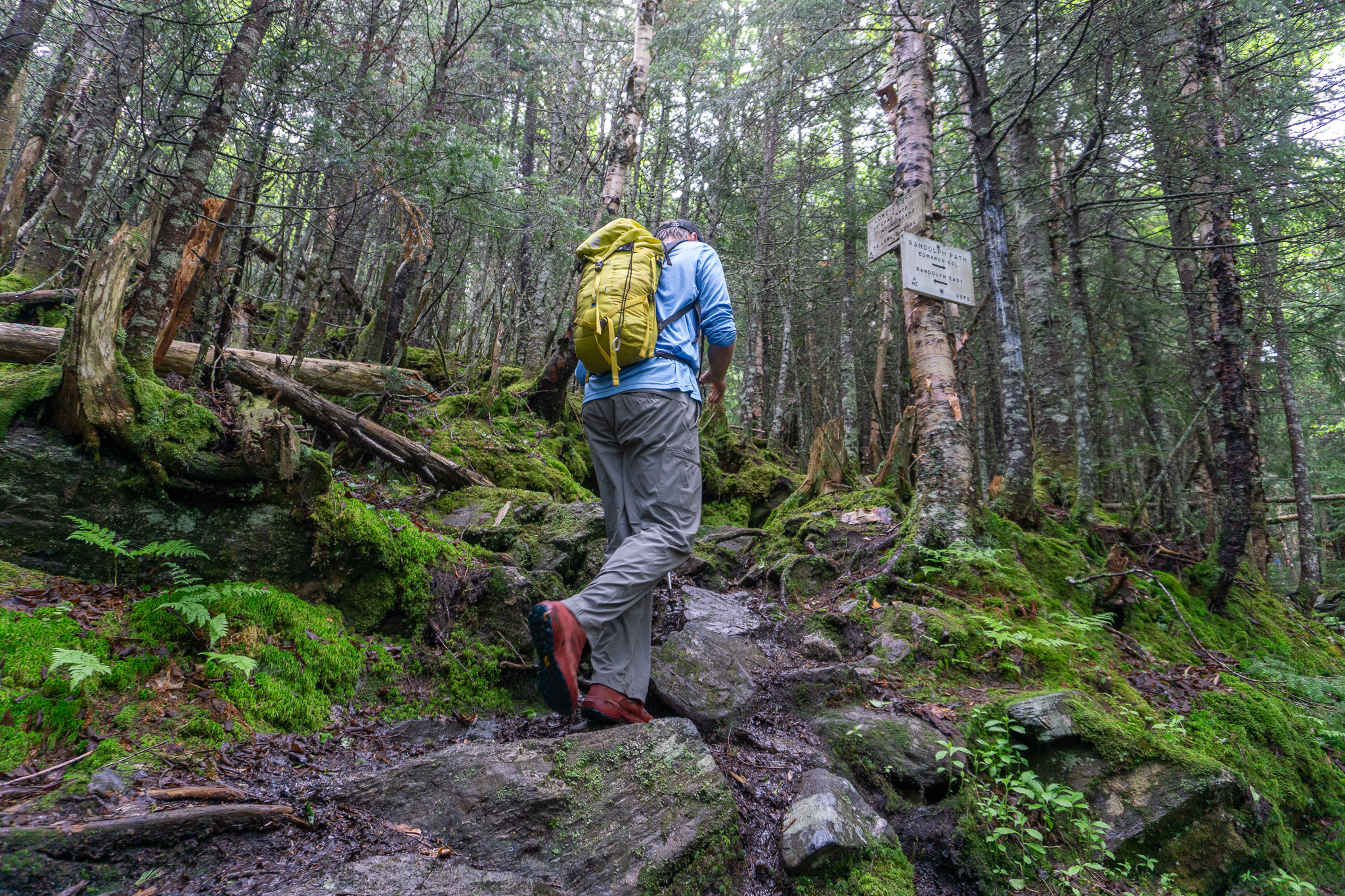
The first of many trail junctions is near the 1.7-mile mark, where the path intersects with the Link Trail. Shortly thereafter, the King Ravine Trail splits off to the left. At both junctions, be sure to follow the rectangular blue blazes of Lowe’s Path.
The First Cabin
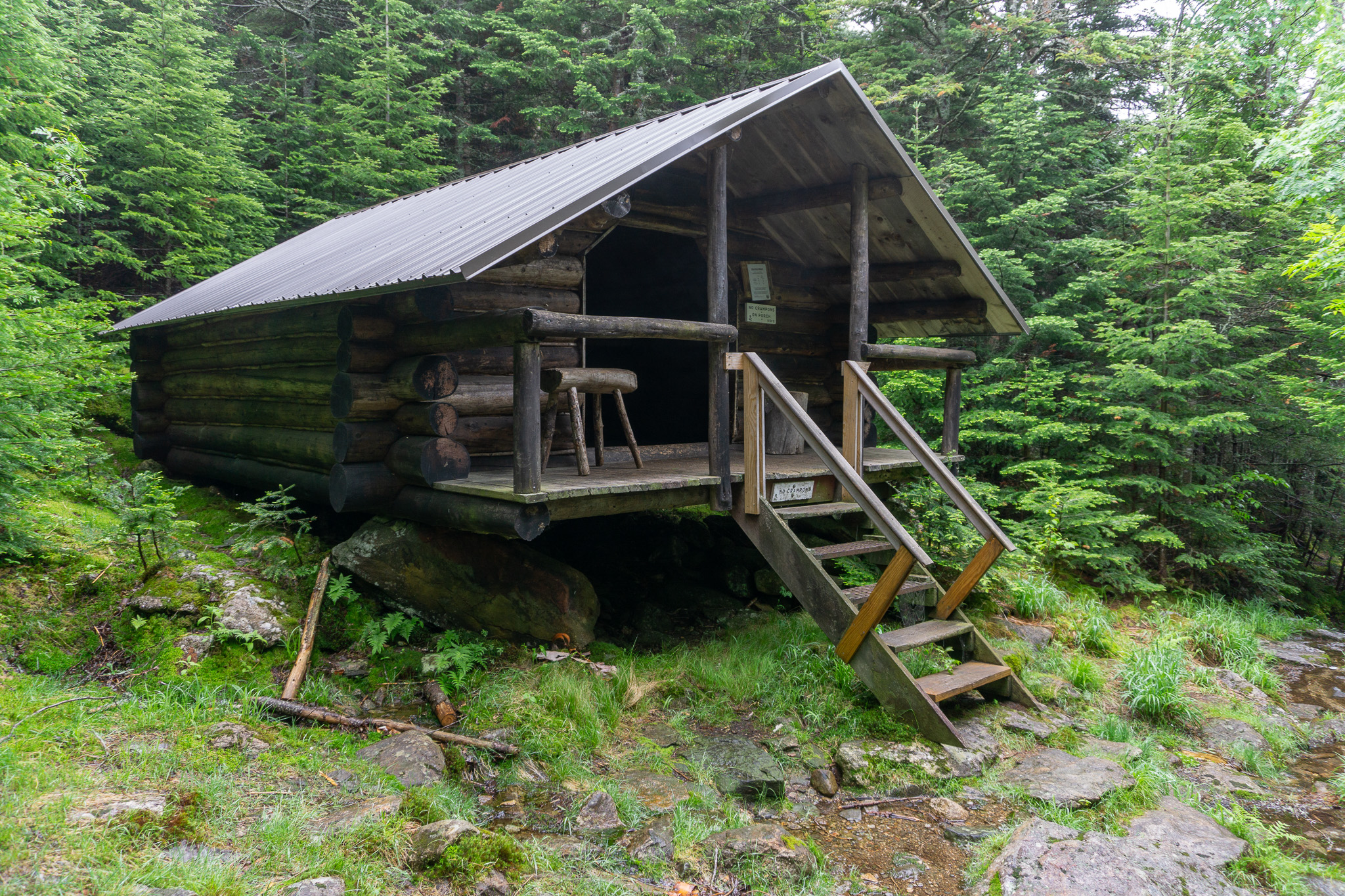
After 2.5 miles on the trail, hikers will approach the Log Cabin ($20 a night for non-Randolph Mountain Club members and $15 for members). A simple, “Alaskan trapper style building” that sleeps up to ten hikers in spartan conditions, think a lean-to but with nearly four sides and an outhouse. Much like the trail itself, the cabin site is riddled with history—the Log Cabin, which was built in 1985, is the third structure at the location. The earliest building was a bark shelter constructed by Lowe and Nowell in 1876 as they worked on the trail.
For day trippers, the Log Cabin is a great place to take a break and experience the history of one of the White Mountains’ oldest recreational camps. When you resume hiking, remember that the site is near several trail junctions—be sure to follow the rectangular blue blazes of Lowe’s Path instead of the Log Cabin Cutoff Trail.
Gray Knob Cabin
Above the Log Cabin, the trail is rocky and often slick as it continues the ascent of Mount Adams via Nowell Ridge. There’s a small clearing near the 3.2-mile mark with a good overlook that allows hikers to look back on the terrain they already covered. Farther in the distance, the Kilkenny Ridge looms in the northwest, while the Castellated Ridge on Mount Jefferson and Bretton Woods are both readily visible to the south and southwest, respectively.
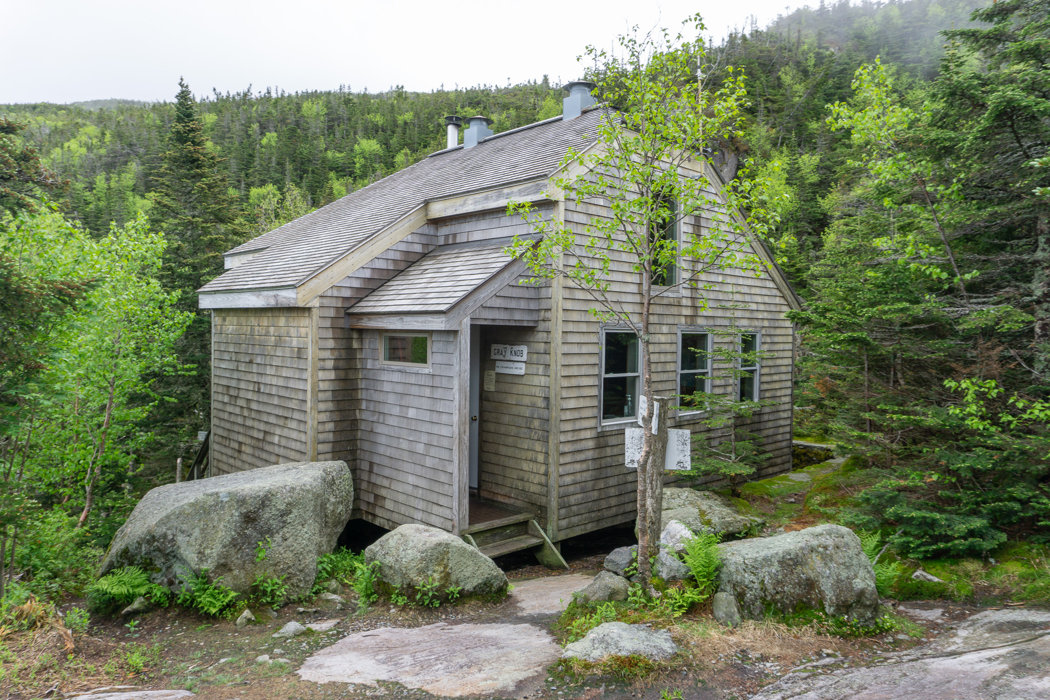
From this clearing, a spur trail called the Quay departs, soon joining with the Gray Knob Trail and bringing hikers to another RMC shelter: the Gray Knob Cabin ($30 a night for members, $50 for non-members). This historic site is definitely worth a visit—the original cabin was built in 1905 and replaced by the current cabin in 1989. Gray Knob Cabin is open year-round, with limited heating.
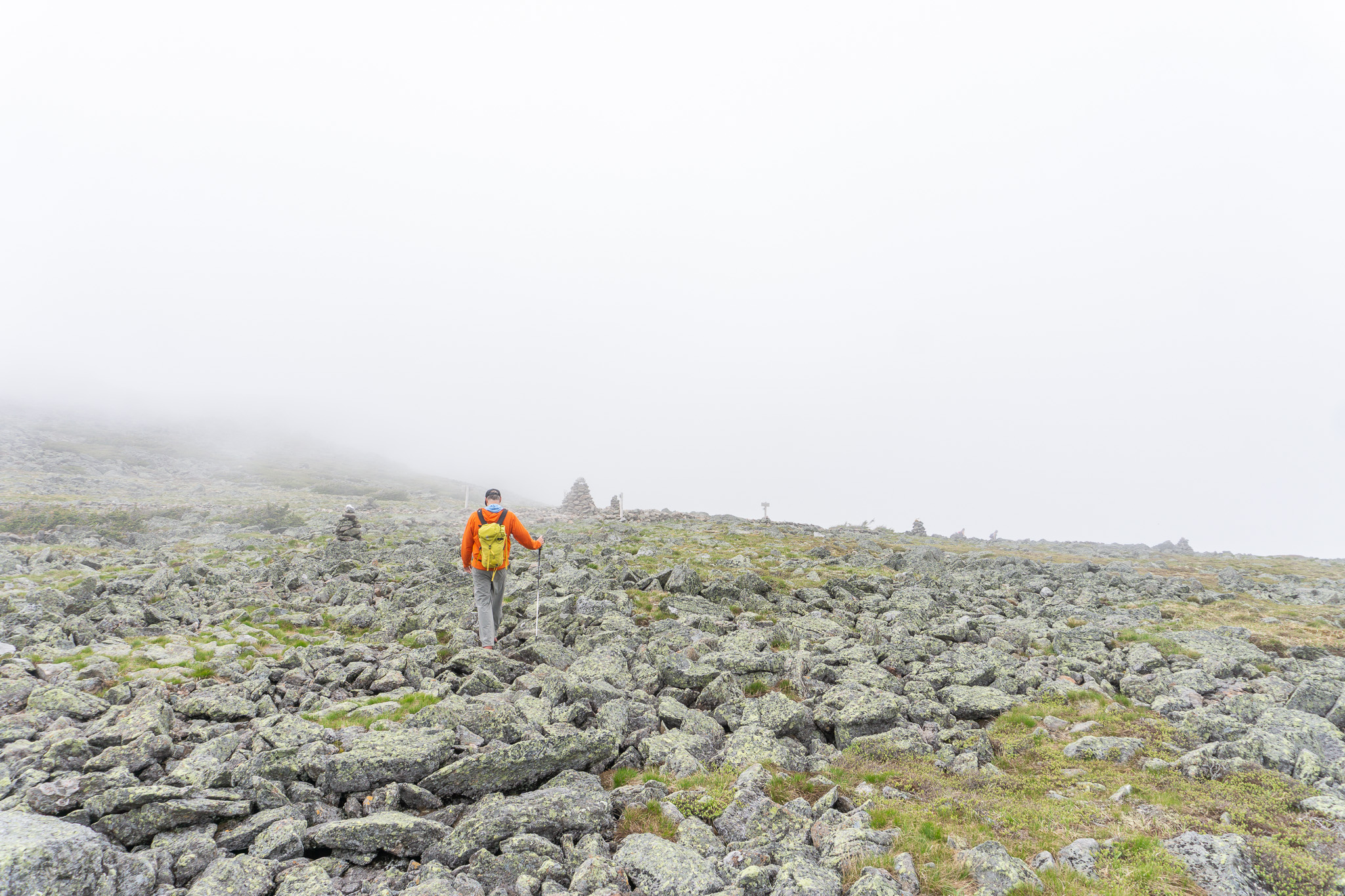
Above Treeline
After the overlook, the Lowe’s Path runs entirely above treeline for the remaining 1.6 miles to the summit of Mount Adams. Between the exposed position and the spectacular views (look for King Ravine to hikers’ left and the Ravine of the Castles and the Castellated Ridge to hikers’ right), this section of trail is best hiked on a clear day with good weather.
Among the notable landmarks on this section of the path is Mount Abigail Adams, a prominent sub-peak of Mount Adams and one of the five peaks in the Northern Presidentials named after members of the Adams Five. Lowe’s Path crosses directly over the summit of Mount Abigail Adams and is an excellent place for a snack break. The historically inclined should look for the plaque on the eastern side of the peak just after the Lowe’s Path dips off the summit.
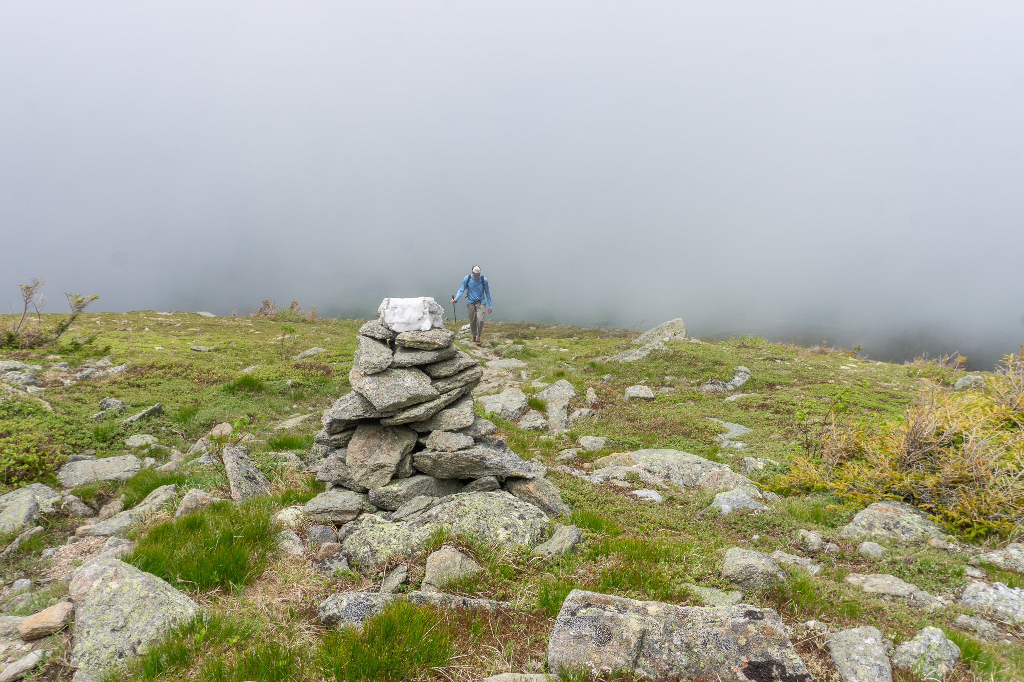
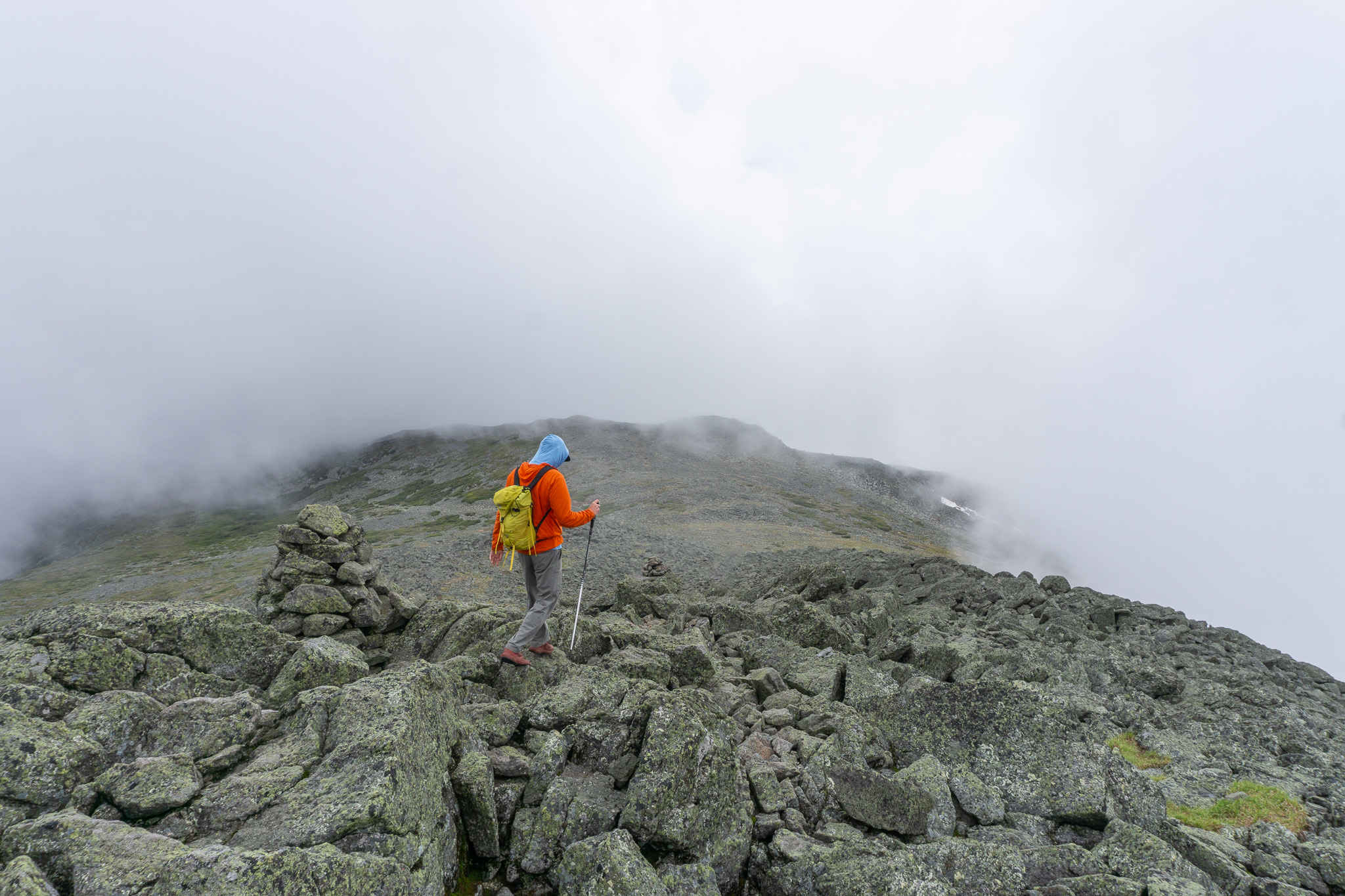
Above Mount Abigail Adams, Lowe’s Path continues to ascend Nowell Ridge. Looming large on hikers’ right is Mount Sam Adams, another of the Adams Five, while to the left is King Ravine. Soon, you’ll reach the very large cairn at Thunderstorm Junction. Among the trails that intersect with Lowe’s Path here is the Gulfside Trail, the main north-to-south thoroughfare along the higher summits of the Northern Presidentials and part of the Presidential Traverse.
The Final Push
From Thunderstorm Junction, the final half mile of Lowe’s Path climbs Mount Adams’ blocky summit cone. Rock and block-hop your way to the peak. On top, enjoy the dazzling 360-degree views of Mount Madison and Star Lake behind you, and Mounts Jefferson and Washington before you.
On days when the weather is good, the summit is an outstanding place to hang out for a while. Expect to see hikers arriving from several different directions and trailheads.
The Descent
The descent is relatively straightforward—just retrace your steps on Lowe’s Path for 4.8 miles back to the trailhead. The most consequential part of the descent is off the summit cone. Use particular care here, since portions can be steep and rocky. Once you’re below treeline, the descent is at times slick and rocky. Be sure to watch your footing.
The Kit
- The bottom third of the Lowe’s Path is commonly wet, particularly around the Log Cabin. A sturdy pair of Gore-Tex hiking boots, like the Vasque Breeze AT GTX (men’s/women’s) not only provide the waterproof protection needed at lower elevations, but they also offer plenty of support for negotiating the rough above-treeline terrain.
- Many will find a hike of the Lowe’s Path demanding—trekking poles like the EMS Summit poles, help take some of the pounding off knees, ankles, and feet while providing additional stability.
- Warm weather is a rarity in the Northern Presidentials; the record high on Mount Washington—the only peak in the Whites higher than Mount Adams and its neighbor—is just 72°F! Stay toasty at rest breaks and on the summit with the EMS Feather Pack Hooded Jacket (men’s/women’s).
- Given the notoriously fickle weather of the Northern Presidentials, it’s also a good idea to bring along a winter hat, gloves, and a neck gaiter.
- The terrain found on the Lowe’s Path is rugged compared to most of the Whites, which can make for slow going. A headlamp like the Black Diamond Spot 400 is good insurance in the event you run out of daylight.
Keys to the Trip
- The summit of Mount Adams is best enjoyed on a clear, windless day. Consult the Mount Washington Observatory’s Higher Summits forecast when planning your trip to find the best weather day.
- Lowe’s Path intersects with numerous trails over the course of its roughly five miles, which makes it a smart strategy to keep a map of the area handy. Treat yourself to a waterproof and tear-resistant map and consult it whenever in doubt.
- Sadly, there isn’t a great après spot super close to the trailhead. Rek’-lis Brewing is close-ish—roughly 30 minutes away and well worth the drive. Get the tacos and wash them down with a 30,000 Light Year Double IPA; you won’t be disappointed.
- Stay at the Log Cabin. If you’re getting to the Whites late in the day, overnighting at the Log Cabin lets you knock off some mileage and elevation. Those interested in slightly more glamorous accommodations will want to check out the Twin Mountain/Mt. Washington KOA.
- Taking a dip in Lower Ammonoosuc Falls in Twin Mountain is a fun way to cool off after a long day on the Lowe’s Path.
Current Conditions
Have you hiked Lowe’s Path on Mount Adams recently? Post your experience and the conditions (with the date of your outing) in the comments for others!
Related Posts


