

A little more than a century ago, the White Mountains were home to a booming logging industry and all its accompaniments: railroads, camps, and towns. Unsustainable logging practices, however, put a damper on the industry in the region and led to the abandonment of these once-thriving logging towns and camps. With the creation of the White Mountain National Forest, nature has slowly reclaimed the land and hidden the relics of the past. But as we found on our recent Ghost Town Traverse, if you look closely, it’s still pretty easy to see the extensive legacy of the area’s extractive history.
What is the Ghost Town Traverse?
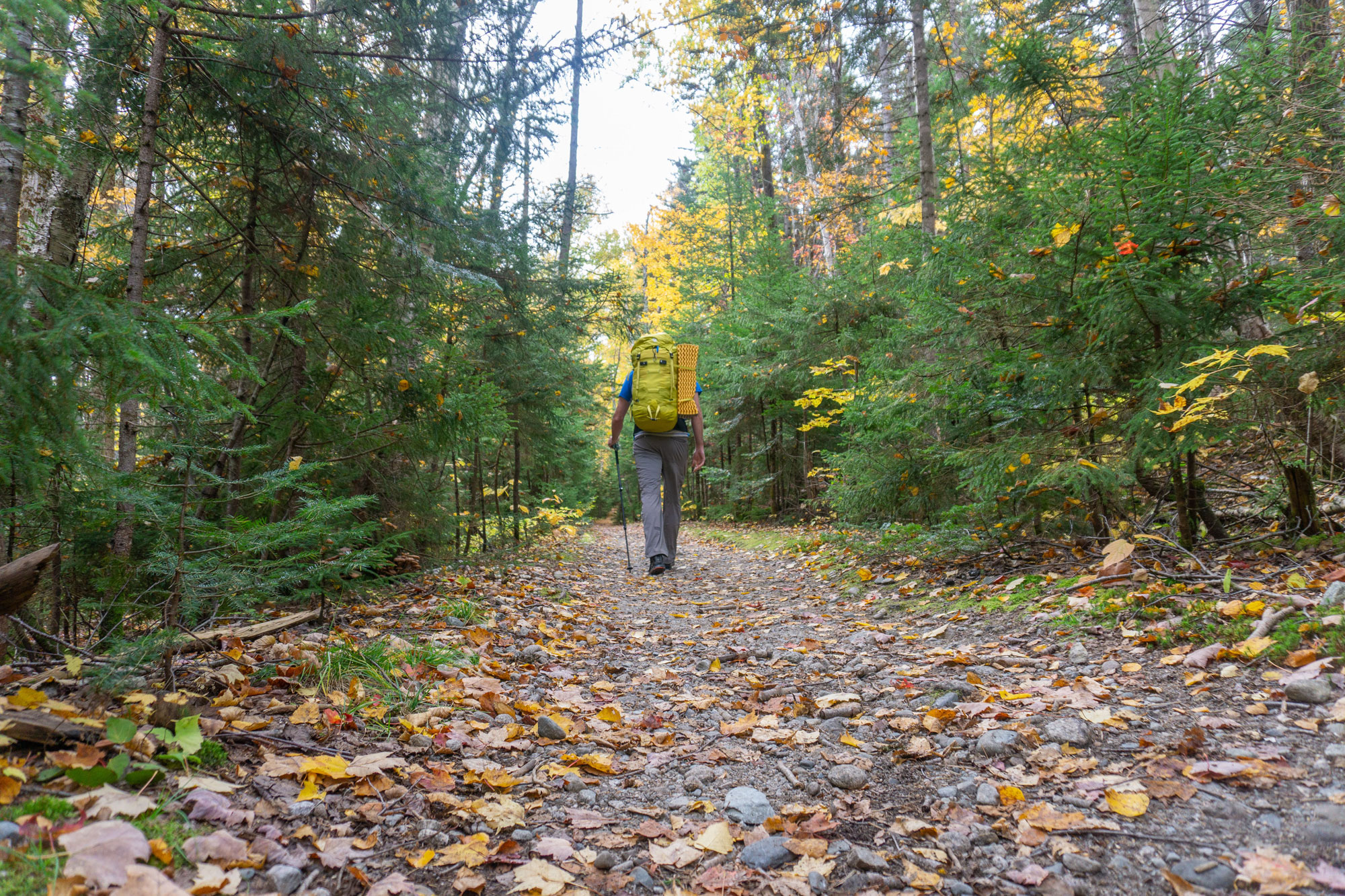
Running in an almost north-to-south line from the abandoned logging town of Zealand to the remnants of the once-thriving town of Livermore, the Ghost Town Traverse immerses hikers in the White Mountains’ logging history. For much of the Traverse’s 20+ miles, hikers travel along old logging railroad beds that have since been transformed into fire roads and hiking trails. Along the way, hikers pass the remnants of now-overgrown logging camps as well as modern scenic vistas like Zealand Notch, Thoreau Falls, and the Mount Carrigain summit overlook, all while spending a significant chunk of time deep in the Pemigewasset Wilderness. Best done as an overnight when the foliage is at its peak, the temperatures are crisp, and the bugs are gone, the Ghost Town Traverse should be on every White Mountain hiker’s to-do list.
Getting Started: Zealand and Zealand Valley
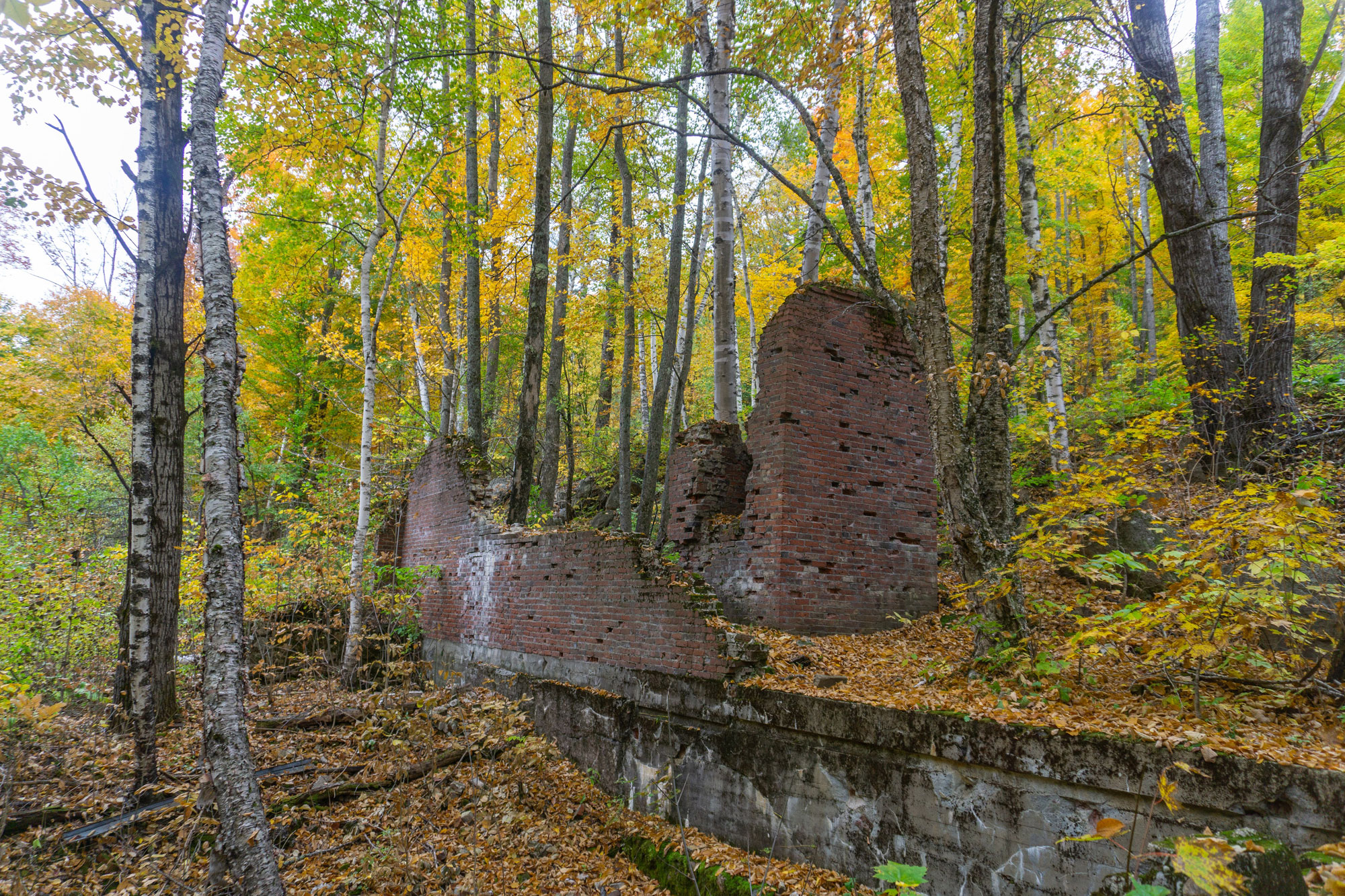
The Ghost Town Traverse starts appropriately enough—at the historical marker for Zealand at the junction of Route 302 and Zealand Road. Now a ghost town, Zealand was short-lived, sprouting up in the mid-1870s and abandoned less than two decades later due to deforestation and forest fires. Like other communities in this area, Zealand was a company town, where everything was built and owned by White Mountain lumber baron J.E. Henry. The community included a sawmill, boarding house, store, homes for employees, charcoal kilns, and two railroad stations. Little remains of Zealand today; the vestige of the kilns still stand, but are off route and hard to find.
The first eight-ish miles of the Ghost Town Traverse use the bed of what was once the 11-mile-long Zealand Valley Railroad. Much of the initial portion of that railroad, which brought logs from the Zealand Valley to the sawmill in Zealand, is now Zealand Road. Backpackers can hike (or drive) the three miles to the trailhead, then continue along the mostly flat Zealand Trail, largely following the same former railroad bed for 2.5 miles to the Twinway-Ethan Pond Trail junction.
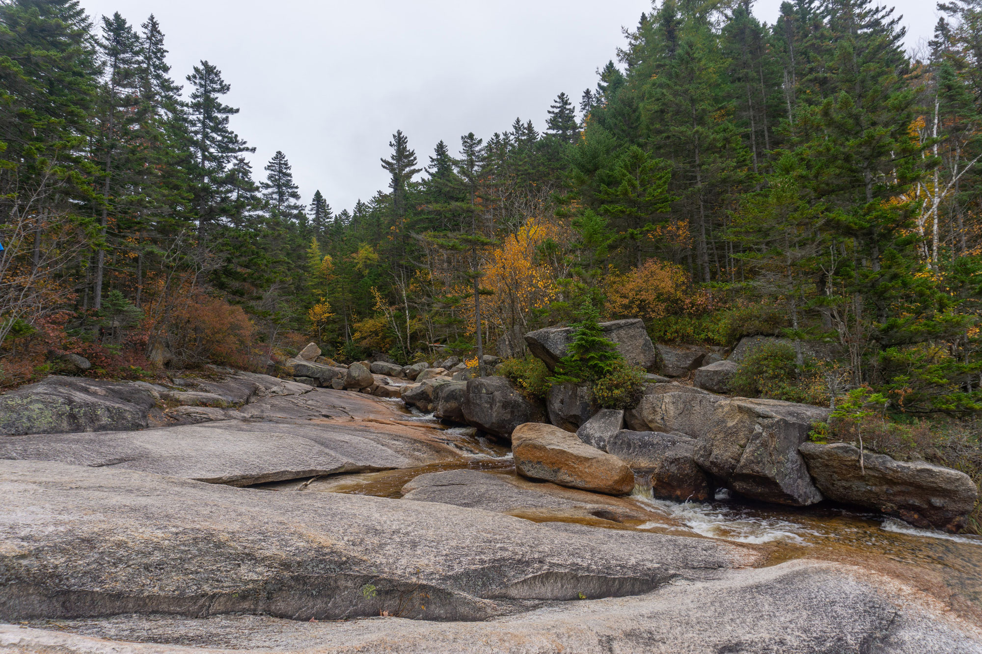
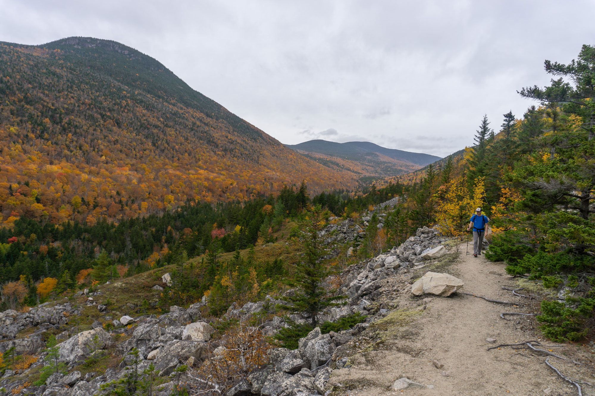
At this junction, the Ghost Town Traverse joins the Ethan Pond Trail, which continues to follow the former bed of the Zealand Valley Railroad. Below is Whitewall Brook; keep an eye out for its several brookside camping options in the initial half mile. About a mile from the junction, hikers enter Zealand Notch. With the talus-filled slopes of Whitewall Mountain climbing to the east, Zealcliff’s rocky cliffs rising steeply to the west, and a wonderful White Mountain vista spilling out in between, Zealand Notch is a perfect spot to take a break, snap some pics, and fuel up.
The scenery in Zealand Valley is much better today than it was at the tail end of its heyday. According to the 21st Edition of the A.M.C White Mountain Trail Guide, this area was “reduced to a jumble of seared rock and sterile soil by a series of hot forest fires prior to 1900,” with the recovery only “reasonably complete” by the guide book’s 1976 printing. While the guidebook’s authors appropriately attributed this recovery to “remarkable and outstanding testimony to the infinite healing powers of Nature,” the contrast is a stark reminder of one ghost town’s haunting legacy.
Thoreau Falls
From Zealand Notch, the Ethan Pond Trail continues to follow the old Zealand Valley Railroad for about 1.5 more miles. Along the way, be sure to make a short detour to Thoreau Falls, a series of small cascades, pools, and ledges. An excellent location to break for lunch or a snack, Thoreau Falls offers a great view of Bond, Guyot, and Zealand, and its cool water and numerous wading pools likely made this spot one of the nicer logging camps of the era.
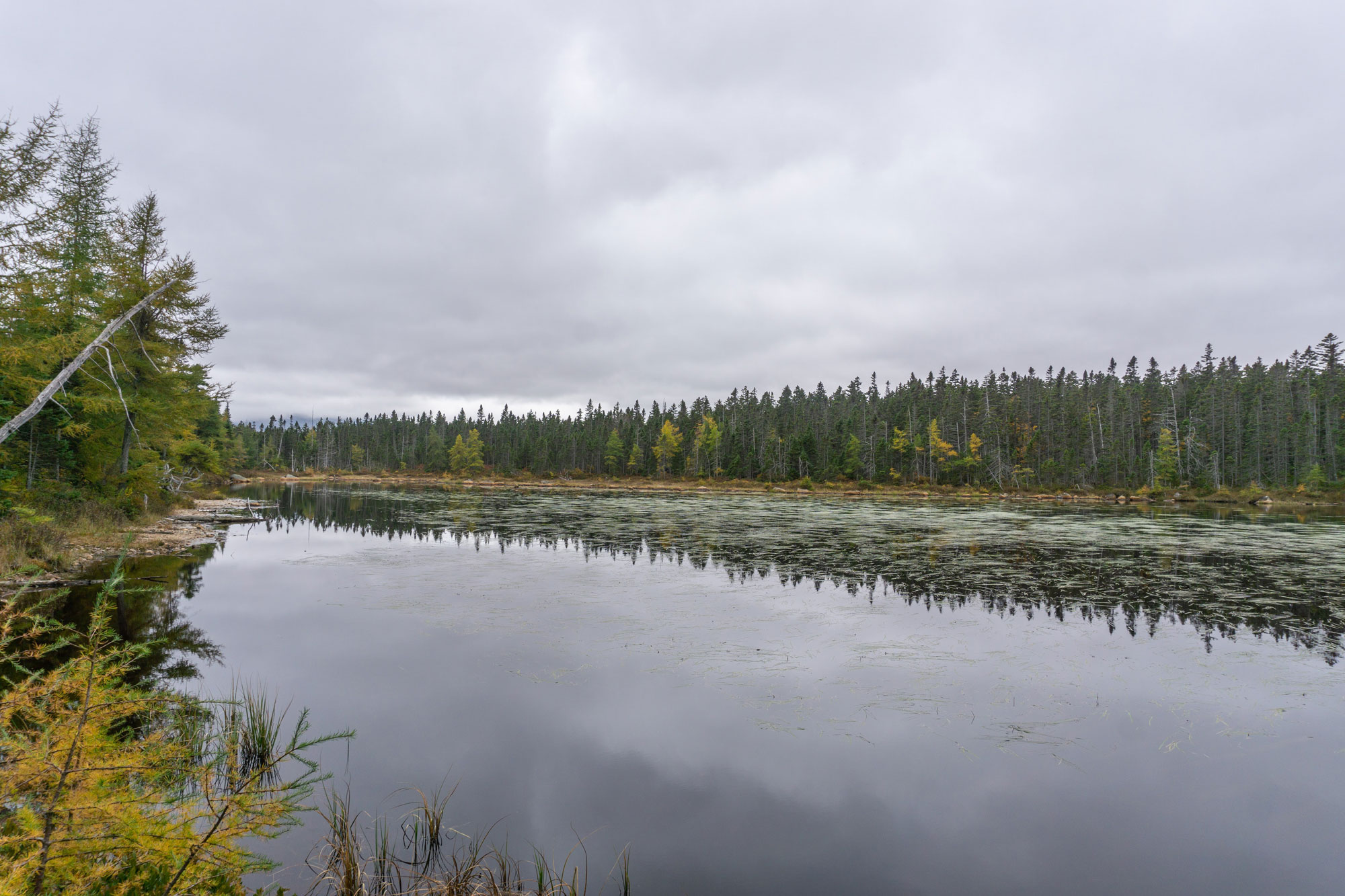
Just past Thoreau Falls, the Zealand Valley Railroad splits, with one branch heading east toward Ethan Pond, the other heading south toward your next destination: Shoal Pond via the Shoal Pond Trail. At the southern terminus of the Zealand Valley Railroad, the pond sits on hikers’ right, with a now-indiscernible abandoned logging camp nearby on the left. From Shoal Pond, the trail narrows temporarily, only widening again when it joins the former bed of one of the outermost branches of the East Branch and Lincoln. At 4.3 miles long, the Shoal Pond trail serves as a vital connector on the Ghost Town Traverse.
The East Branch and Lincoln
With Zealand’s collapse, J.E. Henry moved on to greener pastures, setting up a new company town in what would become Lincoln. There he founded the East Branch & Lincoln Railroad which, at its zenith, was the largest logging railroad system in the Whites. With more than 72 miles of train lines in the Pemigewasset Wilderness, the abandoned rail beds form the backbone of almost every trail system in the region.
The Ghost Town Traverse largely follows a branch that once extended to near Shoal Pond from a rail junction at a river crossing with the East Branch of the Pemigewasset near the present-day junction with the Carrigain Notch Trail. In most places, the trail is wide and flat, with repeated intersections with Shoal Pond Brook. Along the way, there are numerous camping options as well as the remnants of what appeared to be a logging camp (likely “Camp 21,” if our reading of this map is correct). According to that same map, these woods were logged extensively between 1911 and 1916, contributing some of the millions of board feet of wood pulled out of this region.
At the junction, the Ghost Town Traverse briefly follows the Carrigain Notch Trail upstream, just above the banks of the Carrigain Branch of the Pemi River. Between here and the junction with the Desolation Trail, there are numerous backwoods camping options.
Desolation Trail
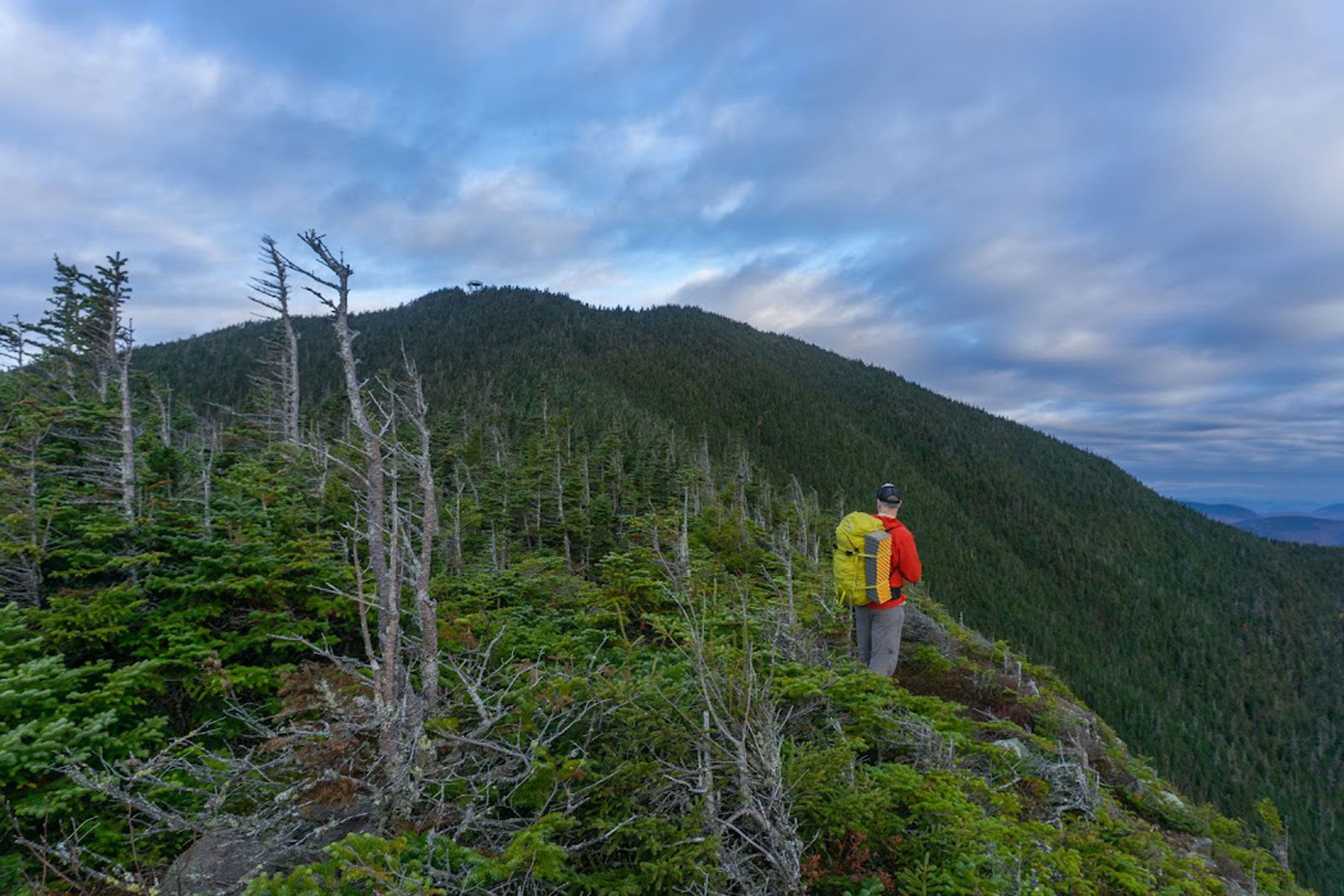
The only ascent of any significance on the Ghost Town Traverse begins on the Desolation Trail, a path ascending the north side of Mount Carrigain. Established by the AMC in 1932, the Desolation Trail climbs to the summit first via an old logging road, then through virgin forest at the higher elevations. Dauntingly steep, the Desolation Trail easily earns its place on the Terrifying 25 Elective List as it ascends 2,500 feet in less than two rough and rocky miles up Carrigain.
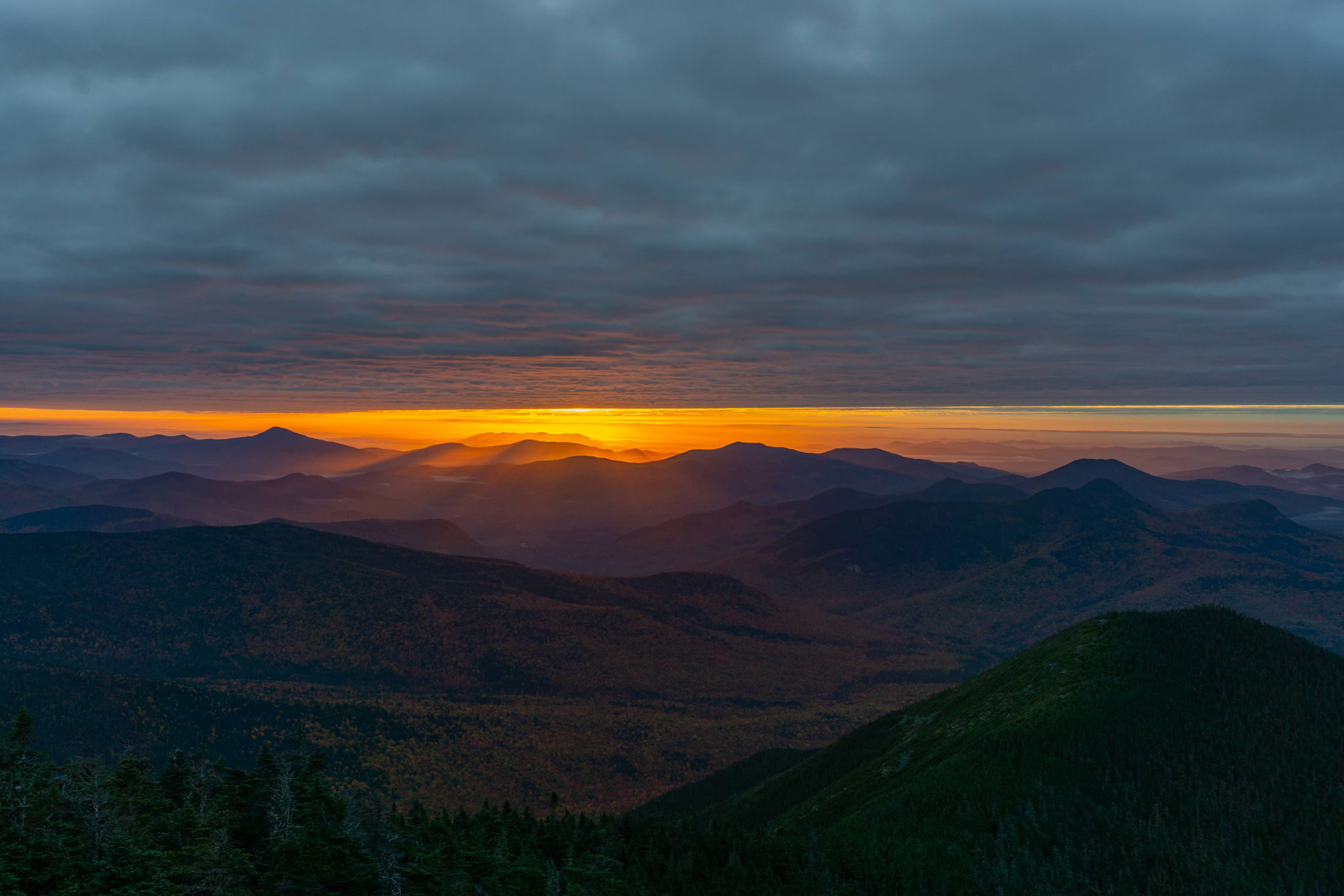
While there are few views on the Desolation Trail, Carrigain’s summit fire tower delivers an unrivaled 360-degree view of the region. The fire tower is one of a series of lookouts built by the NH Timberland Owners Association, the state of New Hampshire, and the US Forest Service in 1911 in response to the blazes that devastated towns like Zealand. Pay close attention while climbing the Desolation Trail and you’ll see parts of an old signal line that ran to the top of the mountain.
Atop Carrigain, backpackers can camp at one of the dispersed sites on the summit or continue onward, with the Ghost Town Traverse heading downhill on the Signal Ridge Trail toward Livermore, another ghost town.
Signal Ridge
The Traverse’s roughly five-mile descent down Signal Ridge treats you to one of the finest sections of trail in the Whites. Descending relatively smoothly at first, the trail weaves through low pines, passing an old well (the sole remnant of the fire warden’s cabin that once stood on Mount Carrigain) and then several open viewpoints delivering excellent vantages of Mount Nancy in the foreground and the Presidentials hulking behind them. As you traverse Signal Ridge, the summit tower slowly recedes in the distance and the forest thickens.
Below Signal Ridge, the trail becomes increasingly rocky and steep, losing elevation quickly. After three-ish miles, there’s finally some smoother terrain, speeding you toward the Signal Ridge Trailhead. But while these final two miles to the trailhead are decidedly flat, don’t take them too quickly. Here, the Ghost Town Traverse largely follows the old bed of a branch of the Sawyer River Railroad and in some places, you’ll see some sections of rail that are still in the ground.
Livermore
From the Signal Ridge Trailhead, Livermore, the endpoint of the trip, is close at hand. It is just a short, mile-ish walk down the Sawyer River Road, a road that largely follows the main trunk of the Sawyer River Railroad. This logging railroad—the third distinct railroad system of the Traverse—was Livermore’s lifeblood, transporting trees the residents cut down in the region to a depot near present-day Route 302 and then on to market.
As you head toward the remnants of Livermore, perhaps the best known of New Hampshire’s ghost towns, you’ll notice foundations of the former town on the left, along with a handful of old, still-productive apple trees. On the right are the remnants of the town’s old pumphouse and sawmill. Like so many other communities that inhabited this region in the late 1800s and early 1900s, fires, floods, and the lack of saleable timber sealed the fate of Livermore.
Logging’s Lasting Impact on the Whites
It’s strange to think, but the exhaustive logging in the Whites provided the foundation for the White Mountains we know today. Clear cutting led to massive forest fires, flooding, and damaged watersheds, and created enthusiasm to conserve the area while the logging companies’ railroad beds provided a foundation for the over 1,400 miles of trails that are presently spread throughout the Whites. While the Ghost Town Traverse explores just a small segment of this vast area, it gives backpackers ample opportunity to look for artifacts and contemplate what this area looked like over a century ago.
Related Posts


