

The idea of standing on top of Mount Washington and testing oneself against the “worst weather in the world” has made a winter ascent of the Lion Head Winter Route the must-do mountaineering trip in the Northeast. Although plenty of people reach the summit of the “Rock Pile” off the couch, you’ll have a lot more fun on (and better odds of completing) the eight rugged miles and 4,000+ feet of elevation gain if you’ve done some training. So while we can’t guarantee you good weather on Washington, we can suggest a progression for enhancing your fitness and alpine skills.

1. Mount Tecumseh
Mount Tecumseh, in Waterville Valley, New Hampshire, is the perfect outing for you to get comfortable winter hiking and dial your higher-elevation layering system. Although it’s the smallest 4,000-footer in New Hampshire (technically it’s 3,995 feet tall), the 2,000+ feet of elevation gain in the almost 2.5 miles to the summit will have your legs burning, while the traverse across the summit ridge will give you some hands-on experience with your layering system.
When building a layering strategy for a trip up Tecumseh, and later Washington, there are a handful of things to consider.
- Start chilly: Hiking generates a lot of heat and leaving the parking lot all bundled up is a surefire way to end up sweaty and cold later on.
- Proactive changes: Think strategically about where you’ll stop and add layers. For example, above the summit ridge is almost always windier and colder than below, so put on your windshirt just before heading across the ridge.
- Pack a puffy: A puffy coat is a mountaineer’s best friend—so don’t bury it in your pack. Keep it accessible near the top of your bag and pull it on at every stop to retain body heat.
- Accessorize: Big layers like jackets are easy to focus on, but don’t forget about accessories like gloves, hats, balaclavas, and neck gaiters. Sometimes the difference between being too hot and just right comes down to simply taking your hat off or switching to a lighter set of gloves.
Everyone is different and finding the right combination of layers is difficult—what works for one person might not work for you. Ideally, you’ll want to dress in a manner that keeps you comfortable and from breaking a sweat. Traditionally, having a few key layers is nice, but seasoned hikers/mountaineers employ a variety of lighter layers to fine-tune their systems. Use a trip (or two) up Tecumseh to dial your system in.
2. Mount Pierce
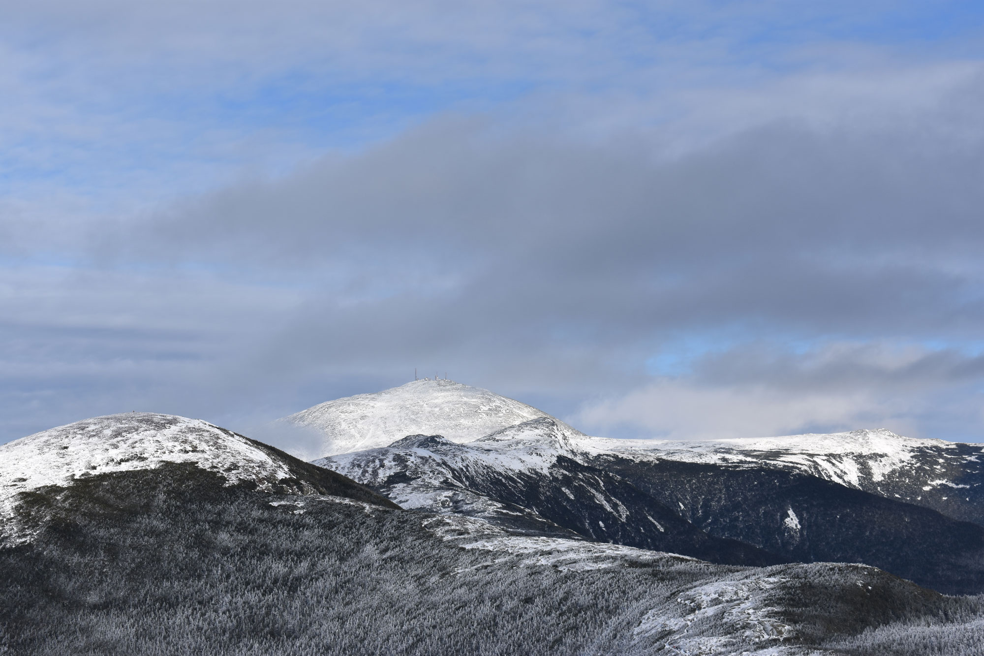
Mount Pierce is a good next step for building your fitness and testing your layering system, all while giving you a taste of the weather found in the Presidentials. Similar to Tecumseh, a trip to the summit of Mount Pierce via the Crawford Path is mostly in the trees, only popping out at the very top. If you’re lucky, you’ll have a great view of the Rock Pile and the Mount Washington Observatory from the summit of Pierce.
The Mount Washington Observatory is a fantastic resource for trips to the Whites, especially in winter. In the lead up to your trip to Mount Pierce, and later Mount Washington, get in the habit of checking the observatory’s higher summits forecast to gain insight into not only what the weather is forecasted to do while you’re there, but what it’s done and what it’s predicted to do. Was there a lot of snow prior to your hike? Consider packing snowshoes. Is a storm moving in? Think about an alpine start to stay in front of it or switch objectives.
In addition to building your skillset and offering a logical fitness progression—Pierce covers more mileage than Tecumseh while gaining about the same elevation—the rocky and icy Crawford Path is the perfect place to get familiar with hiking in traction devices. These are the traction devices you’ll likely be using on the first couple miles of your Lion Head ascent. On Pierce, expect to use these for the entire ascent and descent.
3. Mount Moosilauke
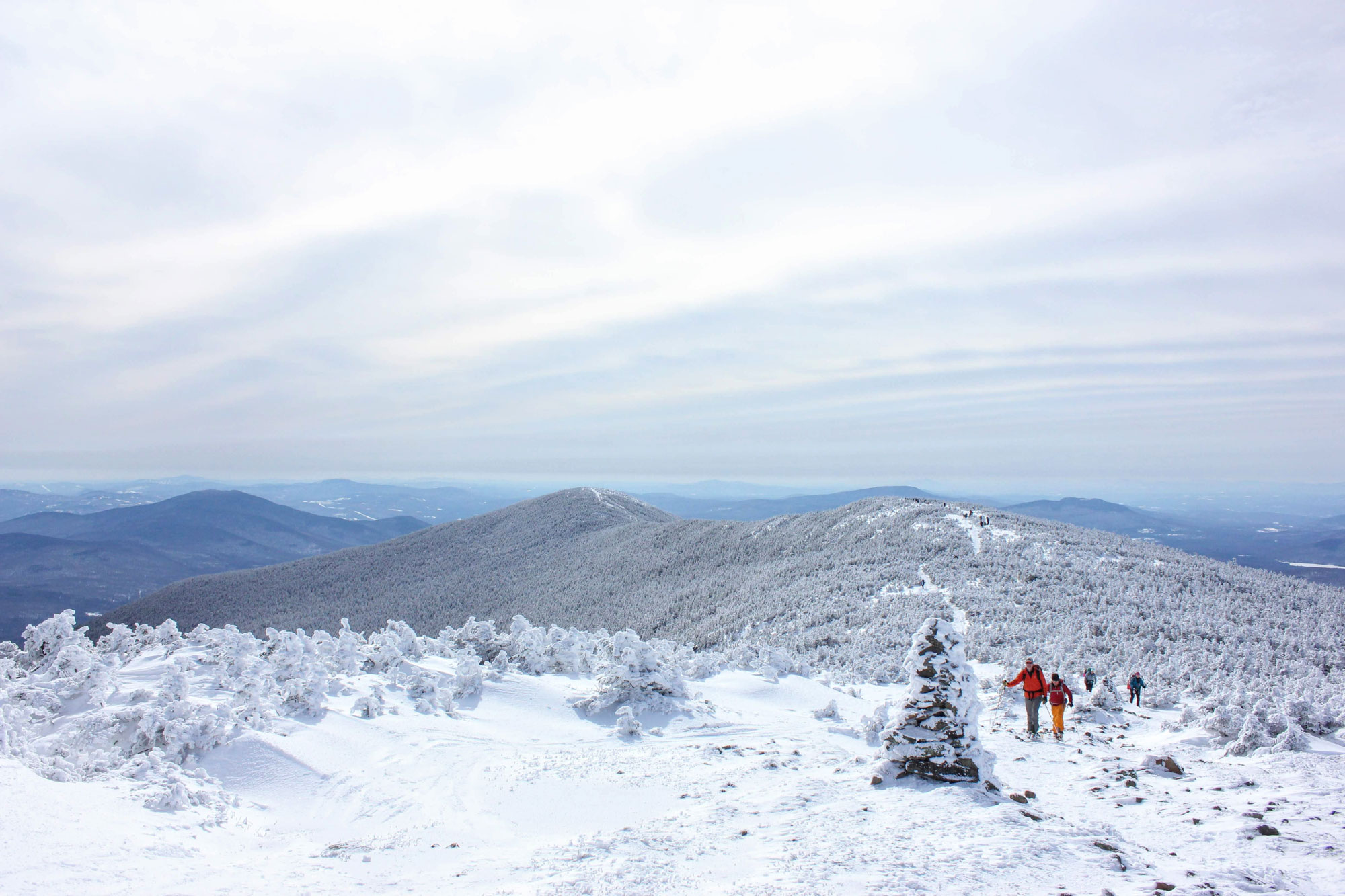
Mount Moosilauke is a worthy objective on its own, regardless of your Mount Washington aspirations, and is a good introduction to high-consequence climbs in the White Mountains. Traveling along the Glencliff Trail, you’ll cover roughly 7.5 miles and gain more than 3,000 feet of elevation—another increase in fitness—on the way to the 10th highest peak in the Whites. The majority of the Glencliff Trail is protected by trees, but its last half mile provides an excellent opportunity to build some new skills.
One skill to build here is wearing crampons. Use the rocky, windswept summit of Mount Moosilauke to get acquainted with them, as you’ll be wearing crampons on your feet on the upper portions of the Lion Head. Since above 4,000 feet in winter is no place to fiddle with crampon sizing, fitting them to your boots in the comfort of your home is a must. And since walking in crampons is awkward at first and Moosilauke’s summit is a long way from a road, pay attention to where you’re stepping and how crampons affect your normal stride.
Winter navigation is a second skill to practice on Moosilauke. It’s easy to get disoriented on Mount Moosilauke’s expansive open summit, especially in the wind, snow, or fog—not unlike Mount Washington. Have your goggles ready and your hiking app, handheld GPS, or compass ready in the event the weather gets bad or you get turned around.
4. Mount Madison
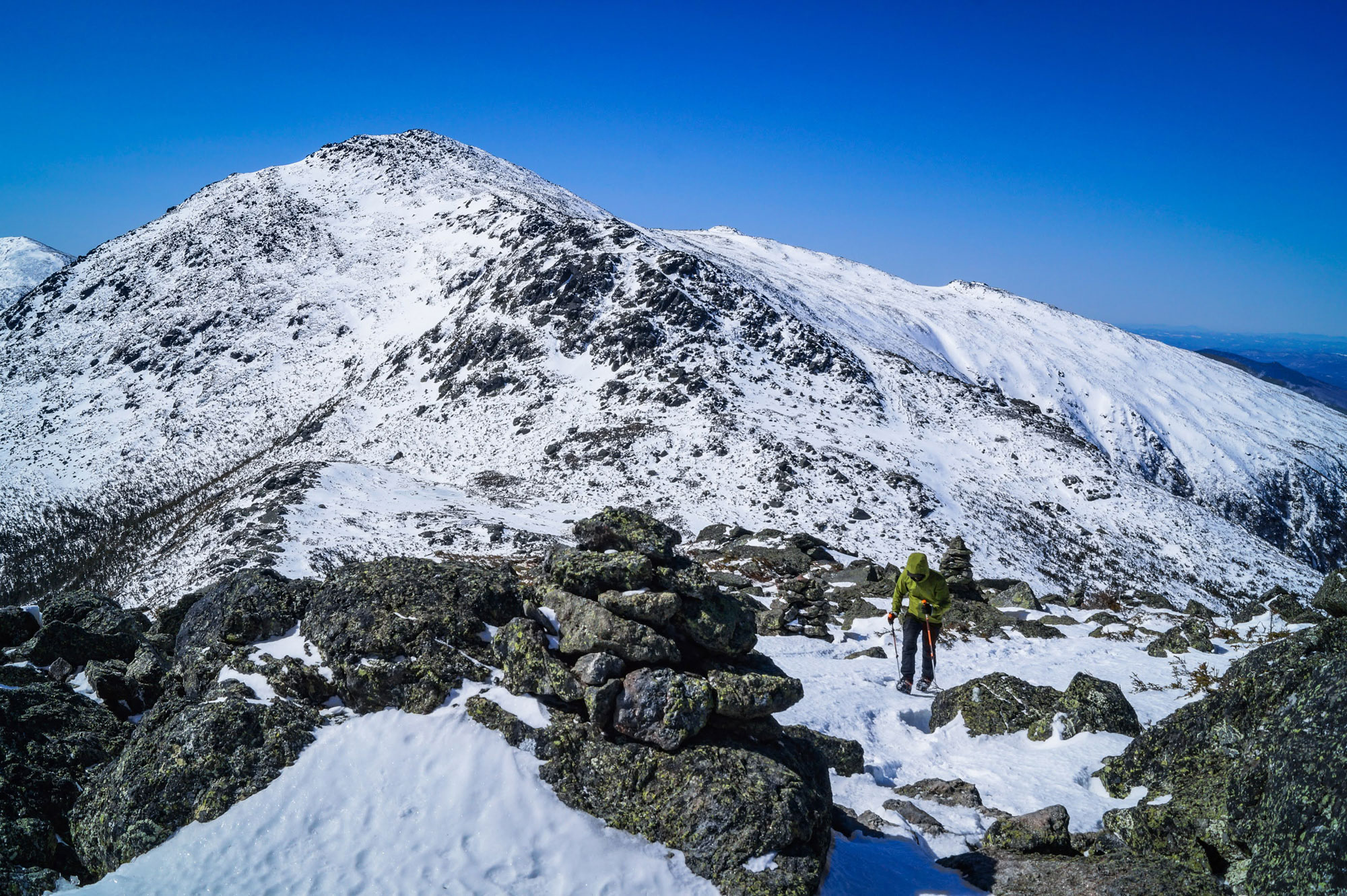
If anyplace can replicate the weather, ruggedness, and effort required of a winter Mount Washington hike, it’s the Northern Presidentials. Mount Madison via Valley Way is the most approachable of these mountains, climbing roughly 4,000 feet in nearly eight miles—a pretty equivalent to the Lion Head. As an added bonus, huddling from the weather behind the Madison Hut feels eerily familiar to seeking shelter from the wind behind Mount Washington’s summit buildings.
An ascent of Mount Madison via Valley Way has similar mileage and elevation gain as Mount Washington. However, it’s more protected from the weather and offers easier terrain than the Rock Pile, making it a good spot to see how you handle a big day in New Hampshire’s big mountains (It can take hikers anywhere from six to ten hours to bag Washington and get back to the trailhead).
Long days in the mountains are about more than fitness, and keeping yourself fed and hydrated is of the utmost importance. Cold winter temps can make it difficult to tell you’re getting dehydrated, and stopping for a snack isn’t always possible when it’s frigid or you have a lot of trail left to cover. Before heading into the mountains, have a snack strategy and plan on stopping to drink and eat either at certain spots or times. For example, plan to stop at Valley Way’s intersection with the Watson Path, at the Valley Way Campsite, and the Madison Hut on your ascent.
Also plan on carrying an ice axe on Madison, deploying it on the peak’s upper slope. While you may not truly need it here, you’ll carry an ice axe on Washington and it’s good to get familiar with its weight and use in a less-consequential situation.
The Lion Head Winter Route is a big objective and a coveted prize for Northeastern mountaineers, but there are a lot of great mountains in the Whites. The mountains listed above will all reward you with beautiful summits, unforgettable experiences, and help you build the skills and fitness needed to send the Rock Pile.
Related Posts


