

Fall is objectively the best time of year in New York City. Summer’s oppressive combination of heat, humidity, and trash-day odor is finally fading away, and the icy sidewalk chaos of winter is still weeks off. It’s the best time to do anything in the five boroughs.
It’s also the right time to catch the foliage and enjoy the natural wonders that abound in the surrounding country. The options within reach of public transportation or a short drive are both surprisingly plentiful and equally cool.
So, get out of town! Borrow a car and head up the Palisades! Hop a train to the Appalachian Trail! Take a hike!
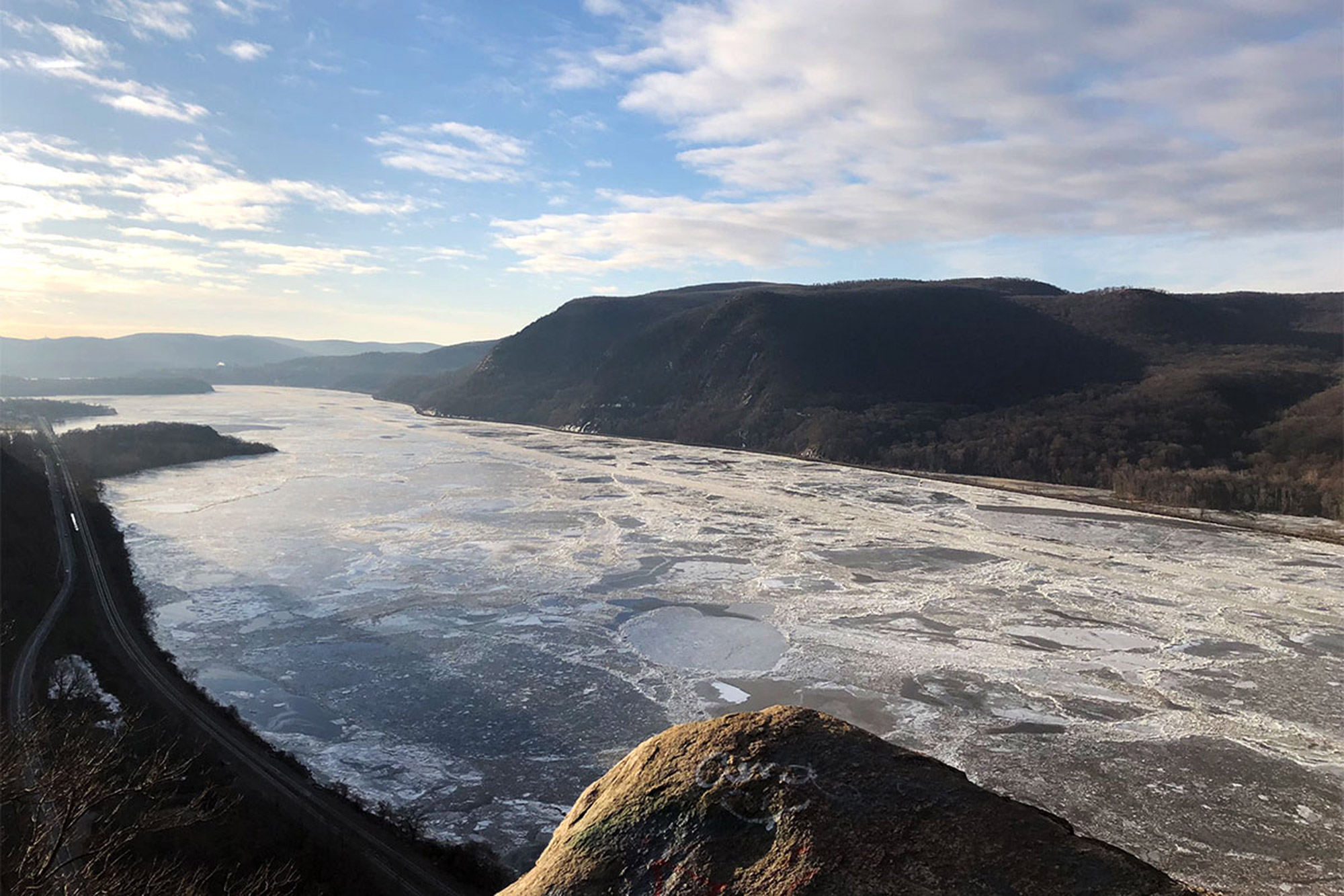
Breakneck Ridge
Make no mistake about it—Breakneck Ridge is popular. On a fair Saturday or Sunday from April to October, this place will be absolutely mobbed for two good reasons. One, it’s accessible via public transportation with its very own Metro-North stop. The other reason is that it’s awesome. Consider, for example, the 1,250 feet in elevation the Breakneck Ridge Trail gains in its opening, three-quarter-mile scramble. It’s steep, it’s rough, and the views are extraordinary. If you don’t feel like dealing with the crowds, consider Breakneck Ridge on a weekday or in winter. When it’s not covered in ice, it’s definitely still hikeable with a decent pair of MICROspikes and an abundance of caution.
From the Breakneck Ridge train station—as an aside, it’s really more of a staircase next to some rails than an actual station—walk south on NY-9D to a tunnel. The trailhead begins here and runs up over the tunnel to head east over the road. Follow the white blazes up the scramble and keep doing it. It’s steep and rough, and if you’re there on a nice day, you’ll have plenty of people to deal with, as well. Keep on climbing, and you’ll hit a nice open area with a flagpole and a view that’s great for a first breather. There’ll be two more of these on the ridge’s exposed section, so keep going up.
Eventually, you’ll run out of ridge to climb and will enter the woods, where the trail alternates between rough ups and downs. At the junction with the red-blazed Breakneck Bypass Trail, bang a left. From here, the hard work is done, and the trail descends moderately through mixed hardwood forest. In short order, the Breakneck Bypass Trail dead-ends into the yellow-blazed Wilkinson Memorial Trail. Take another left, and continue heading on down to the road—the train station will be right across NY-9D.
Bear Mountain
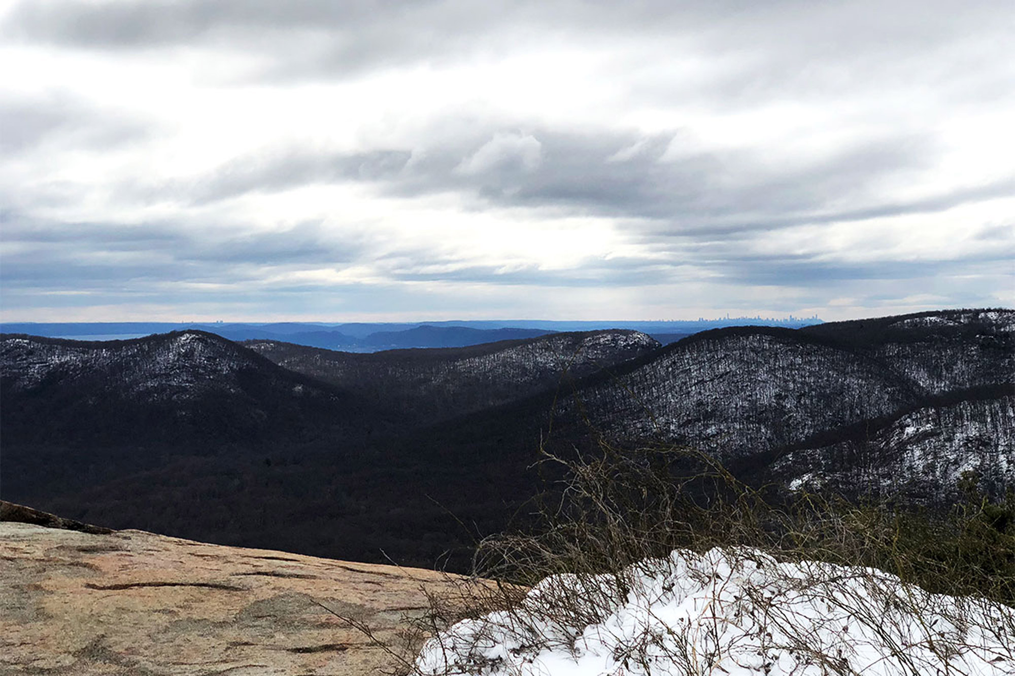
Hiking Bear Mountain is a tale of two trails. The rugged Major Welch Trail ascends the mountain’s decidedly woodsier northern slope, scaling several exposed mammoth rocks along the way. The northbound Appalachian Trail, on the other hand, descends to the east over gentle grades, groomed paths, and even the occasional road walk. But, despite their differences, they combine to create a lovely little loop hike with several excellent viewpoints and even a summit tower for those of us who want a little extra.
Start your hike at the junction of the Appalachian, Major Welch, and Suffern-Bear Mountain Trails, just east of the Bear Mountain Inn. The steeper, more rugged Major Welch Trail is a better bet for going up, so follow the signage and the red-and-white bullseye blazes and head out along a paved path. The path runs along Hessian Lake for a little bit, before branching off into the woods to the left, the official start of the Major Welch Trail. Follow those bullseye blazes as the trail climbs moderately, switching back twice before it ascends the slope directly.
The mammoth rock formations are a fun feature and offer views to the north and east. Keep going up, and at 1.6 miles, after another steep effort up a pile of smaller rocks, cross Perkins Memorial Drive—the alternate route up for the mechanically inclined. From here, it’s just another 0.1 miles to the flat summit and Perkins Memorial Tower. From here, on a clear day, you can see four states: New York, New Jersey, Connecticut, and Pennsylvania. Continue across the paved parking area to the viewpoint on a ledge with open southern exposure and, way off in the distance over the Hudson Highlands’ rolling hills, a view of the Manhattan skyline.
Your way down, the ever-white-blazed Appalachian Trail, descends to the south. Trail maintenance has recently rerouted the AT to the roadway, but enjoy the views as you make your moderate descent.
Gravel, steps, and cool boulders are the order of the day as the AT takes you back to Bear Mountain Inn.
Appalachian Trail Metro-North
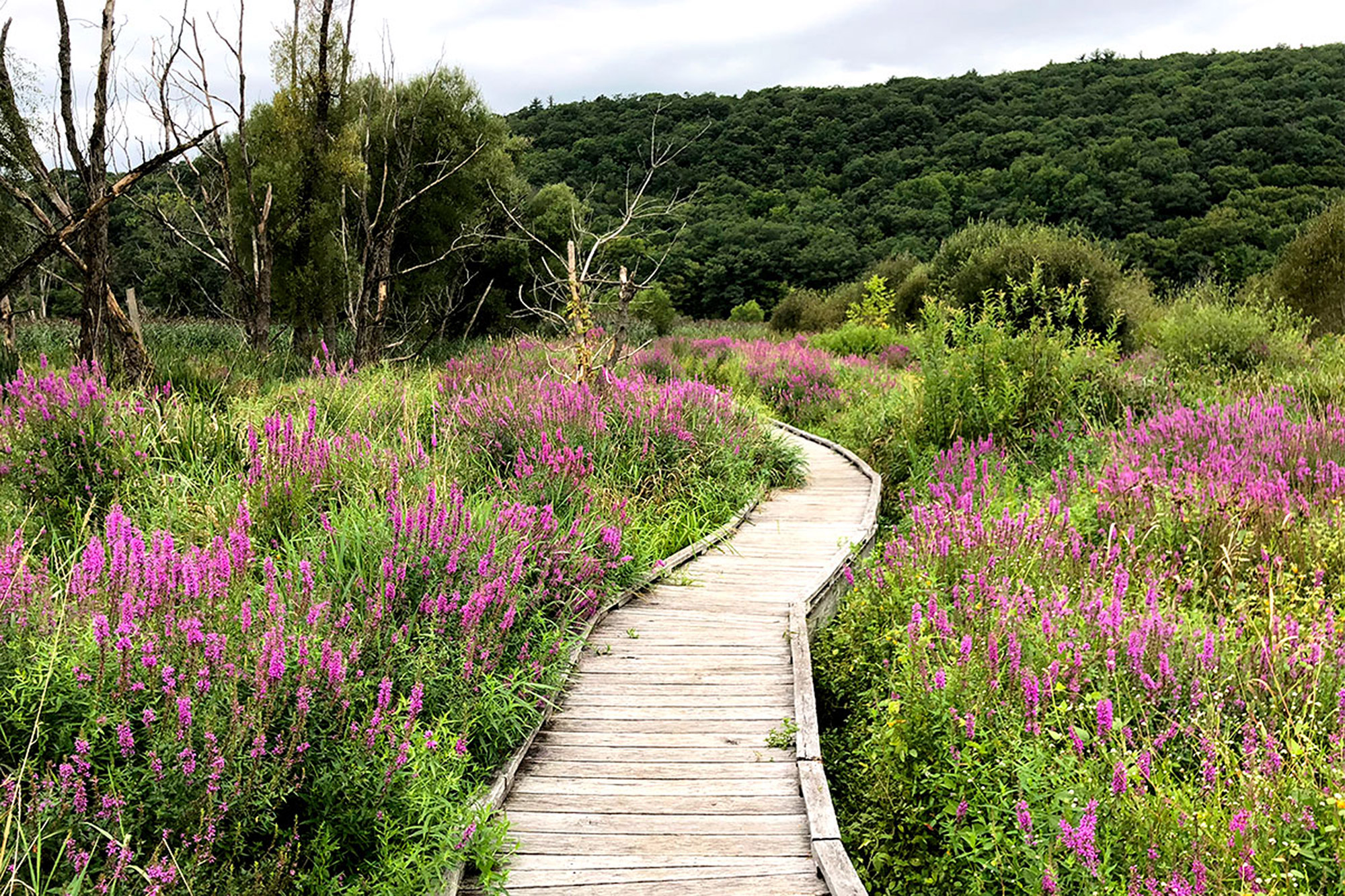
Courtesy of a small, weekends-only stop on the Metro-North Railroad’s Harlem Line, you can hop a train from Midtown Manhattan to access the entirety of the Appalachian Trail without ever getting behind the wheel of a car.
From the train station, cross the tracks (carefully) and start heading south. You’ll immediately be met by the Swamp River Boardwalk, a beautiful, 0.4-mile wooden walkway that traverses The Great Swamp and provides a dry route from the wooded hills to Route 22 in Pawling, New York. The reeds and cattails flanking the route on both sides create a cool kind of natural tunnel, while the abundant wildflowers attract hummingbirds.
After the boardwalk, the woods begin and so does the ascent—gently at first, until around 1.1 miles, where it gets a bit steeper. The mixed forest is thick at first, opening up a bit as you climb, until, at 1.5 miles, it reaches a meadow of tall grass and wildflowers. From here, the trail narrows and traces the border of a private home. At some points, it’s rather overgrown but isn’t difficult to follow at all. Then, it’s mostly downhill to West Dover Road and the Dover Oak, a beautiful, truly massive white oak. With a height of 114 feet and trunk circumference of 251 inches, it’s the largest—and likely the oldest—of its kind in New York State.
Take a photo with the cool tree, and then, cross the road to continue on the AT, back into the woods. After a quick initial dip, the trail resumes its climb—rocky at times—to Cat Rocks, an east-facing overlook at 3.25 miles. From here, you can survey the surrounding hills and open meadow you’d just passed through.
To return, retrace your steps to the train station for a nice, little 6.5-mile hike with around 1,350 feet of elevation gain.
Fishkill Ridge
Short, steep, and rocky ascents characterize many hikes in the Hudson Highlands, and this route up Fishkill Ridge over Lambs and Bald Hills is no exception.
From the parking area at the end of Sunnyside Road, in Beacon, New York, the red-blazed Overlook Trail begins climbing immediately. At 0.5 miles, a trail to a private campground enters from the left, and the grade evens out a bit before dipping into a gully to cross a small stream and resume climbing.
At around 1.4 miles, the trail levels out once more in an open hardwood forest with some cool stone walls. The Overlook Trail then dead-ends into the white-blazed Fishkill Ridge Trail at 1.7 miles. Here, bang a left and head up the rocky final ascent to the top of Lambs Hill at 2.2 miles. Looking back, the City of Beacon and the Hudson River provide the view.
From here, the Fishkill Ridge Trail is a true ridge walk, alternately climbing and descending and cutting through thinly wooded high grasslands and rocky outcroppings in the process. Viewpoints at 2.5 and 3.0 miles offer nice places to stop and chill before the final climb up Bald Hill at 3.7 miles.
Just past the summit—which is not actually bald and doesn’t offer much of a view–an unmarked trail enters from the left. Pick this up to head back down the hill. This portion is wide and somewhat rocky, and resembles an old woods road. Keep on it, until it eventually joins the red-blazed Overlook Trail, which will lead you back to the parking lot, making a 5.2-mile loop that covers 1,600 feet of elevation gain.
Giant Ledge and Panther Mountain
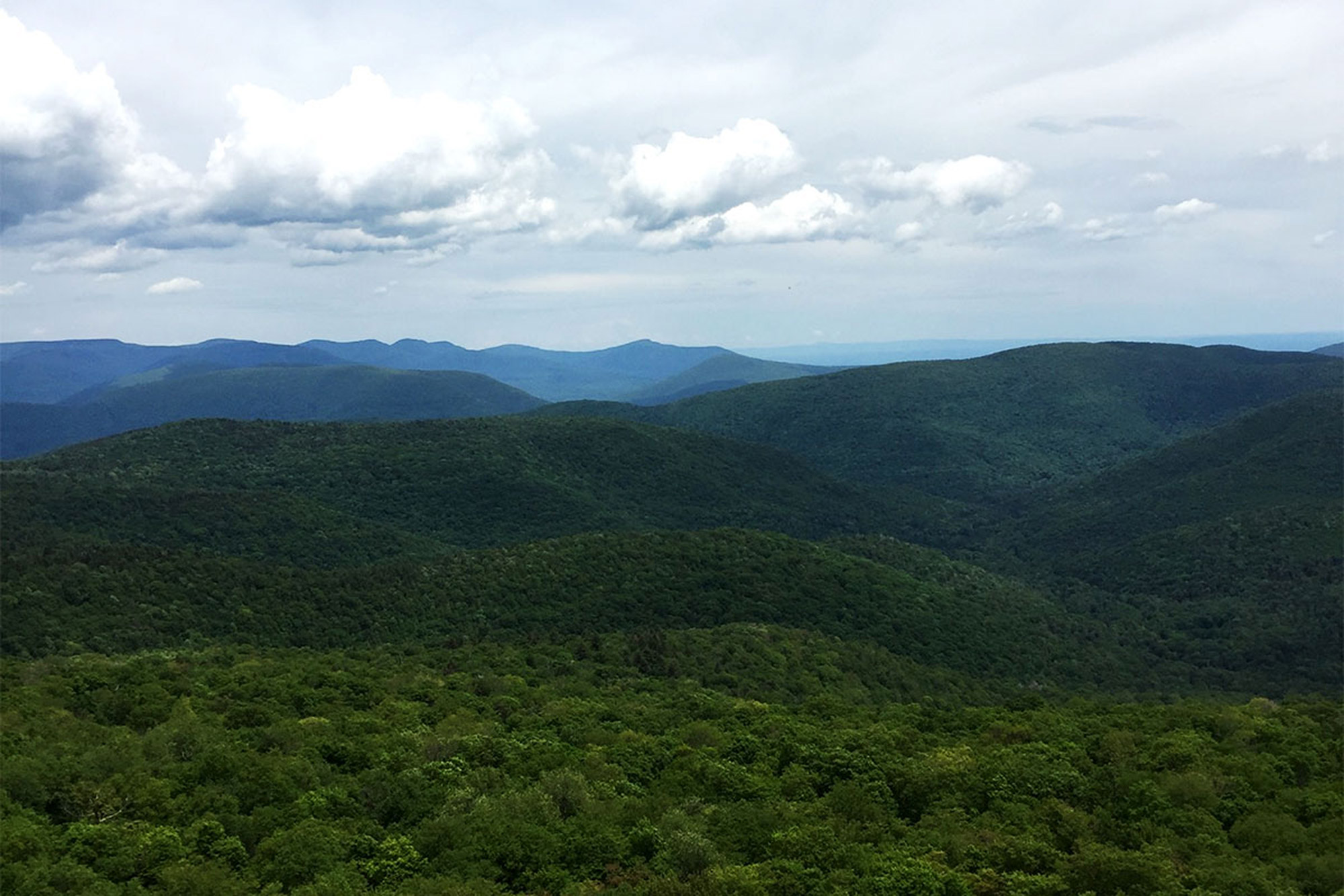
If wilderness is what you’re looking for, then you’re in luck. A mere two-hour drive north will land you in the rugged and wild Catskill Mountains, home to 287,500 acres of public forest preserve and 35 peaks over 3,500 feet in elevation. The trail up to Panther Mountain—one of those peaks—is a great example of what the Catskills have to offer in a fun-size day hike.
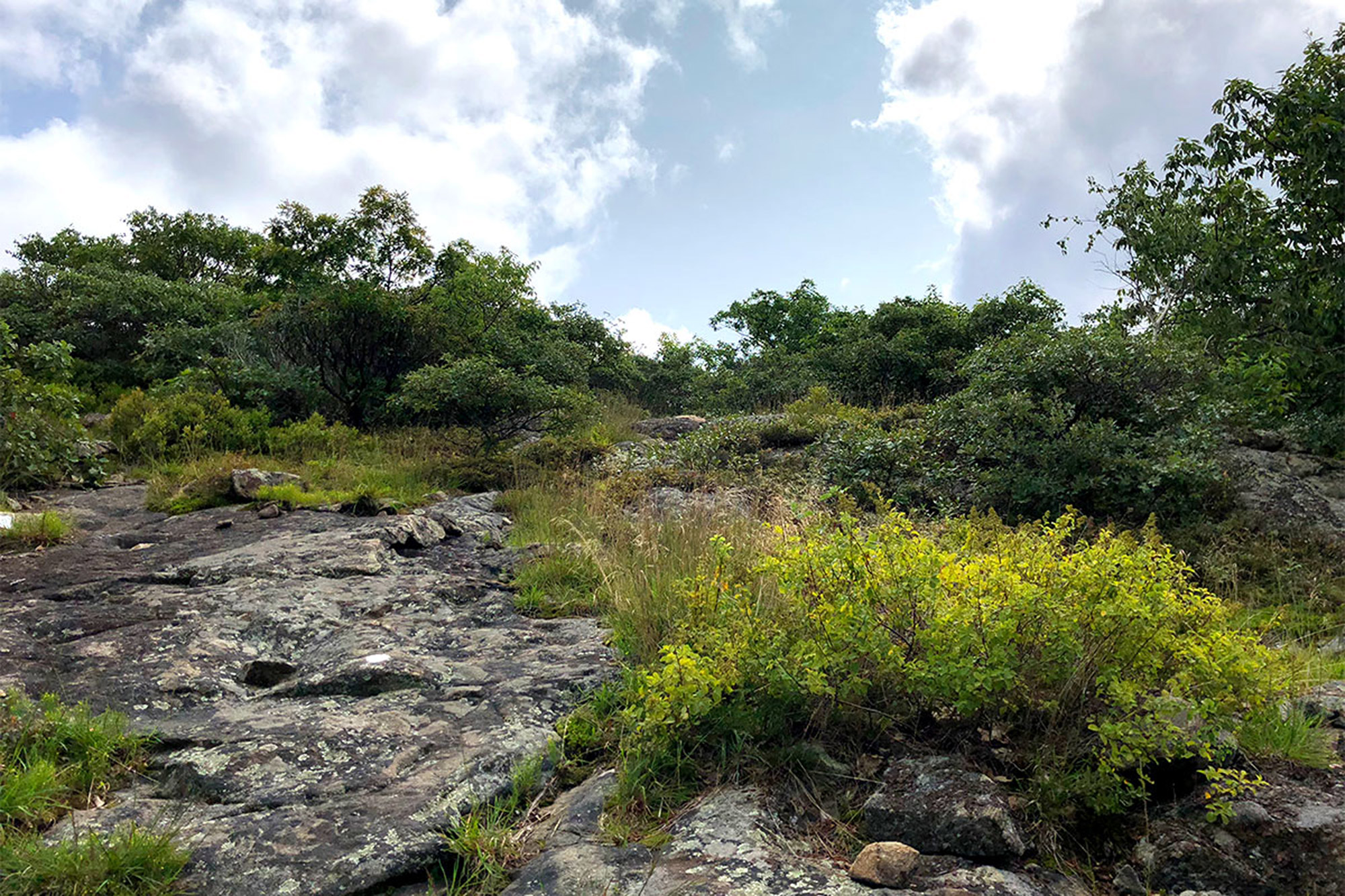
Begin on the Phoenicia-East Branch Trail, just a few steps up the hill from the parking area at the hairpin turn on CR-47, 7.2 miles south of its junction with NY-28. The trail ascends gently for 0.7 miles through a mixed forest, before reaching a well-marked intersection with the Giant Ledge-Panther Mountain-Fox Hollow Trail. Take a left onto the Giant Ledge-Panther Mountain-Fox Hollow Trail, and begin the moderate climb to Giant Ledge.
This is also a very popular trail, as the view-to-effort ratio is considerably low. At just 0.8 miles from the Phoenicia-East Branch Trail, a short spur trail to the right brings you to Giant Ledge. Here, you’ll get an incredible, sweeping view east of Devil’s Path’s jagged ridgeline to the north and the Slide Mountain Wilderness to the south, including Wittenberg, Cornell, and Slide Mountains.
Continuing from Giant Ledge to Panther Mountain, the trail levels out a bit, before climbing moderately to the true summit just 3.0 miles in. Take in the view—similar to Giant Ledge’s but including a few more summits to the north, and much cooler because it’s on top of a mountain. Retrace your steps to the parking area for a nice, little six-mile out-and-back.
Related Posts


