

There’s something special about the Connecticut shoreline in the offseason. Boardwalks and beaches once teeming with beachgoers stand mostly empty and the memory of summer is palpable. To some, it can be a bit creepy—to others, peaceful. Either way, gone with the summer sun are the crowds, and just like any other ecosystem in fall and winter, the coast gets its opportunity to rest, to regenerate, and to become a refuge for those seeking quietude and connection with nature.
Caught between I-95 and the Long Island Sound, the Nutmeg State’s 332 miles of coastline is a mix of densely populated cities and towns, gradually dissipating as the distance from New York City increases. And though much of it has been urbanized or carved up into tidy lots for beach homes, the pockets of nature that remain—in the form of state parks and beaches—are pearls in a strand that runs from Greenwich all the way out to the Rhode Island border.
Short trails and easy terrain characterize the spots below so whether you’re looking to mix up the trail running routine or you just want a chill hike that can end in a lobster roll, heading down to the shore is the right move.
Sherwood Island
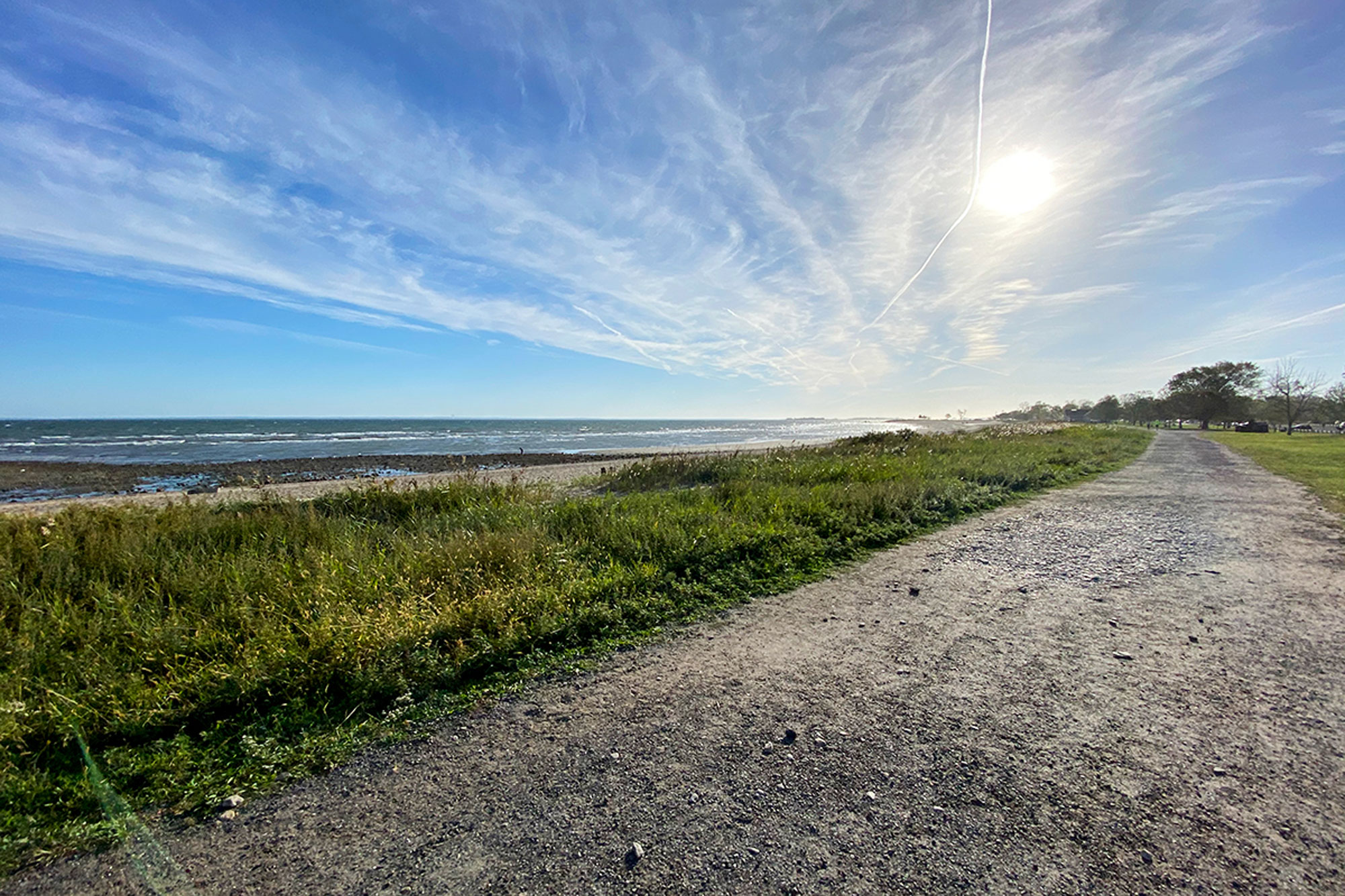
With open lawns, sweeping ocean views, and sandy beaches, it’s no wonder why Sherwood Island State Park in Westport is Connecticut’s first state park. And while this little gem in the state’s densely populated “Gold Coast” is hardly a wilderness, getting a moment to yourself in such a setting is nothing to pass up.
Sherwood Island’s beach is split in two—East Beach and West Beach—each with a small loop trail at its end. The western loop runs through a stand of oak trees over roughly paved ground while the eastern loop navigates a grassy maze of paths flanked by a salt marsh to the north. In between, a gravel path just off the beach offers friendly ground over which to stroll or run. Combining the loop trails on the west and east ends of the island with a run along the beachside path and back weighs in at 3.3 miles.
Silver Sands
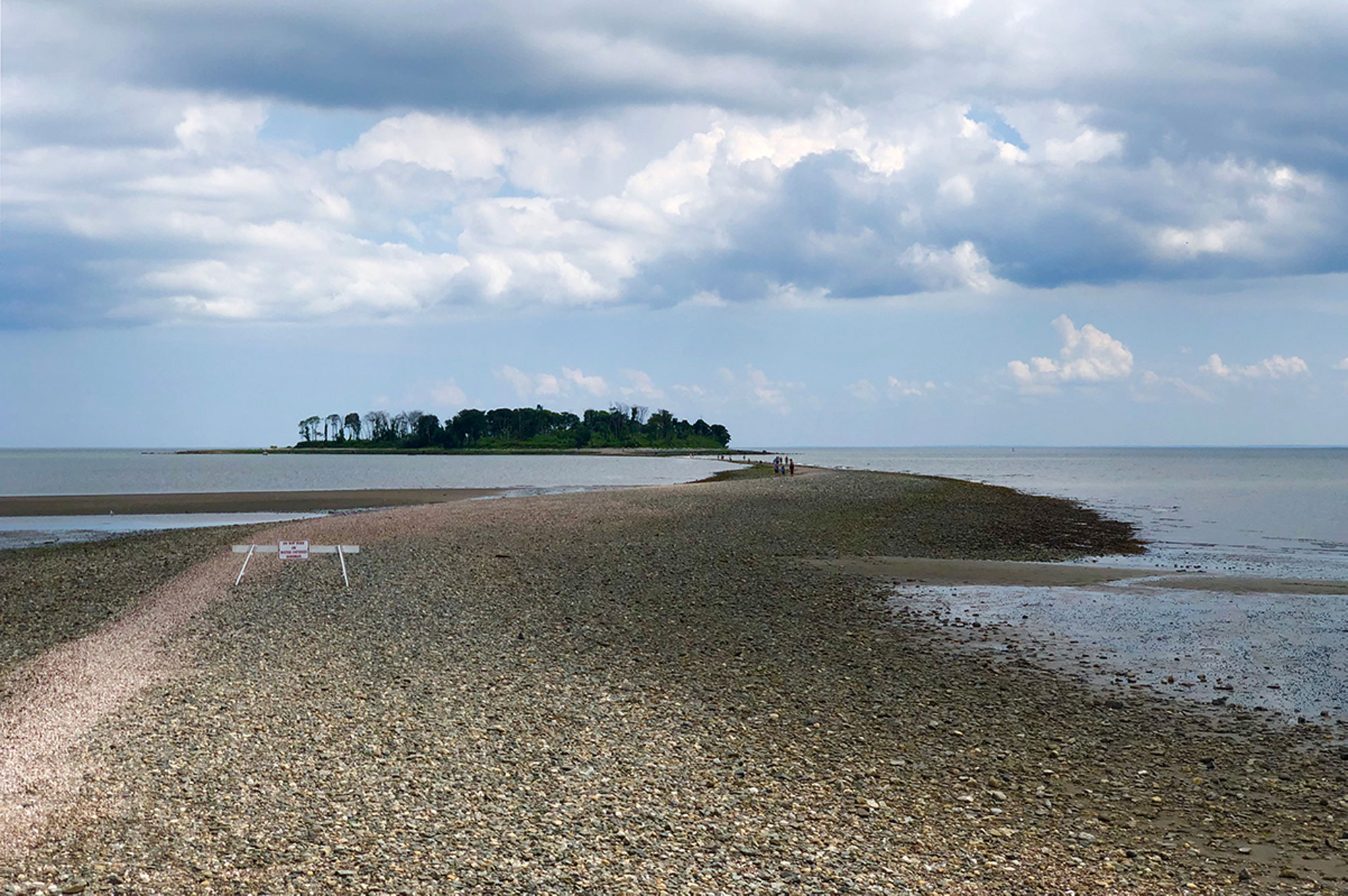
Silver Sands State Park in Milford is a quintessential Connecticut beach: more pebbles and shells than sand, picturesque salt marshes, and an immaculately weathered wooden boardwalk, all framed by the calm, lapping water of Long Island Sound.
What makes Silver Sands unique though is that, at low tide, the Sound reveals a rocky land bridge—known as a tombolo—that reaches out into the water, connecting the beach with nearby Charles Island. Tricky currents on either side of the tombolo make crossing a foolhardy endeavour in even just a few inches of water, so correctly timing your trip is essential. Consult a tide chart, pick a day where the tides are at their most extreme—when the moon is either new or full— and leave the beach at least an hour before the low tide. A roundtrip hike across the tombolo, around the island and back will run 2.5 miles.
Please note that access to Charles Island—and use of the tombolo—is forbidden from May 1–August 31 as the area is closed for the protection of nesting birds.
Hammonasset Beach
Drawing an estimated one million visitors annually, Hammonasset Beach State Park in Madison is one of Connecticut’s most popular destinations. In a typical summer, its two miles of wide, sandy beach regularly fill to capacity, and its large campgrounds are abuzz with activity. And while Hammonasset still draws visitors in the off-season, a trip here in the fall can feel like a completely different place.
On the far southeastern edge of the state park, the beach fades away to rocky shores and coastal wetlands—this is Meig’s Point. A handful of short-but-lovely trails stretch out from the Nature Center in the center of Meig’s Point that, when combined with a tour of the beach, can make for a really enjoyable walk or run. An out-and-back starting from West Beach and ending at the terminus of the Moraine Trail will net you around 5.0 miles of beach, bluff, and beautiful views of Long Island Sound.
Rocky Neck
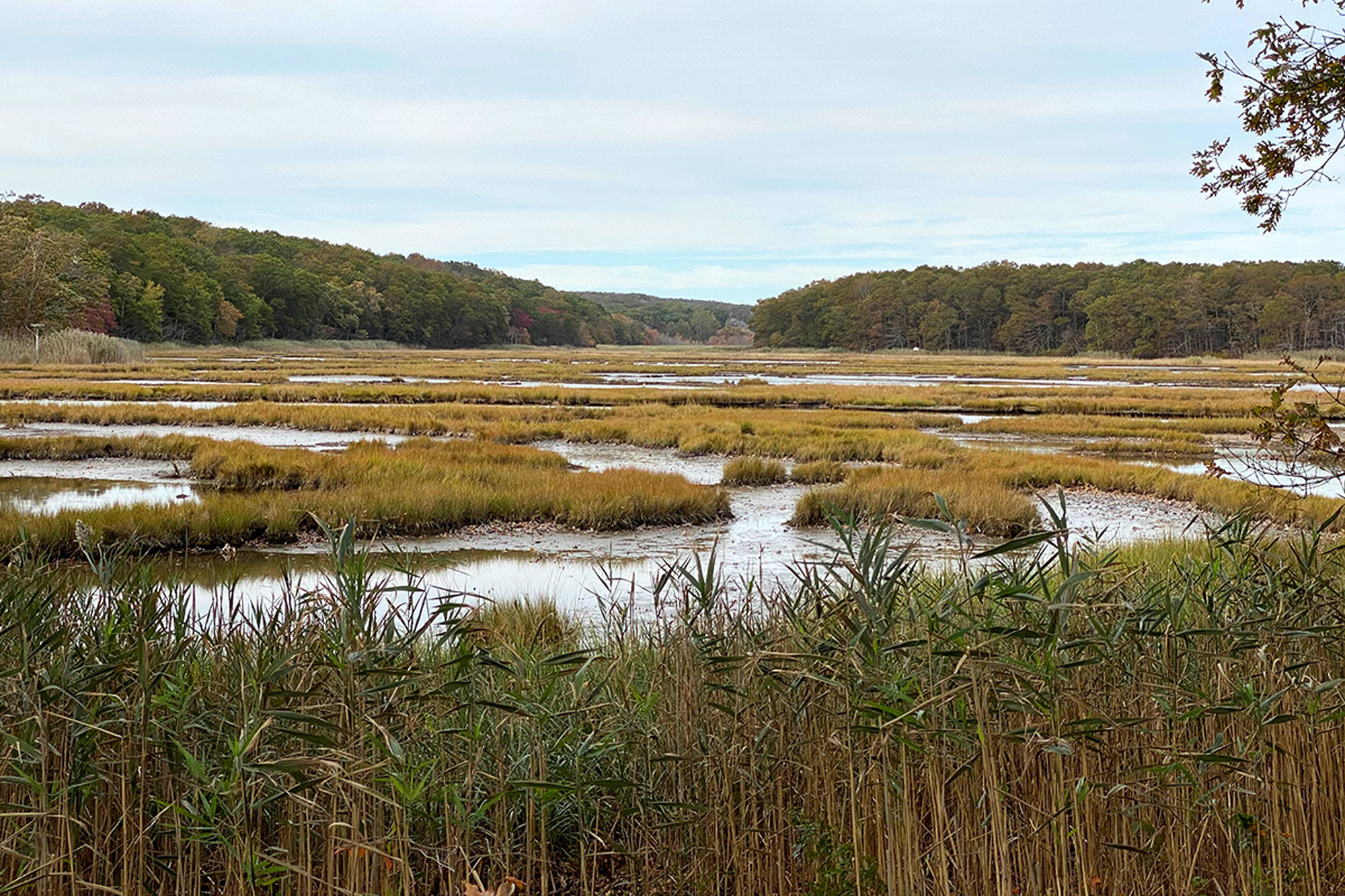
Much like Hammonasset Beach, Rocky Neck State Park in East Lyme is an incredibly popular summertime destination for Connecticut residents seeking sun, sand, and surf. The beach itself, bounded by a busy passenger railroad, is a bit developed (and can be a little noisy), but the draw of Rocky Neck for hikers and trail runners are its coastal woodlands and its salt marshes, both of which are accessible via a network of well-marked and well-maintained trails.
A large stand of woods separates the park’s western boundary—the tidal Four Mile River—from the salt marshes at its interior. The trails within weave and wind through dense mountain laurel and coastal hardwood forest with occasional views to the river, the salt marsh, and Long Island Sound. It is, in some places, paved, but the majority of the trails here vary between wide, easy former woods roads and rocky, rooty singletrack. The densely packed trails at Rocky Neck make for a bit of a choose your own adventure in terms of distance, but the most pleasant of rambles will get you between 2.0 and 4.0 miles, easily.
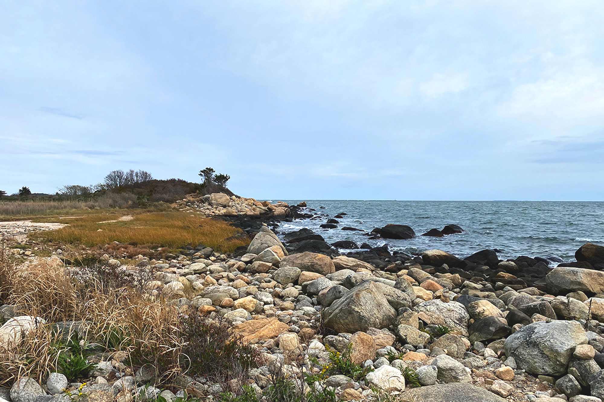
Bluff Point
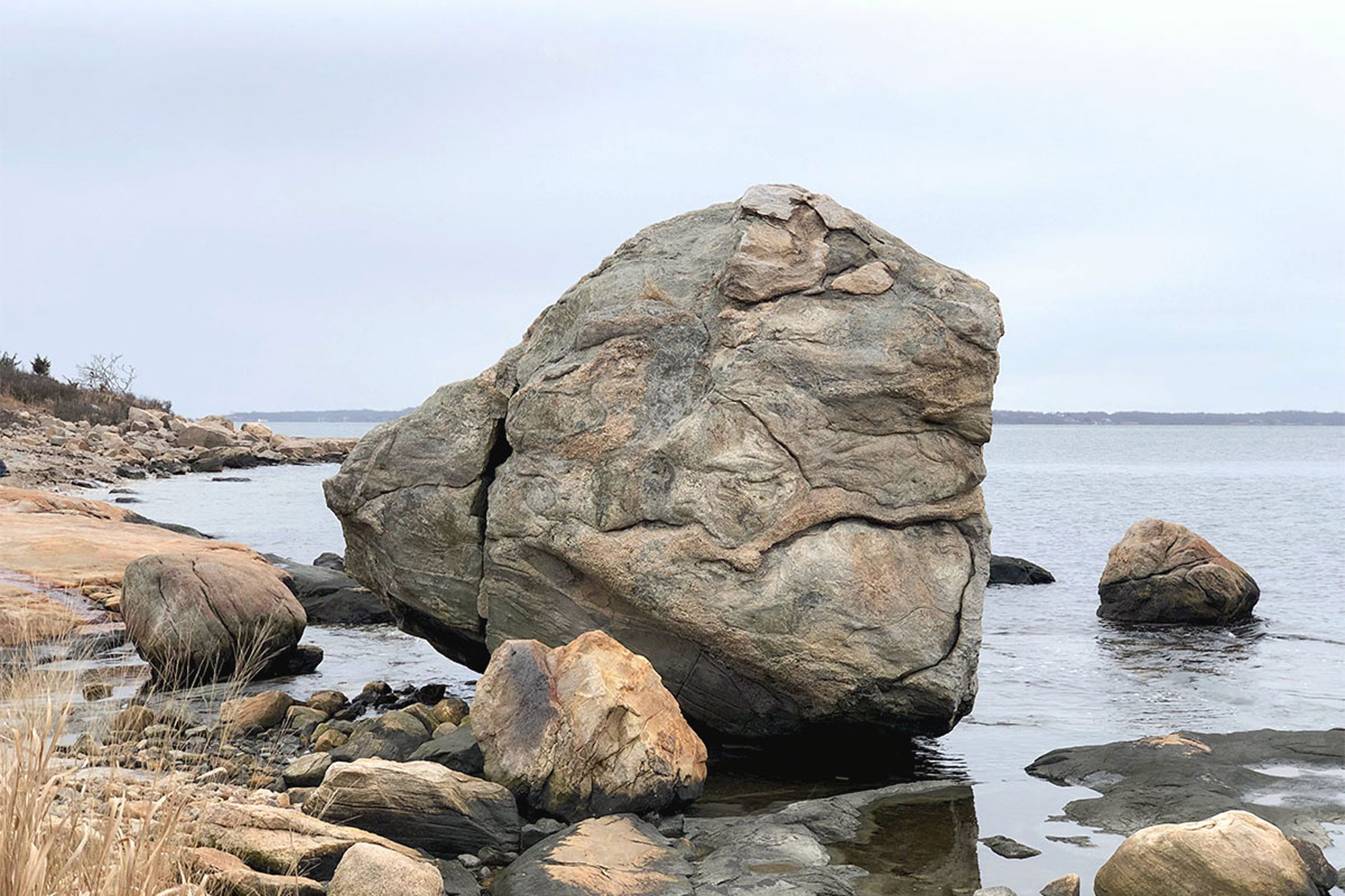
Undeveloped shoreline is exceedingly rare in Southern New England, and that’s what makes Bluff Point State Park and Coastal Reserve, a wooded peninsula in the city of Groton, such a special place. At over 800 acres, characterized by nearly untouched coastal forest and rocky shore, it’s the largest such tract of land remaining on the Connecticut coast.
The main artery through Bluff Point is a wide, graded gravel road. The ground is easy and flat and intermittent views of the Poquonnock River to the west open up to broader views of Fishers Island Sound as you head south. Despite its proximity to a densely-populated city, and the ease of the graded path, Bluff Point has a distinctly natural feel. Gradually, the woodlands give way to sweeping views and rocky shoreline where large boulders, fascinating rock formations, and the dramatic, eponymous Bluff Point take center stage.
A chill and peaceful loop on this gravel road takes it all in over an easy 3.6 miles.
Related Posts


