


This twisting, narrow roller coaster off an Adirondack High Peak is a historical artifact and classic ski line in New York
Originally designed and cut in the 1930s, during the early years of alpine skiing, the Wright Peak Ski Trail is still one of the classic ski tours of the Adirondack High Peaks region. After a fresh snowfall, this trail can be an amazing ride of nearly 3 miles that offers a bit of everything. From tight steeps in the evergreens of high elevation, to open birch glades at lower elevations, to the fun and challenging bobsled-like track of the lower hiking trail, this one has it all. It is a great intermediate trip that offers more difficulty and true skiing than some milder tours like Avalanche Lake, without quite the risk and avalanche hazard of a more advanced tour to one of the steep slides across the High Peaks, and it remains one of the few officially designated ski trails in the High Peaks region.
Quick Facts
Distance: 7.1 miles, round-trip
Time to Complete: Half day
Difficulty: ★★★★
Scenery:★★★
Fees/Permits: Parking Fee at Adirondack Loj/HPIC lot is $15 a day or $7 for Adirondack Mountain Club members.
Contact: dec.ny.gov/lands/9164.html
Turn-By-Turn
This tour begins from the Adirondack Mountain Club’s Heart Lake Program Center. Exit Interstate 87 at exit 30 and turn onto Route 73 West. Proceed for just under 30 miles before turning left onto Adirondack Loj Road. Adirondack Loj Road becomes narrow and rough at times, but is passable with any car, and ends at the Heart Lake property after about 4.5 miles. Hiker/skier parking is found next to the High Peaks Information Center (HPIC). At the far end of the lot closest to the HPIC, you will find the trailhead/sign in kiosk (44.18290, -73.96267).
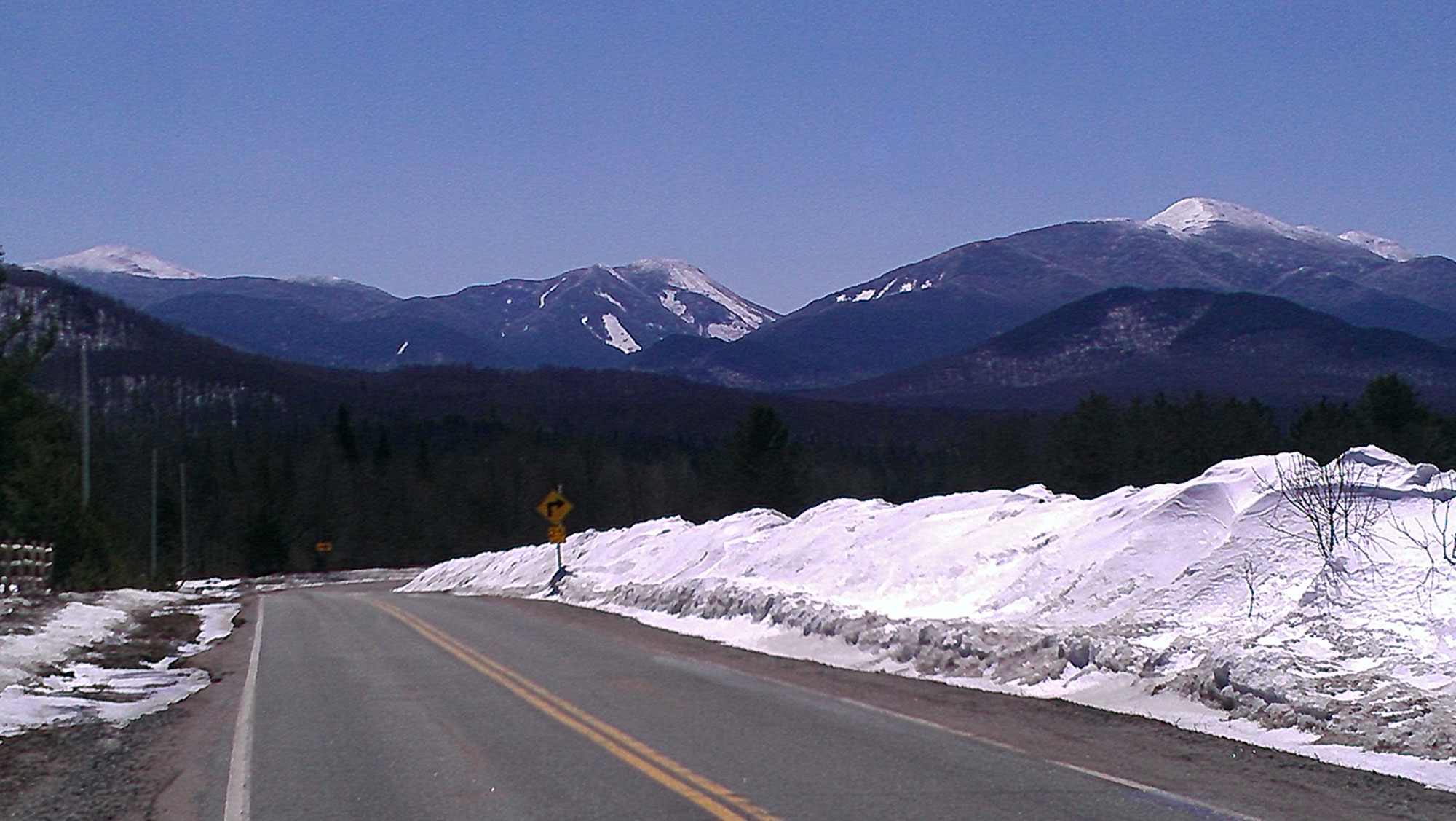
Getting to the Ski Trail
After signing in, begin your tour on the Van Hoevenberg Trail towards Marcy Dam and Mount Marcy. This is one of the busiest trail corridors in the region and is likely to be packed with other hikers and skiers. In the first half mile you’ll pass several side trails that are Heart Lake property hiking or ski trails to the left or right. Soon, you’ll depart ADK lands, and enter state land. This first section is relatively flat but there are a few mild hills and extended bog bridging that can be tricky if the conditions are icy. After .9 miles you will reach a trail intersection (44.17241, -73.95898): The Van Hoevenberg trail turns left toward Marcy Dam. Proceed straight onto the Algonquin Trail.
This first section of the Algonquin Trail gradually starts to get more steep. The skiing on this section of the tour, especially on the descent, can be challenging but fun. It’s especially important here to have ample snow cover: The trail is eroded, leaving frequent boulders and small stream crossings on this stretch. Originally this section of the ski trail was wider and easier to ski. However, at one point the DEC re-routed what was a separate hiking trail onto this lower section of the ski trail. Maintaining this as a primary hiking trail has resulted in narrowing, water bar construction, and other work that while okay for hiking has made skiing more challenging. Luckily, the DEC has proposed to eventually reroute this lower section of the ski trail to be separate from the Algonquin Trail which will remain for hikers.
As it remains now though, you will need to be ready for narrow turns, buried rocks, and be mindful of ascending snowshoers. The sides of the hiking trail however remain fairly open, and with deep enough snow you can dip into them as needed to slow your descent or to taste some more of the powder! On the descent of this section you will also face a few short uphill sections as you approach the Van Hoevenberg trail again. Splitboarders may need to transition on the descent, so pay attention as you skin up.

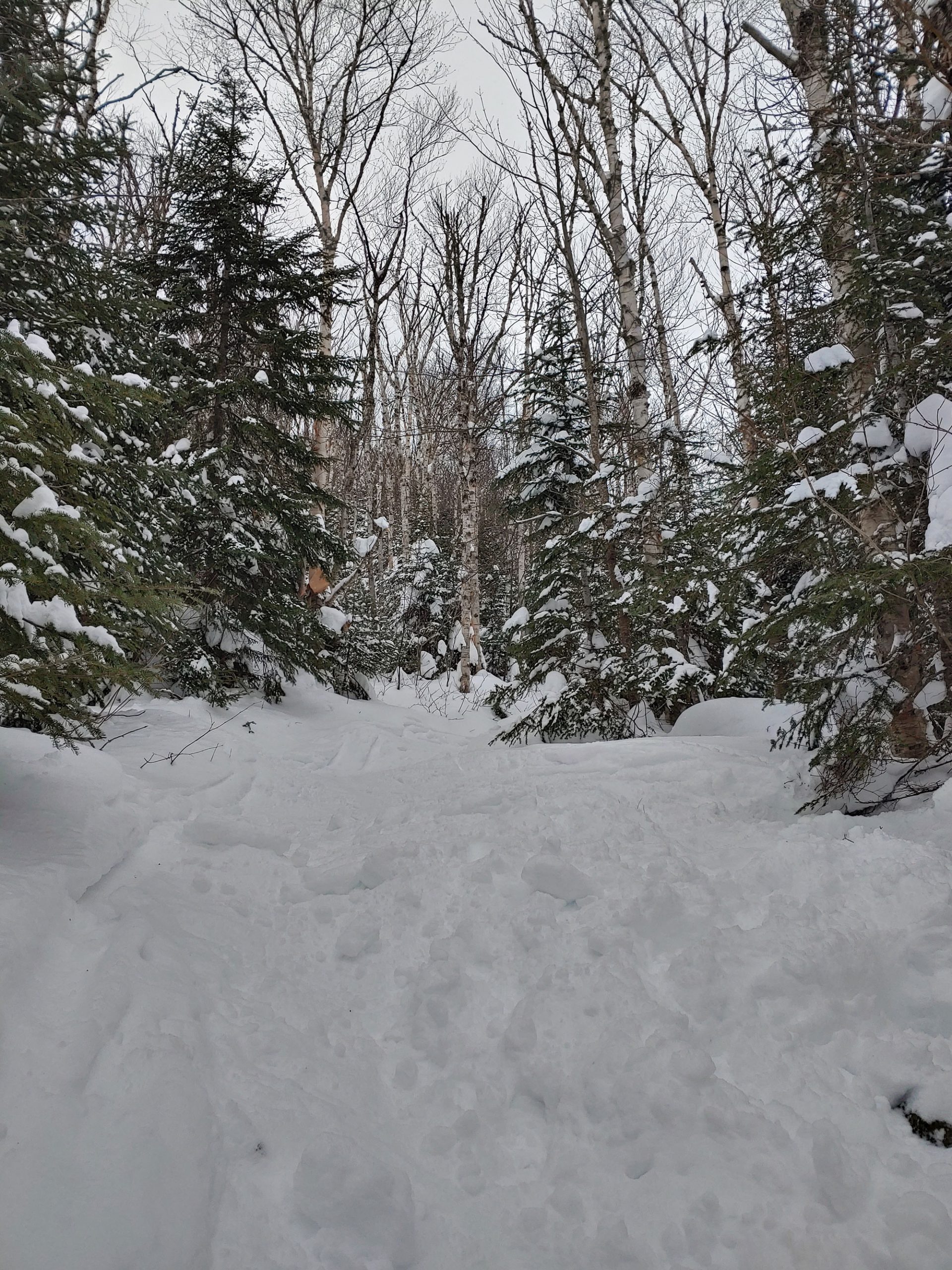
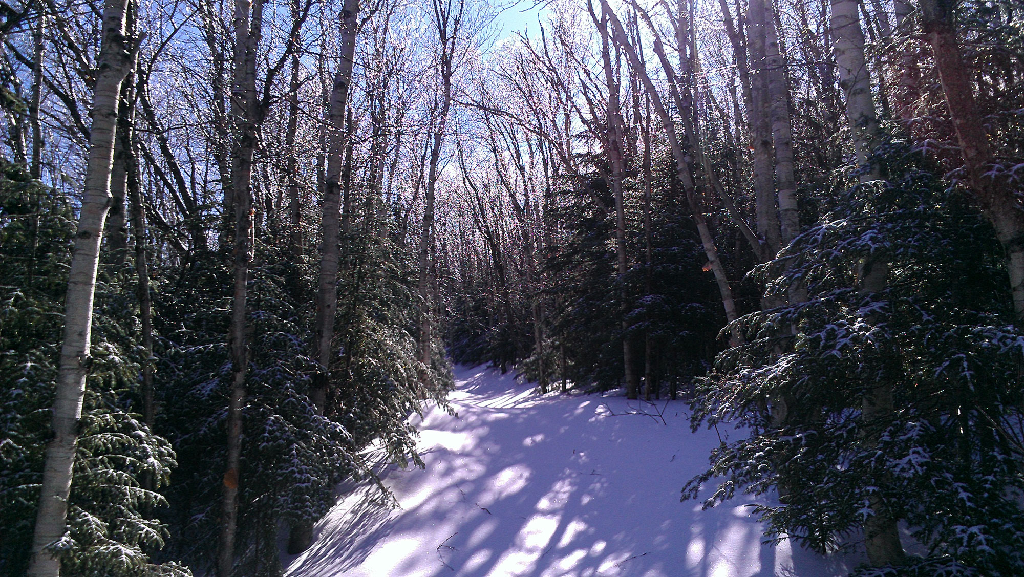
After 1.4 miles you may notice the unmarked Old MacIntyre trail on the right (44.16888, -73.96560), and just a tenth of a mile after that the Whales Tail Ski trail exits to the left. The Whales Tail Ski trail can make a nice add-on to this tour if you are looking to score some more turns before returning to your car. The Old MacIntyre trail can be used as an alternative return route to Heart Lake if you found the main approach too icy or bare.aAfter these intersections, the trail becomes steeper as it winds its way through beautiful birch and evergreen mixed forest.
Skiers/Snowboarders Only
At the 2.3-mile mark, the Wright Peak Ski trail exits left with a steep rise to the left and a sign (44.16020, -73.97835).
The first section of the ski trail is where, especially in deep snow, split/snowboarders and some skiers will have trouble maintaining speed on the descent. It consists of some narrow and relatively flat sections split up with some short rises as the trail works its way east before gaining the ridge of Wright Peak and turning more southerly. On the way up, it’s a good warm up for a stiffer climb ahead, but on the descent be sure to keep your speed as much as possible.
The last mile or so of the ski trail has alternating sections of short steep pitches, mild side-hill sections, and gentile turns. You will see much less traffic, and ideally much fresher snow. The ascent is steady, rising over 1300 feet in just over a mile of trail. As you climb the rise becomes more consistent and steep.
The climb becomes noticeably more mild for the last 300 yards or so as the ski trail takes a final turn West towards the summit. It ends abruptly and obviously in a tight stand of stunted spruce. It is important to note that the ski trail does not reach the true summit of Wright. It stops short of the summit, and a steep and difficult bushwack to the true summit is not recommended, nor is trying to ski from the summit to the trail. For the adventurous soul, a turn due south and a short bushwack scramble up through the evergreens and snow will get you to the open rock of the summit ridge.
Now its time for your descent! Like a roller coaster through the woods, this top section is just wide enough to make comfortable backcountry turns, but narrow enough to make you feel like it’s a true backwoods adventure. In good snow conditions this can be the best part of the day. Snow funnels well into this section creating those sweet deep and steep powder turns that we all dream about.
From the bottom of the Ski Trail at the Algonquin trail, retrace your route in, remembering to share the trail with hikers. Stop for a moment to rest, and enjoy what are some of the prettiest woods of the trail.
The Kit
- You will want to have true backcountry skis or a splitboard for this tour. The terrain and profile would be a bit much for typical cross country skis or hybrid skis depending on the skier’s ability.
- A ski/snowboard-specific pack like the Osprey Kamber 32 offers lots of useful features like ski carry options, a helmet holder, and built-in pockets for avalanche gear when you need it.
- A good pair of gloves is key for ski touring, and the lifetime guarantee of Outdoor Research products like the Point N Chute Gore-Tex Sensor Gloves is hard to beat. These are midweight gloves that breathe so work great for both a cold uphill day and a descent. I keep a warmer pair of mitts in the pack on standby.
- While you will likely be working up a sweat on the skin up, it is always nice to have a warm down jacket for transitions or emergencies stowed in the pack. The value, warmth, and durability of the EMS Feather Pack Hooded Jacket is hard to beat in this category.
Keys to the Trip
- It’s important to have sufficient snow depth for this tour. In low tide conditions, bare/icy ground on the approach and exposed rocks on the descent can take the fun out of things—or worse. It is best to have several feet of base, and doing this tour right after a snowfall before snowshoes have flattened the powder on the shared trail portions can be amazing. The NERFC is one great resource for basic data, and with a little bit of work you can find trip reports and condition beta on social media or hiking pages as well.
- If the initial approach from the lot to the first intersection and start of the Algonquin trail was in poor shape on the way in, another option on your exit is to turn left onto the old MacIntyre Trail before reaching the Van Hoevenberg trail intersection. This old trail turns into the Old Marcy Dam trail/Heart Lake Loop and will bring you back to the Heart Lake Property at the Adirondack Loj just west of the lot you started in (44.18234, -73.96639). It sees less traffic, and can be too wet in the summer, but often has better snow and is a good alternative exit.
- After the tour, and just down the road from the Adirondack Loj Road is Big Slide Brewery and Public House, offering great food and beverage options for an apres ski!
Current Conditions
Have you skied the Wright Peak Ski Trail recently? Post your experience and the trail conditions (with the date of your ski) in the comments for others!
Related Posts


