


The Cross New Hampshire Adventure Trail (XNHAT) is an easily adaptable bike trip across northern New Hampshire and is popular with all types of riders, from done-in-a-day gravel grinders to multi-day bikepackers.
A quintessential bike trip across northern New Hampshire, the Cross New Hampshire Adventure Trail (XNHAT) takes riders past charming New England towns and under some of the region’s most iconic peaks as it traverses from the state’s border with Vermont to the ski town of Bethel, Maine, along lovingly maintained bike paths, quiet dirt roads, and scenic paved roads.
Quick Facts
Distance: 83 miles
Time to complete: 1 to 3 days
Difficulty: ★★★
Scenery: ★★★★
Getting There
Riders can tackle the Cross New Hampshire Adventure Trail in one of two directions. They can either depart from its western terminus in Woodsville, New Hampshire, and travel east, or leave from its eastern endpoint in Bethel, Maine, and ride west. The route’s difficulty is similar no matter the direction of travel and riders will find ample food, lodging, and resupply opportunities along the entire route.
This guide outlines the specifics of a west-to-east trip, which saves the forgiving pavement portion of the trail and the abundance of dining and lodging options in the resort town of Bethel, Maine, for the end of the trip.
There is a grocery store in Woodsville for west-to-east riders who need any last-minute items.
Turn-By-Turn
Woodsville and Bath
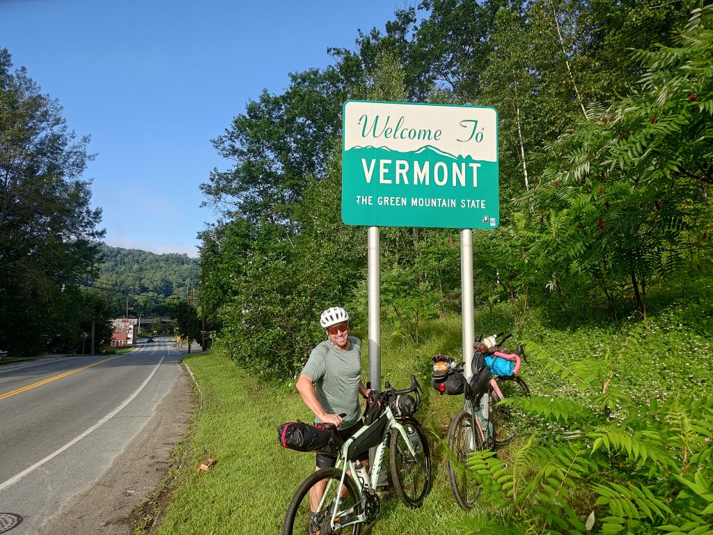
Depart from a small parking lot on Monroe Road lot in Woodsville, New Hampshire, and head left toward Route 302. At 302, turn right and make the short trip over Wells River via the Veterans Memorial Bridge and into Vermont. Grab a photo at the “Welcome to Vermont” sign before turning around and reentering the Granite State.
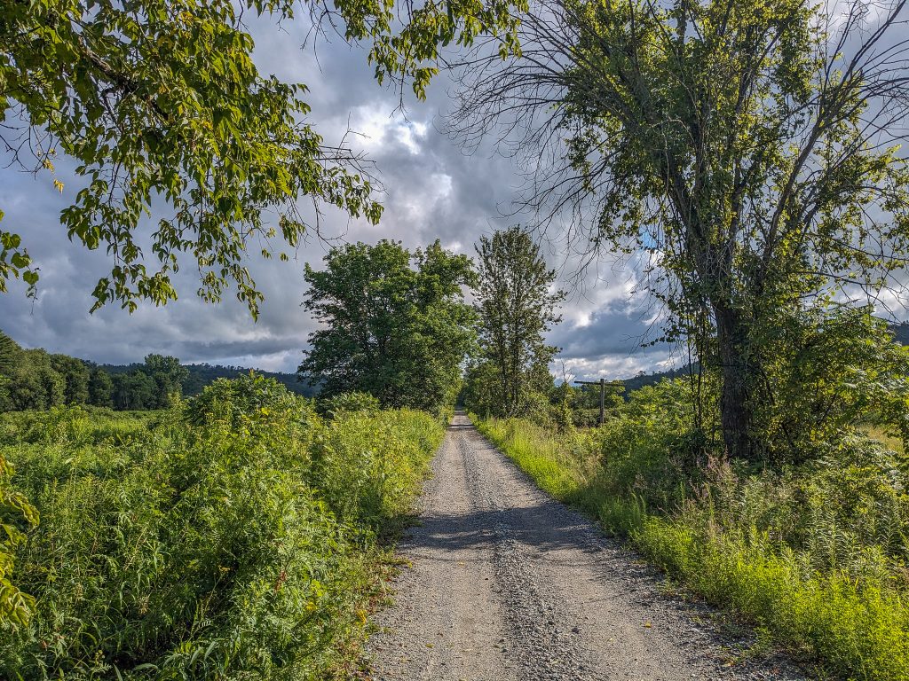
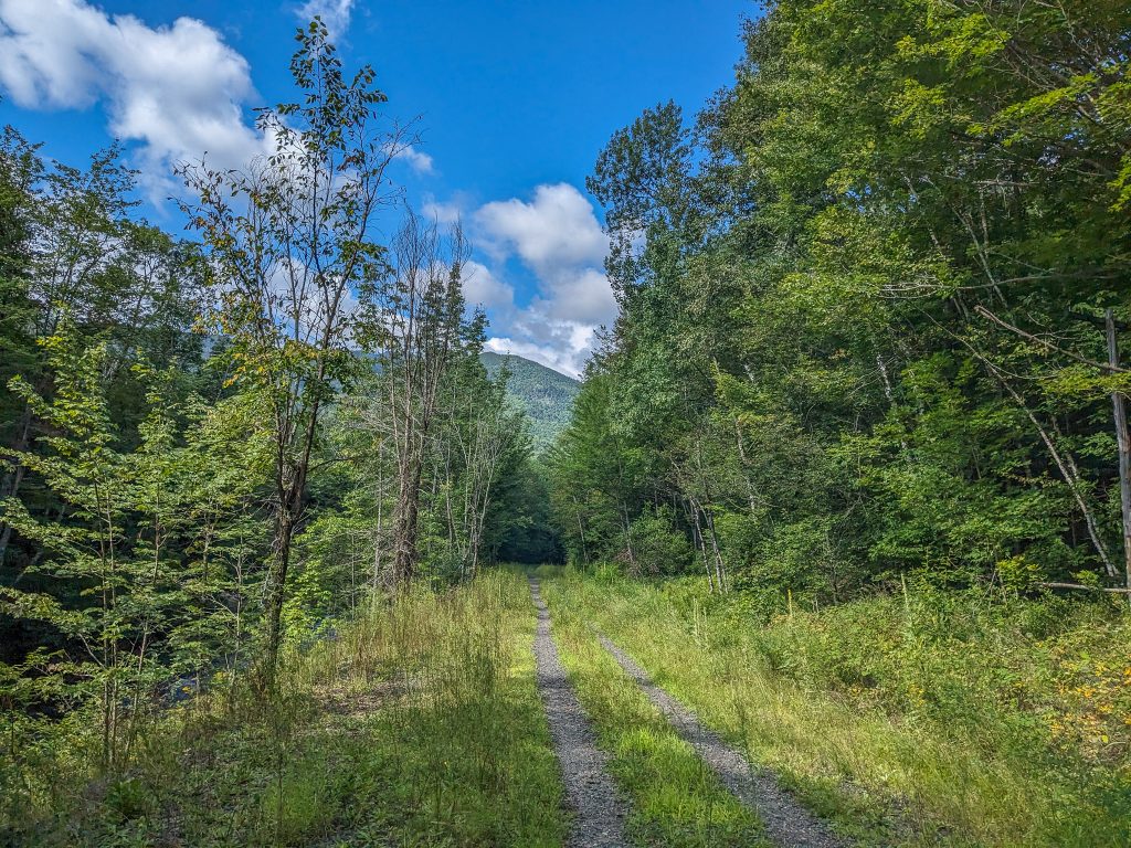
From the New Hampshire state line, follow the road for about a half mile before gaining the Ammonoosuc Rail Trail on the left. The 19-mile rail trail parallels its namesake river, delivers stellar views, and passes a number of historic bridges. The rough gravel rail trail features a firm base with larger stones on its surface. This section of trail is open to ATVs, which can cause some rutting and erosion. Stay aware of changing trail conditions to avoid an accident, it’s still early in the ride.
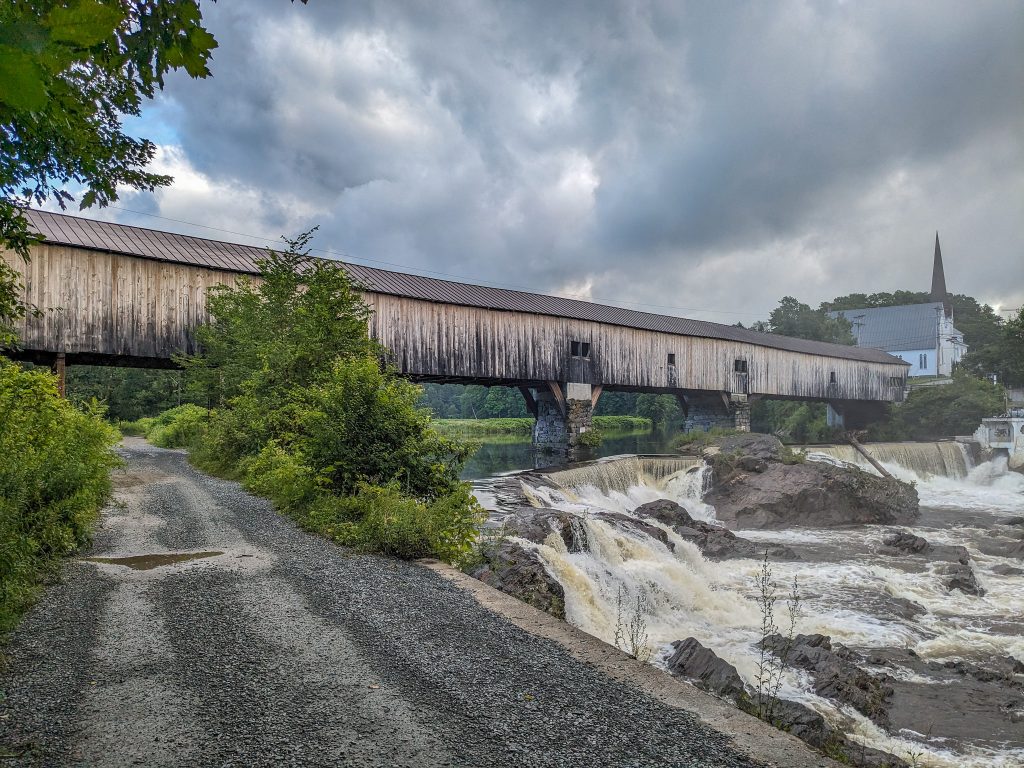
The trail from Woodsville to Bath passes a restored blue caboose on an old rail line in the front yard of a home and three bridges, including the super-scenic 345-foot-long covered bridge in Bath at approximately the five-mile mark. This bridge dates back to 1832 and is the oldest covered bridge in the Granite State. A number of small waterfalls rumble beneath the bridge and serve to heighten its grandeur. This beautiful spot is an ideal location to grab your first rest of the day, even if you’ve only ridden a few miles at this point.
Lisbon and Littleton
A little after 10 miles on the trail, you enter the town of Lisbon. The restored Lisbon B&M Railroad Depot (which dates back to roughly 1868) marks the entrance into the town proper. Here the XNHAT veers off the rail trail and through downtown Lisbon—on Main Street, School Street, Bishop Road, and Lyman Road—before regaining the rail trail. (Note: it’s possible to stay on the rail trail all the way to Littleton). Lisbon provides a chance to grab supplies, as you pass a market, convenience store, and pizza place.
At about 20 miles, the XNHAT enters Littleton, a vibrant town with a bustling Main Street. At a little over 21 miles the trail crosses Industrial Park Drive—caution there is traffic on the road—and passes Hammer Down Adventures at the Snow Yard on the left. After roughly 2 more miles, the trail crosses Cottage Street. This is a good place to enter downtown Littleton and take advantage of its numerous dining, lodging, and resupply opportunities.
Also, just a short pedal down Cottage Street is Littleton Bike & Fitness, which is handy if you need any mid-ride adjustments or realize you’re missing a key piece of bike-specific gear.
Whitefield
Whitefield is arguably the least scenic section of the XNHAT. A large portion of the trail—from roughly mile 25 to a little past mile 35—is on pavement and travels on Route 116. The road is busy, however, it does feature a wide shoulder. The smooth pavement also provides a pleasant reprieve from riding on jarring gravel bike paths but does lead to the first real climbing of the trip.
Route 116 takes riders through downtown Whitefield, where they’ll find further snacking and resupply opportunities; the town is home to a market, convenience store, and sandwich shop. If you have a hankering for something outside of the normal fare, Triangle Dairy Bar is en route and serves hot food and, more importantly, ice cream.
Following a short climb out of town on Route 116, you leave the busy road, but not the pavement, behind and turn onto Hazen Road. From here, a quick mile-and-a-half pedal brings riders to Airport Road. The route stays on pavement for another mile and passes Mount Washington Regional Airport. This small airport is nestled below the White Mountains in a spectacular location.
A short punchy climb after the airport delivers you to the Presidential Rail Trail and a return to gravel.
Jefferson and Randolph
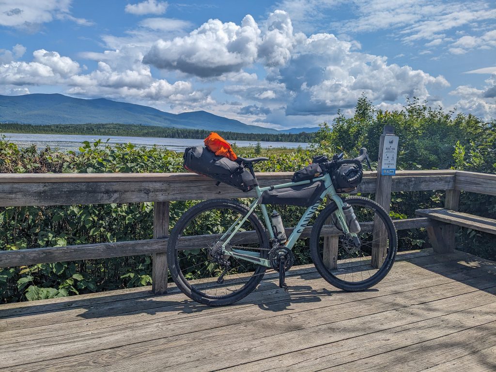
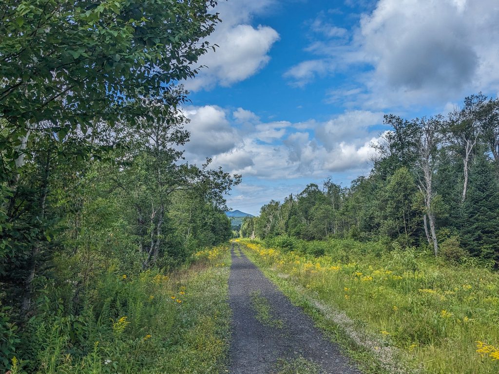
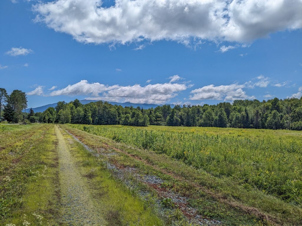
The Presidential Rail Trail starts at the Pondicherry Wildlife Sanctuary and embarks through what is arguably the prettiest section of the XNHAT. Nestled underneath the Pliny Range and the massive Presidential Mountains, the Pondicherry Wildlife Refuge is often called one of the “crown jewels” of the New Hampshire landscape.
About a mile and a half of pedaling along the Presidential Rail Trail brings you to a viewing platform and an example of why this area is known for its beauty. Leave your bike behind and follow the short wooden boardwalk to a stellar view across Cherry Pond to the Pliny Range and its lone New Hampshire 4,000-footer, Mount Waumbek, towering above. The viewing platform features built-in benches, making this an ideal spot to grab a snack and take in the scenery.
Break away from the viewing platform with the knowledge that sights will continue to improve, soon the northern end of the Presidentials will dominate the landscape. A little over a mile away—via Meadows Road and Israel River Road—is Israel River Campground. Located at roughly the halfway point of the XNHAT, it makes an ideal stopping point for those looking to ride the route over the course of two days.
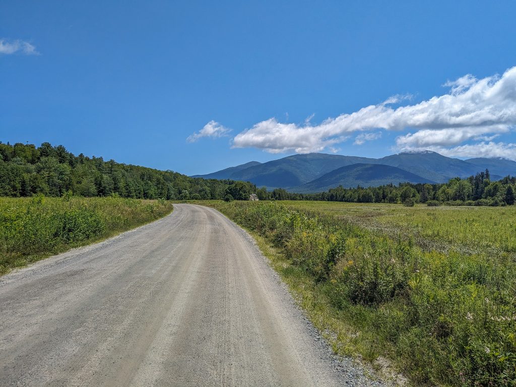
From the campground, follow Valley Road, which starts off paved and gives way to some of the nicest dirt roads on the entire route. Between the high-quality surface and eye-catching scenery featuring Mount Madison and Mount Adams in the foreground and the surrounding open countryside, you’ll hardly notice the route subtly climbing to its high point. After about five miles on Valley Road, rejoin the Presidential Rail Trail for another two(ish) miles of very moderate climbing.
There’s nothing marking the high point of the XNHAT, but you’ll know when you’ve crossed it as your average speed is likely to pick up a few miles per hour. Although not a sharp descent, the next 10 gravity-assisted miles on varying qualities of gravel are welcome to legs with 40+ miles already in them. Enjoy the ride as the trail speeds past popular trailheads—like the Lowe’s Path Trailhead and Appalachia—leading to the peaks above and toward Gorham.
Gorham
Before entering Gorham proper, the XNHAT crosses Jimtown Road. Here is another option for those looking to spend the night. A short pedal up the road is Moose Brook State Park and its numerous campsites. It’s also home to a refreshing swimming hole—if you like frigid water, that is. Crossing Jimtown Road and staying on the rail trail will soon deliver you to downtown Gorham, which offers an abundance of dining, lodging, and resupply opportunities. Brace yourself, it’s also likely to feel busier than any other place on the XNHAT.
In Gorham, the XNHAT joins Hogan Road, another well-worn and comparatively rough dirt road that parallels the Androscoggin River. Cyclists share this section with ATVers, which accounts for some of the erosion, loose conditions, and large puddles. Use caution and make sure you’re visible to other trail users. While this section will test your bike handling, it pays off with a fantastic perspective of the Carter-Moriah range as it passes the photogenic Reflection Pond.
After about five miles, the XNHAT departs Hogan Road and joins the smooth and rolling pavement of North Road. After grinding away on dirt and gravel for the majority of the XNHAT to this point, it’s all paved from here.
Shelbourne, Gilaead, and Bethel
North Road is an idyllic byway that is almost devoid of traffic. Riders on the XNHAT are sure to enjoy the nearly 20 miles on the smooth pavement after logging some serious time on the gravel and rock paths preceding this point. While the surface offers a pleasant reprieve from dirt roads and bike paths, it also delivers considerably more varied riding than at any other point on the trail, so expect a fair bit of climbing and descending.
North Road winds past quiet forests and seemingly forgotten farms as it works its way toward Maine. In fact, without a GPS or sharp eyesight, you likely won’t know when you’ve left the Granite State and entered Vacationland. The state line is indicated by a small granite marker on the left side of the road—blink and you’ll miss it. You can tell you’re getting close to Bethel as otherwise nonexistent traffic begins to pick up.
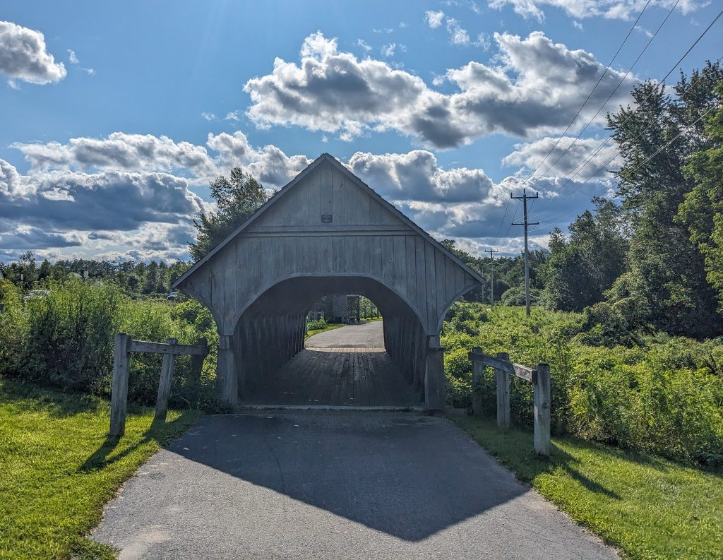
After a little less than 20 miles on North Road, and a little more than 80 miles on the XNHAT, make your final turn of the trip—unless you’re riding it as an out-and-back—onto the Bethel Pathway. Enjoy the last mile of easy pedaling on the paved pathway as you pass over the Androscoggin River for the last time, underneath a small covered bridge, and into the parking lot at Davis Park.
Bethel, Maine, has a veritable cornucopia of food and lodging options. Kick back and enjoy your accomplishment!
Getting Back
Ambitious riders can always turn around and return the way they came. Riding the route in reverse is a surprisingly pleasant option and it’s amazing how different the route feels when riding in the opposite direction. It’s also shocking to see how much you missed the first time through.
That said, the majority of riders tackle the XNHAT in one direction, stashing a vehicle at both ends of the trail. There are also a number of shuttle services that will pick you up at one end of the trail and deliver you to the other.
The Kit
-
- You’ll see a variety of bikes on the XNHAT, however, the trail is best suited to gravel bikes—another reason why you need a gravel grinder. Gravel bikes provide the versatility for efficiently covering the multiple surfaces encountered on the route.
- The XNHAT suggests riders use a bike with at least 32 mm wide tires. That said, tires between 42 mm and 45 mm offer extra traction (great for dealing with the more rugged sections of the route), reduce vibration, add comfort (particularly important on a multi-day bikepacking trip), and are highly recommended. A tire with a slick center centerline and knobby lugs on the side is a good choice for navigating the terrain on the XNHAT, which ranges from rugged dirt roads to slices of singletrack to idyllic paved country roads.
- The XNHAT provides GPS routes for the route in both directions (from Woodsville to Bethel and Bethel to Woodsville). Upload them in advance of your ride to a bike-specific GPS or a GPS watch like the Garmin Edge Enduro to ensure you stay on track.
- Although you’re never far from town on the XNHAT, you’re often a ways from a bike shop. Prepare to make easy fixes on the trail by carrying a small repair kit that includes a multitool, CO2 inflator (or small pump), spare tube, and tire levers.
- No matter if you’re spending your nights on the XNHAT at a hotel in town or campground along the route, you’ll have a lot to carry. The Blackburn Outpost Frame Bag (medium/large) offers a convenient place to store everything from extra layers to camping gear.
- New Hampshire is famous for its lack of helmet laws—it’s one of just three states without a motorcycle helmet law, and only bike riders under the age of 16 are required to wear a bike helmet. That said, wearing a bike helmet is always a good idea and those like the Smith Persist are so comfortable you’ll barely notice it on your head.
- Knobby and semi-knobby tires traveling on dirt roads and gravel roads have a tendency to kick up a fair bit of debris. Protect your eyes without impeding your vision of the XNHAT’s stunning scenery with a pair of performance sunglasses like the Smith Wildcat.
Keys to the Cross New Hampshire Adventure Trail
-
-
- One of the great things about the XNHAT is how easily it’s adapted to riders of varying abilities. Super-strong cyclists may want to tackle the trail in a day while those who prefer a slower pace can take their time and travel the route over two or more days.
- There’s no shortage of great reasons to stop on the XNHAT, from secluded swimming holes to charming towns to stunning scenery. Make sure to leave yourself enough time to enjoy it all.
- Ready for more mileage? The Cross Vermont Trail Association is working on building a route that goes from the beginning/end of the XNHAT in Woodsville across the Green Mountain State and ends in Winooski, Vermont.
- Great places to stop and eat along the XNHAT abound. A few favorites include:
- The Hub16 Asian Bistro in Lisbon, NH
- The InkWell Coffee & Tea House in Littleton, NH
- Schilling Brewery Pub and Kitchen in Littleton, NH
- Littleton Freehouse Taproom & Eatery in Littleton, NH
- White Mountain Cafe & Bookstore in Gorham, NH
- Big Day Brewing in Gorham, NH
- Nona’s Kitchen in Gorham, NH
- Cafe DiCocoa in Bethel, ME
- Butcher Burger in Bethel, ME
- Sud’s Pub in Bethel, ME
- There are also some great places to resupply on the XNHAT. A few favorites include:
- Littleton Food Co-op in Littleton, NH
- Whitefield Market and Deli in Whitefield, NH
- Good Food in Bethel, ME (pro tip: save their menu in your phone and order ahead)
- Mainely Provisions in Bethel, ME
-
Current Conditions
Have you recently pedaled the XNHAT? What did you think? Share your favorite parts in the comments!
Related Posts


