


Challenging terrain, breathtaking views, and the summits of six New Hampshire 4,000-footers combine to make the Carter Range Traverse one of the best backpacking trips in the White Mountains.
Rugged but weather-protected terrain, fantastic views of Mount Washington and the northern Presidentials, a multiplicity of camping options, all without the crowds of some of New Hampshire’s better-known overnights, and foliage that’s among the best in the Whites make this a must-do fall point-to-point backpacking trip. And, for those who want to go luxurious and light, there’s even an Appalachian Mountain Club hut that’s right in the middle of the traverse.
Many hikers begin the Carter Range Traverse at the Carter-Moriah Trailhead on Bangor Street in Gorham. They then head south on the Carter-Moriah, Wildcat Ridge, and Lost Pond Trails for 17-plus miles, crossing six 4,000-footers before ending at Pinkham Notch on Route 16.
Quick Facts
Distance: 17 miles, thru-hike.*
Time to Complete: 2 to 3 days
Difficulty: ★★★★
Scenery: ★★★★
Fees/Permits: None
Contact: https://www.fs.usda.gov/whitemountain
*The AMC Guidebook lists this hike ar roughly 20 miles, but our GPX and other independent sources have tracked it as less.
Turn-By-Turn
Getting to the Carter-Moriah Trailhead is simple. Bangor Street is across from the Androscoggin Valley Country Club on Route 2 in Gorham. From Conway, follow Route 16 North approximately 24 miles to Route 2. Take a right onto Route 2, and look for Bangor Street on your right about a mile down the road. There’s a small hikers’ parking lot a few houses before the end of the street. Park there, and then, walk down to the trailhead (44.3822, -71.1694) at the end of the street.
If you have two cars, leave one at each trailhead. For an alternative, take advantage of the shuttle service provided by the Appalachian Mountain Club. For leaving a car at Pinkham Notch, it’s even easier to find than the Carter-Moriah Trailhead, as it’s right in the middle of Gorham and Conway. If you’re coming from Gorham, just follow Route 16 South for roughly 12 miles, and the building will be on your right. When you’re coming from Conway, Pinkham Notch is roughly 12 miles past the Glen intersection on Route 16 South, and the building will be on your left.
Although there’s limited parking at the Carter-Moriah Trailhead, the Libby Memorial Pool off Route 16 has additional parking. If you end up parking there, it is just a short road walk to the trailhead. As an added bonus, you get to cross a cool hikers-only suspension bridge to get to the trailhead.
Moriah
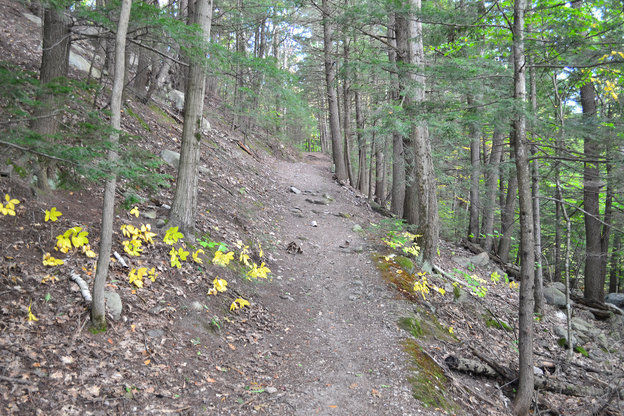
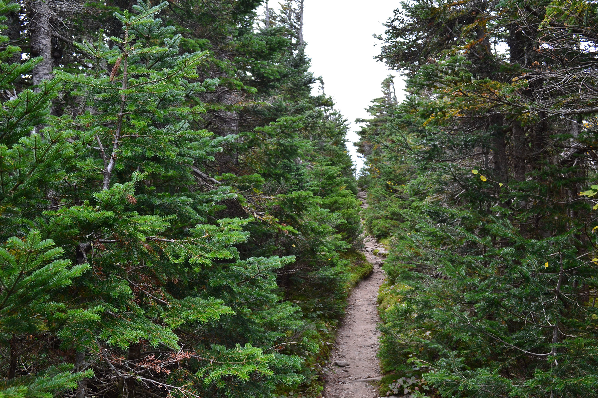
On the way to Moriah’s summit, the Carter-Moriah Trail (CMT) gains more than 3,000 feet of elevation over the course of 4.5 miles. The trail itself is easy to follow but relatively nondescript, with the most notable feature being the rock ledge near the summit of Mount Surprise. If you haven’t taken a break yet, this is a good spot, as it is almost halfway to the summit.
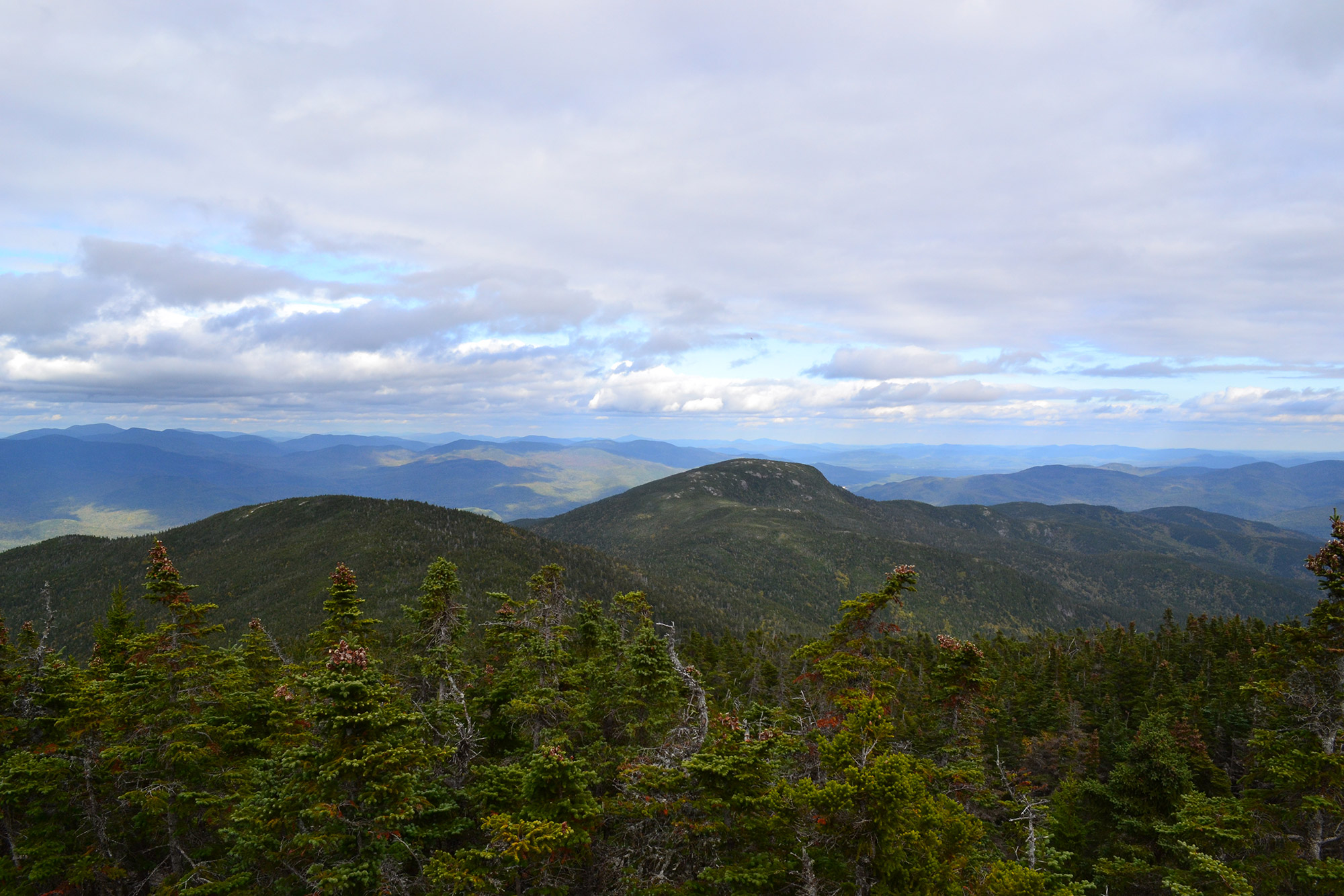
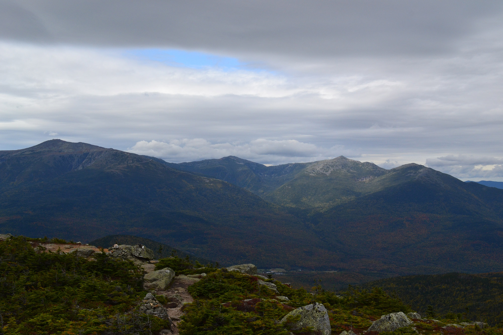
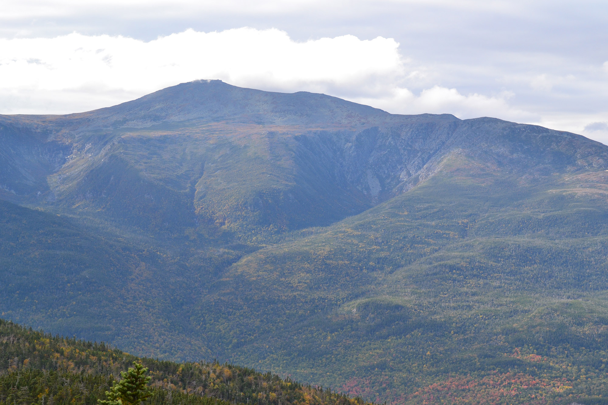
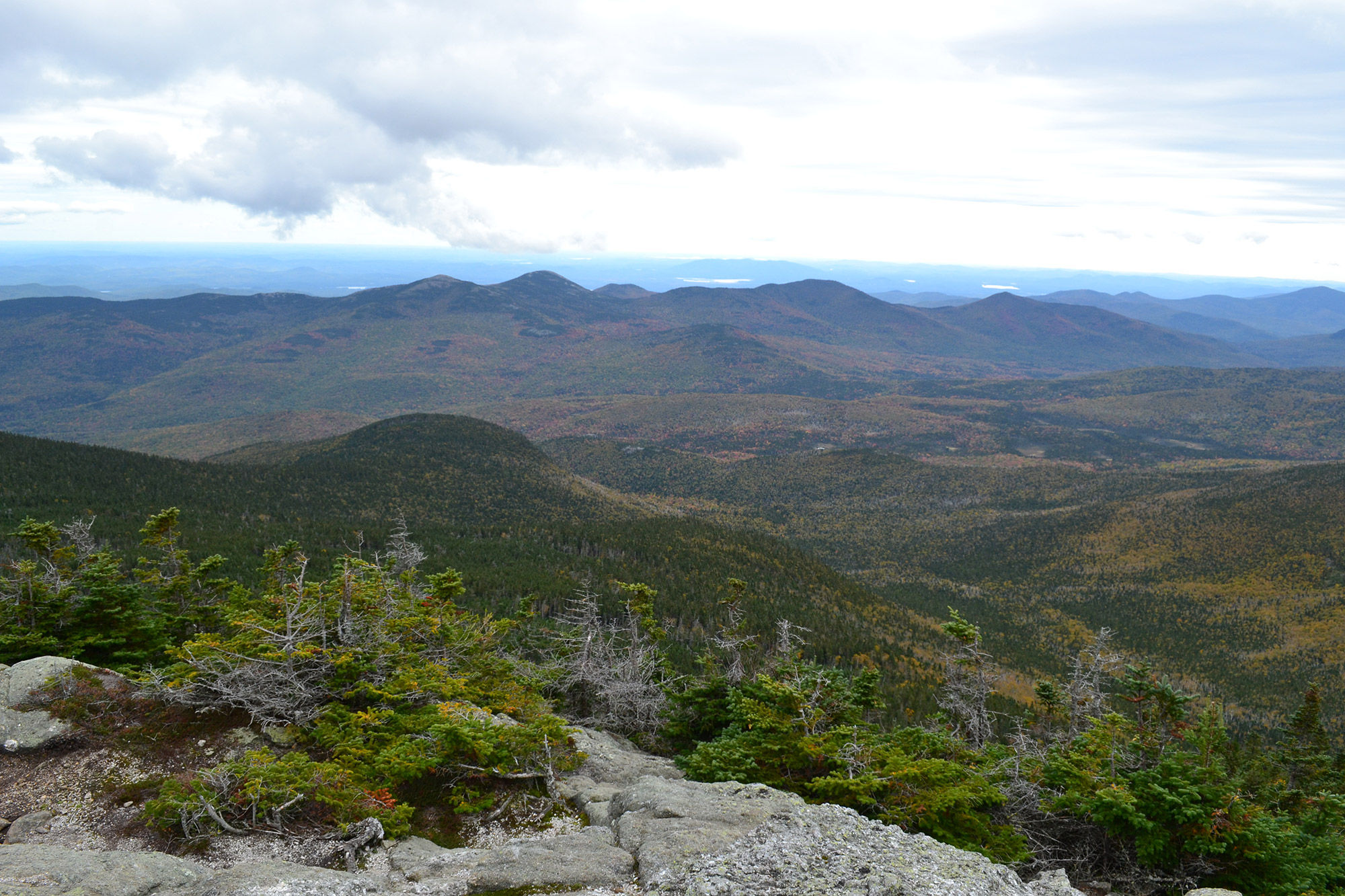
After 4.5 miles of uphill terrain, you’ll reach a short spur trail that leads toward Mount Moriah’s summit ledge (44.3403, -71.1315). The views from the summit and surrounding area are among the best in the Whites, with the Northern Presidentials to the west, the Wild River Wilderness and Maine to the east, and portions of the traverse visible to the south.
Moriah to Imp Shelter
From Moriah’s summit, head south on the CMT. After a few minutes, you’ll come to a short, exposed downclimb that can be tricky. Be especially careful if you’re carrying a heavy pack. At the junction at the bottom of the downclimb, keep right to stay on the Carter-Moriah Trail. Although the junction is well signed, if you have any doubts from here on out, you’ll be following the Appalachian Trail’s white blazes, so there’s really no excuse for getting lost.
The trail then meanders across ledges and open slab, with great views east into the Wild River Wilderness and Maine’s forests and mountains. Eventually, the trail begins to descend steeply over the open slabs without compromising those views. Along the way, you’ll come across several fantastic overlooks, where you’ll probably find hikers ascending Moriah from the south pausing to catch their breath. Use caution when descending, however, as this section is often icy.
About 1.5 miles from the summit, the trail drops back into the trees, where it begins to flatten out. Almost immediately, you’ll arrive at a well-signed junction with the Moriah Brook Trail, but you’ll want to stay on the CMT. Soon thereafter, the trail crosses a boardwalk through a marsh area before coming to the Stony Brook Trail junction. At the junction, remain on the CMT for 0.75 miles, until you come to a spur trail for the Imp Shelter.
Coming up the Stony Brook Trail and skipping Moriah is an easier way to reach the Imp Shelter. It’s a great option for those starting late in the day on the first day of their trip or for those looking to do a single-day range traverse.
Down a short spur trail, there’s a shelter (44.3291, -71.1502) and five tent platforms (available for $10), with a caretaker present during summer months, as well. Tucked in the shadow of Imp Mountain, this is a great place to spend the night if you’re doing a three-day trip. If you’re doing the traverse in two days, consider pushing on, as you’ve only done one-third of the mileage.
Pro Tip: Since the stream at Imp Shelter is the last reliable water source before Carter Notch, it’s a good idea to refill here.
Up North Carter
If you spent the night at Imp Shelter, the early-morning hike up North Carter on the Carter-Moriah Trail can be a rude awakening. It’s steep and rough, gaining 1,400 feet over the course of roughly two miles. More so, it is probably the traverse’s hardest part, so take your time—there’s a long day ahead.
If you’re looking to catch your breath, a few spots on the way up North Carter have good views north toward Moriah. You might miss them, though, when heading uphill, since you’ll be facing the wrong direction.
About 1.6 miles from the shelter, you’ll stumble onto North Carter’s summit (44.3131, -71.1645). Although it is 4,530 feet in height, the Appalachian Mountain Club doesn’t consider North Carter a 4,000-footer. The col on the ridge from Middle Carter only descends 60 feet (18 m), thus making North Carter a secondary summit of that peak.
Ridge Running the Carters
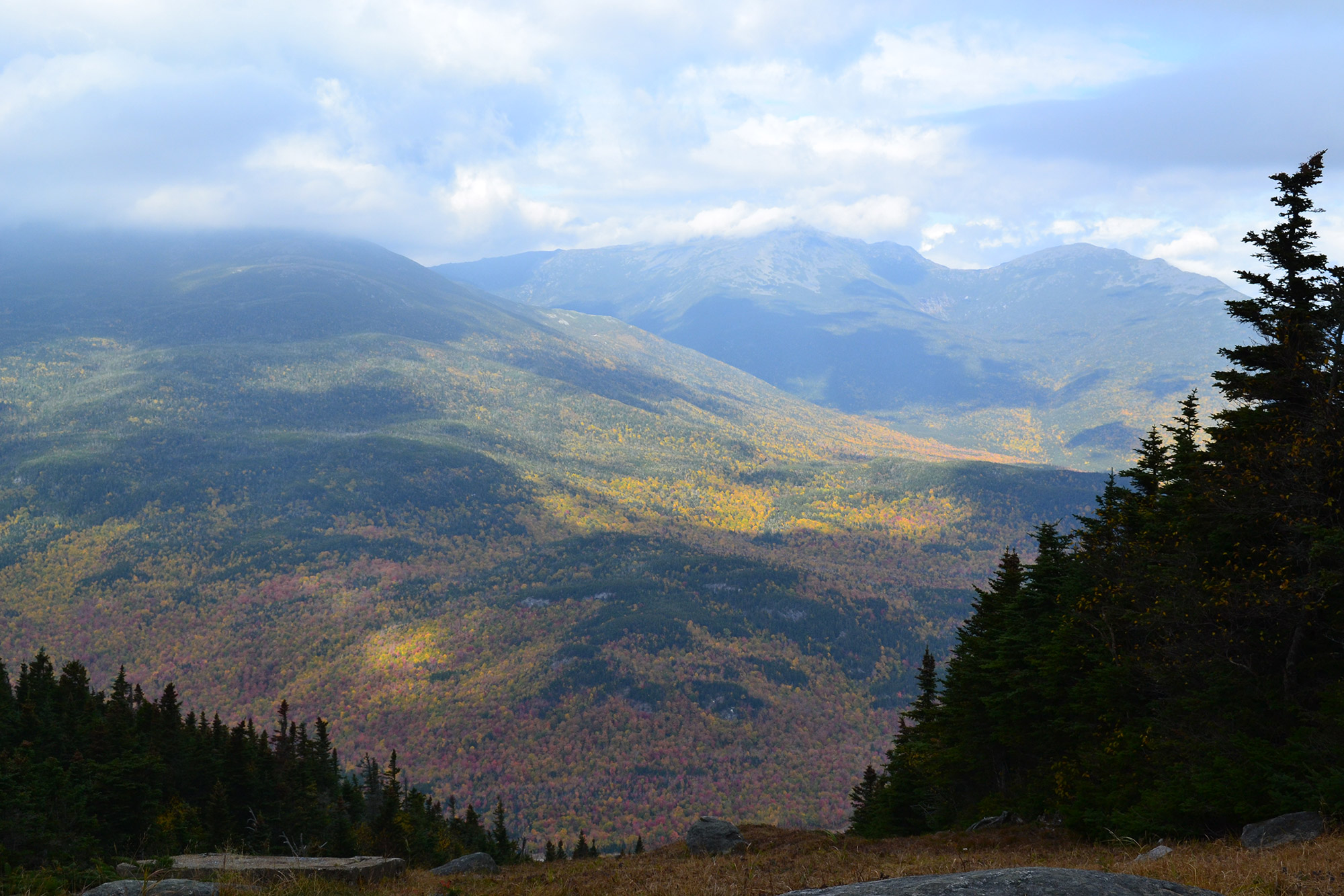
Once you’ve climbed to the ridgeline, the CMT mellows considerably along the rolling Carter Ridge. As well, trees shelter the ridgeline, offering great protection from the weather. Occasionally, breaks in the trees offer views both to the east (Maine, the Baldface Range, and the Wild River Wilderness) and to the west (the Northern Presidentials). And, because Carter Ridge isn’t a straight line, a few opportunities offer a glimpse of what lies ahead.
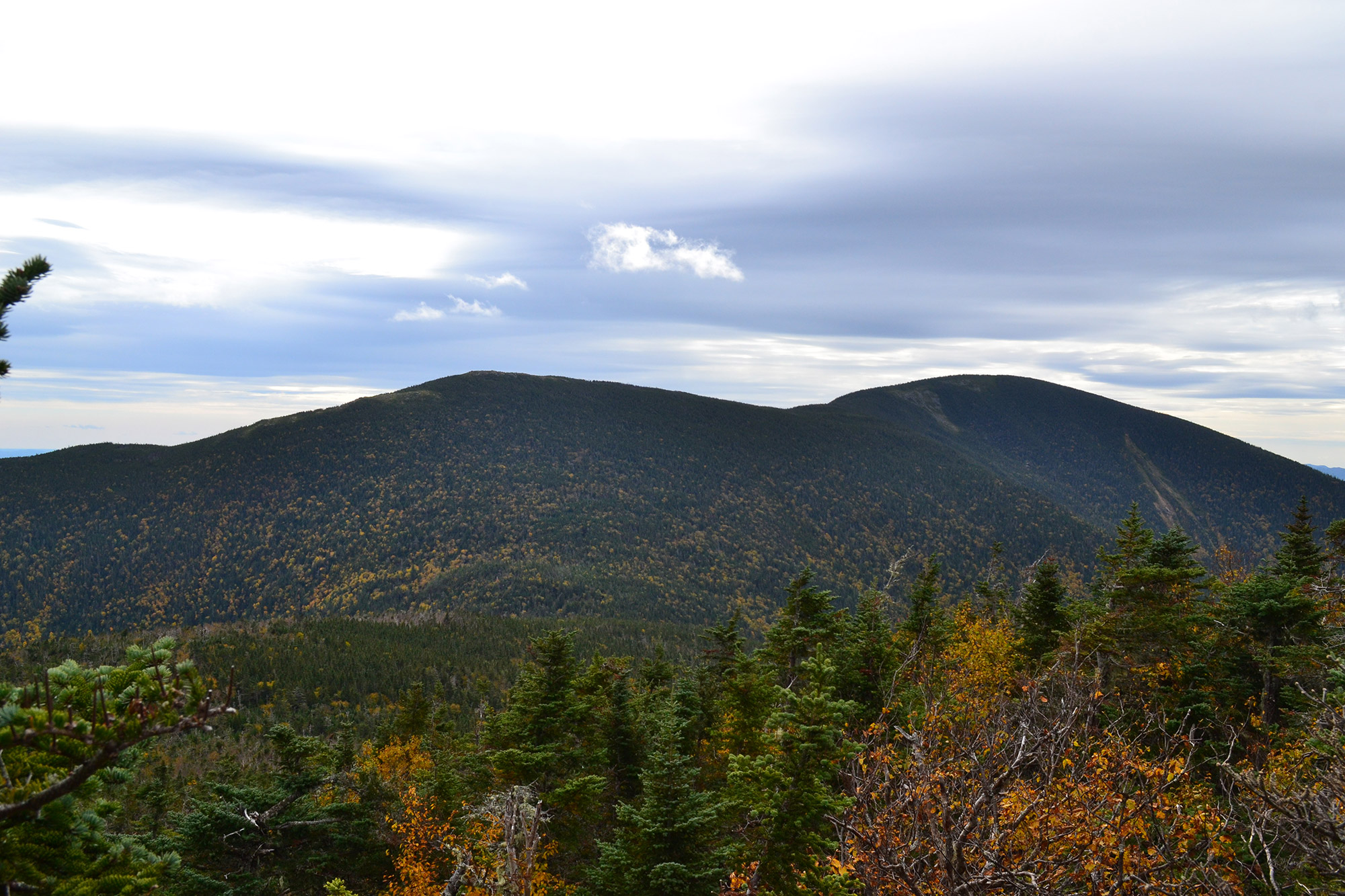
About a mile from North Carter’s summit, the trail surmounts Middle Carter (44.3031, -71.1673). Although you’ll get great views before and after the summit, the summit itself is wooded and nondescript. And, because you’re near a wilderness area, the summit itself isn’t signed. Look, instead, for a cairn.
From Middle Carter, the trail descends gradually to the col between Middle and South Carter. At this point, it climbs gently toward the summit of the latter peak (44.2898, -71.1762). About a half-mile from the col, be on the lookout for a very short spur trail to South Carter’s official summit. Again, there are no signs, but it is pretty hard to miss the small cairn. And, although the summit has no real views, an outlook sits a few steps away on the other side of the trail. Your next objectives—Mount Hight and Carter Dome—dominate the horizon to the south.
To reach them, continue south on the CMT for 0.8 miles as it heads downhill toward Zeta Pass. While it descends quickly at first, it then meanders through the woods and over boardwalks as it nears the pass.
Carter Dome and the Mount Hight Detour
From Zeta Pass, the Carter-Moriah and Carter Dome Trails temporarily merge, both headed for Carter Dome’s summit. Soon, however, they split at a junction (44.2789, -71.1737), with the CMT taking a slightly longer route with a detour to the outstanding overlook atop Mount Hight. If time is of the essence and you want to skip Mount Hight, take the Carter Dome Trail (blue blazes) directly to the top of Carter Dome. It saves about 0.2 miles, but you’ll be skipping one of the hike’s key highlights.
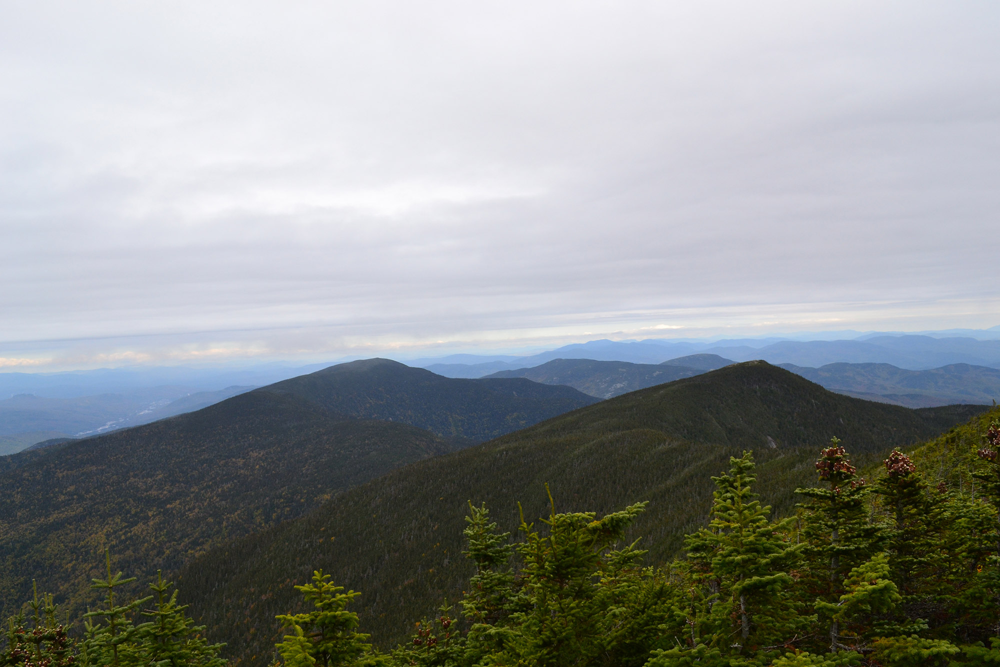
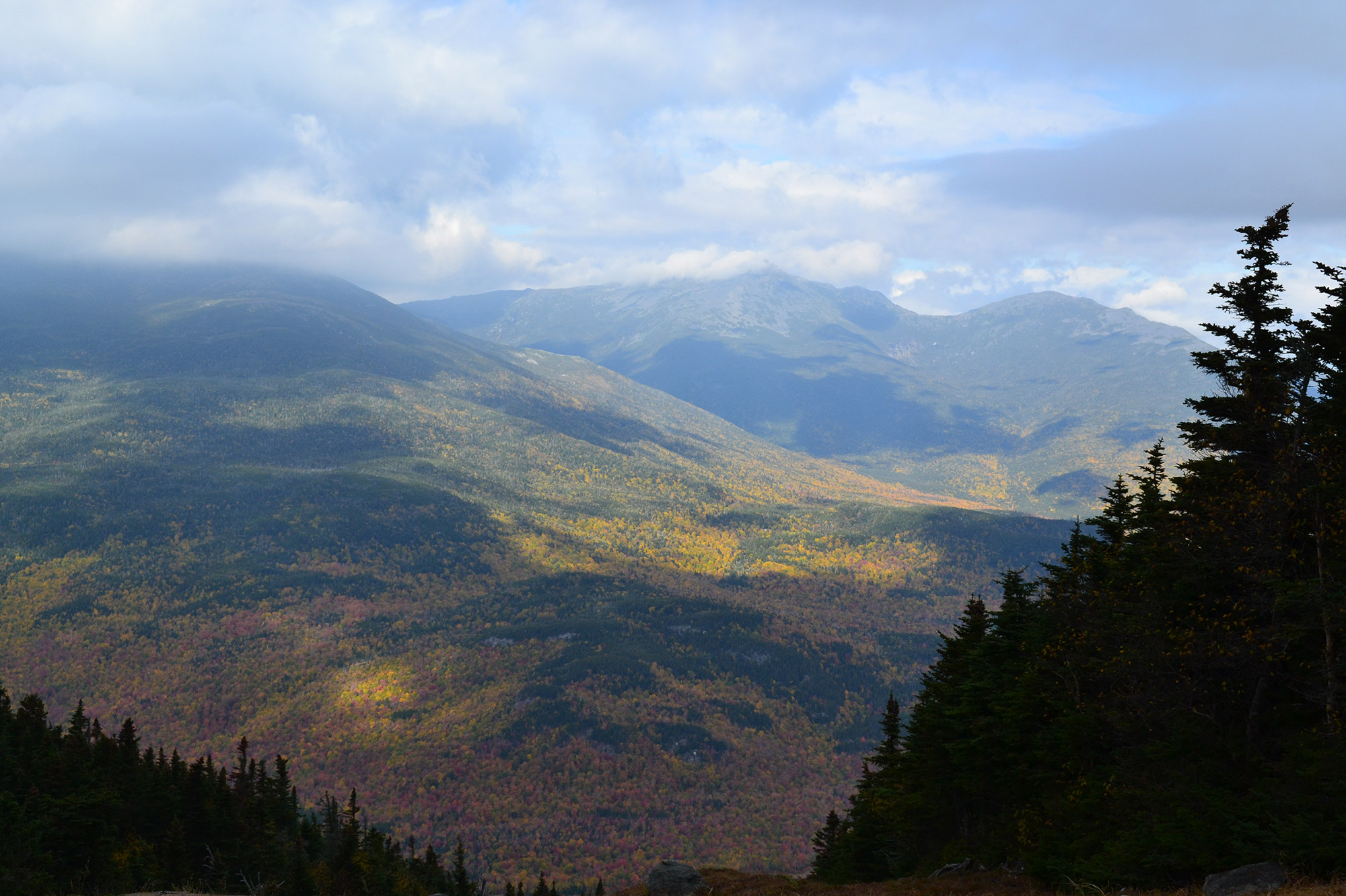
To get to Mount Hight, a subpeak of Carter Dome, simply continue following the AT’s white rectangular blazes. After a few minutes, the trail begins to climb steeply. Although some effort is involved, keep hiking: The alpine zone and 360-degree views of the Presidentials, the sections of the Carter Range you’ve traversed so far, and the Wild River Wilderness are well worth it. When you can peel yourself away from the summit (44.2759, -71.1702), continue along the CMT and AT, until it intersects with the Carter Dome Trail, a short distance below Carter Dome.
Compared to Hight, Carter Dome is unimpressive, with a small open space and some competing summit cairns (44.2674, -71.1792). The summit’s northwestern side also has an overlook toward the Northern Presidentials.
Carter Notch
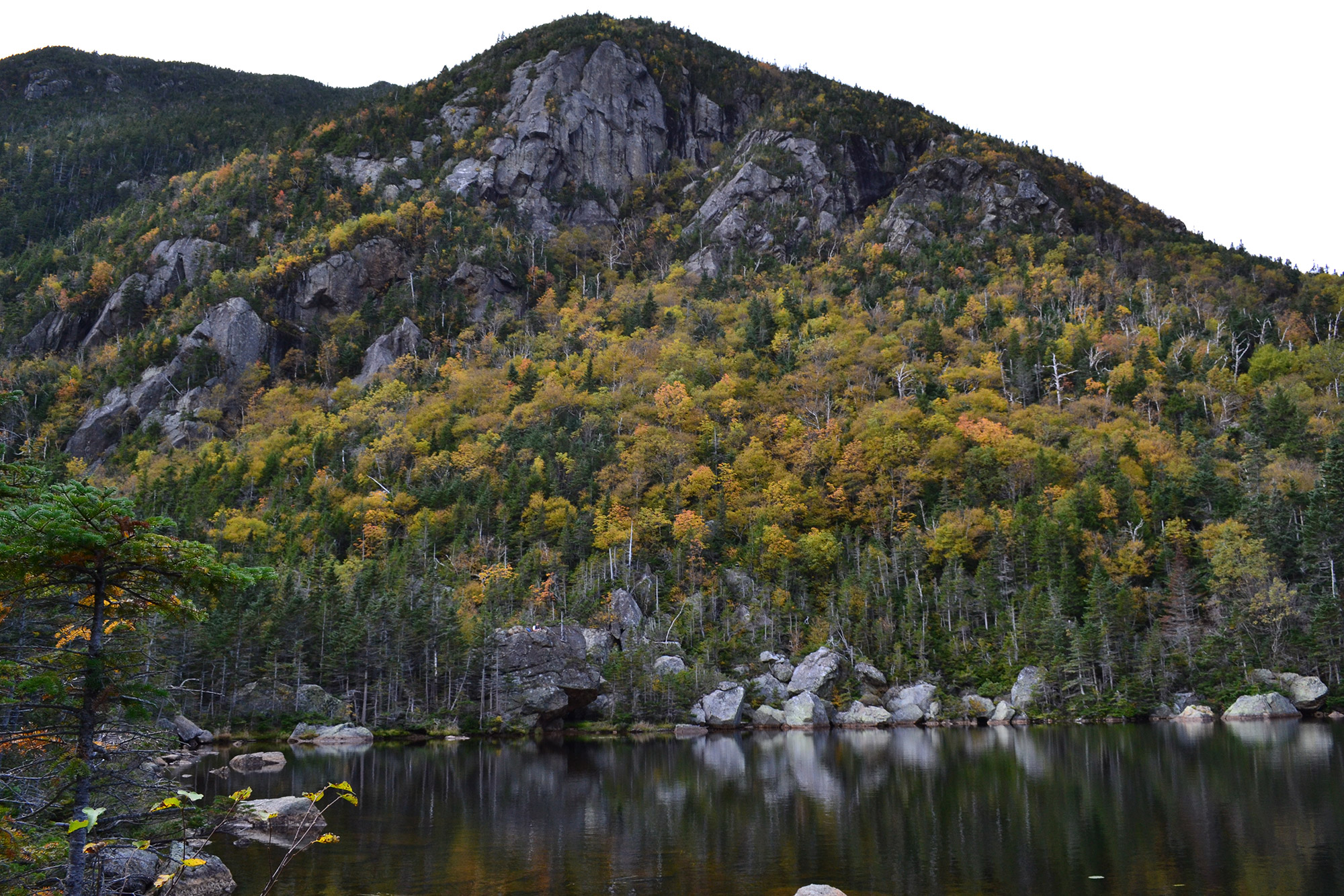
From Carter Dome, the CMT descends into Carter Notch. Here, the trail is steep with several sections where you’ll want to watch your footing. About halfway down the trail is a nice overlook, where you can see the Carter Notch Hut with Wildcat Ridge as a backdrop.
The CMT spills out into Carter Notch at the junction at Carter Lake. If you’re spending the night at the Carter Notch Hut (44.2588, -71.1951) or just looking for snacks and water, follow a short spur trail left, past two small lakes for 0.1 miles. Built in 1914, the hut offers full services during the summer months, as well as self-service during the rest of the year. Those thinking of spending the night in one of the two bunkhouses can make reservations with the AMC.
If you’re continuing on toward Wildcat Ridge, turn right instead, following the trail along the edge of Carter Lake and then up as it begins to climb out of the Notch. Since the trails around Carter Notch are maze-like, pay careful attention, so you don’t get lost and lose any time.
Up Wildcat Ridge
Whether you spent the night at the hut or continued to push on, the 0.7-mile climb up Wildcat A is a tough one. The trail travels continuously over rough terrain, gaining elevation with a series of long, traversing switchbacks. Since the best views are behind you, use that as an excuse if you need to take a break.
You’ll know you’re near the summit when the trail briefly levels out. The summit (44.2590, -71.2015) itself is inconspicuous—just a small cairn a few feet off the trail. But, just before, an overlook delivers good views of Carter Dome, the Notch, and the Hut.
Across the Ridge
Wildcat Ridge rolls along across Wildcat’s five named peaks—A, B, C, D, and E. Although only two count as official 4,000-footers (A and D), you’ll still have to earn each one, as even their short elevation gains seem like real work this late in the traverse.
The most notable of the subpeaks is C, mainly because of the stellar views of Mt. Washington’s Tuckerman and Huntington Ravines on the descent. Be careful, as well, on the descent off C into Wildcat Col; a few of the sections require some easy downclimbing.
The sights and sounds of civilization indicate you’ve climbed out of the col and are nearing the summit overlook atop Wildcat D (44.2493, -71.235). It’s the first summit on the trip that’ll be crowded with non-hikers—Wildcat’s gondola runs near D’s summit on fall weekends—but you can at least appreciate that your climb up was much more challenging. And, if the crowds are minimal or it’s off-hours, the observation platform is a great place to admire Mount Washington.
Down to Pinkham
From the overlook, the trail meanders over Wildcat E and soon thereafter begins to descend. Easily one of the Whites’ hardest hikes, descending the Wildcat Ridge Trail may be even more demanding than ascending it. Rocky, slabby, and at times extremely steep, the trail even features rock and wooden steps to ease hiking on such vertical terrain. As it plummets down two miles and roughly 2,000 feet of elevation, people who are carrying big packs, have tired legs, or are uncomfortable negotiating exposed terrain should consider taking the shortcut down the Wildcat Mountain Ski Area.
Near the bottom of the Wildcat Ridge Trail, take the Lost Pond Trail for an easy 0.9 miles to Pinkham Notch. Although this route is longer than just finishing out the Wildcat Ridge Trail, it eliminates the need to cross the Ellis River.
As another reason doing the traverse from north to south is advantageous, after passing the final summit, hikers can quickly scamper down the ski slope to the resort’s parking area, instead of continuing on the steep and rugged Wildcat Ridge Trail to the Glen Ellis Falls Trailhead. The preferred hiking trail is the Polecat Trail, a 2.2-mile green circle that gently weaves down the mountain. From Wildcat, hikers can do a quick road march back to Pinkham Notch.
The Kit
- The EMS Refugio 2 Tent is a great choice for those who feel that staying in the hut is too luxurious but aren’t psyched on going super-lightweight. Weighing roughly a pound and a half more than its ultralight sibling, the Velocity 2, the Refugio delivers plenty of space to stretch out and has voluminous vestibules for storing gear.
- The Sawyer Mini Filter makes access to potable drinking water easy. Simply screw it onto a water bottle or rig it to your hydration bladder. Or, even drink right from the source using the included straw.
- After a long day on the trail, appetites are high, but the motivation to cook is low. A canister stove like the Jetboil Flash makes preparing dinner as easy as pushing a button.
- Super small and compact, the Sea to Summit Ultralight Sleeping Pad is perfect for keeping pack size down and doesn’t disappoint when it comes to comfort.
- The EMS Mountain Light 20 is warm, compressible, and cozy, making it perfect for trips like the Carter Range Traverse. Open the super-versatile bag up for unseasonably warm weather, or wear your jacket to bed and cinch the hood for those cold fall nights.
Keys to the Trip
- From mid-September through mid-May, the AMC’s Carter Notch Hut is self-serve. During the self-service season, a bed is provided and so is the use of the hut’s stove, cookware, and utensils. While neither dinner nor breakfast is offered during the self-serve season, you can ditch the weight of a tent and stove. The cost is $45 a night for AMC members and $54 a night for non-members. However, it’s always a good idea to reserve a place in the hut in advance.
- Although the Carter Wildcat Traverse is pretty straightforward, it’s always smart to carry a map, and the White Mountains Waterproof Trail Map is a good one. In addition to being helpful in the event you get turned around, it’s also perfect for getting stoked before your trip and scheming up the next traverse once you’ve checked the Carter Range Traverse from your list.
- After a couple long days of GORP, granola, and freeze-dried meals, you deserve something decadent. Treat yourself to an incredible cupcake (or two) from White Mountain Cupcakery.
Current Conditions
Have you recently hiked in the Carters or Wildcats? Have you done the complete traverse? What did you think? Post your experience in the comments!
Related Posts


