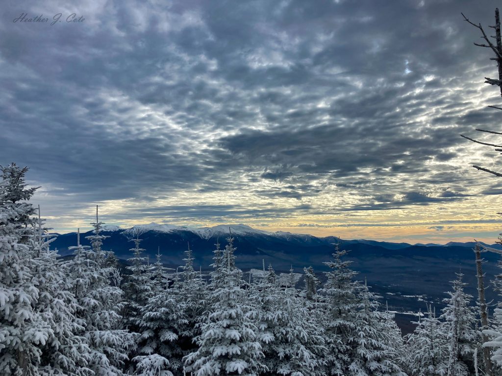
Every hiker can summon the image of a perfect bluebird day in their mind. The clouds, if they exist, are white and fluffy. There is a gentle breeze, just enough to remind you it’s still winter. The sun beams with all of its glory, keeping your face warm and requiring sunglasses. These are the days perfect Instagram images are made from. Unfortunately, not all winter hiking days are accompanied by perfect weather. When there are high winds in the mountain forecast, cold temperatures, and less-than-ideal sun conditions, a hiker can still get out there by choosing trails that do not travel above treeline. Thankfully there are many options to choose from.
Hiking Considerations
Staying below the treeline has many advantages. They include added protection from high winds, plus the ability to stop and adjust gear and consume nutrition while staying protected from the elements. There is also the opportunity to grab a viewpoint without exposing yourself to conditions that could be beyond the scope of your ability or gear. Over the years, I have used hikes with viewpoints or complete tree cover to conduct tests of my winter gear and build fitness. The beauty of grabbing a peak south of the White Mountains usually means the ability to experience full-on winter conditions in a “safer” environment.
Another advantage of more popular, below treeline hikes, is accessibility after snowstorms. Often the trailheads in the northern regions of New England are not plowed out after weather events. If the town or the State chooses not to handle plowing, then it is left to a good Samaritan or the stream of drivers in 4 x 4s who pack it down and make it accessible. Southern regions tend to have better access, giving hikers an opportunity to break out trail after big snow events and not get their car stuck! As always, check the trail conditions at New England Trail Conditions or TrailsNH. A diligent, safety-minded hiker will also check whether at the National Weather Service Recreation Forecast or the Mt. Washington Observatory Higher Summits Forecast.
As always, please carry snowshoes and Ice Talons for your hikes. I understand they add extra weight, but snowshoes are critical to preventing “post holes” and maintaining the integrity and safety of the monorail. Traction, such as microspikes, are quite literally a lifesaver on slick trails. If I had a dollar for every hiker I’ve passed by in regular street sneakers, with no traction or snowshoes on full winter condition trails, I would be able to buy another pair of new snowshoes. Not only does this destroy the trail, but it is uncomfortable and excessively hard on the hiker.
Suggested Below Treeline Hikes
The following are a few of my favorite hikes that provide access and a decent winter challenge across New Hampshire:
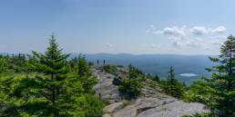
Castle in the Clouds – Mt. Roberts – Lakes Region
This region is a hidden gem of old carriage roads and hiking trails. The views of the Whites are impressive on a clear day. This particular hike will peak you out on open areas, allowing for gear testing on well-marked trails. The main parking areas at Castle in the Clouds are generally plowed and maintained. Hike the Mount Roberts trail to the summit and back (5 miles/1,321 ft. of gain). This trail is located near the hiker parking lot by the horse barns. I suggest buying the map for this area and exploring other peaks, such as Mt. Shaw and Turtleback Mountain.
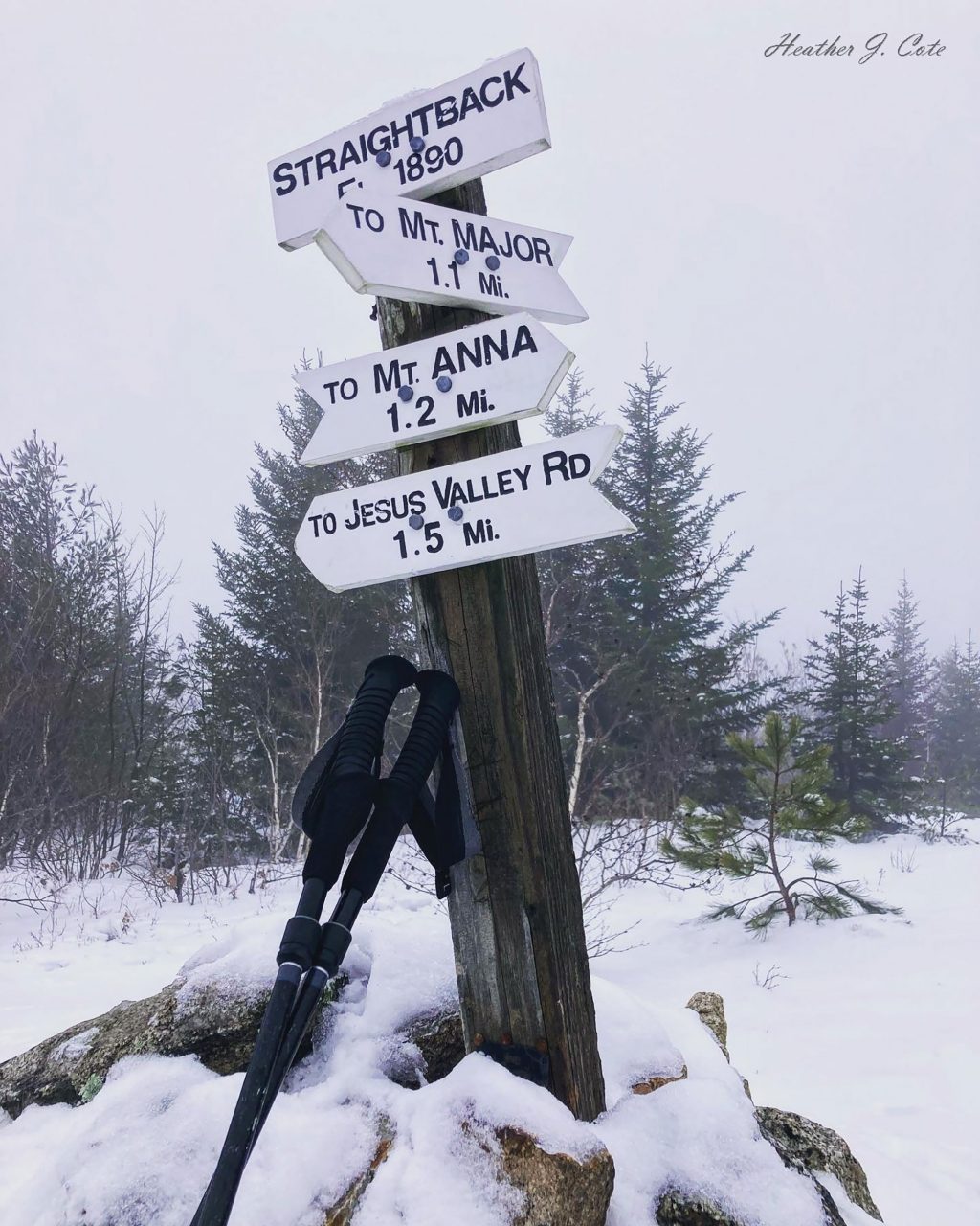
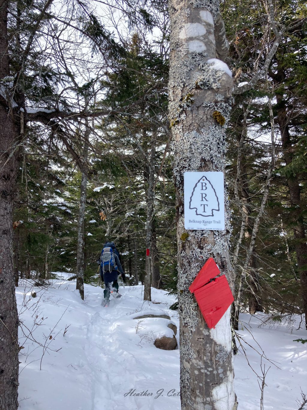
Belknap Range Trails – Lakes Region
Most known for Mount Major, the Belknap Range is a fantastic playground if you love technical, “Whites-like” trails, viewpoints, and a wide variety of peaks. A tremendous amount of work has gone into the maintenance of this trail network. Hikers can earn patches for the Belknap Range Hiker as well as the Belknap Range Redlining. While Mount Major is busy year-round, using the map you can find trails less traveled. I would suggest a shakedown hike on Mount Major in full winter conditions. It has made for an excellent gear testing ground for me over the years. Other fun peaks include Mount Straightback, Mount Whiteface, and Piper Mountain. Hikers looking for a daylong challenge can follow the Belknap Ridge Trail, which runs from Mount Major to Mount Rowe (Gunstock ski area). This 12-mile adventure boasts nearly 4,000 feet of gain. A car spot is necessary, so bring a friend or three. All the winter gear you would carry in the Whites is needed here too! This trail is designated by the blue trees on the map.
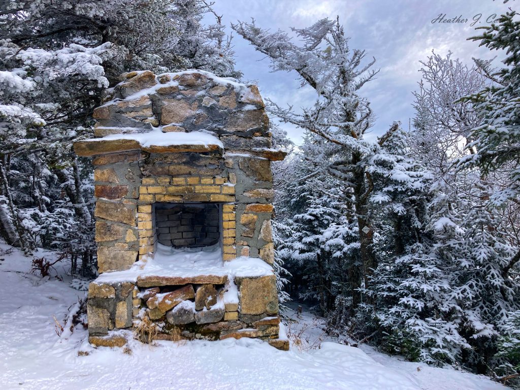
Mount Starr King – Jefferson NH
This peak, standing at 3,915 ft., is located on the southern end of the Kilkenny Ridge. Hike 2.6 miles/2,300 ft. of gain to the viewpoint and chimney… yes chimney… on Mount Starr King. The Mount Starr King trailhead is heavily used and well-packed out. There is a small viewpoint area in an otherwise wooded hike. Go another mile and grab Mount Waumbek (one of the 48 4,000 footers) if you are up to the moderate hike. The chimney on Mount Starr King is the remnants of a shelter removed many years ago.
While these suggested hikes range in elevation from 1,500 ft. to nearly 4,000 ft., do not discount the lower peaks of southern New Hampshire. A full-on winter experience can be achieved, with a little less driving! Small peaks around the State remain accessible and provide opportunities to build fitness in all seasons.