


Who says the East doesn’t have bigtime, open backcountry skiing? A classic not just among Northeast skiers, Tuckerman Ravine is a serious challenge for all skiers and boarders.
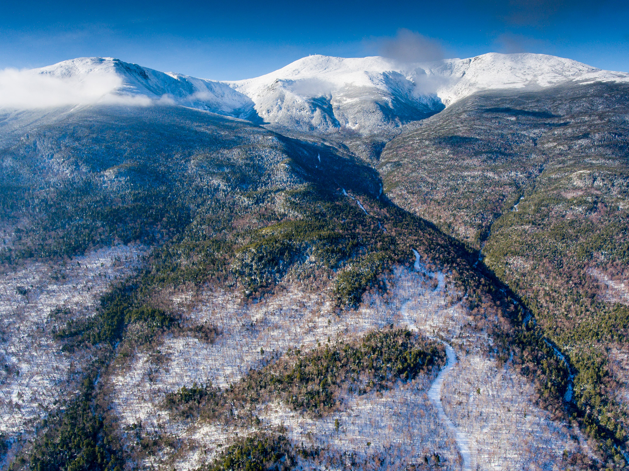
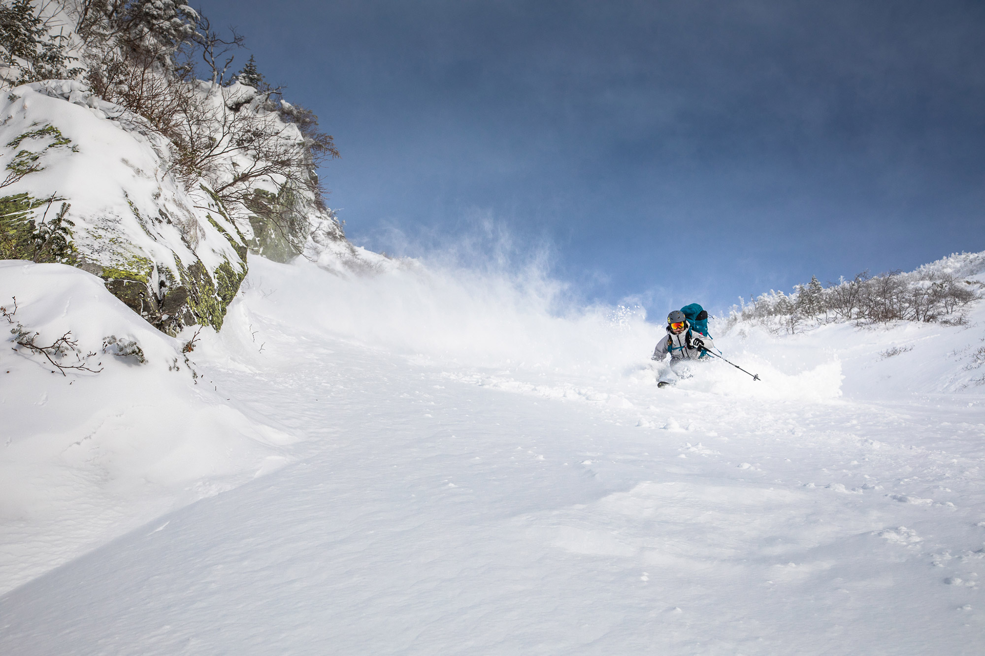
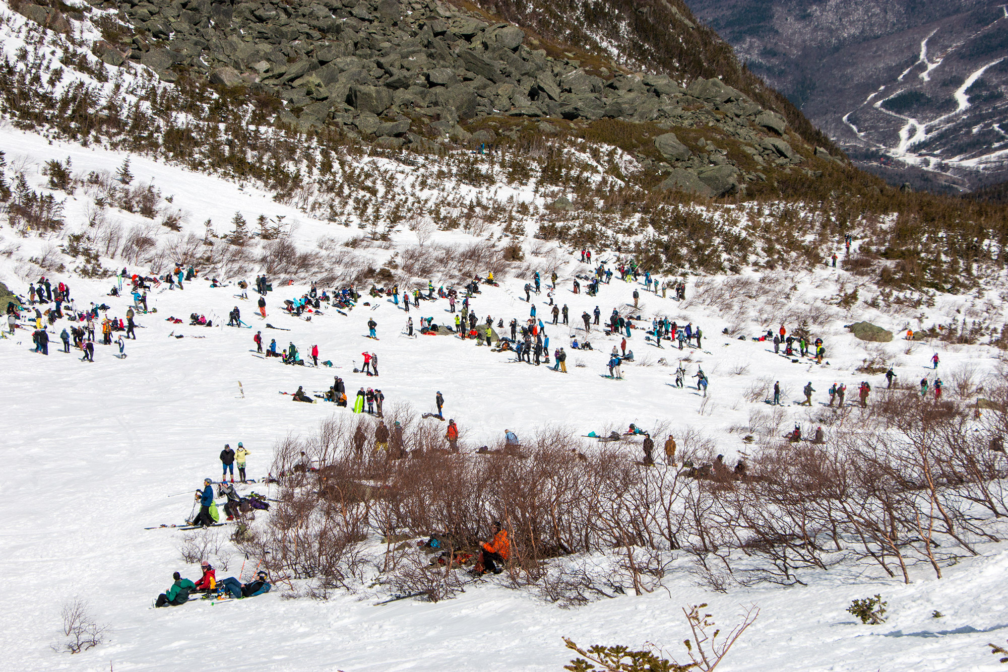
“Skiing Tucks” is a rite of passage for almost every East Coast skier. The glacial cirque offers some of the best terrain east of the Mississippi, with high alpine conditions, steep chutes, and cozy gullies. The birthplace of “extreme” skiing in the 1930s and ’40s, it’s now the East’s most well-known and highly traveled backcountry skiing destination. Amongst its beautiful, rugged, and powerful terrain, its rich community, and addicting atmosphere, Tucks keeps the locals and the travelers alike coming back year after year.
The trip is easily done in a day, but staying multiple days allows for more skiing, earlier starts, and bigger weather windows.
Quick Facts
Distance: 2.9 miles to Tuckerman Ravine Floor, one way.
Time to Complete: 1 day
Difficulty:★★★★★
Scenery:★★★★
Fees/Permits: None
Contact: https://www.fs.usda.gov/recarea/whitemountain/recarea?recid=78538
Turn-By-Turn
Parking and trailhead access to the Tuckerman Ravine Trail are at the Appalachian Mountain Club’s Pinkham Notch Visitor Center located on Route 16 between Gotham and Jackson. Weekend parking fills up quickly, but an overflow lot is located just south of the Visitor Center. Stop in the Visitor Center for last-minute supplies, trail conditions, and weather information before starting your ski up the trail.
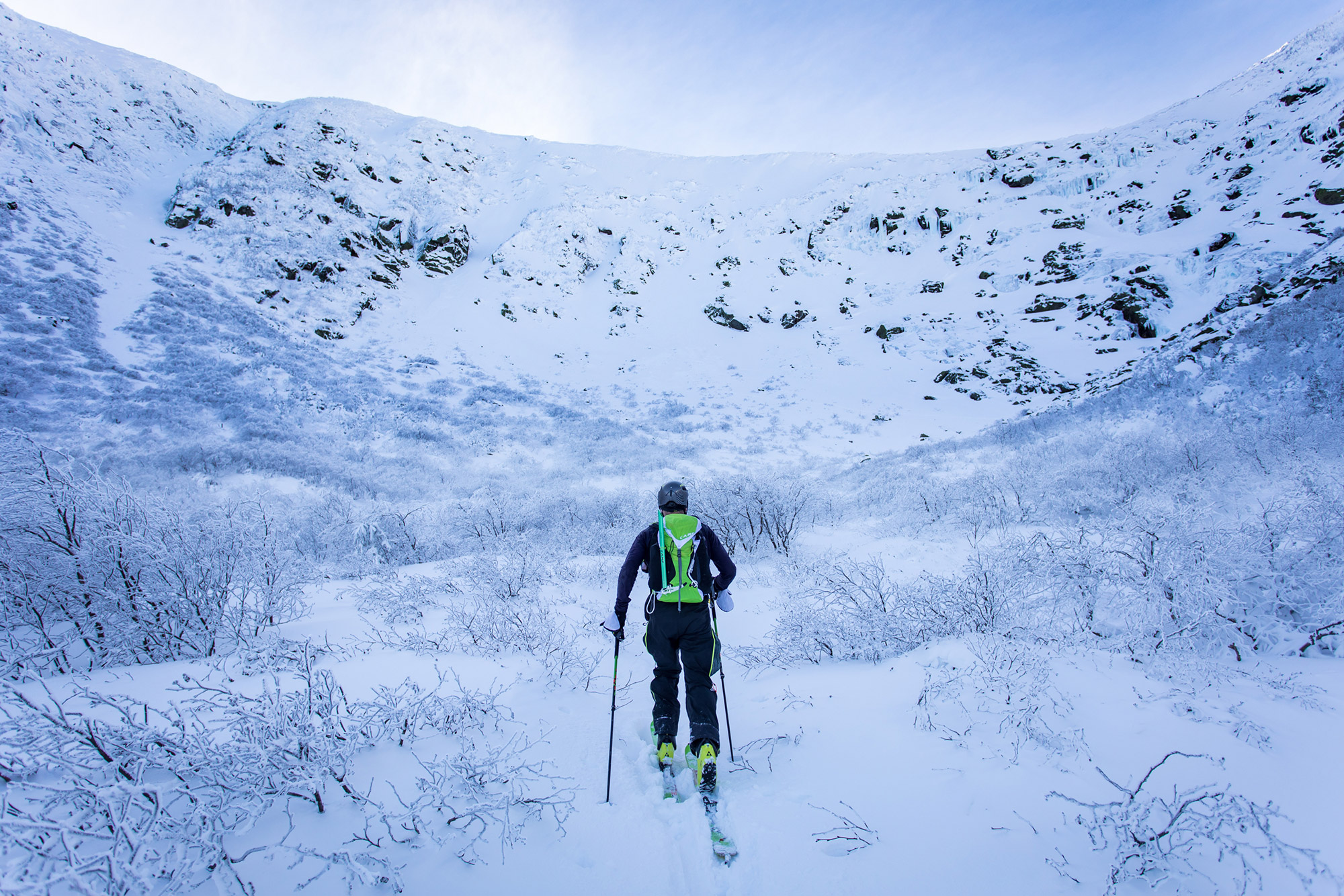
The Approach
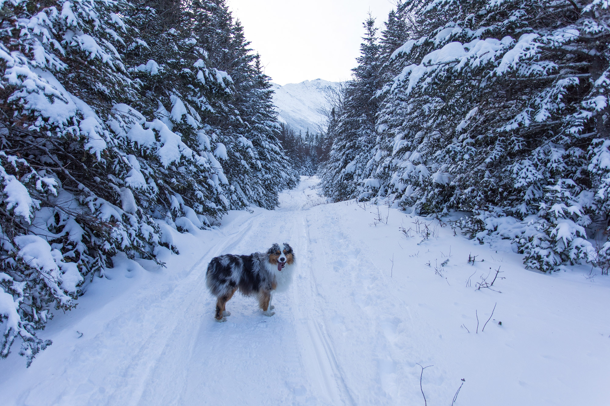
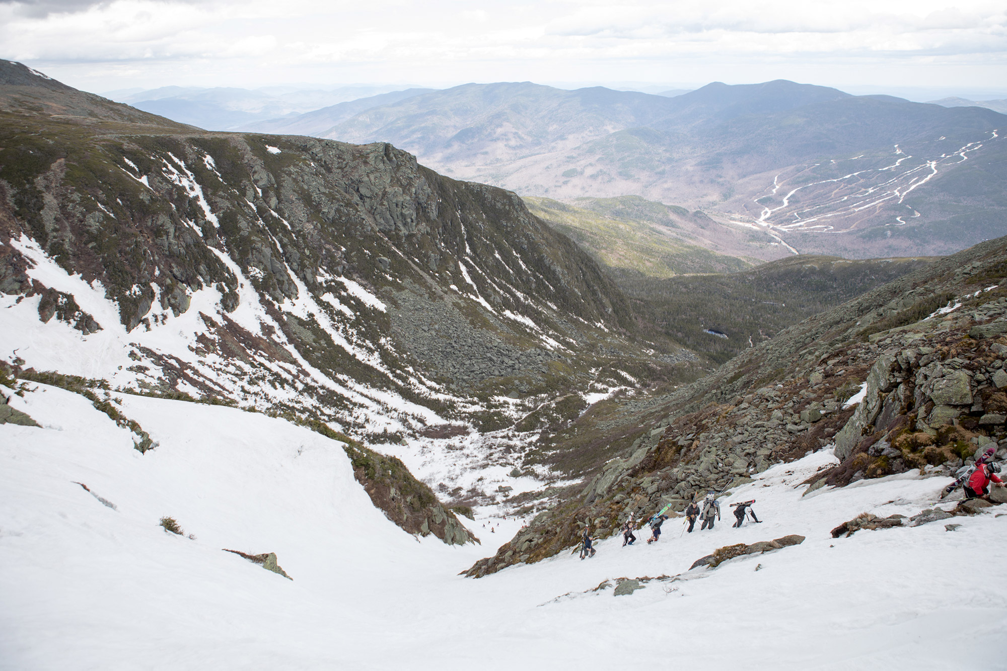
Follow the Tuckerman Ravine Trail from Pinkham Notch Visitor Center for 2.4 miles to the Caretaker Cabin at Hermit Lake Shelters (44.13269° N 74.85318° W). From the Visitor Center, the trail switchbacks before straightening out for a sustained climb to the intersection with the Huntington Ravine Trail. From there, you’ll pass the Harvard Cabin Fire Road junction before climbing to the Hermit Lake Shelters, where you’ll finally gain stunning views of the ravine. Chat with a Ranger or stop into the Caretaker Cabin for up-to-date weather, snow, and safety information before heading up into the ravine. From the Caretaker Cabin, continue up the Tuckerman Ravine Trail for just over a half-mile to reach the ravine’s floor.
While skiers can hike or skin to the floor, once you choose your runs for the day, climbing on foot is necessary to get to the top of the steep slopes. It is strongly recommended to climb up what you intend to ski down to get an accurate view of the conditions and terrain. Remember that the runs are always changing due to the amount of snow and how the snow fills into each run.
After Your Ski
The fastest and most enjoyable way down is the Sherburne Ski Trail, which is accessible from the Caretaker Cabin at Hermit Lake. This trail is roughly three miles long, would equate to a “Blue Square” in difficulty at your local ski resort, and, at the end, drops you off at the south side of the Pinkham Notch Visitor Center parking lot. The “Sherbie” is also a great objective when avalanche danger is high for the day, or if you just want to go for a quick ski tour. As spring progresses, however, Sherburne’s skiable area decreases. So, keep an eye out for a cross-cut back to the Tuckerman Ravine Trail when the coverage gets thin.
If you are looking to spend the night, check out the AMC Hermit Lake Shelters for a winter camping experience and quick access to the ravine; Harvard Cabin for a cozy, rustic night halfway up the trail; or Joe Dodge Lodge next to the trailhead for a bunk, a shower, and a meal.
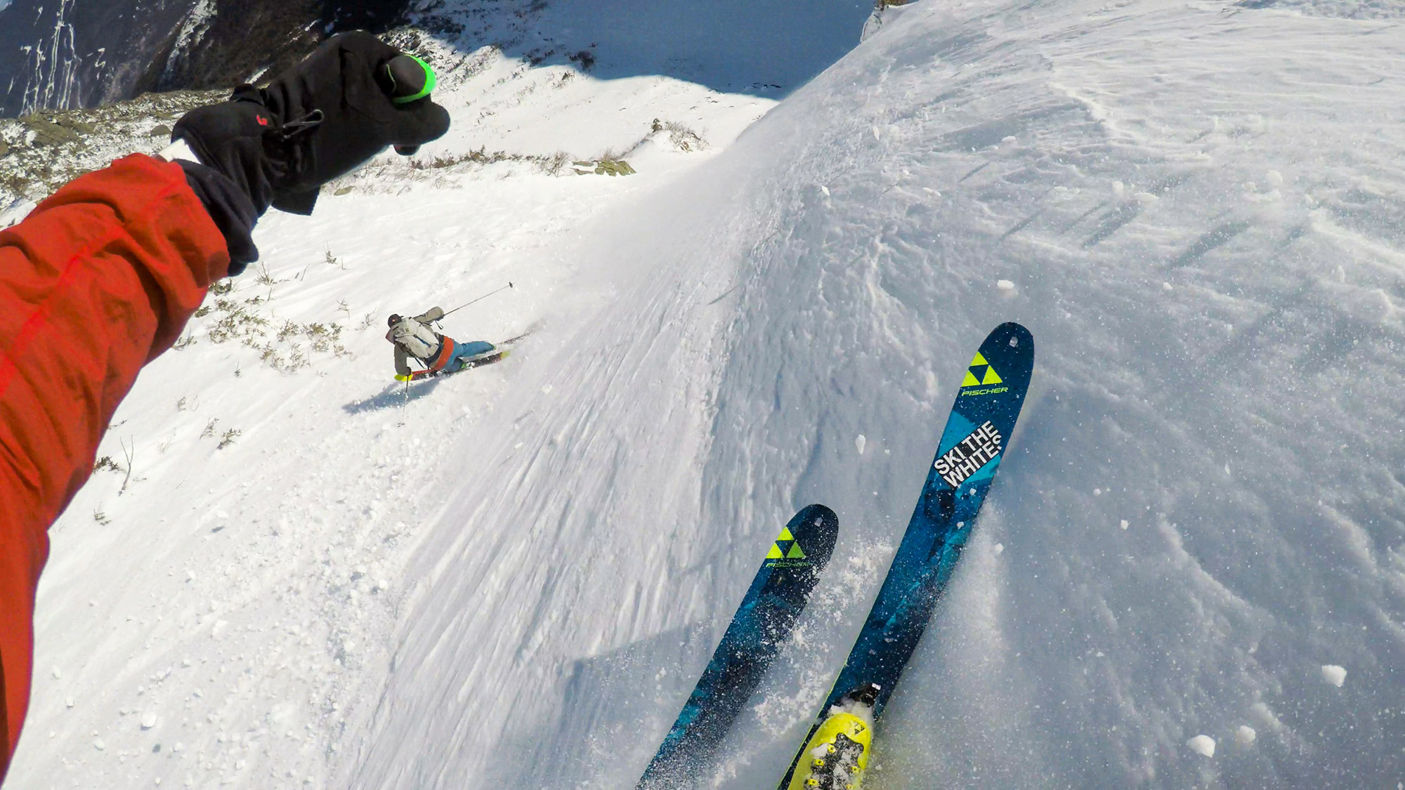
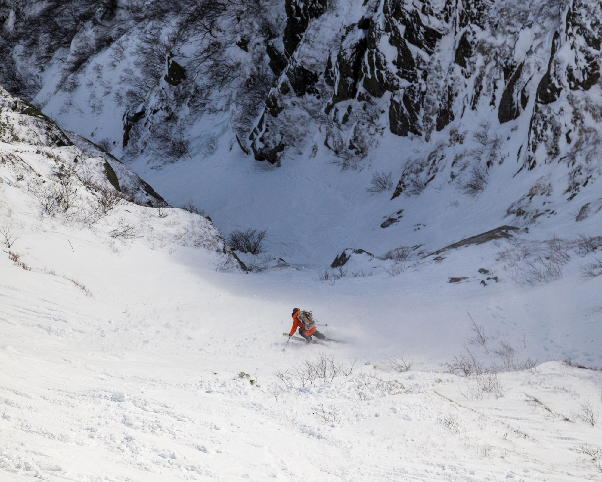
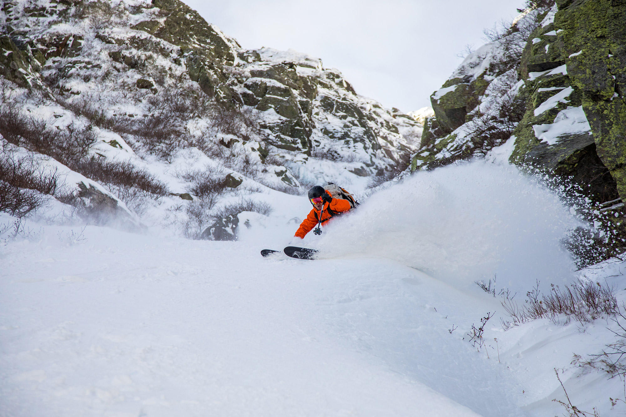
The Runs
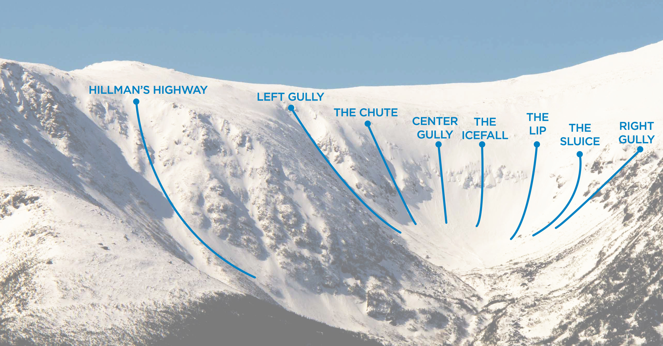
Hillman’s Highway
Aspect: East-Northeast
Steepest Slope Angle: 40 degrees
Vertical Distance: 1200 feet
Hillman’s is slightly removed from the main “bowl” and is located under the Boott Spur Buttresses. Get a great view of the run from Hermit Lake Shelters’ visitor deck. Easy access is found by heading up the Sherburne Ski Trail from the Caretaker Cabin. Points of reference on Hillman’s include “the dog leg,” the skiers’ left-hand curve near the bottom; the top of “the Christmas Tree,” an area of vegetation to the climber’s right of the slide path that, when filled with snow, looks like a Christmas tree from a distance; and the fork near the top of the run, where skiers have a choice of two different variations.
Left Gully
Aspect: East-Northeast
Steepest Slope Angle: 45 degrees
Vertical Distance: 850 feet
The ravine’s left-most prominent run is Left Gully. In the ravine, this run is often the first and last to be skied over the course of the season, as its northeast orientation helps the slope hold snow a bit longer due to decreased sun exposure. The top offers two general entrances to get into the run. When climbing up the gully, look to the right for a steeper entrance, or continue straight up for a slightly more mellow one. About halfway down, the run narrows a bit before making a left turn to drop you back into the bowl.
Chute
Aspect: East
Steepest Slope Angle: 50 degrees
Vertical Distance: 750 feet
Chute is easily identified by the hour glass-shaped choke point near the center. The steep entry funnels skiers through this 30-foot-wide point into open skiing and lower slope angles below. Use caution when climbing through the choke point, as skiers (and their sluff) may be descending. A great spot for a rest on the way up or down, a natural bench is under the rock buttress to the climber’s left of the choke point. It’s ideal for taking a minute to decide whether to keep going, to have a snack, or to take in the great views across the ravine.

The Lip
Aspect: Southeast
Steepest Slope Angle: 45 degrees
Vertical Distance: 750 feet
The Lip is located on the climber’s right-hand side of the headwall, where a gap in the steep wall of rock and ice lets skiers sneak through and make big, open turns into the bowl. When skiing into The Lip, trend to the left to avoid going over the icefall area. The Lip becomes progressively steeper as you ski into it; this decreases the visibility of the run below you, until you reach the steepest pitch. As such, find visual landmarks as you climb up, and use them as a route-finding tool on the way down. All eyes are on you when you’re skiing The Lip, so make it count!
Sluice
Aspect: South-Southeast
Steepest Slope Angle: 50 degrees
Vertical Distance: 700 feet
Sluice is found between The Lip and Right Gully. Its entrance is steep and has a tricky double fall-line, when the obvious ski run dictates one direction of travel, but gravity wants to take you in another. A good reference point for this climb is Sluice Ice, a cliff that holds vertical ice a few hundred feet up from Lunch Rocks. Use caution with your route-finding in the spring, as ice begins to shed as the temperatures rise. Skiers finish the run by skiing to the left side of Lunch Rocks.
Right Gully
Aspect: South
Steepest Slope Angle: 45 degrees
Vertical Distance: 700 feet
The most prominent gully on the south-facing wall is Right Gully. Because of their orientation, this run and Lobster Claw see the most sun in the ravine, so keep this in mind when searching for the perfect soft spring corn. Though it’s a bit shorter than some of the others, the consistent slope angle and half-pipe-like feel make this a favorite. A great place to scope out the line, decide whether to keep climbing, or have a snack is on the natural bench that forms under the climber’s right side of the slight choke point, just under halfway up the run.
Lobster Claw
Aspect: South
Steepest Slope Angle: 40 degrees
Vertical Distance: 700 feet
Once you locate Right Gully, look a few hundred feet to the right to find Lobster Claw. This run is under the ravine’s Lion Head area. Slightly narrower than Right Gully, the slope angle is a bit mellower and gets about the same amount of sunlight. Lobster Claw is home to quite a bit of vegetation and can often take longer to fill in enough to be skiable. When the ravine is crowded with skiers, however, Lobster Claw is often a less-crowded option. Use caution exiting the run, because plenty of rocks and trees sit below the main part of the gully.
The Kit
- Your avalanche rescue kit and the skills to use it are crucial when you’re traveling into the ravine. A popular combo is the PIEPS DSP Sport beacon, Black Diamond Transfer 3 shovel, and Black Diamond QuickDraw 280 probe.
- Though they are not a substitute for crampons on steep slopes, Kahtoola MICROspikes are useful on lower-angle trails, or if you have to hike with your ski boots on a slick surface.
- The slope angles in Tuckerman are steep! Having a small, lightweight ice axe, like the Petzl Glacier, and knowing how to use it are extremely valuable tools for steep skiing and can add a bit of extra security.
- An lightweight sun hoody like the EMS Trail Run Ascent (men’s/women’s) will keep your skin from burning while skiing in the ravine. Remember that snow is highly reflective and can amplify the effects of your goggle tan to a very unpleasant point.
Keys to the Trip
- Avalanches are real and happen very regularly in the ravine. Check out the Mount Washington Avalanche Center forecast online in the morning, before you head into the ravine, and then, check in with USFS Avalanche Rangers or the AMC Caretaker for up-to-date beta on the best spots of the day.
- On the way through North Conway, stop by Frontside Grind Coffee Roasters for a hot brew and bagel before you start your climb.
- For beers and burgers after the trip, check out Moat Mountain Smokehouse & Brewing Co. and Tuckerman Brewing Co.
- For some early morning pre- or afternoon post-skiing yoga, check out the yoga classes at The Local Grocer. This is a great way to both warm your body up before a big day and recover after by stretching and keeping your body moving before the car ride home.
- North Conway has many quirky shops that are unique to New Hampshire. Some of my favorites are the candy counter and hot sauce aisle at Zeb’s General Store; Dondero’s Rock Shop, where any geological nerds can find local and global samples of rocks and minerals; and Beef & Ski for truly bangin’ sandwiches.
Related Posts


[…] snowshoes on Burnt Mountain. Just don’t forget to buy an uphill pass. And, of course, spring in Tuckerman Ravine is a rite of passage for every New England skier. Pro Tip: Go on a weekday, so you don’t have to […]
[…] are venturing into Adirondack slide skiing, avalanche safety and preparedness are a must. Unlike Tuckerman Ravine, the Adirondacks have no avalanche forecasting. Nonetheless, having the proper knowledge is […]
[…] plans likely got scrapped, you can at least dream about ripping classic lines in Huntington and Tuckerman Ravine just like Townsend and friends do in Episode 23. At just over 15 minutes long, there’s no reason […]