In the final installment of our Scoops and Summits adventure, we tour the Mountain West in pursuit of stunning hikes and delicious ice cream to complement them. The one rule of the adventure is that at every location we hike a trail everyone can explore—none of the hikes require backpacking or technical climbing—and complete the trip with a scoop that everyone will enjoy. Lace up your boots and go West with goEast.
Scoops and Summit in the Mountain West
Utah
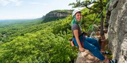
Provo, Utah, is an outdoor playground. The city is home to excellent biking, hiking, climbing, and paddling—just about every outdoor activity you can name is easily accessed from this friendly mountain city. The best way to get a feel for Provo is from the top.
Provo’s cityscape abruptly ends and the adventure begins at Rock Canyon Park. Leave your car here and follow the well-defined path into the canyon. Desert grasses and brush soon give way to larger vegetation as the rushing of Rock Canyon Creek erases the last echoes of civilization. The canyon immerses you in nature while its walls rise above as you gain elevation on the rocky path. Look up and see climbers scaling the canyon’s vertiginous walls and birds soaring. But don’t let your gaze linger aloft too long; there are rattlesnakes on the trail and it’s important to watch your step.
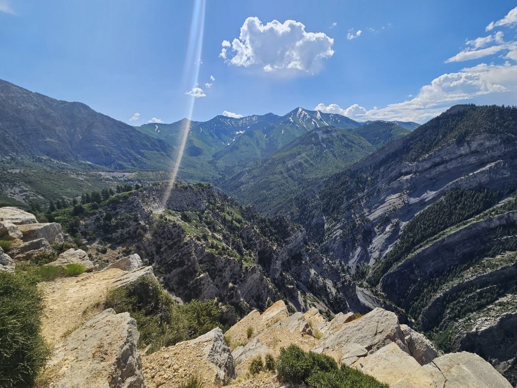
After about a mile and a half, turn left onto the steeper, more wooded Kyhv Peak Trail. From here, another mile of hiking delivers you to a clearing edged by the distinctive white trunks of aspen trees containing a meadow teeming with vibrant wildflowers. Towering above the aspens is Mount Timpanogos. It’s tempting to linger at this sweet spot, but keep moving as more stunning mountain scenery reveals itself at every turn.
Reaching the top of Kyhv Peak, you’re treated to a spectacular 360-degree view, including of Provo far below stretching all the way to Utah Lake. Sitting on the summit and taking in the view of the rocky mountains streaked with white snow rising above verdant green pine forests, it’s hard to believe the city is just a few miles away. Once you’ve had your fill of scenery, turn around and head back the way you came. After nearly 7.5 miles round trip, you’ve earned ice cream.
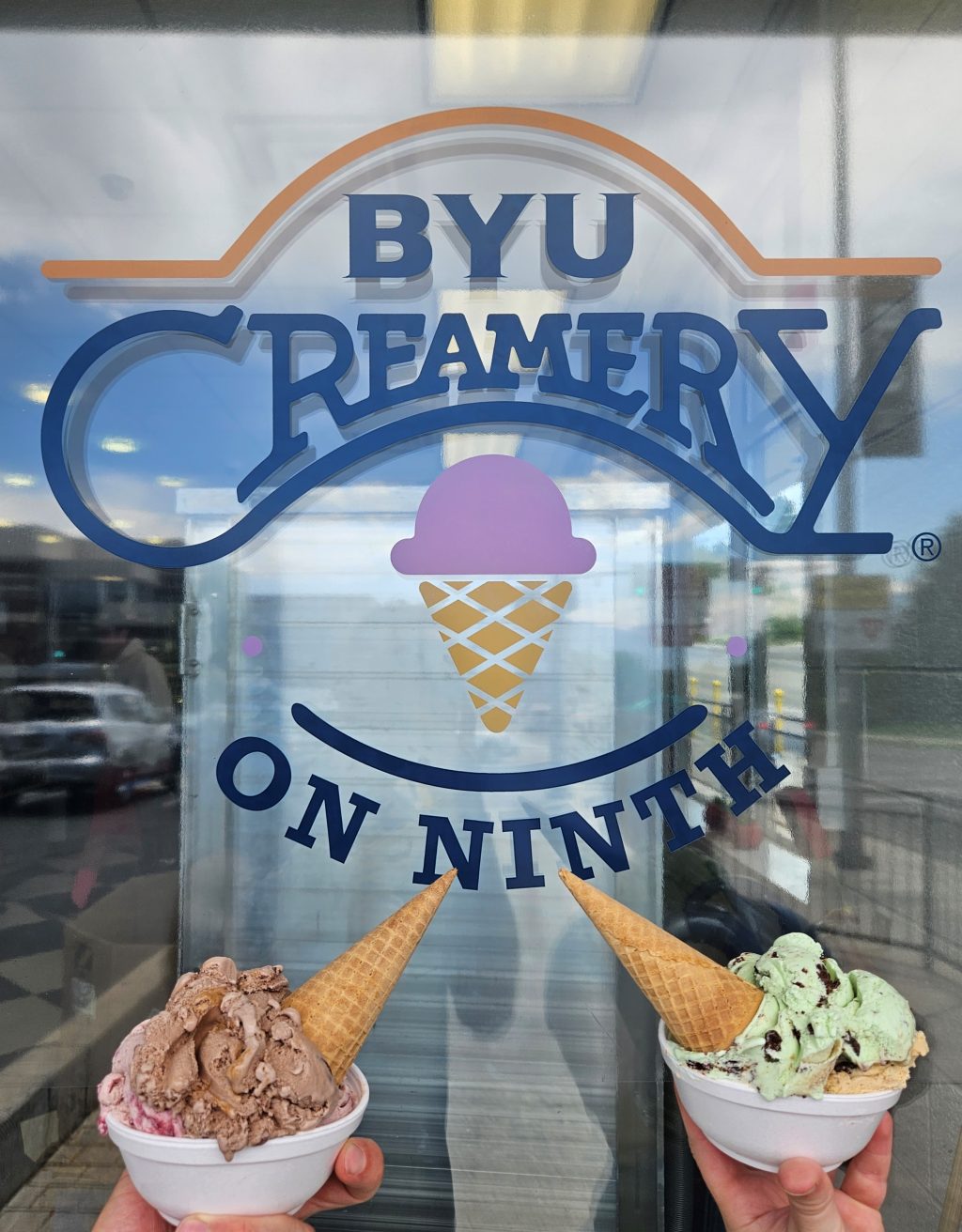
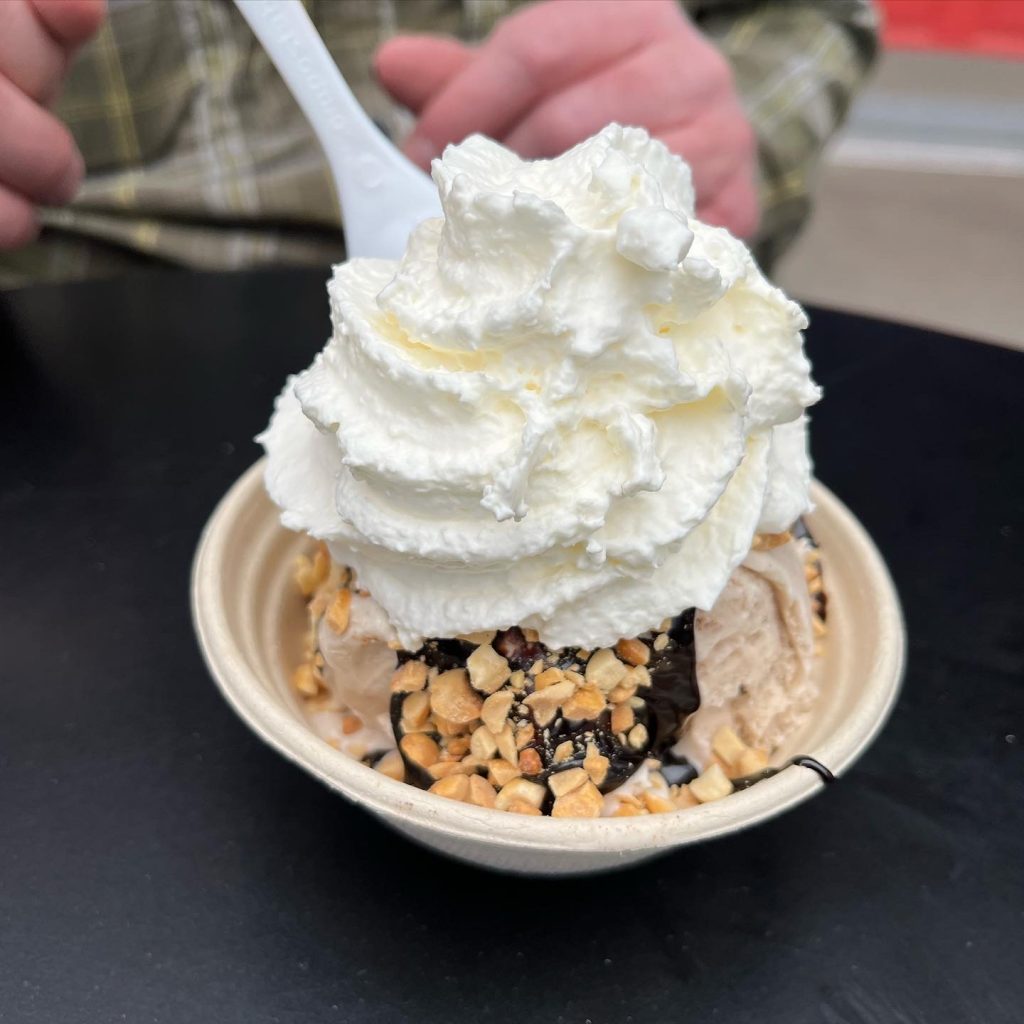
Just a couple minutes from the trailhead is Brigham Young University’s Creamery. Wow, this place is good! Even better, it’s an excellent value. The creamery serves a hearty helping for less than most shops charge for a single scoop. They also don’t skimp on the ingredients. The ice cream featured the perfect balance of brownies, berries, and nuts while the high-fat-content cream made for a super smooth texture. BYU Creamery scooped all the classic flavors plus a large number of creative options. I had Marionberry, Bishop’s Bash, Mint Brownie, and Graham Canyon. I would hike Kyhv Peak and stop for a scoop at BYU Creamery every week if I lived in Provo.
Hike Footnote: Park at Rock Canyon Park in Provo, Utah. Hike 7.4 miles round trip up Kyhv Peak gaining 2,800 feet of elevation.
Colorado
Colorado conjures up thoughts of rocky 14,000-foot peaks piercing the sky and covered in powdery white snow. Although beautiful, it’s also intimidating to coastal hikers used to mountains with more modest elevations. Luckily, in Glenwood Springs, you can get a taste of Colorado’s mountains without the bitter cold and extreme altitude.
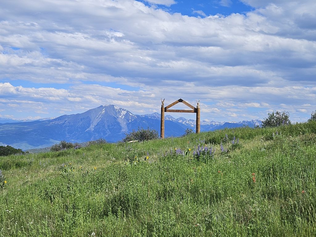
Departing from the parking lot of the Sunlight Mountain Resort, head up the wide and obvious Compass Peak Trail south. The dusty trail steadily snakes up the mountain, weaving through a variety of landscapes including dense groves of aspen, open meadows packed with wildflowers, and shaded pine forests. As you near the top of Compass Peak, the clearing becomes more plentiful and wildflowers more colorful. At one point on my trip, it felt like I was swimming through a purple lake of lupine guided by a lighthouse of black-eyed Susans growing on a knoll ahead. The final stretch was ablaze in the crimson color of the Indian paintbrush lining the trail.
Standing on the just-shy-of-10,000-foot summit, you’re treated to an exceptional view of the Elk Range with the snow-covered Mount Sopris standing proudly in the foreground. The gray granite peak climbs over 6,000 feet above the community below and is truly a wow-worthy spectacle. Behind Mount Sopris is the 14,131-foot Capitol Peak, one of the state’s 58 peaks above 14,000 feet. Capitol Peak is considered one of the most challenging 14,000-footers to summit thanks to its narrow knife’s-edge ridge. Peak baggers must negotiate it on the way to the summit and it’s turned around many ambitious climbers. Descend the way you came and keep your eye out for columbines, the Colorado state flower, and their striking blue, white, and yellow colors contrasting against the red walls of Glenwood Canyon. It’s now time to cool off with ice cream.
In the center of Glenwood Springs—a historic town known for its fabled hot springs where presidents and celebrities of the Wild West have soaked—you’ll find Sundae. This small-batch ice cream shop is constantly experimenting with new flavors that you won’t find just anywhere. Among the more unique flavors, I tried Avocado Coconut, Cinnamon, Salted Cookies and Cream, Black Forest, and Salted Caramel Cookie. As its name suggests, treat yourself to a sundae and mix in even more flavors to these interesting concoctions.
Hike Footnote: Park at Sunlight Mountain Resort. Hike 5.4 miles round trip to the summit of Compass Peak gaining 1,900 feet of elevation.
Arizona
Saguaro National Park is a fascinating place combining everything from desert valleys to towering mountains to a wide variety of unique flora and fauna, including the park’s namesake saguaro cactus. This prickly plant (and icon of the American West) is a fixture of scenery in many Westerns. Saguaros can grow as tall as 40 feet and sprout many arms over their 150+ year life spans. The cactuses can store over a thousand gallons of water and play host to a multitude of species, especially birds like woodpeckers, house finches, and owls. As captivating as these cactuses are, however, there is so much more to see.
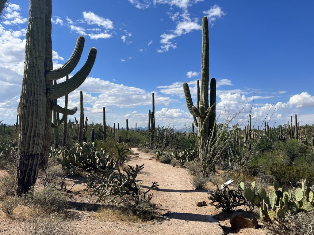
The King Canyon Trail is an excellent place to begin exploring this incredible location. The roughly 4-mile-long path leading to the summit of Wasson Peak parallels the canyon and provides sweeping views of the desert. The trail also takes you past an abundance of vegetation including ocotillo, a wiry plant with flame-like flowers, and prickly pear cactus, which resemble a collection of green plates glued end on end and capped with a crimson bulb. Trailside, there is also teddy bear cholla. Despite its cuddly-sounding name, don’t get too close to this cactus, it wears a coat of sharp barbed spines. Sharp-eyed hikers might spot a Gila monster, desert tortoise, or javelina (similar to a wild hog).
The summit of Wasson Peak provides panoramic views of the park with thousands of saguaros accenting its ridgelines and valleys. As you descend, keep your eyes peeled for deer and lizards. Barrel and compass cactus—which always lean southwest—point the way back to the trailhead via the Hugh Norris Trail. Another nature lover’s dream, the trail is home to an abundance of plants and animals.
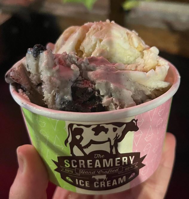
Ice cream is a logical conclusion to any hike, but especially one in the desert. The Screamery in Tucson will satisfy the desire for a scoop…or two. This local establishment makes small batches of unique flavors, such as Drunken Cowboy, a bourbon ice cream with oatmeal, walnuts, and chocolate chip cookies. The Lemonilla had me screaming for another scoop, while the Sweet Sonoran Desert, Cookies & Cream, and Mississippi Mud were all tasty.
Hike Footnote: Park at the King Canyon Trailhead and follow the trail 4 miles up to Wasson Peak. Descend via the Hugh Norris Trail. After 2 miles, turn left onto the Sendero-Esperanza Trail which will reconnect with the King Canyon Trail after 1.3 miles. Turn right onto the King Canyon Trail to hike the final mile back to the car. Round trip, this hike is 8.2 miles and gains 2,000 feet of elevation.
Other Ice Cream and Hiking Pairings
If you haven’t read our earlier installment of Scoops and Summits, make sure to check out our East and West Coast pairings.