

The state of North Carolina is home to hundreds of waterfalls. In the area of Pisgah National Forest alone, hikers can find over 250 cascades with glistening falls and exotic swimming holes. And heading to the falls gives adventurers a unique way to see the state, move their bodies, and occasionally take a dip. Whether you’re a local or you’re visiting from out of town, exploring North Carolina’s best waterfalls is guaranteed to satisfy your wanderlust.
Catawba Falls via the Catawba Falls Trail
- Black Mountain, North Carolina
- 2.3 miles round trip
- 341 feet of ascent
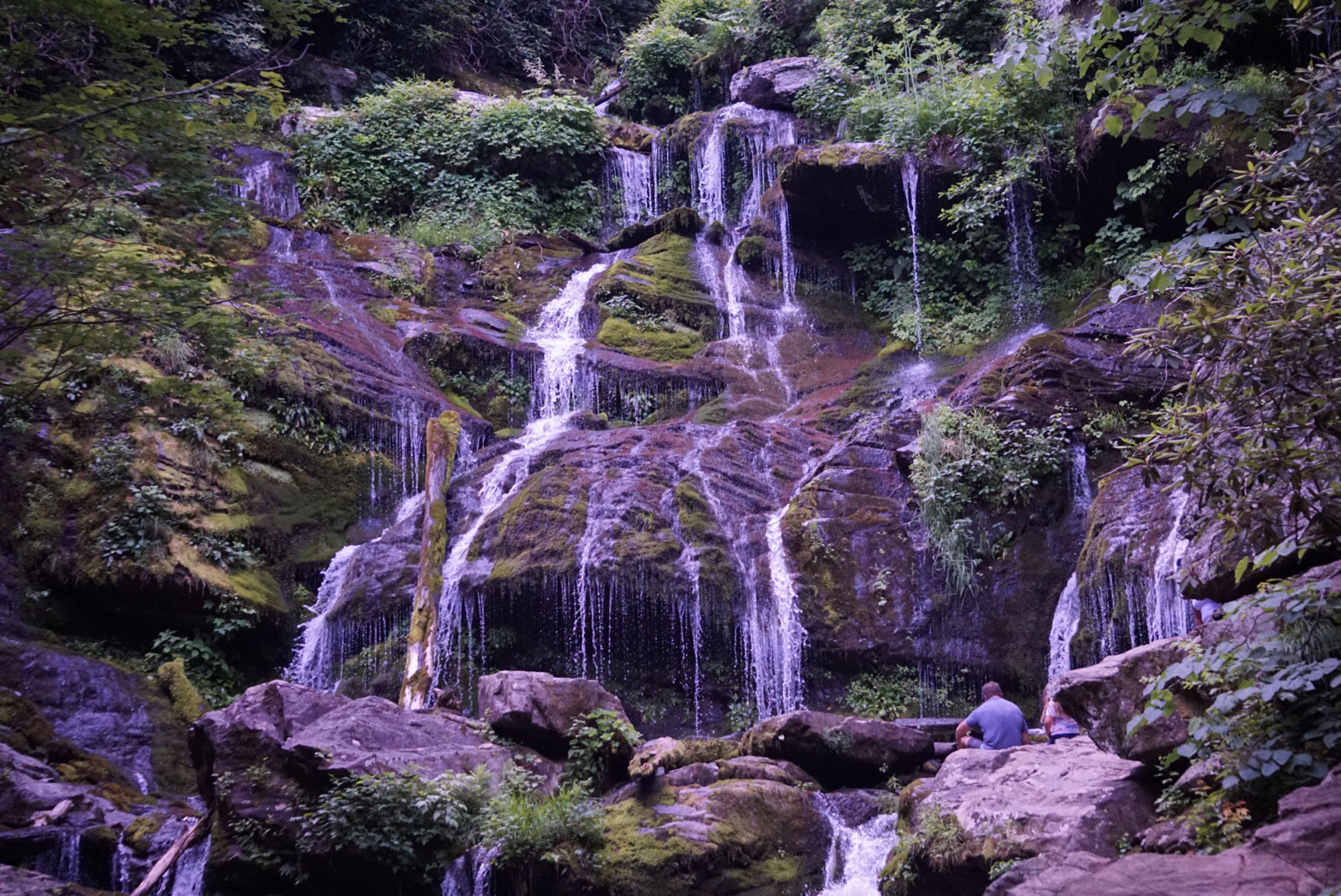
Catawba Falls is one of the most visually captivating waterfalls in all of North Carolina. The moss-covered rocks appear to be out of a fairytale, and the waterfall reaches a stunning height of 100-feet. This is an iconic waterfall for anyone who wants the quintessential North Carolina experience. The rolling hills are graded for hiking abilities of all kinds. And it takes just a short jaunt to get to your destination.
From the parking lot, hikers have a 1.15-mile hike up a mellow trail. Once you dip into the trees, you can expect your hike to remain shady until you reach the falls. Along the way, you’ll see remnants of a dam that was created in the early 1900s. There’s also an old historic building and a number of small waterfalls. You’re likely to see families and other hikers on your journey. And it can be helpful to make it to the trailhead early to avoid fighting for parking. But the journey to the top is worth it. The region is also dog-friendly. While many adventurers play in the river near Catawba Falls, there aren’t any substantial swimming holes in the region. Instead, you can enjoy some of the 470 species of birds that can be found in North Carolina.

Triple Falls in Dupont
- Dupont State Forest
- 3.2 miles round-trip
- 439 feet of ascent
Dupont’s Triple Falls hike takes you to Hooker Falls, Triple Falls, and High Falls, giving it a great bang for your buck. You can travel to all three waterfalls in about 3.2 miles round-trip, making it a good pick for the casual adventurer. The trails in this region are well graded with portions of chunky gravel and a few hills. Adventurers could easily mountain bike the region and connect the waterfall hikes to a larger trail network.
There’s a parking lot that’s located at the Triple Falls Loop and Staton Road junction. From the parking lot, hikers can cross Staton Road to access Hooker Falls. Hooker Falls is about a 0.43-mile hike (round trip). Hooker Falls is a long and thin waterfall that opens up into a wide river. This 14-foot waterfall is still breathtaking in its splendor. Triple Falls and High Falls are situated on the east side of Staton Road. Triple Falls and High Falls are both 125-foot waterfalls.
Swimmers can be found in all of the waterfalls during the Summer months. Expect to see crowds, especially on the weekend. If you’d like to turn your adventure into a longer trip, it’s fairly easy to do so. Hikers can continue trekking after they’ve reached High Falls by traveling east on Buck Forest Road. Some hikers may choose to complete the DuPont Waterfall Bonanza, which is a 14-mile hike that connects all of these waterfalls and continues forward by adding Bridal Veil Falls Road and Corn Mill Shoals to the trek. The Dupont State Recreation Area has dozens of trails that can be linked to this waterfall hike. Just note that camping is not permitted in Dupont State Forest while you’re planning your adventure.
Moore Cove Falls Trail
- Pisgah National Forest
- 1.2 miles round-trip
- 154 feet of ascent
The Moore Cove Falls Trail takes hikers up a moderately difficult trail with a low incline. After traveling for 0.68 miles from the Moore Cove Falls Trailhead, which is located directly on the east side of route 276, you’ll reach a large outcropping with a trickling waterfall that reaches a height of 50 feet. It’s possible to explore beneath the lip of the falls, or even to stand right below the water to cool yourself off. It isn’t the most popular waterfall in Pisgah, but you’re likely to see other adventurers along the way. The waterfall is most active in the Spring. Later in the season, it’s commonly reduced to a small waterfall. The hike is about 1.24-miles round trip. It’s well travelled, in part thanks to its convenient location.

Looking Glass Falls
- Pisgah National Forest
- 0.3 miles round-trip
- 36 feet of ascent
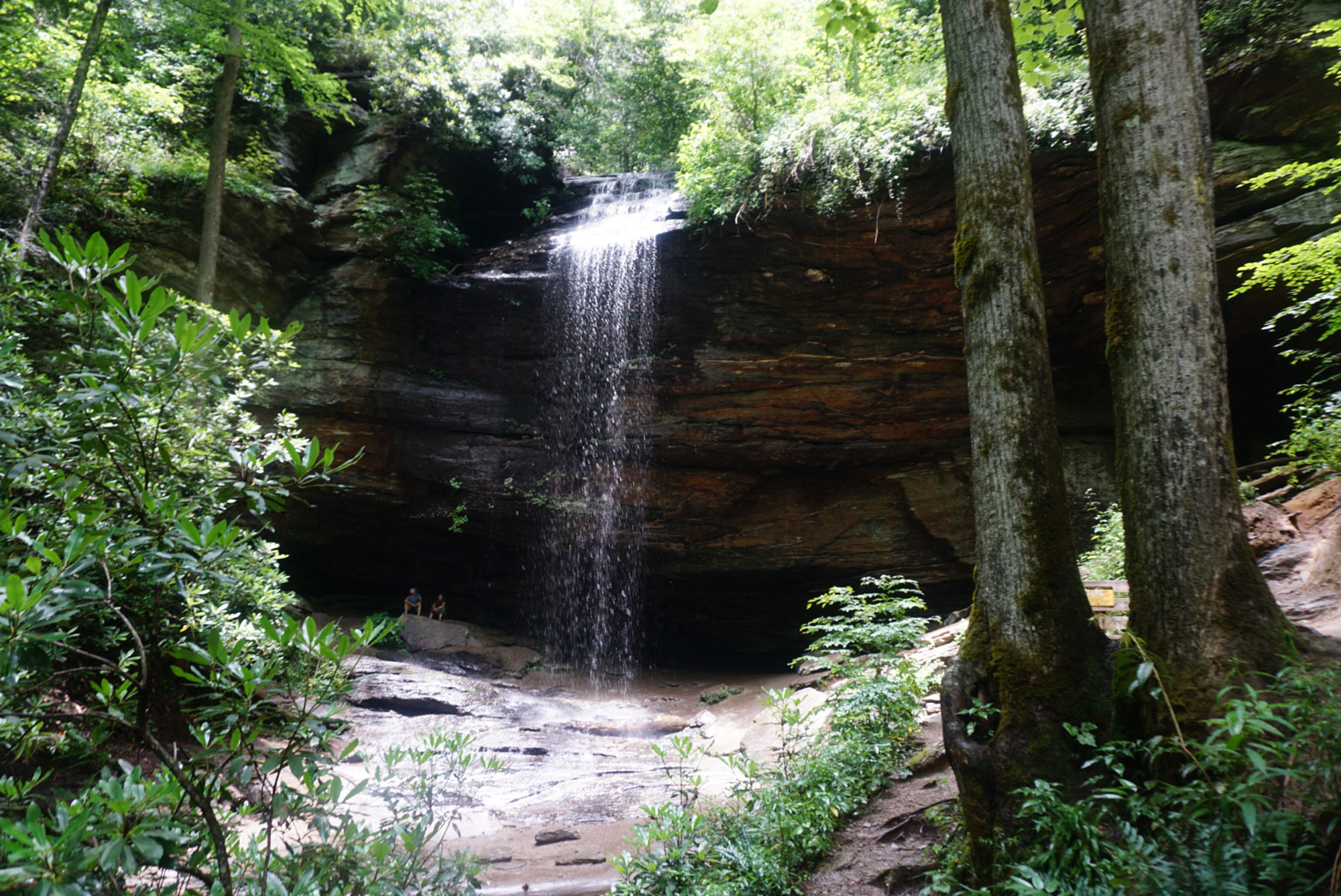
Looking Glass Falls is a great waterfall option for anyone who wants the shock factor of a massive waterfall without hiking tons of miles. This waterfall is located right next to the road. But it’s spectacular in its size. This 60 foot waterfall towers high over the river, looking majestic all-year-round. And it’s framed by mossy rocks that jut into the canyon. Looking Glass Falls is just a 6-mile drive from Brevard, and it’s situated on Highway 276, which makes it a popular destination. During the warm months, it’s common to see visitors cooling off in the water at the base of the waterfall.
Grassy Creek Falls via Lake Imaging Trail
- Dupont State Forest
- 4.52 miles round-trip
- 382 feet of ascent
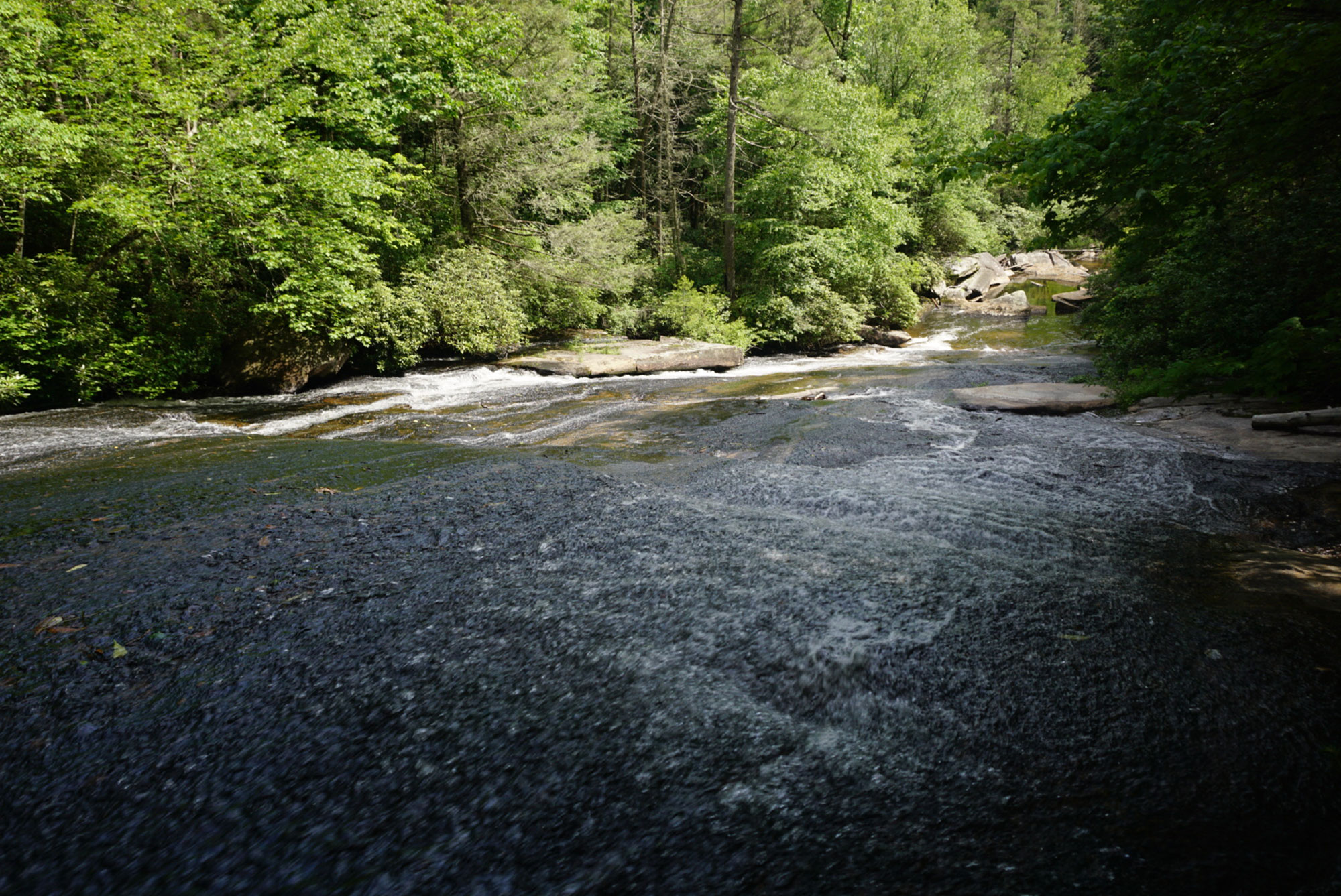
The Grassy Creek Falls hike via Lake Imaging Trail is a gradual trail that takes you deep into the forest. As you travel, you find yourself in brushy green forests. The area is well-loved by mountain bikers, and you’re likely to see traffic as you travel. Eventually, the Lake Imaging Trail connects with the Locust and Hilltop Trails. The Hilltop Trail creates a loop by connecting with the Lake Imaging Trail. If you continue forward on the Lake Imaging Trail, you’ll reach a side trail on the left. If you decide to take Hilltop Trail, you’ll reach that side trail on the right. After about 2.26 miles, you’ll find yourself at the top of a waterfall.
Grassy Creek Falls isn’t the most visually stunning of waterfalls, but it has a charm of its own. Adventurers love to travel to this waterfall to take advantage of its slick top. It’s possible to slide down this waterfall as if it were a waterslide, making it fun and exciting in a unique way. Because of the distance to the falls and the shallow depth of the water, you’re less likely to see hordes of other humans basking in the sun at this destination. Most hikers tend to gravitate towards swimming holes where they can submerge themselves, which means that Grassy Creek Falls is more secluded. Because of this trail’s lengthier hike, it’s best suited for moderate abilities.
Cedar Rock Falls
- Pisgah National Forest
- 1.8 miles round-trip
- 350 feet of ascent
From the Pisgah Fish Hatchery, hikers can begin their journey to Cedar Rock Falls from a gate that’s just a few feet southeast of the building. You’ll begin hiking on a road, and quickly take a right onto the Cat Gap Loop Trail. You’ll cross a bridge a little over a quarter mile from the start of your hike, and begin trudging uphill. About three quarters of a mile from the start of your journey, you’ll encounter a downhill trail to your left, which will take you all the way to the Cedar Rock Falls.
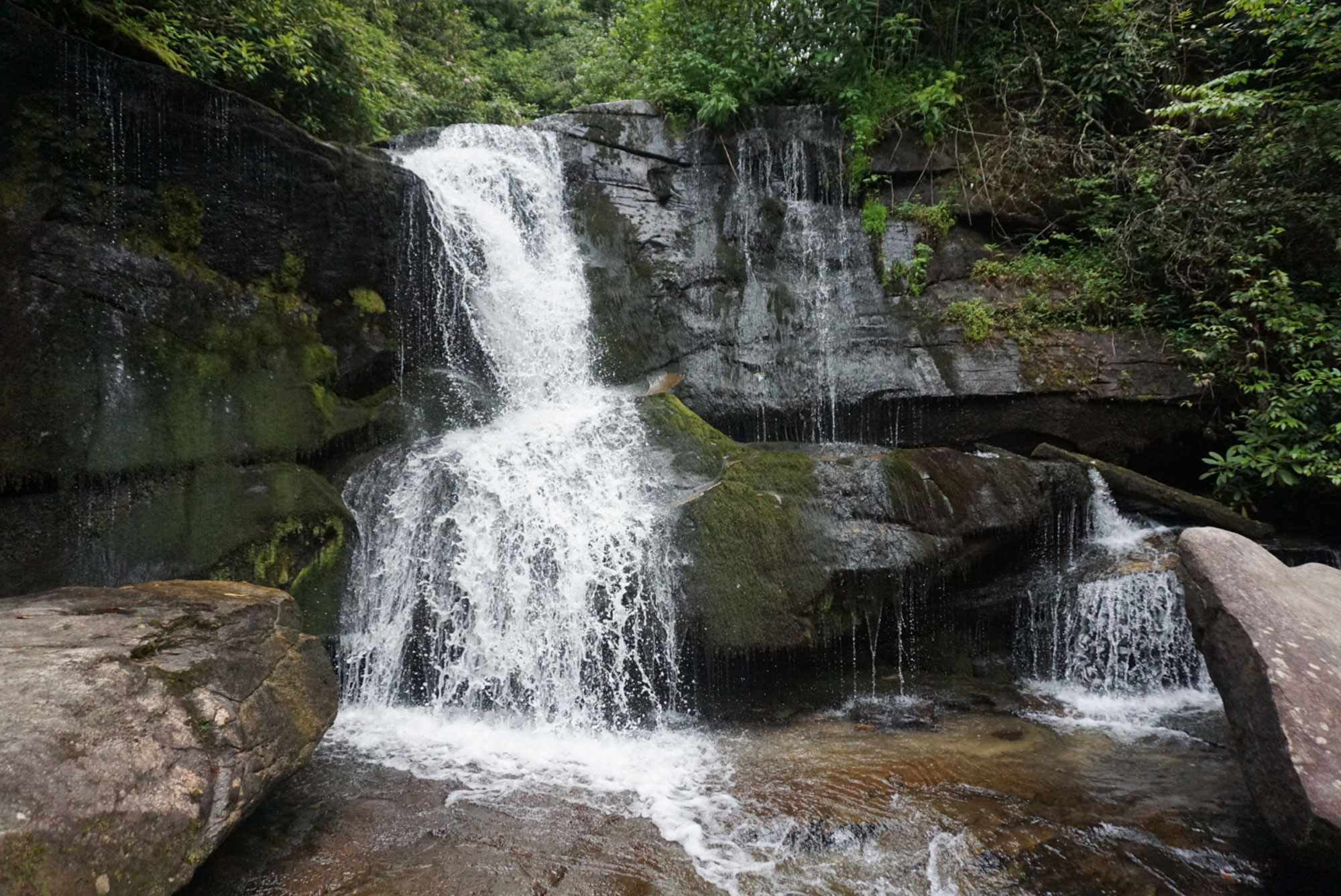
Cedar Rock Falls is accessible year-round. During the weekends, the Pisgah Fish Hatchery is often crowded, and you should expect to see traffic on the trails. To extend your hike, you can continue on the entire Cat Gap Loop where you’ll encounter three more waterfalls. The whole loop is 4.6 miles in length. When you finally reach the falls, you’ll be blown away by the gushing waterfall. Although it’s just 25-feet in height, it flows heavily year round, which creates a beautiful view. At the bottom of the waterfall, you’ll find small pools of water and boulders on which you can enjoy your lunch. The Cedar Rock Falls hike is best suited for moderate adventurers.
Related Posts


