


The Northville-Placid Trail: A 130-mile slice of the Adirondack State Park
The oldest footpath in New York, the Northville-Placid Trail is a rugged and remote 130-mile lower-elevation trail that weaves through seven wilderness areas in Adirondack State Park. If you’re looking for a unique, less traveled, and historic way to see the park’s lakes, ponds, streams, rivers, and remote wilderness areas, this multi-day backpacking trip is the adventure for you.
Quick Facts of the Northville-Placid Trail
Distance: 138 miles from Northville to Lake Placid
Time to complete: Typically thru-hiked in 8-12 days
Difficulty: ★★★★★
Scenery: ★★★★
Fees/Permits: No permits are required
Contact: Adirondack Mountain Club (AMK)
Turn-by-Turn:
The Northville-Placid Trail (NPT) is a point-to-point trail that can be hiked in either direction (i.e., northbound or southbound). A northbound hike starts in Northville and finishes in Lake Placid. The 10 distinct segments of a northbound hike on the NPT are described below.
1. Northville to Benson (miles 0 – 12.32)
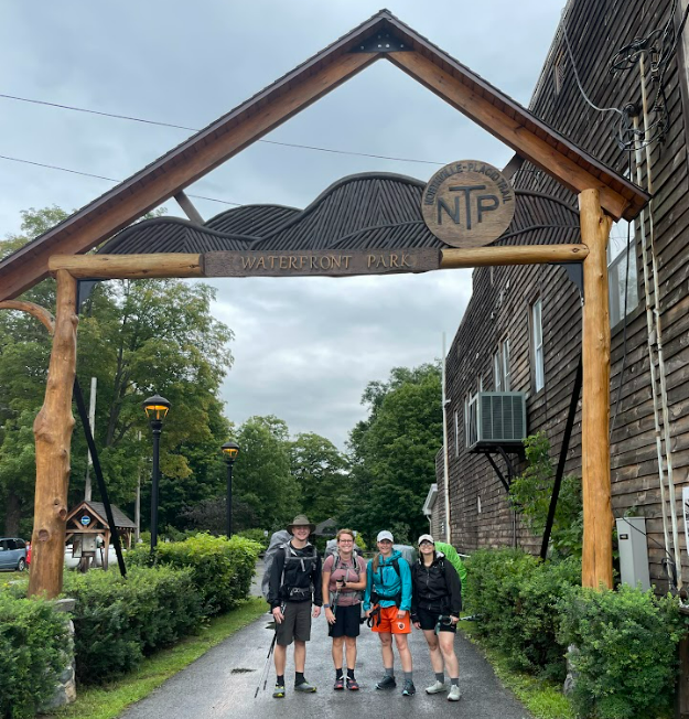
Starting in the heart of Northville, a northbound traverse of the NPT kicks off under the arch at Waterfront Park with a road walk across the Sacandaga River and views of Great Sacandaga Lake. After about three miles on the road, the trail enters the woods, making a steady incline to Mud Lake. The first major milestone is crossing West Stony Creek. About 90 feet wide, make sure to check on the creek’s water level prior to crossing.
After crossing West Stony Creek, a short ascent and spur trail lead to one of the NPT’s newest shelters—the West Stony Creek Lean-To. From here, the trail grade mostly levels out for the remainder of the 3.8-mile hike to Benson Road.
Pro Tip: In the event that the water level at West Stony Creek is too high to safely cross, hikers can follow the NPT’s old route along regional roads to the Benson Road trail intersection.
2. Benson to Whitehouse (miles 12.32 – 33.83)
Crossing Benson Road leads you back into the woods for the second section of a NOBO NPT. Just off the road, along Woods Lake, there are several campsites with great access to swimming. Past the lake, numerous small stream crossings, a mix of rock hops, and log bridges are the most notable features of the trail. A small cairn marks a spur to the Abner Creek tentsite and privy. Almost seven miles into this section, the NPT joins up with the Godfrey Road Spur Trail, marked in yellow, which leads back to parking near Benson Road.
From here, the trail generally ascends toward the view of Meco Lake, where the NPT then begins to descend toward Silver Lake. A designated lakeside tent spot is followed shortly by the Silver Lake Lean-to and privy. Both sites enjoy good access to the lake.
After Silver Lake, the NPT crosses several vleis (marshy areas) along boardwalks on its way to Canary Pond and its several tent sites. Expect a beaver pond re-route following the next vlei crossing, unless it has been exceptionally dry.
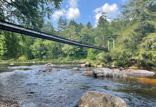
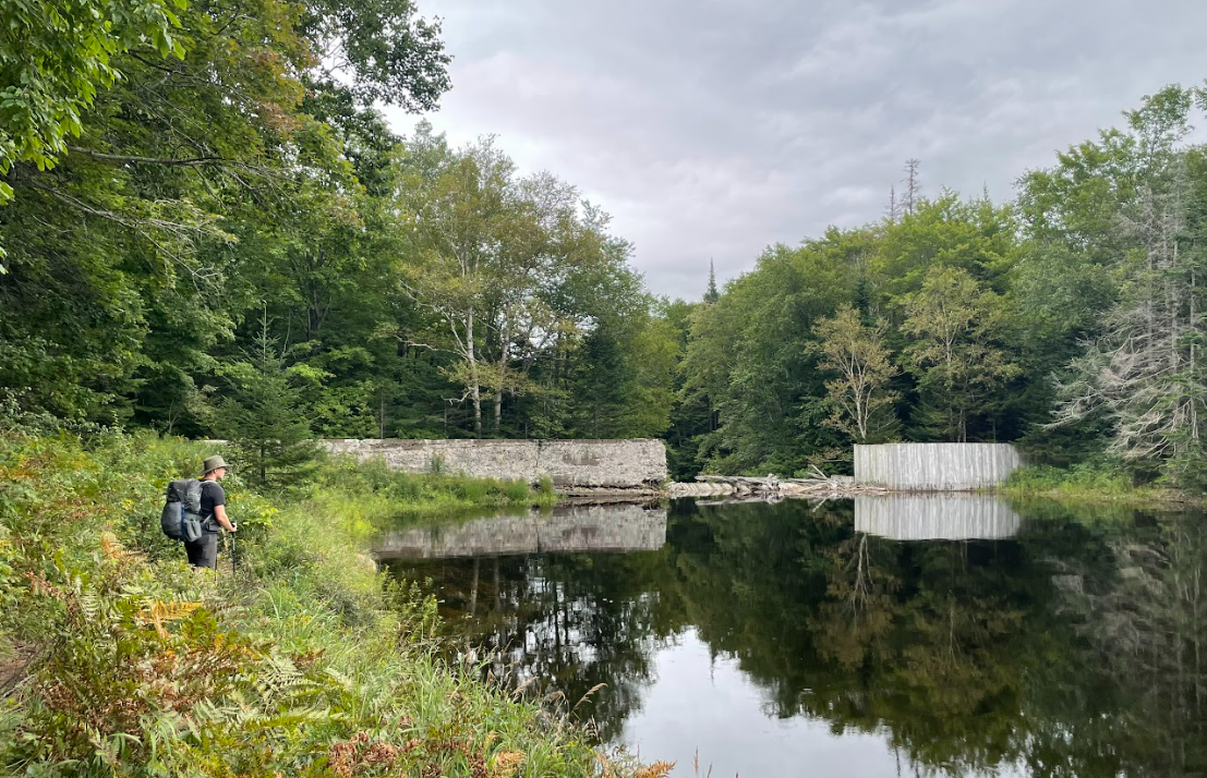
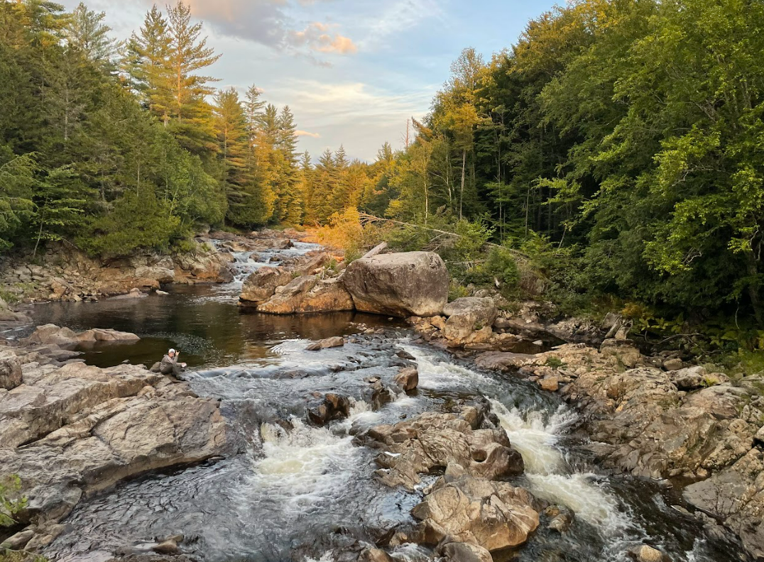
Near the end of the second section, the NPT crosses the West Branch of the Sacandaga River via one of the largest pedestrian suspension bridges in the Adirondacks. This is a great place to rest and enjoy the view of the bridge and the cool water! An old chimney and trail register on the north side of the bridge mark the end of this section.
3. Whitehouse to Piseco (miles 33.83 – 43.02)
From the north side of the bridge, the NPT continues uphill from the river on old tote roads through the woods toward a suspension bridge over the Hamilton Lake outlet. Shortly after the bridge, the trail passes high beaver activity areas with re-routes and marshy bog bridging, leading to a short spur to the Hamilton Lake Stream Lean-to and privy.
From the facilities at Hamilton Lake Stream, the NPT maintains an enjoyable grade until it intersects with Route 8. Here, a roughly three-mile road walk along Route 8 and Route 24 leads to Haskell’s Road trailhead.
Since this section of the NPT runs directly through the village of Piseco, it is a convenient resupply point for backpackers doing a multi-day trek. Here are two key resupply options:
- The Piseco Post Office is located directly on the trail if you want to ship yourself supplies. (Just make sure in advance that they’re open when you plan to pass through).
- The Oxbow Inn is a one-mile round-trip from the Route 8 trailhead and serves up pizzas, sandwiches, and cold drinks. It’s an ideal stop if you’re tired of backpacking food.
4. Piseco to West Canada Lakes (miles 43.02 – 58.07)
Leaving Piseco, the NPT passes a trail register and climbs a steep grade. Just before the Fall Stream crossing are multiple well-used tent spots, followed shortly by the Jessup River crossing and tent areas.
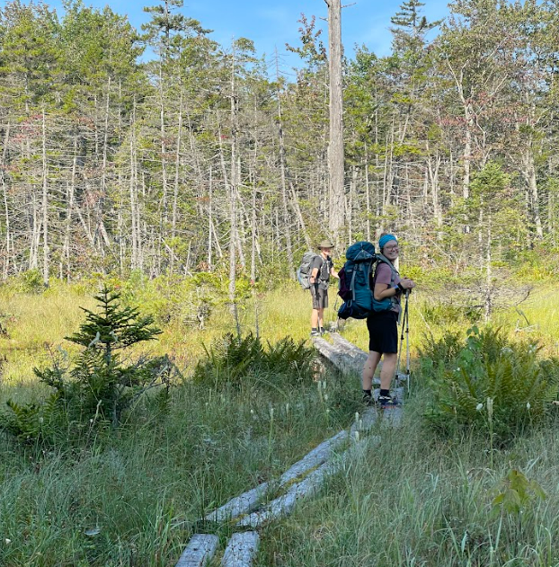
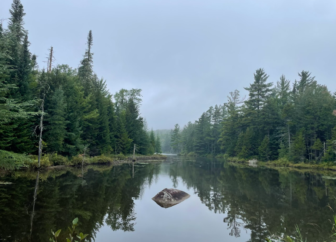
The NPT flattens out as it enters the West Canada Lakes Wilderness, the most remote wilderness in New York State and the second largest wilderness in the Northeast. In this area, the NPT crosses several wet areas on log planks and also spends some time on logging roads.
Soon the first of three Spruce Lake lean-tos is visible. These offer ample options for camping and lake access. Note that as of 2021, the Sampson Bog Outlet bridge is out. This can be a tricky crossing if water levels are high—take your time and choose a good route across.
Following the water crossing, the trail has some ascents and descents, crosses vleis on planks, and traverses deep mud. Pay attention to markers as the NPT and French Louie Trail connect. The woods eventually open up to West Canada Creek, a perfectly picturesque Adirondack view. From here, you can either take a spur trail to the West Canada Creek Lean-tos or continue north on the NPT descending toward South Lake and the South Lake Lean-to.
Just after the South Lake lean-to is the iconic South Lake Outlet bridge and its panoramic views of the lake. At the end of the bridge, sinking planks lead through a marshy grass area and another spur trail leading to the West Lake Lean-to. The West Canadas are notably wet, so expect bog bridging, mud, and planks throughout.
5. West Canada Lakes to Wakely Dam (miles 58.07 – 74.23)
The Northville-Placid Trail continues north on dense, remote woods, occasionally connected by old logging roads. There are several sections of deep mud throughout this stretch, along with multiple short ups and downs that keep the day interesting. Roughly four miles into the section is a spur trail to the first of three Cedar Lakes Lean-tos.
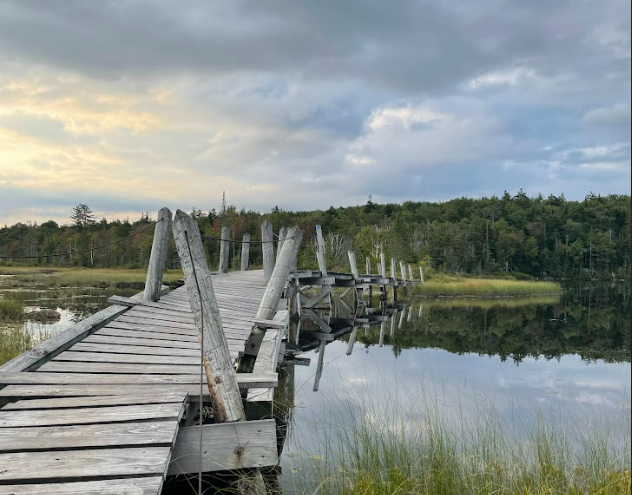
The Cedar Lakes Lean-tos are spread out over three miles and are followed by the Cedar Lake Dam. Past the dam, the NPT skirts the Cedar River over rolling terrain. The next camping opportunity is found at the Carry Lean-to, which offers picturesque, remote forest views.
After the Cedar Lake Lean-to, the NPT is particularly low-lying and is often underwater; anticipate wet feet. However, the trail soon strings together old logging roads and seasonal roads which are easier to follow and reliably drier. The Cedar River Flow can be seen from the trail with a large designated campsite on the shore. There are several tent sites along with a picnic table and fire pit.
The NPT continues toward Wakely Dam via a snowmobile trail and seasonal road in the Moose River Plains. The dam is open to cars and boats, so be aware that this section of trail may be more crowded than many sites along the NPT.
6. Wakely Dam to Lake Durant (miles 74.23 – 86.43)
From Wakely Dam, the Northville-Placid Trail follows cruiser terrain along seasonal roads before heading back into the woods. In the forest, this section of the NPT is characterized by mostly gradual ascents and descents as the trail makes its way to Stephen’s Pond and its well-maintained lean-to.
The NPT from the lean-to is more well-traveled as it nears Route 28 and offers a mostly flat path into the NYSDEC Lake Durant Campground, three miles later. The Lake Durant campground features plumbing, picnic tables, fire pits, and perfectly constructed campsites. Lake Durant offers reserved campsites, but if you’re just passing through, it’s $2 to use the showers and facilities.
From Lake Durant, the NPT follows the pavement leading to Route 28. At the road crossing, you can head west into the community of Blue Mountain Lake or continue on the NPT into the woods. The Blue Mountain Lake Post Office provides another opportunity to resupply. Once again, make sure they’ll be open when you anticipate passing through if you’re using it as a resupply.
7. Lake Durant to Long Lake (miles 86.43 – 100.38)
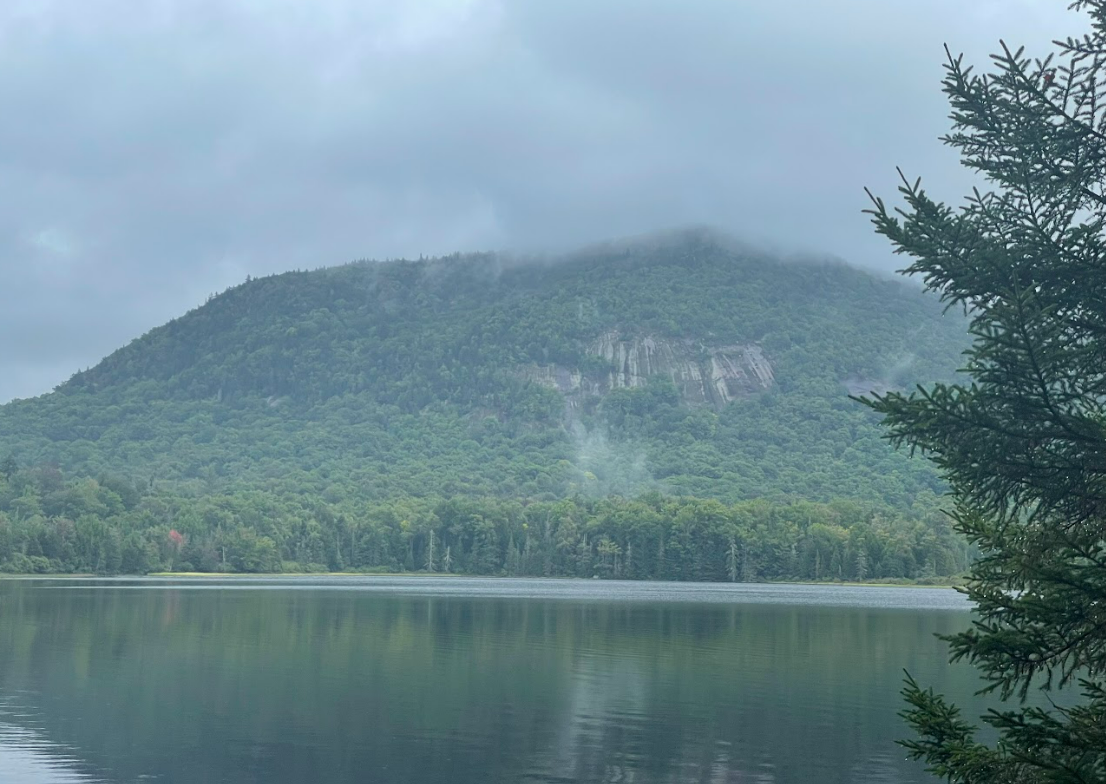
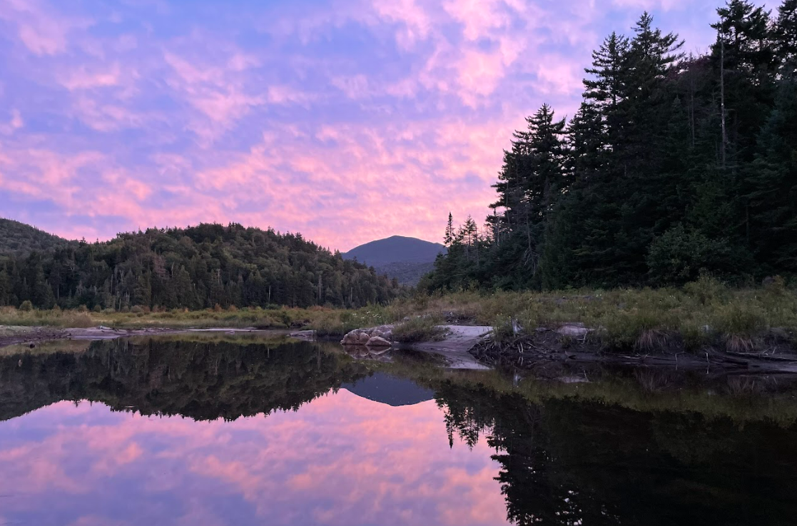
From Route 28, the NPT heads uphill and ultimately skirts between the contours of the Blue Ridge Mountains. Along the way, there are several small creek crossings and slippery log paths. The trail then snakes around Tirrell Pond, offering beautiful views of both the pond and Tirrell Mountain.
The O’Neil Lean-to is conveniently located around mile mark 3.5 and is followed shortly by the Tirrell Pond Lean-to on the pond’s northern end. Just north of the pond is a typically wet section due to beaver activity and a marked re-route if needed.
The NPT thereafter continues through the woods, crossing several old logging tote roads, and leads to a large opening at Chickadee Creek. From here, it’s all uphill to the trail’s high point—noted as “Scenic Viewpoint” on the map—topping out at 3,008 feet. The reward for the climb is a steep descent, as the high point is mostly wooded.
After the big climb and descent, the trail becomes more gradual as it travels through an old-growth forest. A newly cut spur trail eliminates the need for the road march into the town of Long Lake. However, the spur trail features a fair bit of up and down, perhaps making Route 28 more appealing for those with tired legs.
A plank boardwalk leads you most of the way out to the edge of the woods, eventually back to Route 28. Long Lake is roughly a three-mile round-trip detour, but a great stop for multiple resupply, food, and lodging options, including:
8. Long Lake to Shattuck Clearing (miles 100.38 – 112.87)
From Long Lake, a short road walk leads to the trailhead register at Tarbell Road. Once in the woods, the NPT descends to the shores of Long Lake. Planks line the muddier sections of the stretch surrounded by pine trees. Long Lake offers plenty of beauty, but due to its close proximity to town, it can get busy on the weekends. Boaters, seaplanes, and paddlers enjoy the lake and camping opportunities along with those on foot.
Lean-to and camping options are plentiful along this section. After crossing a small boulder field, the first lean-to (Catlin Bay #1), sits just off the trail, followed by a second (Catlin Bay #2) on the shore of Long Lake. The trail follows gentle grades along the lake, next leading to the Hidden Cove Lean-to with fantastic lake access and swimming.
After Hidden Cove, the trail ascends into the woods, and a few miles thereafter are two more lean-tos: Kelly Point #1 and #2. Less than two miles ahead, the trail descends to the Rodney Point Lean-tos #1 and #2. Keep an eye out for re-routes around beaver activity and a section of trail that passes through private property. The highly rated Plumley Lean-tos #1 and #2 offer the final stay with the view of Long Lake before the trail departs from the lake and heads into the woods.
From here, the NPT passes through pine forests, over boardwalks, past wetlands, and along a beaver re-route to end up at Shattuck Clearing.
9. Shattuck Clearing to Duck Hole (miles 112.87 – 124.71)
This remote section through the High Peaks Wilderness kicks off with two of the NPT’s finest suspension bridges—first crossing the Moose River, then the Cold River. Just across the Cold River bridge sit Cold River Lean-tos #4 and #3, both of which provide an amazing view of the bridge and river.
From here, the Northville-Placid Trail follows Cold River and features excellent views of the water and the Santanoni Range. The path also becomes more rugged with blowdowns and short, steep sections. The Seward Lean-to sits near the river and Millers Falls, a great place to stop, have a snack, and enjoy the view of the falls.
Olosuka Pass Brook is crossed on foot, although there are plans to build a bridge. Just after the crossing is the Olosuka Lean-to, which is known for its trailside benches.
Leaving the lean-to, the NPT passes directly through the old hermitage of Noah John Rondeau, the “Mayor of Cold River,” population 1. The hermitage has some remnants, however, it is mostly just noted on a trailside signpost. The trail continues on, passing the Ward Brook Truck Trail junction before it connects with a horse trail toward Cold River Lean-tos #1 and #2. The terrain gets more rugged as the trail forges ahead to the Duck Hole Lean-tos and the old remnants of a ranger station.
10. Duck Hole to Lake Placid (miles 124.71 – 138.36)
The final section of the NPT has a few milestones between Duck Hole and the Northern Terminus. The rugged terrain of the High Peaks Wilderness continues with blowdowns, up-and-downs, and rooty and rocky sections. Shortly after the lean-tos, the trail passes the red-marked trail to Upper Works. Continue north along the shore of Roaring Brook rather than turning to the welcoming bridge to Upper Works.
Beaver activity and wetlands can make the section from the Upper Works bridge to Moose Pond challenging, but the Moose Pond Lean-to offers needed relief just after Moose Creek. One final campsite at Wanika Falls is found off a roughly half-mile round-trip spur trail. The opportunity to sit atop Wanika Falls is a great send-off and well worth the extra steps!
The trail continues along the Chubb River, eventually crossing it on a bridge and then continuing toward more wetlands and rolling hills. A final register and signage mark the end of the final section in the woods, leading to the parking lot at Averyville Road. This is considered the official end (or start) of the trail, however, you can continue along the old section of the NPT to the Lake Placid train station roughly two miles past the lot.
The Kit:
You can reference the entire list of gear that I brought on the Northville-Placid Trail on goEast. A few things to note:
- Even with the abundance of lean-tos, I brought a tent. Lean-tos are first come, first serve. In addition, there are some wonderful tent sites to enjoy along the NPT!
- I switched to trail runners (men’s/women’s) for this trip due to the wet nature of the trail. This was a huge benefit as they dry out quickly.
- Trekking poles were fantastic for the many creek crossings and finding my next step in a muddy stretch of trail.
- I carried my bear canister for the entire trail, although only required in the High Peaks Wilderness. The peace of mind and ease of stashing the can was worth the extra weight.
- Water is plentiful along the trail, but filtering it is highly recommended, even in low-traffic backcountry locations. I used a Sawyer water filter for all water on the trail.
- Taking advantage of all of the swimming opportunities was the icing on the cake each day on the trail. I brought a small pack towel to dry off and extra undergarments for swimming—all worth the weight!
- Bugs can be brutal, especially in the wetland sections of the trail. Bug spray and relief cream were a must in the summer.
Keys to the Trip:
- Highly recommended by hikers is the shuttle service, Bob’s Shuttles, which can be contacted through the NPT Facebook Group.
- The owners of the Adirondack Hotel in Long Lake are extremely hospitable to thru-hikers. It’s a great stay with a restaurant and the option to send a resupply box.
- Be sure to coordinate with your resupply location ahead of time and mark your box with “NPT thru-hiker” and your expected date. It is highly recommended to confirm open hours via phone call, as sometimes Google is not up-to-date or doesn’t account for off-season hours.
- Be prepared for mud, flooded trails, an abundance of creek crossings, and blowdowns. Although the elevation gain is mild, these challenges will significantly impact a typical pace and should be accounted for when planning your days.
- Cell service is reported on the trail from Long Lake to Plumley’s Point LT and scarcely within five miles of Lake Placid. The majority of the trail has no cell service, so plan to use a GPS communication device in the event of an emergency.
- As of 2021, NYSDEC requires a bear can be used for food storage in the High Peaks Wilderness, the Long Lake to Lake Placid section of the trail. Bear canisters should be stored 100 feet away from your campsite. All scented items must go in the canister, such as food, toiletries, garbage, and anything you use to eat your food. See the NYSDEC regulations here.
- Additional Resources:
Have you hiked the NPT? If so, share your experience, best tips, or favorite segments in the comments below.
Related Posts


