

In addition to great boating and swimming, New Hampshire’s Lakes Region is home to two mountain ranges and an abundance of excellent hiking. Below are five great hikes in the Belknap Range to get your exploration of the area started.
The Belknap Range
The Belknap Mountain Range is one of two major ranges in the lakes region—the other is the Ossipee Mountains. An official hiking patch is available to those who bag the 12 named peaks:
- Belknap Mountain
- Gunstock Mountain
- Piper Mountain (North)
- Mount Klem
- Mount Mack
- West Quarry Mountain
- Straightback Mountain
- Mount Rand
- Mount Major
- Mount Rowe
- Mount Anna
- Whiteface Mountain
While these 12 peaks receive the bulk of the attention in the Belknaps, there are several more in and around Belknap Mountain State Forest and the surrounding area worth visiting, like South Piper and Swett Mountain.
The Belknaps are easily accessed by countless trails and each one features stunning views. Any of these mountains would make for a great day hike, many even suitable for families, but they also can be strung together for a challenging day hike. In the summer, they’re teeming with wildlife and bursting with blueberries. This range is certainly a worthy destination in and of itself.
Five Great Hikes in the Belknap Range
1. Mount Major – Blue Trail
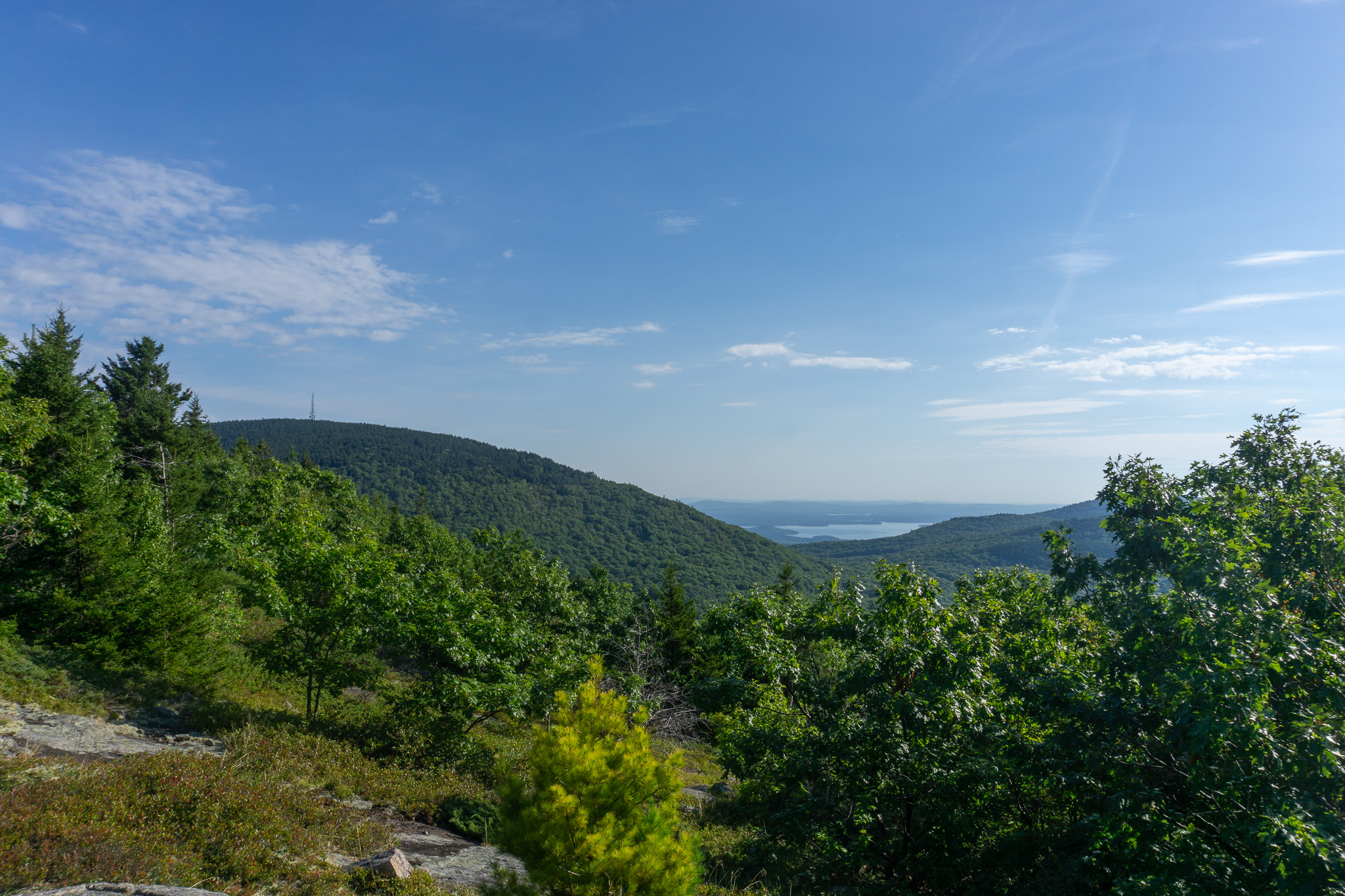
Without a doubt, Mount Major is the most popular peak in the range, thanks in part to its easy access from Route 11 (aptly named the Mount Major Highway). Its popularity is not solely due to its convenience, though—Mount Major’s rocky summit delivers grand, 360-degree views of Lake Winnipesaukee, Alton Bay, and the rest of the Belknap Range.
Hikers can select one of three main trails to the summit: the Blue Trail, the Brook Trail (yellow), or the Boulder Loop Trail. The Blue Trail is the quickest way up and, due to its directness, has several sections that are steeper, which require careful foot placement and the occasional use of your hands to scurry up. Toward the top, much of the bedrock is exposed and the trees begin to thin—so the views are not solely reserved for the summit.
On top of Mount Major, you’ll find a four-sided stone wall that offers protection from the wind and weather. The north-facing side of the summit offers plenty of rocky space with unimpeded views, making it an ideal location to comfortably enjoy trail snacks. The south-facing side delivers an exceptional perspective of Alton Bay.
If you like a challenge on the way up but prefer a more comfortable hike down, follow the yellow blazes of the Brook Trail down from the summit for a longer but more gradual descent. Taking the Blue Trail out and back will net you 3 miles while taking the more gradual way down, Blue Trail to Brook Trail, will result in 3.8 miles.
If you’re looking to find some peace and quiet on Mount Major, consider visiting it during off-peak hours or days. Visiting during the weekdays or during weekends (Friday, Saturday, Sunday) after 5 pm is a tried-and-true strategy for finding both a parking spot and some solitude.
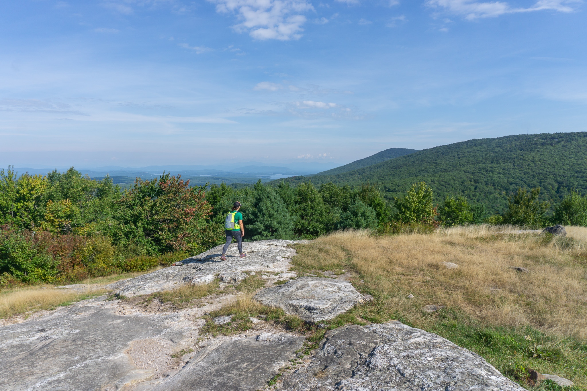
2. South Piper Mountain to Swett Mountain
In stark contrast to some other peaks in this range, the peaks of South Piper and Swett are quiet. The lot for their trailhead is rarely full and the summit of Swett is barely even marked. However, the relative unpopularity of these peaks says nothing about their quality.
Access the peaks via a steady ascent up the Whiteface Mountain Trail and then the Piper-Whiteface Link Trail, which together weave past trickling streams, up granite slides, and past many wild blueberry bushes. Before even reaching the top of South Piper, you’re rewarded with views extending all the way up to the White Mountains. Those looking to extend their adventure, add an extra 1.5 miles (round trip), and bag another peak can easily add a detour to Mount Whiteface to their itinerary by turning right at the junction and continuing to follow the Whiteface Mountain Trail up to its summit.
The Piper-Whiteface Link Trail delivers you onto a ridge where the sign states that you may go left to Piper or return back to Whiteface. What it doesn’t tell you is that going right leads you to Swett Mountain. To tag the top of Swett, turn right and follow Vista Trail’s faded yellow/orange blazes and cairns until you arrive at the unmistakable panoramic summit views. This peak has many blueberry bushes which are prime for picking in July and August. Its solitude also makes it the perfect spot for scouting wildlife like birds and porcupines.
If you can peel yourself away from the vista, head back in the same direction you traveled, and move on past the sign in the direction of Piper and eventually to Piper’s southern peak. This peak has a fraction of the views of Swett, but the beauty is in the ridge. Continue on the mountain highway to Piper’s northern summit where you’ll wind past sturdy pines, vernal pools, and a cairn shaped like a throne. Piper Mountain (North) is also one of the 12 named peaks and is needed to earn a Belknap Range Hiker Patch. Bagging Piper Mountain (North), South Piper, and Swett will result in a roughly 4-mile hike.
If the drive home doesn’t take you past Gilford Village, then it’s worth making a detour. It’s a quaint and quintessential New England town square where, if you’ve worked up an appetite, you can stop in at the Village Country Store for a bite to eat and some local brews.

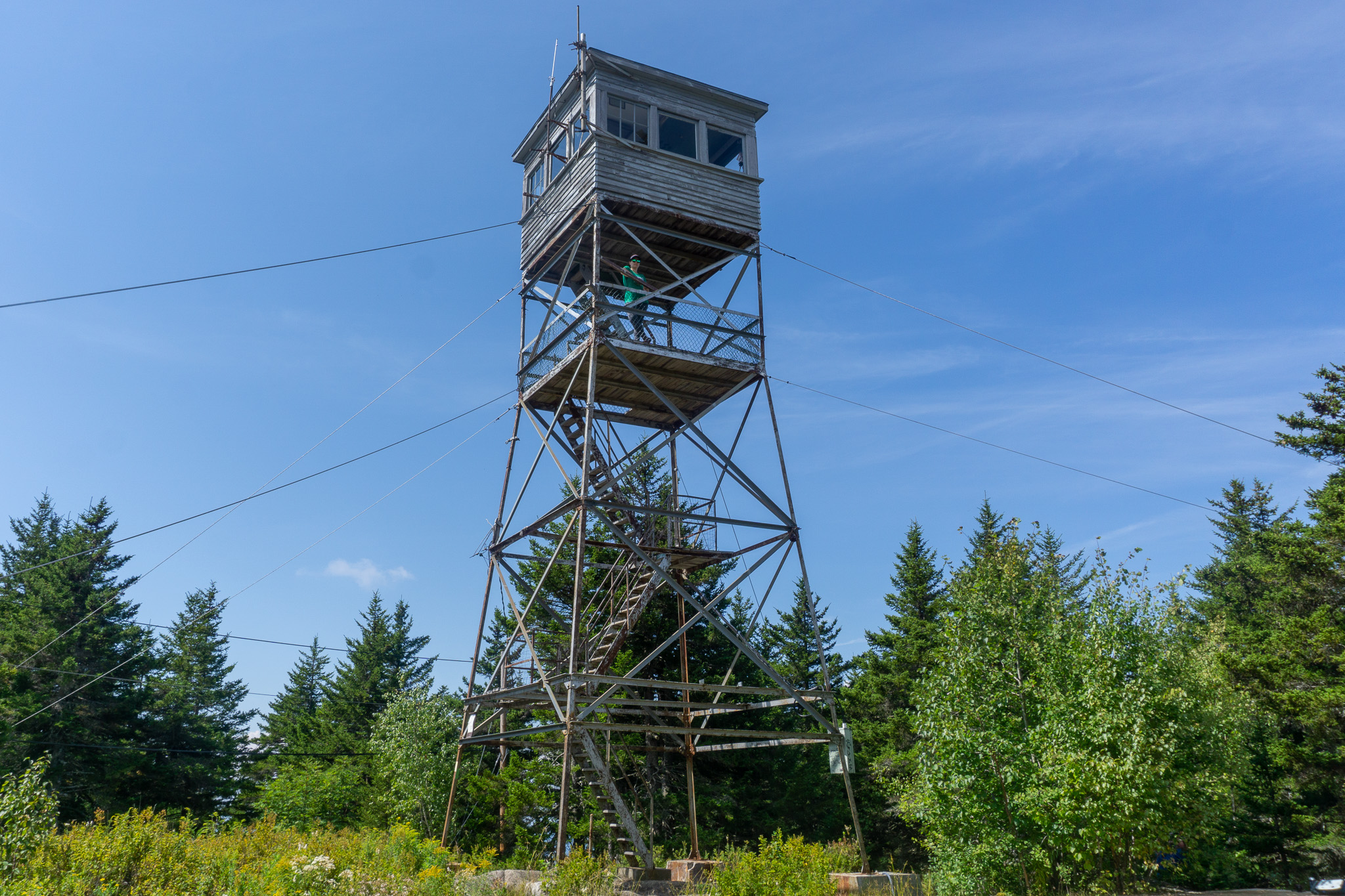
3. Gunstock Mountain
Most notably visited for its ski trails, Gunstock Mountain also makes for a great hike. The main hiking trail is off Carriage Road in Gilford at a junction where several other peaks in the Belknaps are accessed. For this reason, the small dirt lot and available spaces on the road fill up fast. If you plan to end your hike before 6 pm, you can try your luck and continue past the gate to an additional, lesser-known dirt lot with five to eight spaces.
The Gunstock Mountain Trail (orange) is a great option for those looking to hike just Gunstock. This 1.8-mile out-and-back hike nets nearly 1,200 feet in elevation over the course of a trip. It also intersects with a bunch of different-colored blazed trails. Take care to read signs as you pass them to ensure that you remain on the mountain and don’t veer off to neighboring Rowe or Belknap peaks—unless that is your intention.
At the sign that indicates a left turn to the Winter Shortcut trail, it’s suggested that you stay right. This will take you to a wonderful lookout, while the Winter Shortcut remains under tree cover until it meets back up again with the trail. There’s one additional lookout before you reach the summit which is occupied by a picnic table. It’s a popular spot to take a rest, so if you’ve set your sights on a picnic, plan on visiting during off hours.
The summit of Gunstock is just a short hike from the second lookout. Outside of ski season, you’re able to explore the summit, watch the near-empty chair lift make its rounds, and sit on the porch of the ski patrol building for a rest. From the top, there are great views of Lake Winnipesaukee and the Ossipee Mountain Range, which lies on the northeastern side of the lake.
4. Round Pond to Mount Klem
Referred to as the jewel of the Belknap Range, Round Pond is a unique destination. It’s not often you find a body of water untouched and undeveloped in New Hampshire—there are no cabins or docks on the large pond and the only houses found here belong to the beavers. The main trail entrance to this beautiful body of water is found off Bickford Road in Gilford. It’s an unpaved road leading to a dirt lot where the few spots are well-marked to maximize the number of vehicles it can fit.
Begin the hike to Round Pond and Mount Klem by following the red blazes of the East Gilford Trail and bear left at the wooden bridge to continue on to the Gilford Fire Road. This leads to an open field where patches of trees have recently been forested. Here you’ll encounter a junction to many other trails in the area, keep left to continue following red markers up the fittingly named Round Pond Trail to the pond. If done on a damp or rainy day in the summer, the entire trail is teeming with Eastern Newts. No bigger than a pinky finger, their bright orange bodies will catch your eye if you keep your gaze down. Watch your step!
Once you reach the pond, you’ll continue on in a clockwise direction to meet up with the ascent trail to Mount Klem. This trail, even more so than others in the area, highlights the quintessential Lakes Region’s biota. Between the newts, the crazy-looking mushrooms that grow here in the summer, the moss beds, and the ferns, it feels markedly different from hikes in other regions, even within the state. While Klem has a wooded summit, on clear days you’re afforded views on the hike up.
From Mount Klem, you can continue on to other summits—both Mount Mack and Mount Rand are in close proximity—or double back on the same trail to complete your hike. Round trip, the out-and-back to Mount Klem via Round Pond is six miles.
5. Mount Rowe
If you’re looking to avoid crowds and guarantee yourself a parking space, then Mount Rowe is for you. The Mount Rowe Trail offers a steady grade and its elevation gain is nicely spread across its two-mile ascent—this a perfect hike if you’re looking to bring the family.
When you first hit the trail, take a raised boardwalk across a grassy wetland to a short, steep ascent. Don’t let the cruel start deter you; the steepest part of the trail is found in the first 20 yards or so, then it’s a smooth ride to the top, passing some falling waters that make a pool excellent for four-legged friends to cool off in.
The Mount Rowe Trail forks off in a couple of places to Mount Gunstock, so take care to read the signs and ensure you stay on your desired path—following the blue blazes. During the summer months, the top of Rowe is an excellent option for foraging blueberries. It’s also a fantastic spot for harvesting views of Gunstock’s ski trails, the valley below, and little slivers of the surrounding lakes.
If you want to extend your hike, you can take any of the connectors to Gunstock. There is also a 0.5-mile wildlife loop at the bottom before you reach the boardwalk, which brings you past several streams and through the local school system’s cross-country trails.
Before leaving town, if you’re looking to refuel, Sawyer’s is an excellent stop for a good Lobster Roll or a homemade ice cream cone.
Have You Visited the Belknap Range?
Do you have a favorite hike in the Belknap Range? If so, tell us about it in the comments below!
Related Posts


