


Hike up Vermont’s tallest peak, scramble along an alpine ridge, and bask in 360-degree views, all on an ascent of Mount Mansfield via a section of the Long Trail, the U.S.’s oldest long-distance hiking trail.
The Green Mountain State delivers on this must-do hike up one of the state’s five 4,000-footers. A roughly five-mile out-and-back trip along Vermont’s most-famous footpath, the Long Trail, gains 3,000 feet in elevation on the way to the state’s highest peak. The journey begins by wandering through an idyllic hardwood forest, and eventually earns an extraordinary alpine ridge that delivers you to a rocky New England summit—one of only three places in the state to find alpine tundra. As you take in the views of Lake Champlain, mountain ranges in three states (the Greens, the Whites, and the Adirondacks), and, to the north, Canada, you’ll quickly discover what the Von Trapps meant when they sang, “The hills are alive…”
Quick Facts
Distance: 5 miles, out-and-back
Time to Complete: Half day
Difficulty: ★★
Scenery: ★★★★
Fees/Permits: None
Contact: https://bit.ly/2GxSR87
Turn-By-Turn
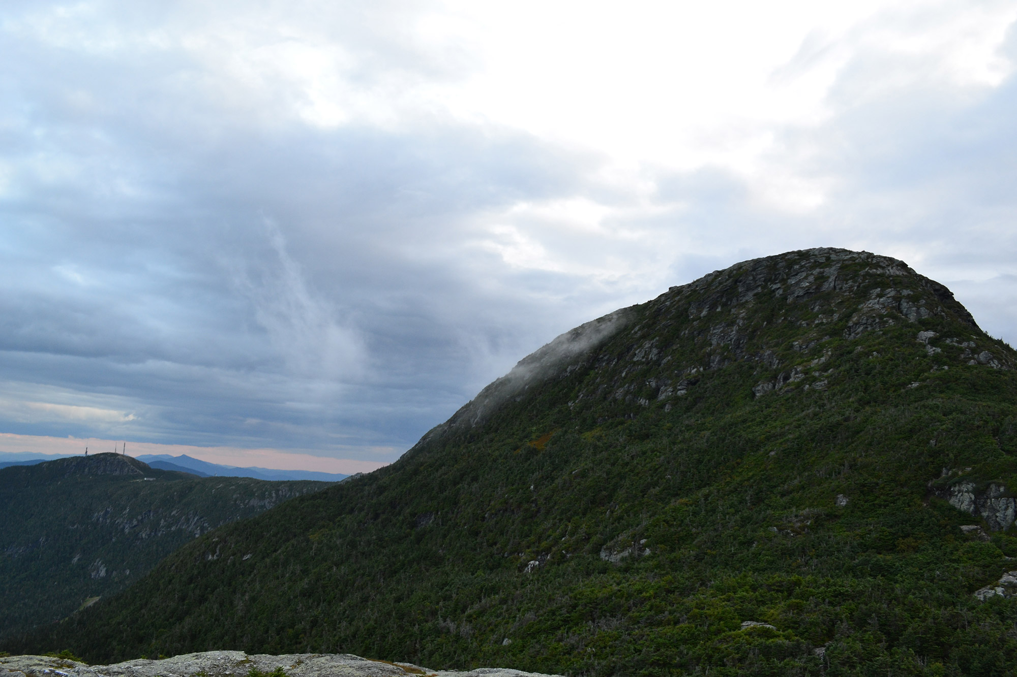
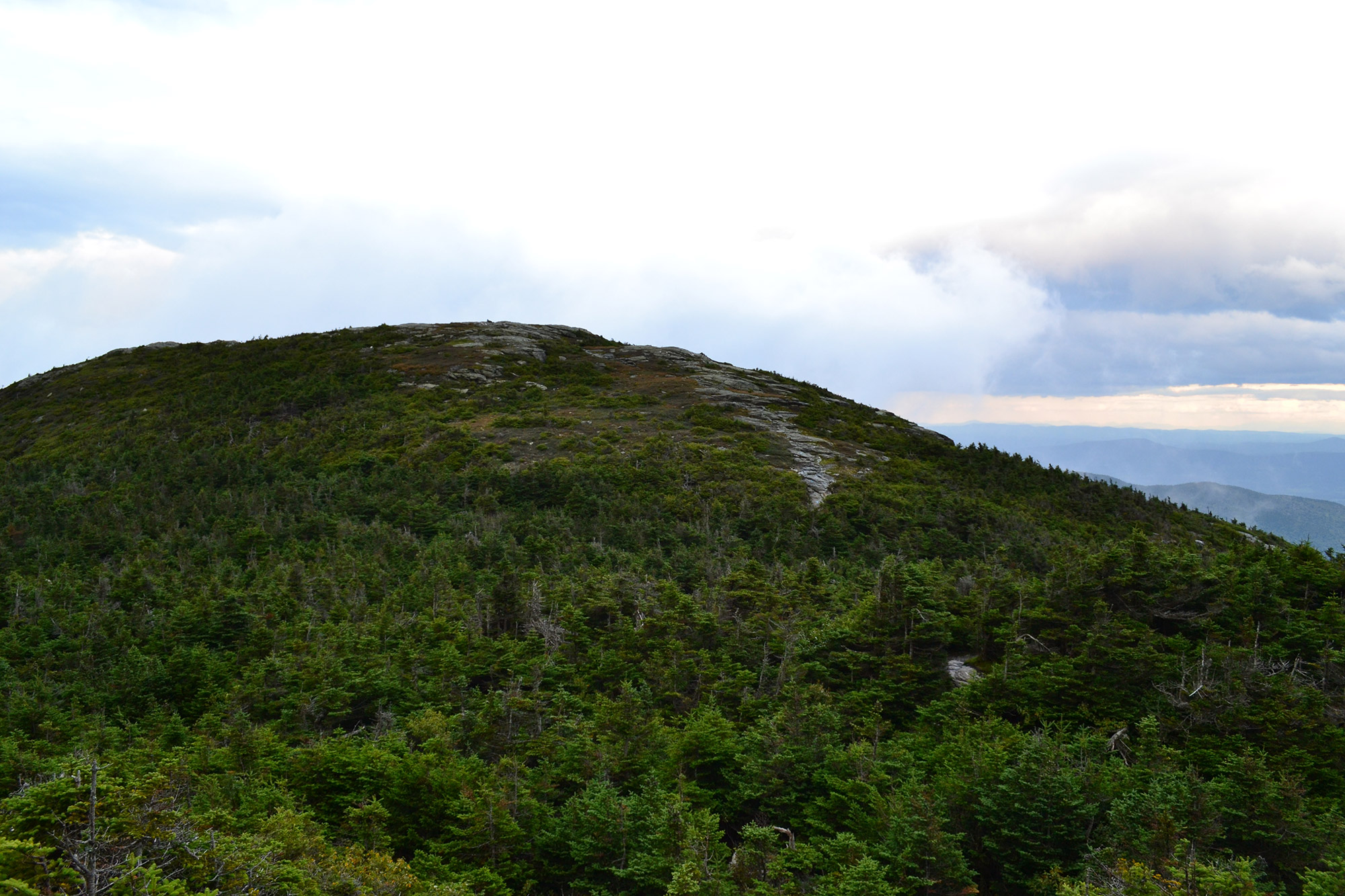
When viewed at a distance, Mansfield’s elongated ridgeline resembles a human head, with the various high points named for facial features: the Forehead, Nose, Chin, and Adam’s Apple. The most straightforward way to get to the true summit, the Chin, follows the Long Trail South’s white rectangular blazes beginning on Mountain Road (Route 108).
If you’re coming from Stowe, there’s a small parking lot on the left side of Route 108, just after Stowe Mountain Resort. Since the lot is small and easy to miss, pay close attention after the resort. If you begin driving uphill on Route 108 into Smugglers’ Notch, turn around; you’ve gone too far.
Once you’ve geared up, briefly follow the Long Trail South as it parallels the right side of Route 108. After about 0.25 miles, the Long Trail makes a sharp left, soon thereafter crossing Route 108. The trail continues on the opposite side of Route 108 at a break in the trees (44.537126, -72.790910) about 50 yards down the road. Look for an information board and trail marker a short way into the woods.
The Initial Climb
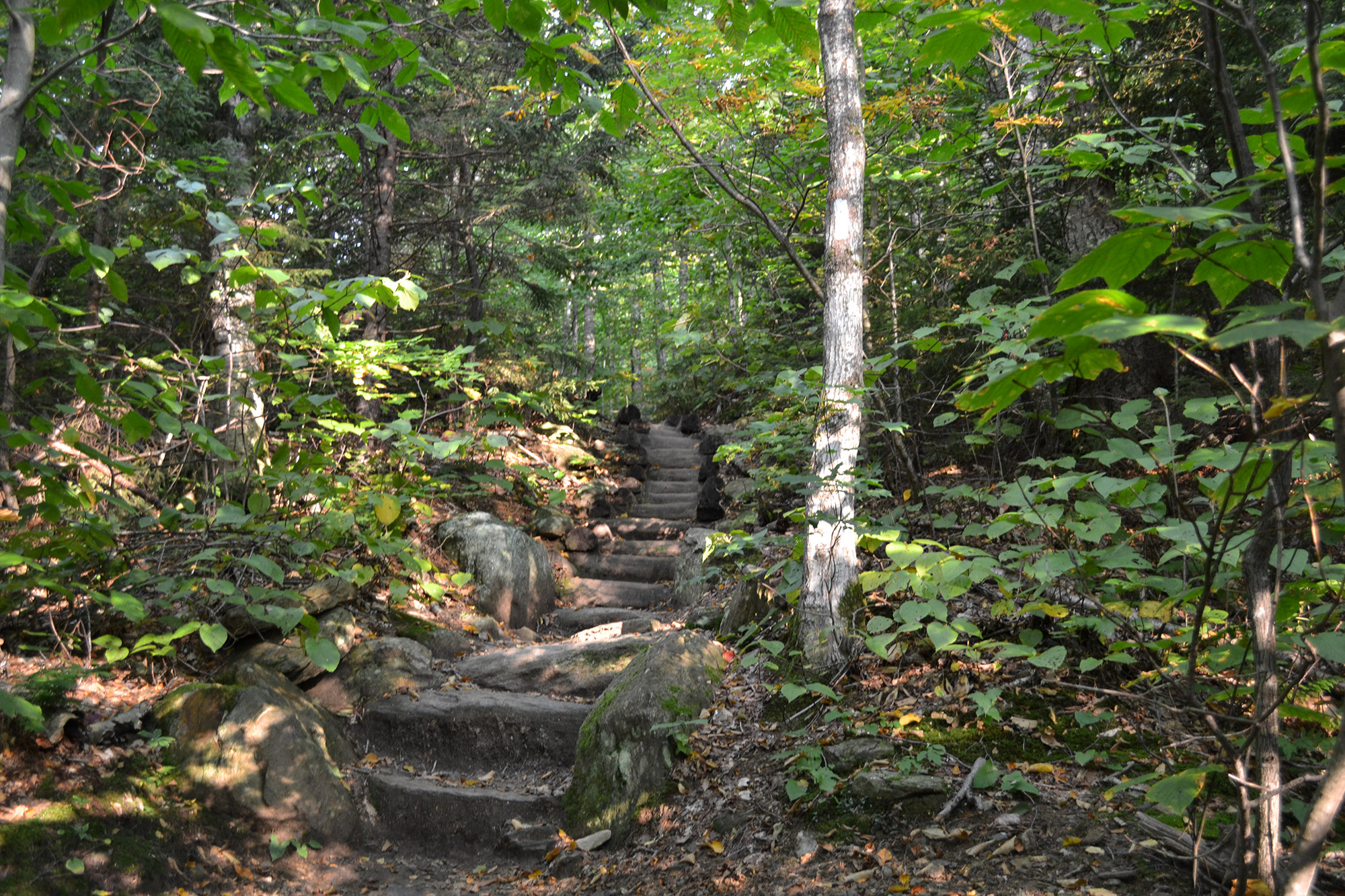
The hike continues on relatively smooth trail through a hardwood forest. It is well marked and easy to follow. It also starts climbing almost immediately, which is no surprise, considering the trail gains 3,000 feet in a little over two miles and occasionally crosses some small streams.
Around the one-mile mark, the trail becomes rockier, climbing up short, slabby sections. The footing here is not quite as good, but nothing out of the ordinary for anybody who’s climbed some of the Northeast’s 4,000-footers. Trekking poles are helpful.
The Taft Lodge
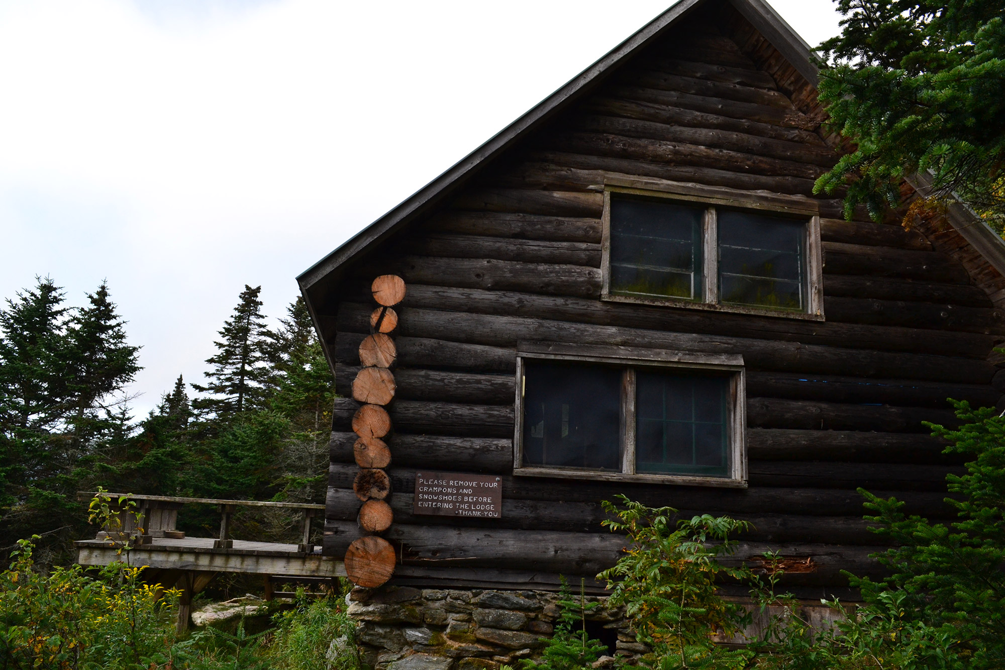
Just past the 1.5-mile mark is the Taft Lodge (44.542551, -72809568), the oldest hut on Vermont’s Long Trail. For a moderate fee, hikers can stay here overnight either on the way to the summit or as part of a longer outing. The lodge, built in the 1920s and recently renovated, sleeps up to 24 and has outhouses and a water source nearby.
Whether you’re day-hiking or backpacking, Taft Lodge is on Vermont’s Register of Historic Places and worth visiting, even if only to have a snack. And, because the lodge is near treeline, it’s also a great place to assess whether you’ll need to add a layer (or two).
The Ridgeline Push
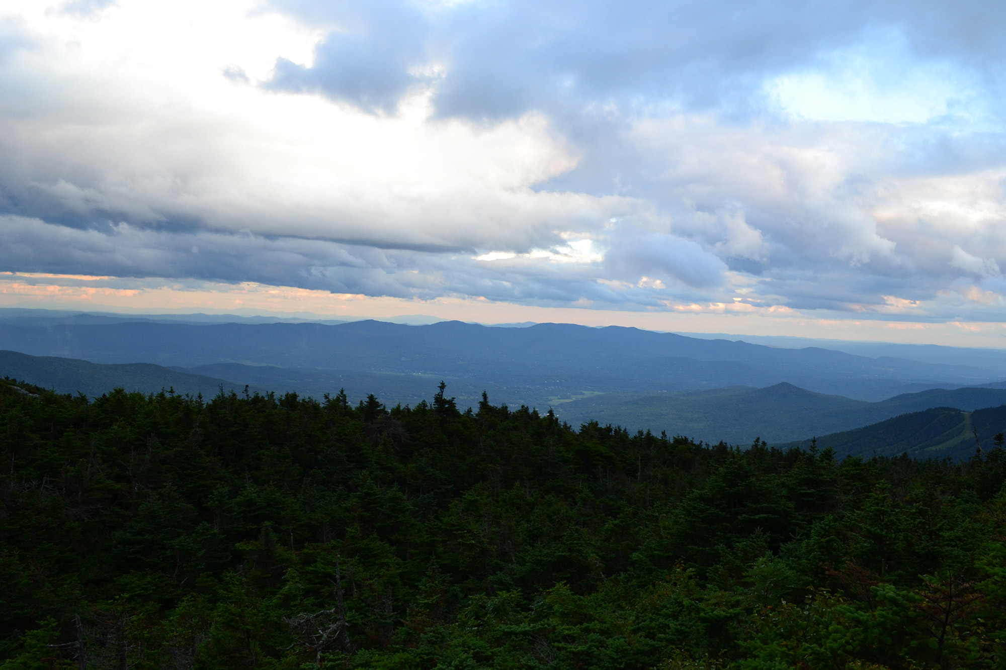
From Taft Lodge, stay on the Long Trail South and continue climbing toward the ridgeline. The trail above the lodge remains rocky, offering hikers regular glimpses of Mansfield’s ridgeline through the thinning tree cover. There are also a few spots to turn around and look south, with Stowe in the foreground and the Green Mountains in the distance. If you’re out of breath due to the elevation gain, spend a few moments trying to spot the unmistakable double-bumped alpine ridgeline of Camel’s Hump, another of Vermont’s classic alpine summits.
In one-third of a mile, the Long Trail South reaches the col between the Chin (the true summit) and the Adam’s Apple. Here, the Hell Brook Trail and the Adam’s Apple Trail join the Long Trail. Since the junction (44.545639, -72.811772) is moderately sheltered, it’s a great spot to add an extra layer before popping further above treeline.
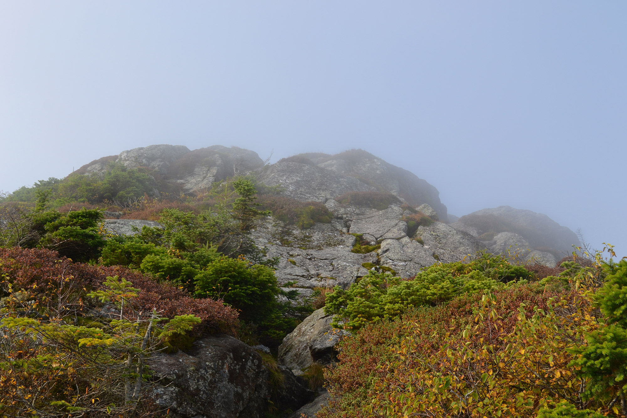
The Ridgeline
From the junction, the Long Trail South makes a sharp left, climbing the ridge toward Mansfield’s proper summit, the Chin. This section is open and exposed to the elements. If wind is coming from the west, this will be the first time you feel it.
Near the top of the summit cone, there are a few short-but-exposed sections that require scrambling and careful footwork. As you ascend, try to memorize the hand and foot holds for the descent.
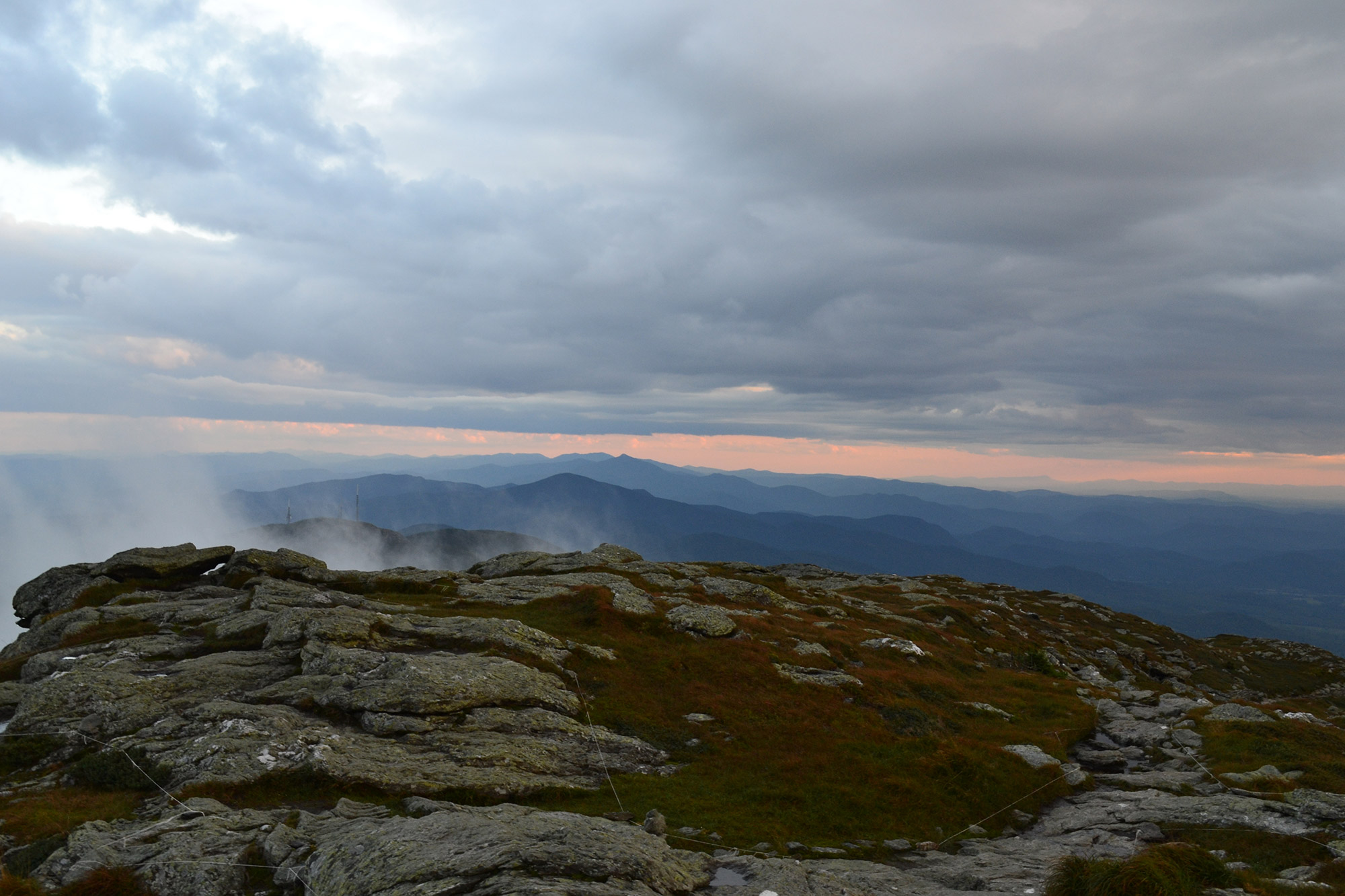
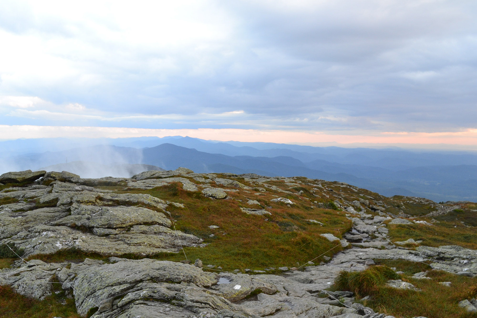
The Summit
Mansfield’s summit is a large, flat alpine area that offers plenty of room to spread out. So, find a rock, sit back, and enjoy the broad, open summit (44.5430453, -72.815436) and incredible 360-degree views. Looking west, hikers can see Burlington and Lake Champlain, with New York’s Adirondacks in the distance. To the north is Canada! In the distance to the east are New Hampshire’s White Mountains. Finally, the Green Mountains spill out to the south.
Mount Mansfield is home to 200 acres of alpine tundra, and is one of only three places in the state of Vermont where it is found (Camel’s Hump and Mount Abraham being the other two). In addition to its rarity, alpine tundra is also very fragile and susceptible to human impact. Because of this, please stay on the rocks and in the designated paths when traveling above treeline.
Whenever you can pull yourself away from the summit, just retrace your steps to your car, first by taking the Long Trail North to the clearing. Use particular caution on the exposed portions of the ridge, as they can be harder during the descent. Once you’re back at the junction, continue on the Long Trail to Route 108.
Bonus Points
Hikers not ready to return to their car can make a short (five- to 10-minute) detour from the col to the Adam’s Apple (44.546573, -72.810353). The Adam’s Apple Trail offers great views of the Chin and Mansfield’s other features and is usually much less crowded than the Chin. Since it is also slightly less exposed to the weather, it’s a worthwhile objective if conditions put the true summit out of reach.
A longer detour—and one that requires pre-trip car shuttling or a short road march at the end— is to continue on the Long Trail South from the Chin, crossing all of Mansfield’s features. Over 1.5 miles of ridgeline hiking, you’ll pass the Lower Lip, the Upper Lip, the Mount Mansfield Peak Visitor Center, the parking lot for the Mount Mansfield Toll Road, and, finally, the Nose. From the Nose, hikers can head back to the Visitor Center, and then descend a short way on the Toll Road to link up with Haselton Trail, which ends at the base area of Stowe Mountain Resort. Alternately, arrange to have somebody pick you up at the top of the Toll Road.
Pro Tip: If you do decide to hike the full ridgeline and the weather turns, the Cliff Trail is an early option for bailing out. Connecting with the Long Trail just before the Lower Lip, it descends to Stowe’s Cliff House, near the top of Stowe’s Gondola SkyRide. From there, hikers can follow a marked access road or ski trails to the base area.
The Kit
- Traction is at a premium on the exposed sections of Mansfield’s ridgeline. The Asolo Fugitive (Men’s) and Revert (Women’s) are longtime favorites.
- Lightweight and packable, a windshirt is ideal for any trip above treeline. The Outdoor Research Ferrosi Hooded Jacket (Men’s/Women’s) is perfect for handling the ridgeline’s variable conditions, and much like Vermont’s craft brews, it has developed a cult-like following over the years.
- A puffy coat is great for cool mornings and cold summits, and is handy to have in case of an emergency. The EMS Alpine Ascender Stretch is a great winter midlayer that’s breathable enough to be worth stuffing in your pack for cool spring and summer days.
- One minute it’s sunny, and the next, you’re stuck in a downpour. Green Mountain weather can change in a heartbeat, so be ready with the EMS Thunderhead, a reliable and affordable way to ensure you stay dry on your summit bid.
- In the spirit of the state of Vermont, consider a pair of locally sourced socks from Darn Tough, made in nearby Northfield. Living up to their name, these socks come with a lifetime guarantee.
Keys to the Trip
- Depending on the season, you might encounter a Green Mountain Club caretaker at the Taft Lodge. They’re all super nice and great resources for trail information.
- Vermont takes sustainability seriously when it comes to its trails, so get out before the snow melts, or wait until Memorial Day weekend to climb this ultra-classic mountain.
- Celebrate a successful summit day at Doc Ponds in Stowe. The bar is packed with Vermont’s best beers (Hill Farmstead, Lawson’s Finest, and Foley Brothers, just to name a few), and the homemade onion dip with housemade BBQ chips is not to be missed.
- Vermont’s repuation for great beer is well deserved. Since you’re so close, Alchemist Beer’s brewery in Stowe is a must-visit. And, don’t forget to bring your cooler, in case you decide to pick up some souvenirs to bring home!
- If you’re spending the weekend exploring Vermont, make sure to check out our guides to Exploring Burlington Like a Local and hiking Camel’s Hump.
- If you’re looking for a great place to camp, the Smugglers’ Notch State Park is just a few minutes away from Stowe Mountain Resort. Sites book well in advance for popular weekends, so make your reservations early.
Current Conditions
Have you hiked Mount Mansfield recently? Post your experience and the trail conditions (with the date of your hike) in the comments for others!
Related Posts


[…] goEast pieces on hiking Vermont’s 4,000 footers, I ended up hiking four of the five peaks (Mansfield, Camel’s Hump, Ellen, and Abraham) in a 24 hour period. Having done four so casually, it was […]
[…] of views, especially west toward Vermont’s Green Mountains—try to pick out Camel’s Hump and Mount Mansfield on the western horizon. It’s common for Carriage Road hikers to return the way the came, enjoying […]