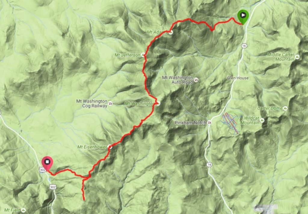
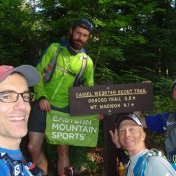
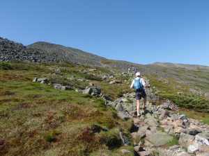
At 7:00 a.m. on Saturday, we hit the trail, taking the Daniel Webster Scout Trail from Dolly Copp Campground right up to the summit of Mount Madison. I had taken this route last year and found it punishing, but the boys thought it’d be fun to do together. After all, what could be better right after breakfast than 4,000 feet of climbing in four miles?
However, none of us anticipated a bizarre rush to the hospital after the run.
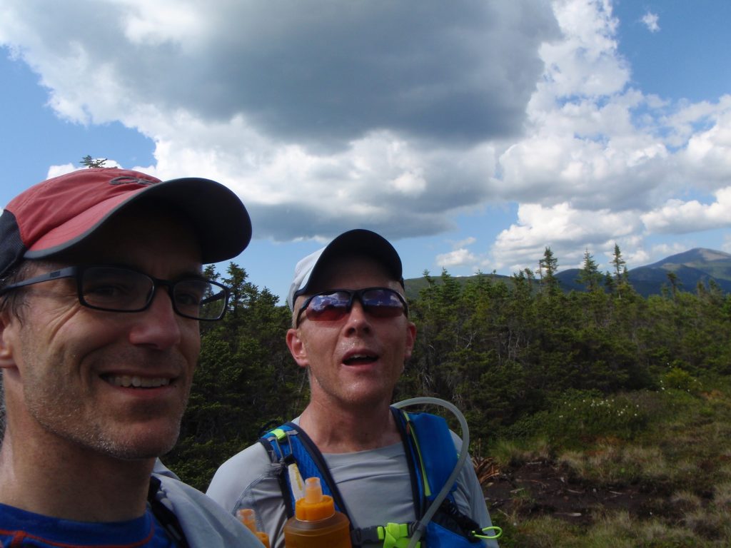
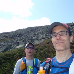
“The boys” are a mix of old and new acquaintances, united by a love of running through the mountains. I’ve known Mark for 20 years. Our adventures on snow, rock, dirt, and sea have taken us through challenging terrain and circumstances, and I trust him with my life. Nat is his running buddy, with whom I’ve run a couple of grueling trail races. Sean is the new guy, a strong runner from my office who has a few 100-mile races under his belt and an endless supply of energy for going uphill.
Friday night, we have dinner together and camp at the campground after staging a car at the other end of Saturday’s route. Everyone gets along well, telling predictable, dude-centric jokes and farting, and detailing to the nth degree our brilliant insights about long-distance running, such as how mood-altering and amazing a Honey Stinger waffle can taste after 40 miles. We are excited for the trip.
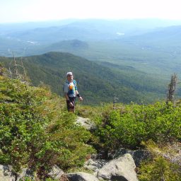
On our way up Madison, everyone dials in their pace. Of course, we start out fast, and then reel it in as the pitch increases. By the time we hit tree line, we are giddy with joy for having a bluebird, 70- to 75-degree day with light winds and partial afternoon clouds for our Presidential Traverse across the White Mountains’ 23-mile spine. It’s so rarely clear up here that we know we are very lucky.
This is the first time I’ve been in the mountains with Sean, and it’s much like our runs at home: He drags me along, until he stops out of sympathy, so I can catch my breath. Except up here, it’s obvious he’s so completely in his element that our fitness differences are magnified. I am pretty sure that inside his trail shoes are a pair of cloven hooves. The man just keeps going up, getting further and further away as his smile gets broader.
I mention to Mark that I feel grateful to be able to propel myself through such a challenging landscape, because, for many folks, an adventure like ours is the pinnacle experience of a lifetime, and we’ve managed to pull off something like it a couple times a year. I’m 46, and my oldest brother died of diabetes and heart failure at age 47, so I do not take for granted being healthy or having friends with whom I can share this run.
I love how the focus required to perform a challenging activity in a tricky landscape removes the distractions of daily life. For me, that focus creates opportunities to dig deep and rely on one another in an intimate way that surpasses most other interactions.
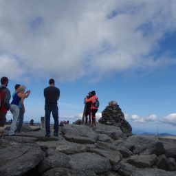
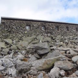
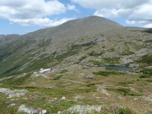
On top of Madison, we chat with some hikers, take our obligatory photos, and then keep rolling. We refill our hydration vests and bottles in the Appalachian Mountain Club’s Madison Spring Hut, where a combination of resting, sweaty morning hikers and showering hut dwellers has created a steamy funk that blankets the windows of the common area and then starts clinging to my glasses. It’s weird to be in such a beautiful spot on the mountain yet not see out.
One of the AMC staff straps on a pack board to hike trash down the hill. I can’t tell if she’s quiet out of sullenness for the chore, or disdain for us tourists. Regardless, we thank the crew for maintaining the hut. We would not be able to move so quickly through our run if we had to refill from natural sources.
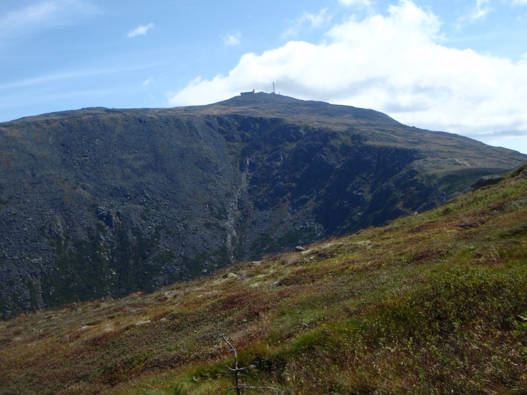
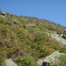
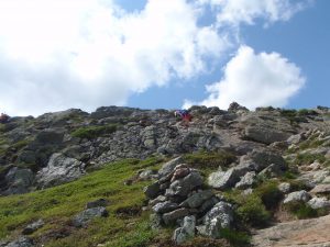
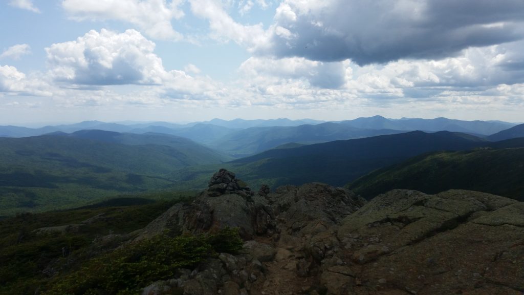
We go onward and upward. The climb out of Madison Hut to Adams’ summit is quintessential Northern Presidentials: above tree line, strewn with boulders, and along the lip of the enormous chasm that is the Great Gulf.
We encounter a couple out with their 10- or 12-year-old son. The dads among us smile tenderly, hoping to someday share this landscape with our kids. At the summit, we run into a couple of women who seem to be moving fast on a mission. Turns out, one is Sean’s friend who joined him on this same traverse last March in the snow for a grueling cold and windy day—small world. We chitchat, and then keep moving.
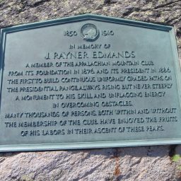
We travel down to Edmands Col, where a plaque commemorates the man who laid many of the trails up here, which allow us to do this run.
The best part of this hollow spot is a little shade, which is welcome amidst the heat of this gorgeous day. The worst part is, it’s at the base of the seemingly endless grind up Mt. Jefferson’s convex northeastern flank.
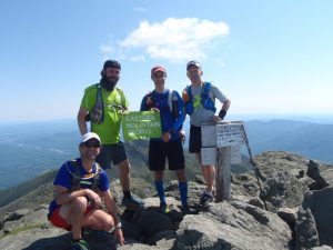
Sean leads the way at his youthful mountain goat pace, and we think that, for the first time, he will manage to stay on the trail up this thing. Apparently, he’s bee-lined it over the talus every other time, with each trip becoming a new approach. Atop Jefferson, we find a crowd, courtesy of the rare bluebird conditions. There’s even a bearded and bandanna-clad dude in the center of the crowd, seemingly all alone with his cannabis spliff.
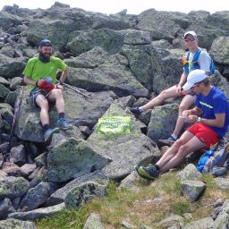
The four of us park ourselves below the summit for a snack and water. Mark had made some sweet potato and coconut rice bars for the crew, while I had made some basil, bacon, and egg spaghetti birds’ nests. Sean and Nat threw in some cookies and sweet snacks. We laugh, excited we’re nearly halfway done and grateful for the weather and the ability to experience such a beautiful landscape. Nat and Sean pitched in with cookies and energy bars.
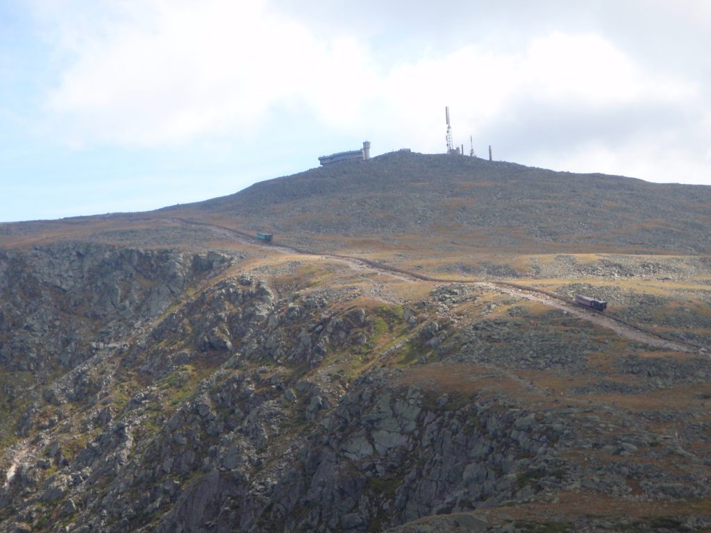
From Jefferson, we head south to cross Mt. Clay and ascend the rock pile atop which sits the Mount Washington Observatory and the tops of the Auto Road and Cog Railway. With that much access, this is the most congested leg. So, we put our heads down and grind it out, cresting Clay, dropping into Sphinx Col, traversing to parallel the Cog Railway’s tracks, and climbing to the summit.
We nod to the masses at the summit stake, not wanting to get hung up in chitchat:
“Did you hike all the way up here?”
“Um, yes.”
“You’re running? Isn’t that hard?”
“Um, yes.”

As it turns out, the Sea to Summit 2 triathlon is today, and we get the chance to cheer a couple of finishers as they complete their route, which includes a 1.5-mile swim in South Berwick, Maine, a 95-mile bike ride to Pinkham Notch, and a five-mile hike to the 6,280-foot summit of New England – and we thought we were tough!
I follow Sean down the stony Crawford Path, which makes for a technical but highly runnable leg to the Lakes of the Clouds Hut. I sense him opening his stride and pushing the pace, so I follow suit, fully engaging mentally and physically in the task of hurtling myself down this thing with as much efficiency and grace as possible. The many hikers can hear me coming and scoot out of the way, some with questioning looks on their faces.
We find ourselves at the hut’s door 16.5 minutes after leaving Mt. Washington’s summit, with enormous smiles on our faces. Running at speed up here, where the winter jet stream meets the hills, feels like flying. The snapshots in my mind of particular rocks dodged, grasses hopped, and hoots of joy at almost catching up to Sean will serve as fuel and inspiration during the relative doldrums of my office life.
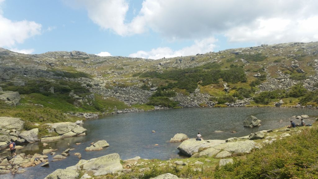
At Lakes, we’ve covered half our route, 11.6 miles, in about six hours. We refill our hydration vests and bottles, stretch for a minute, use the restrooms, and check in with each other, making sure we’re not asking too much of ourselves. I mention a slight headache that I believe is associated with mild dehydration, and while consuming a half-liter of water, I take two ibuprofen, as well. The rest of the crew is also getting a bit fatigued, but we agree to check in again at Mizpah Spring Hut. There, we will reassess and determine whether to carry on south to Mt. Jackson and back, to complete what we think is the full traverse, or head straight down Crawford Path from the hut.
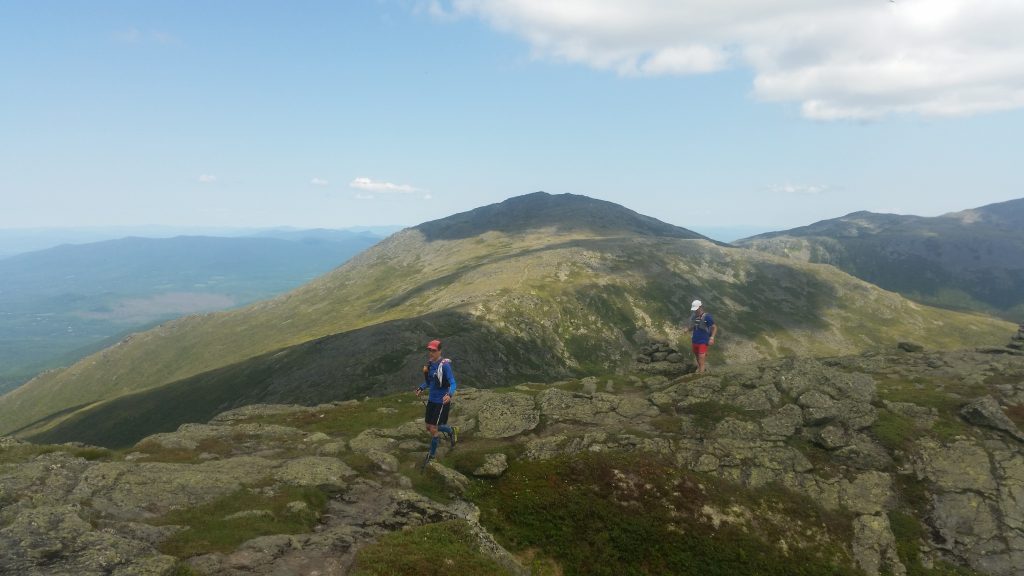
From Lakes Hut, the route traverses the Southern Presidentials, featuring peaks with a character very different from their taller Northern siblings. The views reach out across the ranges from New Hampshire into Vermont and Maine, without being dominated by the massive bulk of the Northern Presidentials. Being a little lower in elevation, they are also less alpine, allowing for more grasses, mosses, shrubs, and even trees. They feel less brutal, but among them lie some difficult sections made harder by the distance we’ve covered and the energy we’ve spent.
After we sat still for a few minutes in the hut, the climb up Monroe feels like an elevator shaft. But, it re-loosens us, and we roll over to Mt. Franklin and Mt. Eisenhower, proudly making sure to take the route over, instead of around, the peaks. After a 600-foot descent down Eisenhower, we scoot up and over Mount Pierce to drop below 4,000 feet for the first time in about seven hours; there, we enter Mizpah Hut for water refills and a quick break.
Mizpah feels almost civilized. I chat with a couple staying at the hut with their young son, whom they are teaching to play cribbage. I’m jealous, as it’s my favorite game and one my father taught me.
On the ledge outside, we munch cookies and sip water, as a hut crew member plays a little jazz on a simple bugle. It’s a random musical memory that will last long, reminding me of a morning surfing in my sea kayak in York, Maine, as a bagpiper played while standing in the sea. Mark, an ex-middle school music teacher, identifies the jazz composer and chats with the bugler.
As a group, we commit to the extra mileage that reaching Mt. Jackson requires, so we stand and move out. The route to Jackson goes over a knoll, through a wet area, and then up a seemingly long climb leading to some pretty ledges.
By this point, it feels like a grind. We all seem to kind of go quiet and stay within ourselves for the duration. I’m likely not the only one slightly under-hydrated and a bit sunbaked. After a slow snack on the summit, we spin around for the final legs to Mizpah and down to the car.
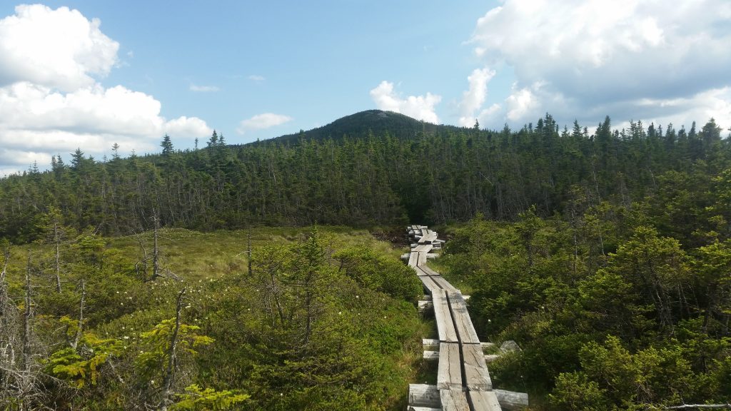
A few minutes down the trail, however, I notice my stomach feels queasy, and in crossing the wet area’s puncheons, my feet fall asleep. I’ve never had this sensation, and as it feels odd to have to keep my balance with trekking poles, I watch my feet to make sure they do not land off the planks.
I figure the cause is the compression calf sleeves I’m wearing for the first time on a long run, and sit to remove them. It feels great to take them off, and doing so seems to allow circulation to return and my feet to feel normal again.
But, my stomach remains off. Mark notices I’ve slowed way down and checks in with me. I tell him about my feet, and that it’s likely I will vomit. I haven’t had a sour stomach like this before, and he coaches me through just walking and sipping water so things can settle down. 10 minutes later, I amble off the side of the trail and empty my gut. It’s unpleasant but greatly relieves my stomach. Mark sticks with me, encouraging me to rehydrate, relating a story of how he came back from the depths of distress during his 88-mile Infinitus race in Vermont this spring by simply continuing at a gentle pace.
I feel pretty weak but keep walking, sipping occasionally, and try to keep up my half of the conversation. It’s been a long Saturday, and we have just three miles to go.
I wake up on Wednesday. I see I’m in a hospital, wonder why, and pass out.