

For many Northeast-based hikers, becoming a member of the AMC Four Thousand Footer Club (NH 48) or the Adirondack 46ers (ADK 46ers) represents the pinnacle of achievement. But, sneaking under the radar—and elevation—of these two illustrious groups is the Catskill 3500 Club.
Organized peakbagging came late to the Catskills. In 1962, the Catskill 3500 Club was formed to encourage hiking in the region—roughly a quarter-century after the 46ers of Troy Hiking Club and five years after the AMC Four Thousand Footer Club.
Members have summited the 35 Catskill peaks over 3,500 feet in elevation, plus Slide, Blackhead, Balsam, and Panther mountains again in winter. Although the majority of these fall shy of the 4,000-foot marker used as a baseline for the other ranges’ high peaks, two Catskill summits meet the cutoff, Slide Mountain and Hunter Mountain.
Slide Mountain
At 4,180 feet in elevation, Slide Mountain is the tallest of the Catskill high peaks. If it were in New Hampshire, it would tie with North Tripyramid for the 32nd-tallest mountain. In the Adirondacks, it would be the 30th-tallest—nestled in between Big Slide Mountain and Lower Wolf Jaw.
Although Slide is recognized as the Catskills’ tallest peak today, that was not always the case. Because high peaks surround it, Slide is difficult to see from afar, and throughout the mid- to late-1800s, few knew it existed. As well, hotel owners in the northern Catskills refused to acknowledge its prominence. Even after its height was confirmed, they were afraid it would hurt their business.
The Hike Up
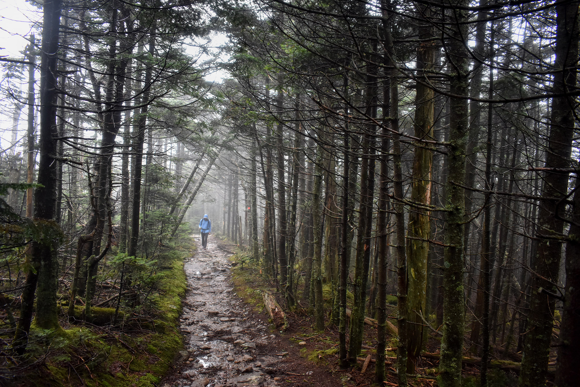
Those early hotel owners had a right to be concerned, however. Today, a trek to the summit is one of the Catskills’ most popular hikes. The most direct and favored route is via the Phoenicia-East Branch Trail and the Wittenberg-Cornell-Slide Trail. Leaving from a well-marked and obvious Phoenicia-East Branch Trailhead located off State Road 47, the hike reaches its crux just moments after leaving the parking lot. Here, you’ll encounter a stream crossing—especially challenging after rain or when the snow is melting.
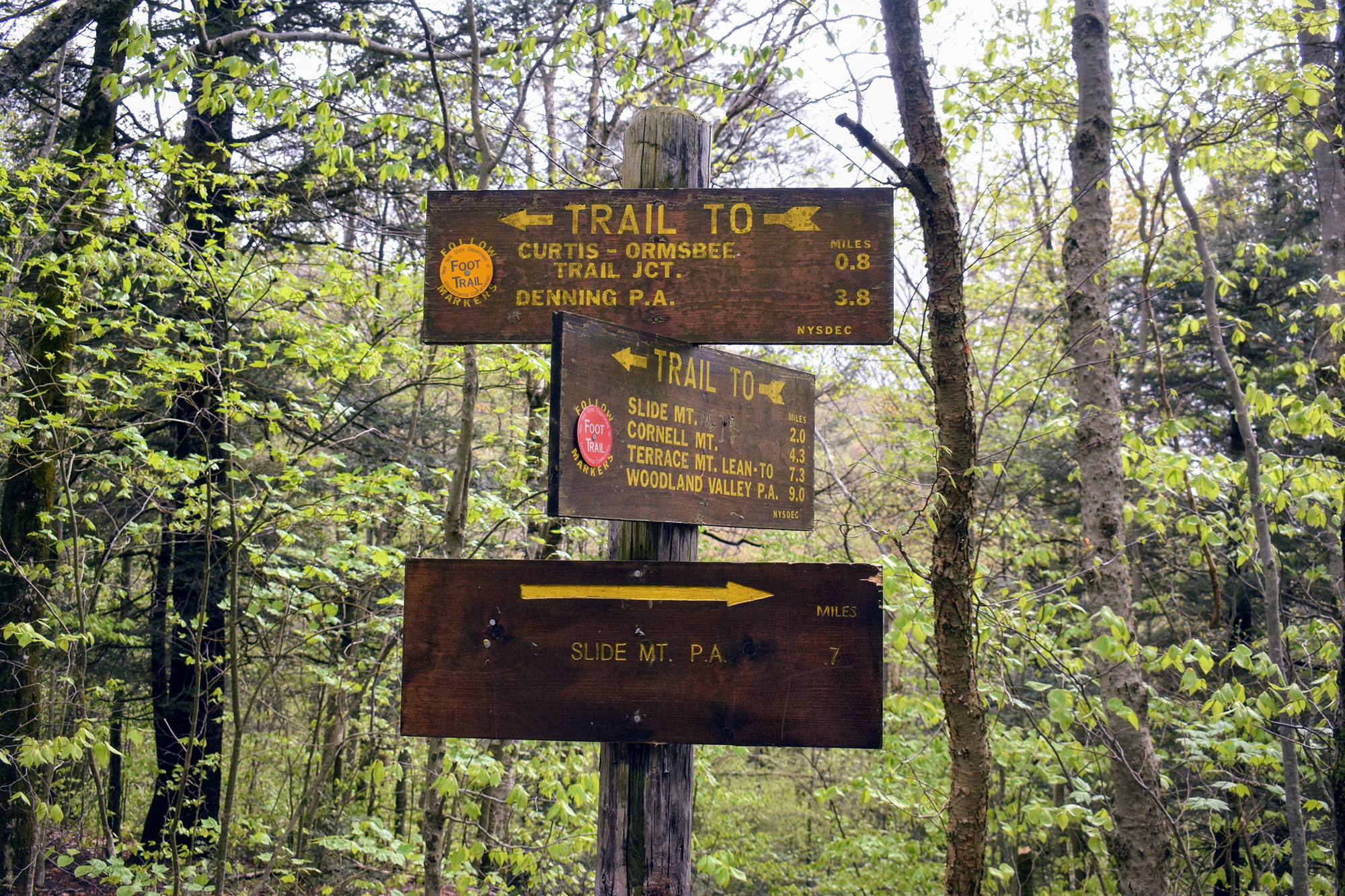
Fortunately, the difficulty eases after. The trail gently ascends the approximately 1,700 feet of elevation to the summit, first following the very moderate Phoenicia-East Branch Trail and then connecting with the Wittenberg-Cornell-Slide Trail at a well-marked junction. You’ll get great views from the Wittenberg-Cornell-Slide Trail as it approaches the summit, so make sure to stop and enjoy them. You’ll also pass a nice slabby overlook a few minutes past the summit. The summit itself, however, is wooded with no view to speak of.
On the summit, inquisitive hikers may locate a few concrete pads—remnants of an old fire tower. Also, a large rock that graces Slide’s summit features a plaque dedicated to the poet and naturalist John Burroughs. In fact, Slide Mountain lies within the Burroughs Range, named after the famed author.
Hunter Mountain
The most direct way up Hunter Mountain is to take the Becker Hollow Trail. Starting in a small parking lot off Route 214, the trail meanders on somewhat flat ground through a forest, before climbing steeply up. As you gain elevation, make sure to turn around and admire the mountains to the east. You’ll come across a few good spots for views and will have time to catch your breath. After about 1.8 miles, you’ll arrive at the junction for the Hunter Mountain Trail. Stick with the blue blazes of the Becker Hollow Trail, and you’ll gain the summit plateau in about another 0.2 miles.
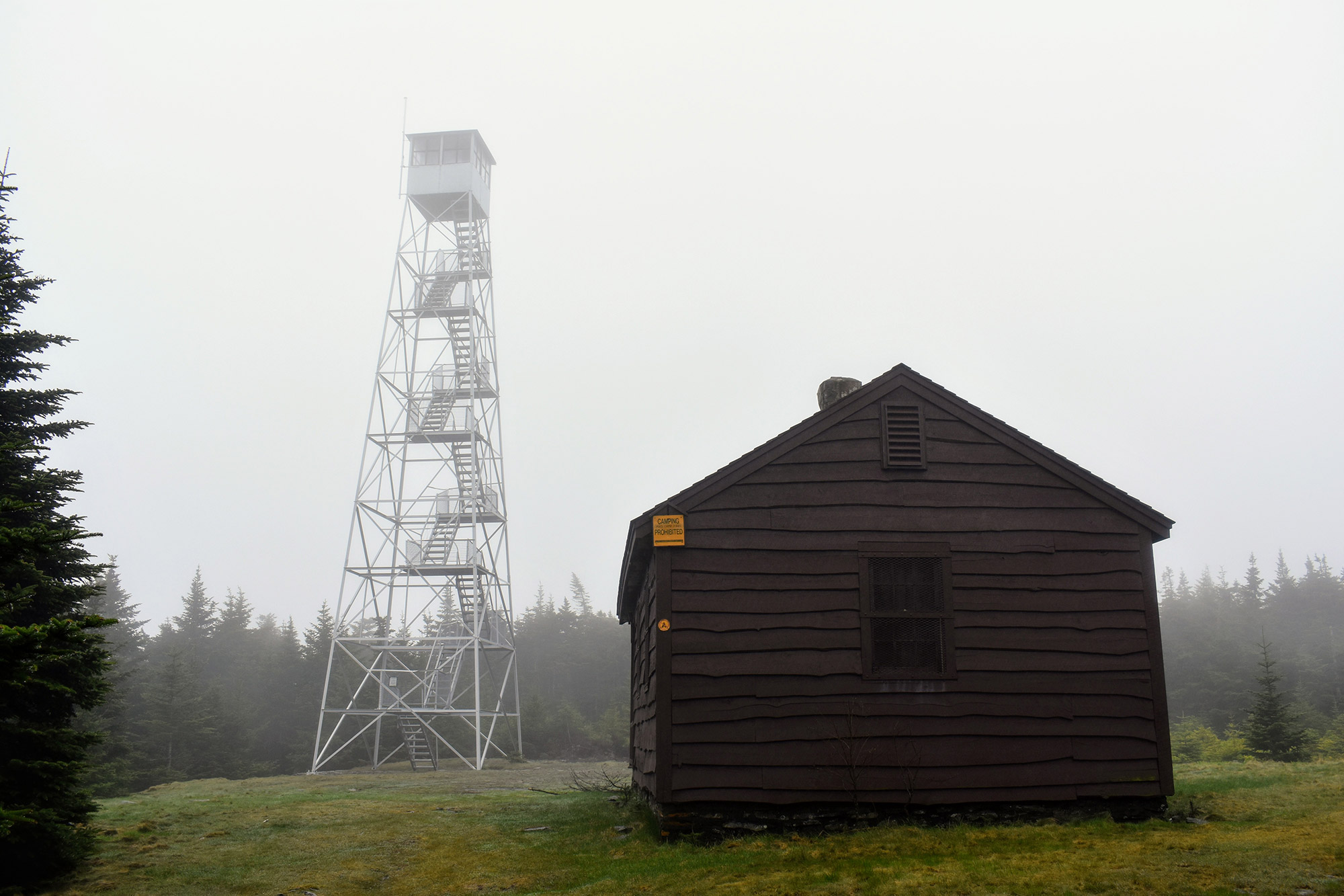
As it crests the plateau, the Becker Hollow Trail opens into a large clearing with a trail junction. Although the Becker Hollow Trail continues straight, the easiest way to the summit is to turn right onto the Becker Hollow Connector Trail. Here, walk on flat ground a short distance to the true summit (at 4,039 feet) and then over to the Hunter Mountain Fire Tower and ranger’s cabin.
The Fire Tower
At 60 ft. tall, Hunter’s tower is the tallest fire tower in the state of New York. As well, it’s one of the few fire towers listed on both the National Historic Lookout Register and the National Register of Historic Places. Locally, it was one of the Catskills’ last staffed fire towers, officially closing in 1989.
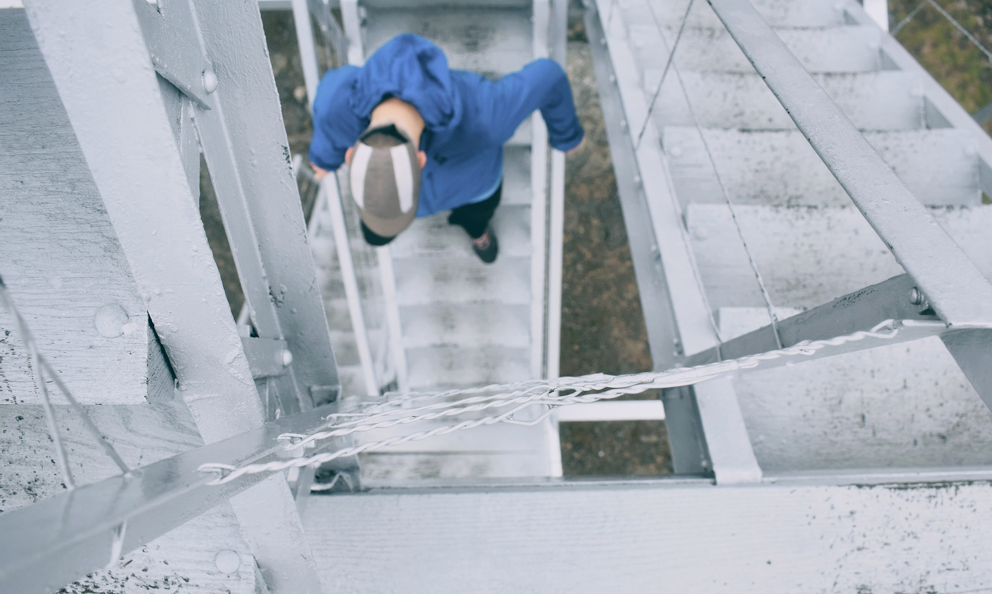
On clear days from the fire tower, hikers can take in spectacular views of the Hudson Valley, Massachusetts, Connecticut, and even southwestern Vermont. Just be forewarned: The room atop is typically locked, and the tower’s stairs are steep and not for everybody. After enjoying the views and having a well-earned snack, follow the yellow blazes of the Hunter Mountain Trail to loop back to a lower junction on the Becker Hollow Trail. Then, retrace your steps back to the parking lot.
For many peakbaggers, it’s possible to summit both Hunter and Slide on the same day—perfect for those looking to check two new 4,000-footers off their lists or get a jump on becoming a member of the Catskill 3500 club. Even better, both Slide and Hunter are included on the NE 111 list. In total, the list includes the 67 New England 4,000-footers, the 46 Adirondack 4,000-footers, and these two Catskill Peaks.
Have you hiked Slide Mountain, Hunter Mountain, or any of the other Catskill 3500? If so, what has been your favorite trip?
Related Posts


