

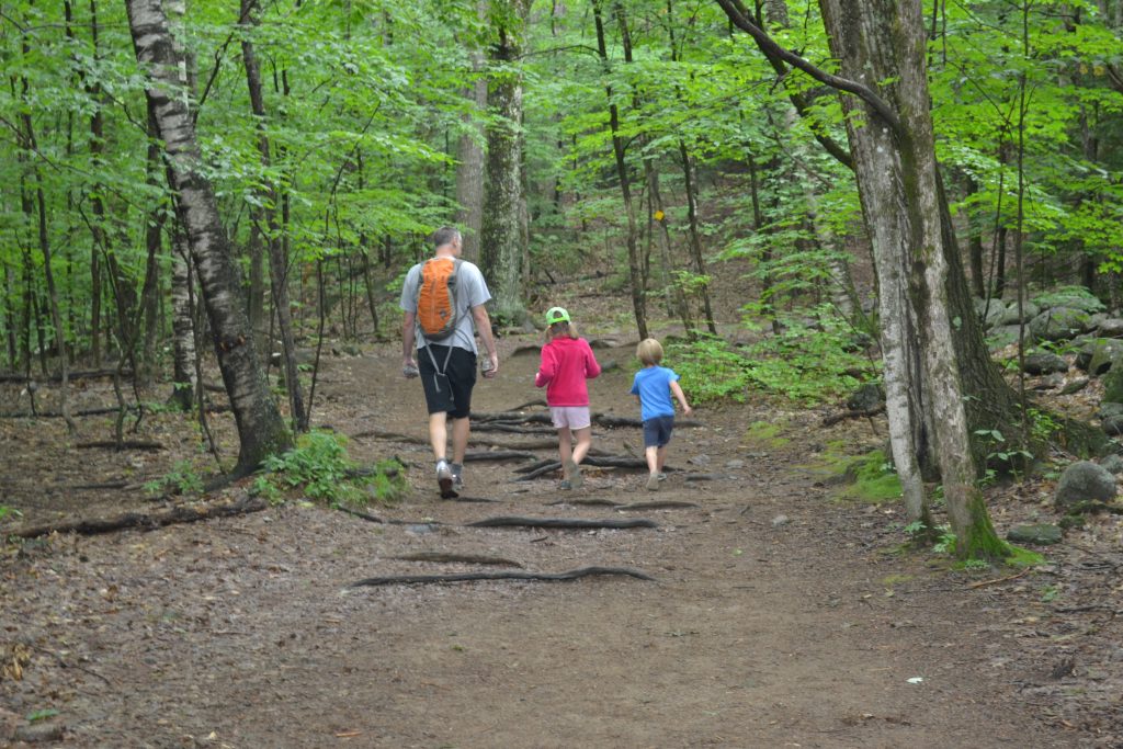
It might be tempting to spend your Lakes Region vacation floating on Squam Lake, sitting on Weirs Beach, or riding the Winnipesaukee Railroad, but no trip to New Hampshire is complete without bagging a summit. Whether it’s a quick scamper up West Rattlesnake Mountain or an all-day climb on Mount Chocorua, be sure to devote some time to exploring the area’s incredible local hiking.
West Rattlesnake Mountain
Looming above Squam Lake is one of the Lakes Region’s best moderate hikes: the Old Bridle Path to West Rattlesnake Mountain’s summit. Leaving from the parking lot off Route 113 in Holderness, it’s a two-mile round trip with less than 500 feet of elevation gain, all on a well-maintained, yellow-blazed trail that is family friendly and suitable for first-time hikers.
The view south of Squam Lake from the summit’s rocky slabs will impress even the most seasoned White Mountain hikers. For the peak-baggers among us, follow the well-marked Ridge Trail east from the outcrops for over 100 yards to the true summit. If you have more energy, consider adding on some extra miles by hiking on toward East Rattlesnake Mountain or downhill toward Five Finger Point, a peninsula that juts into Squam Lake.
The downside? West Rattlesnake is pretty popular, especially on weekends. To avoid the crowds, consider an early or late start, as the hike is easy enough to complete in an hour or so. Just don’t blame us if you’re late returning because you’ve been lingering on the summit to enjoy the views!
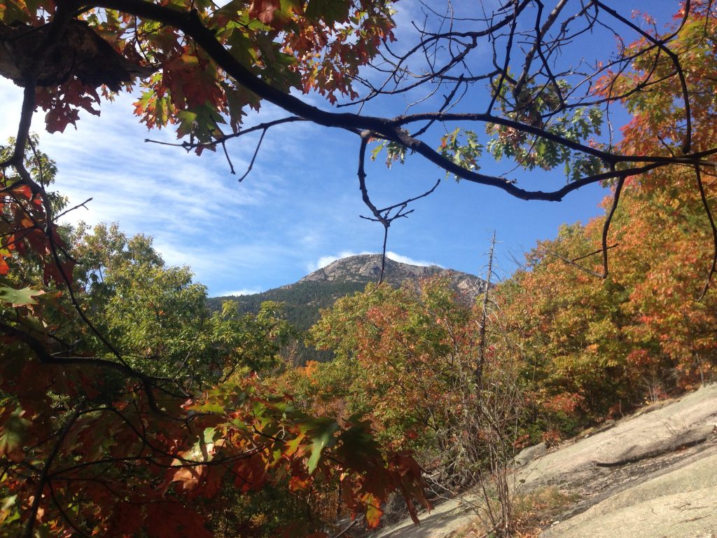
Belknap Mountain
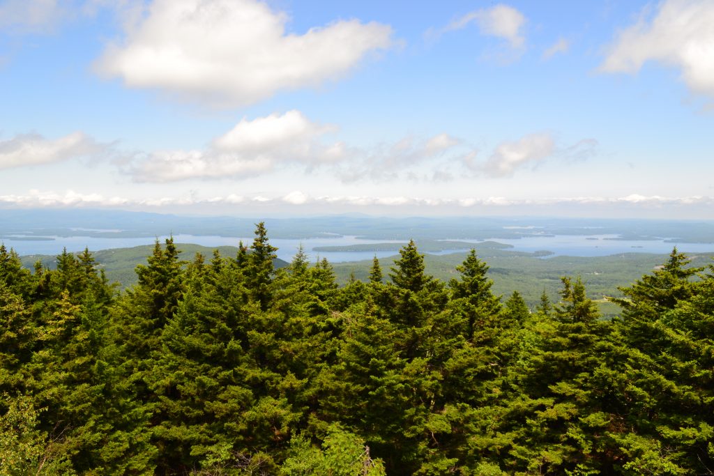
Another family-friendly hike, Belknap Mountain is one of New England’s 50 most topographically-prominent peaks. Three different trails—the Red, Blue, and Green—start at the Belknap Carriage Road parking area and wind their way up over the course of a mile. All are well-marked and have about 700 feet of elevation gain.
Once you get to the summit, make sure to climb the fire tower. It offers a fantastic 360-degree view of the region, with Lake Winnipesaukee being the most prominent feature. If you can pull yourself away from the views (and be careful once you do, because the stairs are steep), explore the old ranger’s cabin and still-working water pump, which are a short distance downhill on the Green Trail.
When planning your Belknap Mountain hike, be mindful that the Carriage Road gate is only open from 9 a.m. to 6 p.m. It’s also worth noting that the Carriage Road’s final segment to the upper parking lot is a steep dirt road that may be difficult for cars with low clearance. But, don’t let either of these stop you from enjoying Belknap Mountain. Instead, you can do a slightly longer hike along the Gunstock Mountain Trail, starting from the lower parking area.
Morgan and Percival Loop
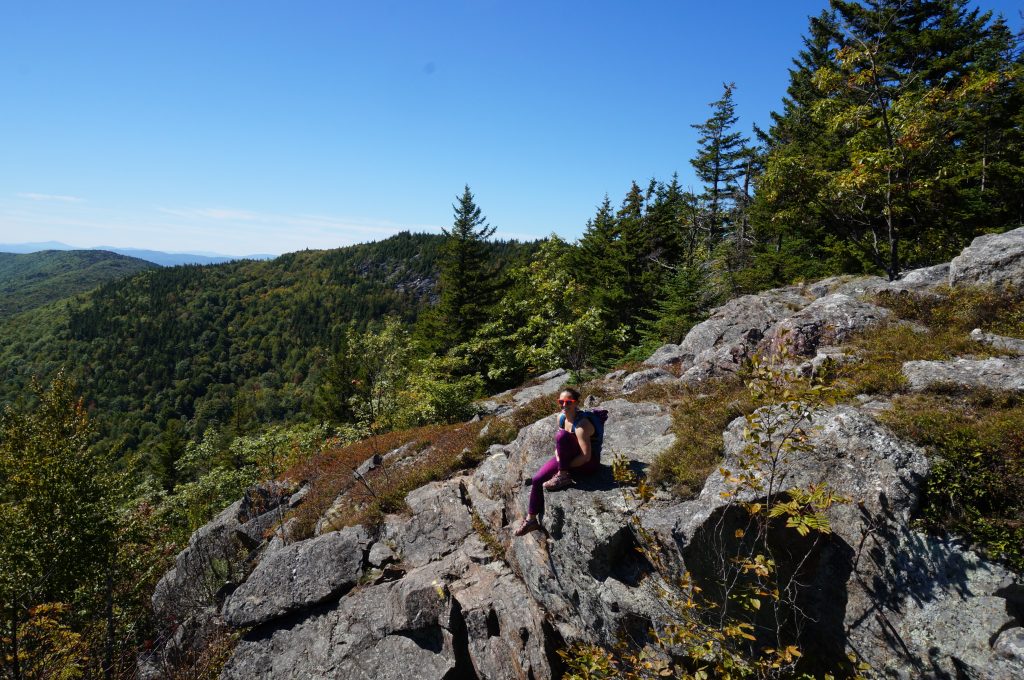
The Morgan and Percival Loop hike is another must-do. Starting from the same parking lot as West Rattlesnake Mountain, this 4.9-mile loop offers something for everyone—fun terrain, a chance to push yourself outside of your comfort levels, and, most notably, fantastic views. While the hiking found here is mostly moderate, the trail does present caves to crawl through, ladders to climb, and open ledges to walk across on your way to the summit of 2,220-foot Mount Morgan and then to 2,212-foot Mount Percival. Of course, if crawling, scrambling, and climbing aren’t your thing, walk-arounds make this hike suitable for almost everyone.
Leaving from the parking lot off Route 113, the Morgan and Percival Loop combines four separate trails: the Mount Morgan Trail, the Crawford Ridgepole Trail, the Mount Percival Trail, and the Morse Trail. Hikers will find them well marked and easy to follow, with signs at all main junctions. Because the trail descending Mount Percival is more gentle in nature, summiting Mount Morgan first is preferred. Be warned that this hike, like its neighbor, is incredibly popular. If you get to the trailhead late, you might find yourself parking on the street and not in the lot. On a positive note, there are plenty of views to go around!
Welch-Dickey Loop Trail
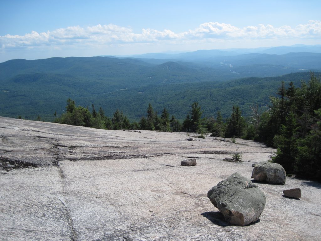
If you’re looking for something a little more difficult, consider the Welch-Dickey Loop. What attracts many is its big-mountain feel jam-packed into just a few miles. With jaw-dropping views, semi-exposed ledges, massive stone slabs, and above-treeline hiking, Welch-Dickey seems like a hike found in New Hampshire’s “big” mountains.
However, with Welch Mountain standing at just 2,605 feet and Dickey Mountain peaking at 2,743 feet, even those of us with sea legs can summit both. Although it’s far from New Hampshire’s most challenging, be warned that it can feel longer and harder than its 4.5-mile length. As well, expect to climb over 1,600 feet and through terrain that can be challenging for non-hikers. Also, because of the hike’s slabby nature, it can be difficult when wet.
Located off Route 93’s exit 28, the Welch-Dickey Loop sits at the Lakes Region’s northern corner. Navigation is relatively easy, as yellow blazes and cairns clearly mark the trail. Most prefer to go counter-clockwise and summit Welch Mountain first, before heading to Dickey Mountain’s summit. Expect to pay a $3 per-day fee to park at the trailhead, or splurge and buy a White Mountain National Forest season pass for $20.
Mount Chocorua
The pinnacle of Lakes Region hiking, Mount Chocorua is one of the Whites’ most recognizable mountains. While just 3,478 feet, its rocky, treeless summit leads many to believe it’s much greater in stature than it is. As such, Mount Chocorua is as challenging, if not more so, than many of New Hampshire’s 4,000-footers. When you consider the exposed ledges, steep slabs, and above-treeline weather, hikers should plan for a full day.
The most popular and direct route up, Piper Trail starts off Route 16 in Albany, N.H., behind Davies General Store. At 4.5 miles (nine miles round trip) and gaining roughly 2,700 feet, the Piper Trail presents a challenge even for seasoned hikers. And, with very steep sections, open ledges, and cliffside scrambling, this trail is perfect for those who like a charge of adrenaline.
For a different route up, continue approximately one mile past the Piper Trailhead on Route 16 to the White Ledge Campground and the Carter Ledge Trail. With nearly the same mileage and vertical gain, the Carter Ledge Trail gives you an option to beat the crowds. However, while this makes the route slightly harder to follow, you intermittently get fantastic views of the summit along Carter Ledge.
If you’re heading to the Lakes Region, or are looking for a reason to go, check out some of these fantastic hikes for their impressive views and challenging terrain. And, of course, we want to hear about your experience. In the comments, tell us which Lakes Region hikes you love or just about the great day you had here!
Related Posts


[…] For goEast, my writing partner and I collected a few of our favorite hikes that you can check out here. I was so inspired after writing this article that I returned to Mount Chocura only to discover it […]