

Traversing 83 miles across Northern New Hampshire and linking bike paths, back roads, and rail trails is the Cross New Hampshire Adventure Trail (xNHAT). If you’re looking for friendly elevation and variation, then this granite state gem is for you! The path itself is open to bikers, walkers, runners, skiers, horseback riders and dogs, but I’ll be focusing on highlights and tips for bikers and bikepackers for this write-up. I would say this trip is great for all levels as well as families (but please note a few of the sections are on a busy Route 116). Here are some tidbits to know before you get started as well as some ways to make it your own.
End-to-End vs. Sectioning
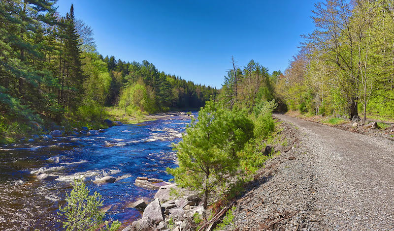
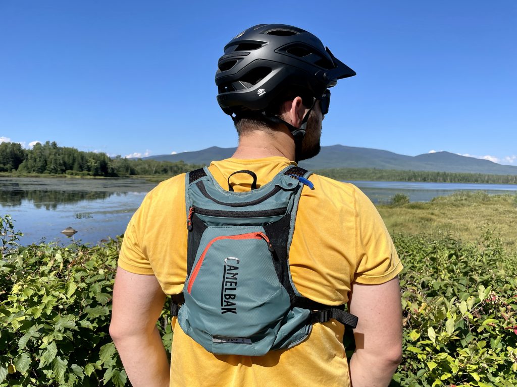
I’ve done this route both in sections and border to border, and either way you slice it, it’s an adventure! Near the Vermont line in Woodsville, New Hampshire, the journey begins on the Ammonoosuc Rail Trail and heads east to Littleton. Here you’ll be dropped into the small and welcoming downtown before hitting the only busy paved road portion of the ride through Whitefield. Though you have to be mindful of traffic, the smooth pavement is a welcome temporary reprieve from the bumps and jostles. Then you’ll find yourself suddenly in the White Mountains—the Pondicherry Wildlife Refuge is the perfect picturesque halfway point of the trip to keep you inspired. From there you’ll be dropped back into civilization again in Gorham (if you’re looking for lodging options, the Israel River Campground in Jefferson is a good place to start). From Gorham, the remainder of the trip is quiet, rolling, and paved backroads all the way to Bethel, Maine.
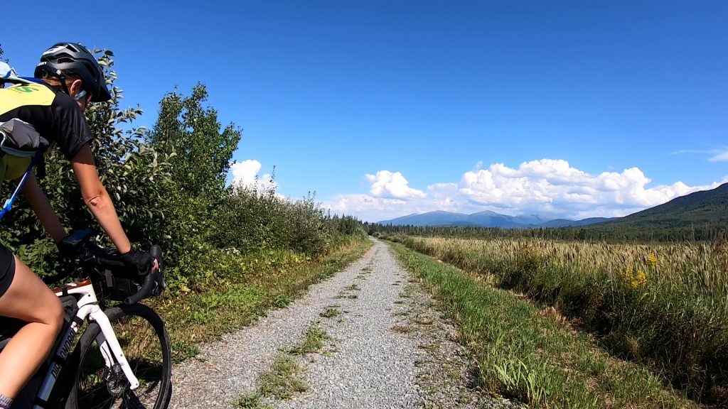
The recommendation I received from the xNHAT team was to do the Presidential Rail Trail for a bite-sized section with beautiful views, and I’ll make that same recommendation to you. I biked this on a very hot 90-degree day but I was completely unbothered with sweeping views of the Presidential Range all around as the route dipped in and out of tree cover. The route, from Jefferson, begins at the Pondicherry Wildlife Refuge (parking at Airport Road), where you traverse fields of wildflowers and bridge-covered bogs at an easy grade on dirt-packed road for 11 or so miles. The xNHAT website also covers more recommended day and multi-day rides here. All in all, the 83 miles consists of 34.5 miles off-road, 9 miles of dirt roads, 29.2 miles of paved backroads, and 10 miles of paved secondary road.
Navigation Tools
The xNHAT’s comprehensive navigation toolkit sets you up for a smooth and successful tour. The website offers paper maps, PDFs, digital route downloads, and cue sheets, and their team is available to answer questions via email. I used the downloadable map with the Ride with GPS app; the audio cues are great and highlight nearby amenities like bike stations and groceries. Direction and navigation are not my strong suite but combining these resources kept me on my bike versus stopping at every intersection to make (the wrong) decisions.
What to Bring
If you’re riding this route in a day, you can count on plenty of pit stops in towns peppered throughout, as long as you don’t mind stopping. If you’re looking to cycle through, consider a day’s worth of snacks, water, and electrolytes just as you would bring hiking or other rigorous activity, taking into account packability and weight, as well as the kind of bike you’re riding (tires of at least 32 mm are suggested). Below are some suggested items to bring along.
- Repair Kit (tube and patches, pump/Co2, multitool
- Hydration Pack
- Helmet
- Gloves
- Rain layer
How to Enjoy
I added this section to note to riders that this isn’t a route I’d go for an FKT on. It’s beautiful and worth enjoying at a leisurely pace— there are scenic views at every turn, and the experience of biking alongside the winding Ammonoosuc is worth relishing. Another key amenity worth noting are the fixed bike repair stations and pumps installed at twelve locations along the route provided by the xNHAT. Additionally, eight other businesses have been provided with hand tools and a hand pump. These resources can save a trip if needed, so take your time and take care of your bike! Find a list of the locations here.
A big thank you to Marianne and the Cross New Hampshire Adventure Trail Team for their assistance and for the awesome work they do. The Cross New Hampshire Adventure Trail is a 501(c)(3) non-profit; donations to help with trail improvements are appreciated. If you’ve biked this trail before, tell us about your experience below!
Related Posts


