


With its pristine waterfalls and dramatic overlooks, a running tour of “The Hopper,” Mount Greylock’s western glacial cirque, is well worth the climb up Massachusetts’ highest peak.
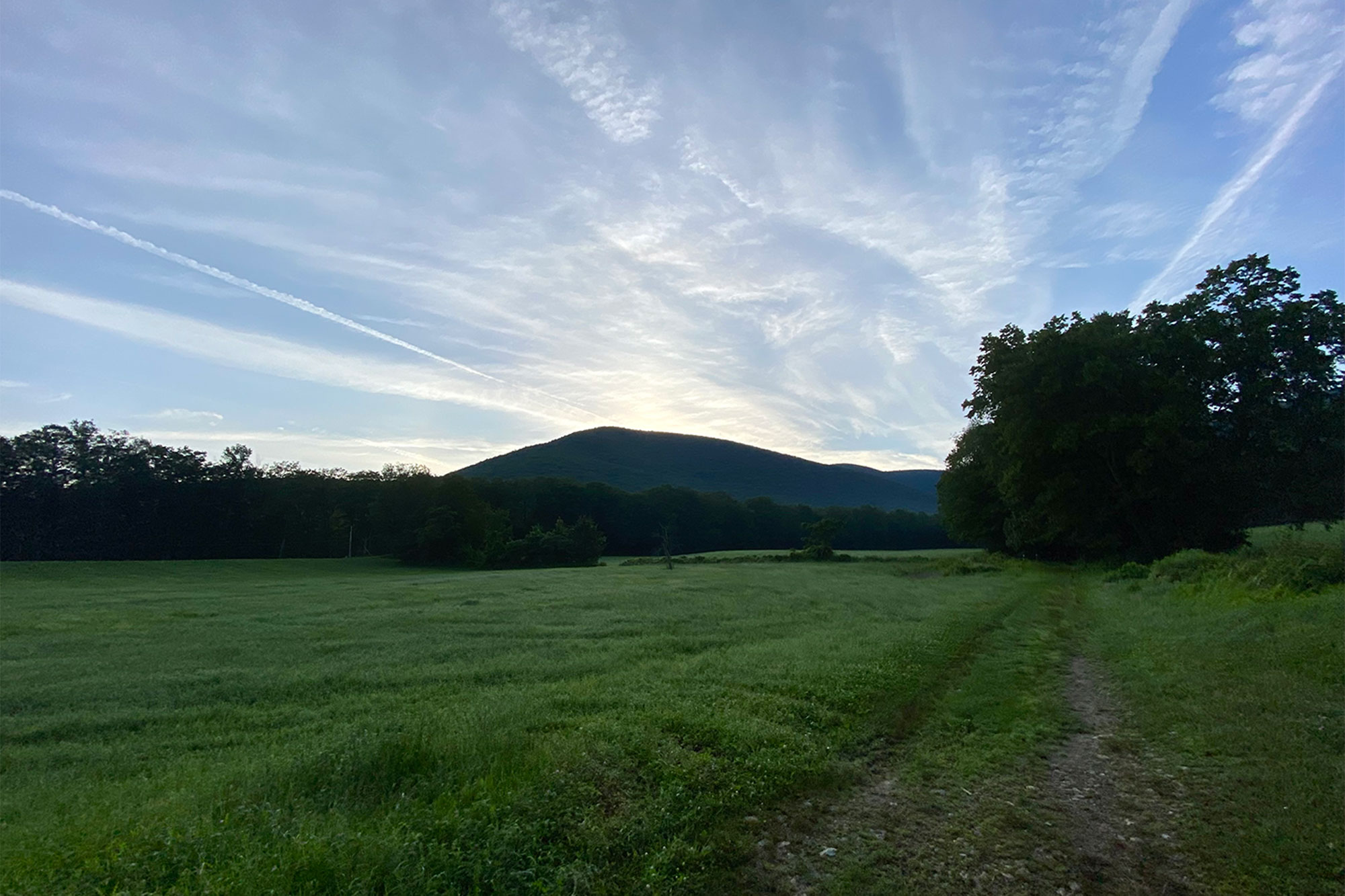
Any way you approach it, Mount Greylock is massive. It’s the highest peak in Massachusetts and the 17th most prominent in New England. From the east, it’s defined by its steep escarpment accessed by quick, lung-bursting climbs like the Thunderbolt Trail; from the west, it’s defined by a massive glacial cirque known as “The Hopper,” so-named for its resemblance to the grain hoppers of old. Though far more moderate than its eastern aspect, a circuit around the Hopper makes for a fantastic long trail run, gaining around 3,500 feet in 14-plus miles, including several excellent diversions such as waterfalls, viewpoints, and—obviously—the top of the Bay State.
Quick Facts
Distance: 14.7-mile loop
Time to Complete: 4.5 to 7 hours for most
Difficulty: ★★★
Scenery:★★★★
Fees/Permits: None
Contact: https://www.mass.gov/locations/mount-greylock-state-reservation
Turn-By-Turn
From downtown Pittsfield, head north on US-7 (First Street) for 15.2 miles to its intersection with MA-43 in Williamstown. Turn right onto MA-43, continue for 2.3 more miles, and turn right again onto Hopper Road. In 0.2 miles, Hopper Road bears slightly right, and continues for another 1.9 miles to its terminus at a large parking area at the Haley Farm Trailhead (42.6554, -73.2051).
Hopper Trail
The blue-blazed Hopper Trail begins at a gate separating the active stretch of Hopper Road from on an old farm road in a perfectly New England pastoral setting before dipping into the trees. Continue on the Hopper Trail, passing the Haley Farm Trail on the right before reaching a junction with the Money Brook Trail at 0.3 miles (42.6547, -73.1995). The Money Brook Trail will ultimately serve as the route of descent on this loop. Bear right and begin a moderate ascent up the wide, rocky, and oftentimes very wet trail as heads east and then south, slowly gaining altitude as it follows a contour line on the eastern flank of Stony Ledge, the minor named summit that accounts for the southwestern border of the Hopper.
At 2.3 miles, turn left as the Hopper Trail joins Sperry Road (42.6337, -73.1890), a wide woods road that leads another 0.1 miles to Sperry Campground, a large, established campsite, and a junction with the March Cataract Trail.
March Cataract
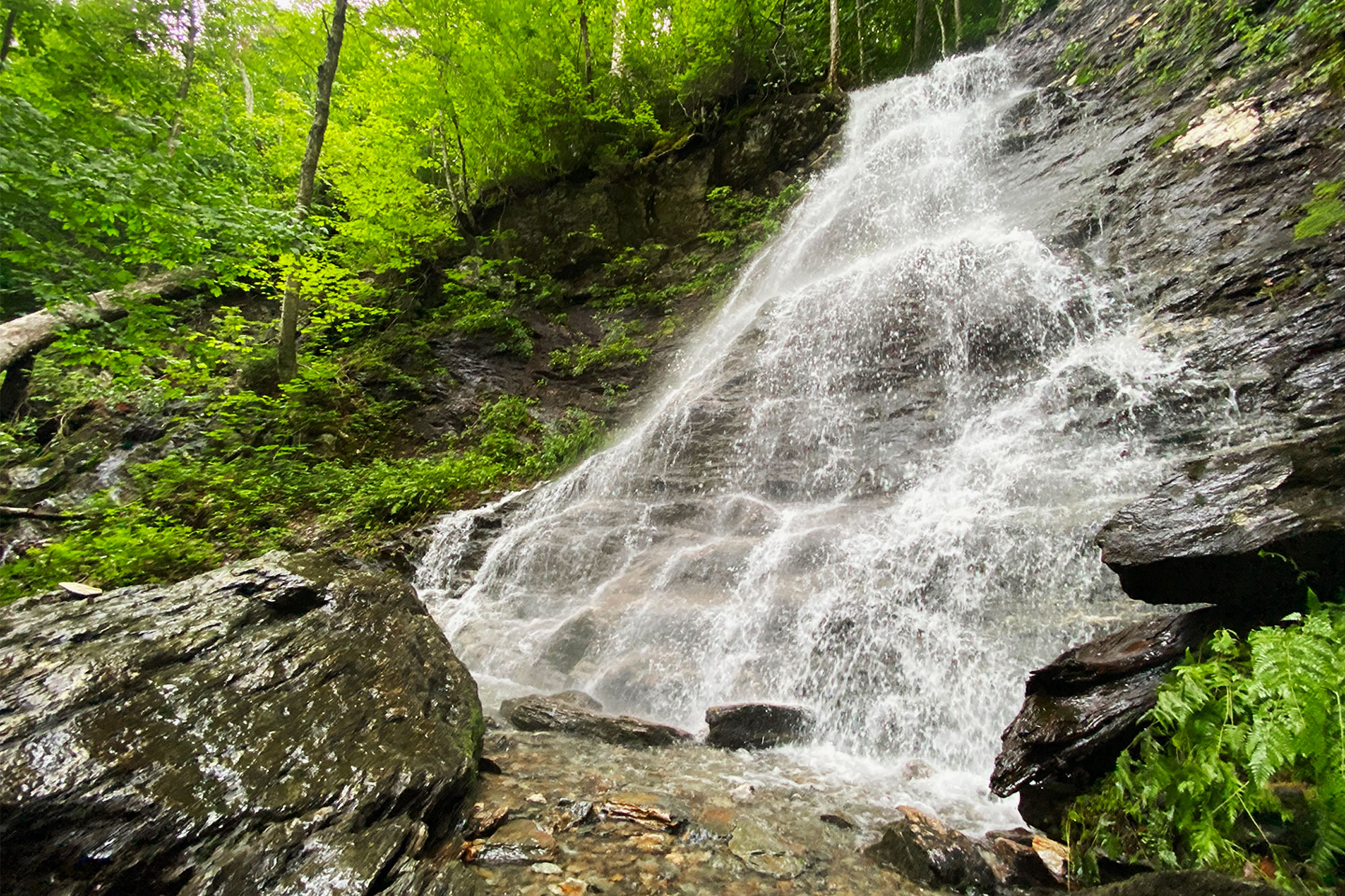
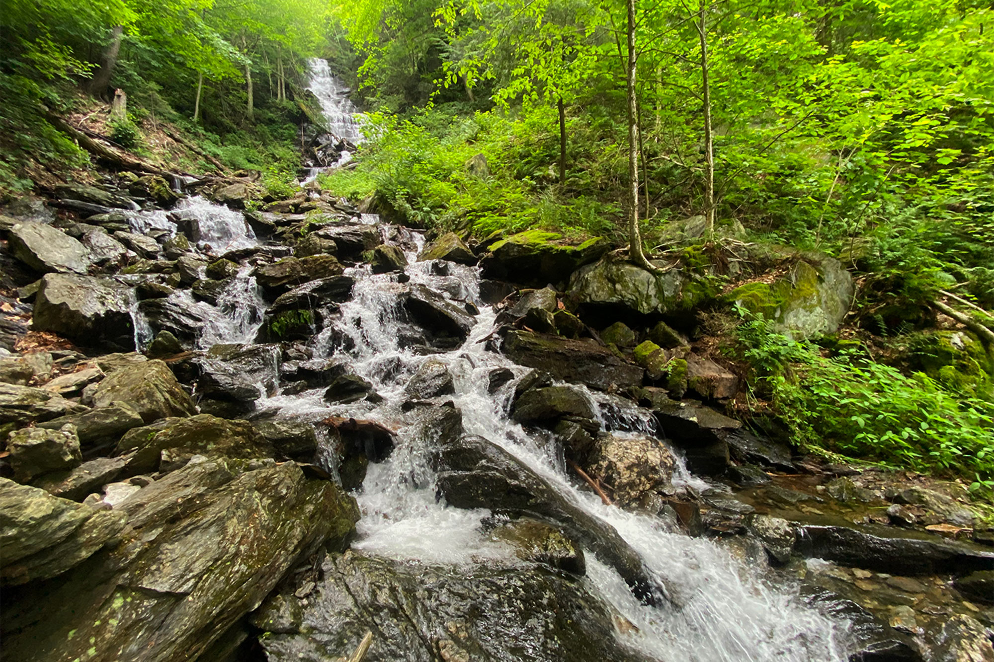
The first worthwhile detour of this romp departs the Hopper Trail on the left at an established campsite (42.6330, -73.1882). The trail departs the campsite and runs for roughly 0.5 miles over rolling and rocky—but still runnable—singletrack, ultimately descending to its terminus at the beautiful, 30-foot-tall March Cataract (42.6363, -73.1799). Take a moment here to cool off and catch your breath before heading back up to the Hopper Trail and the inevitable climb up to the summit.

Overlook Trail and the Summit
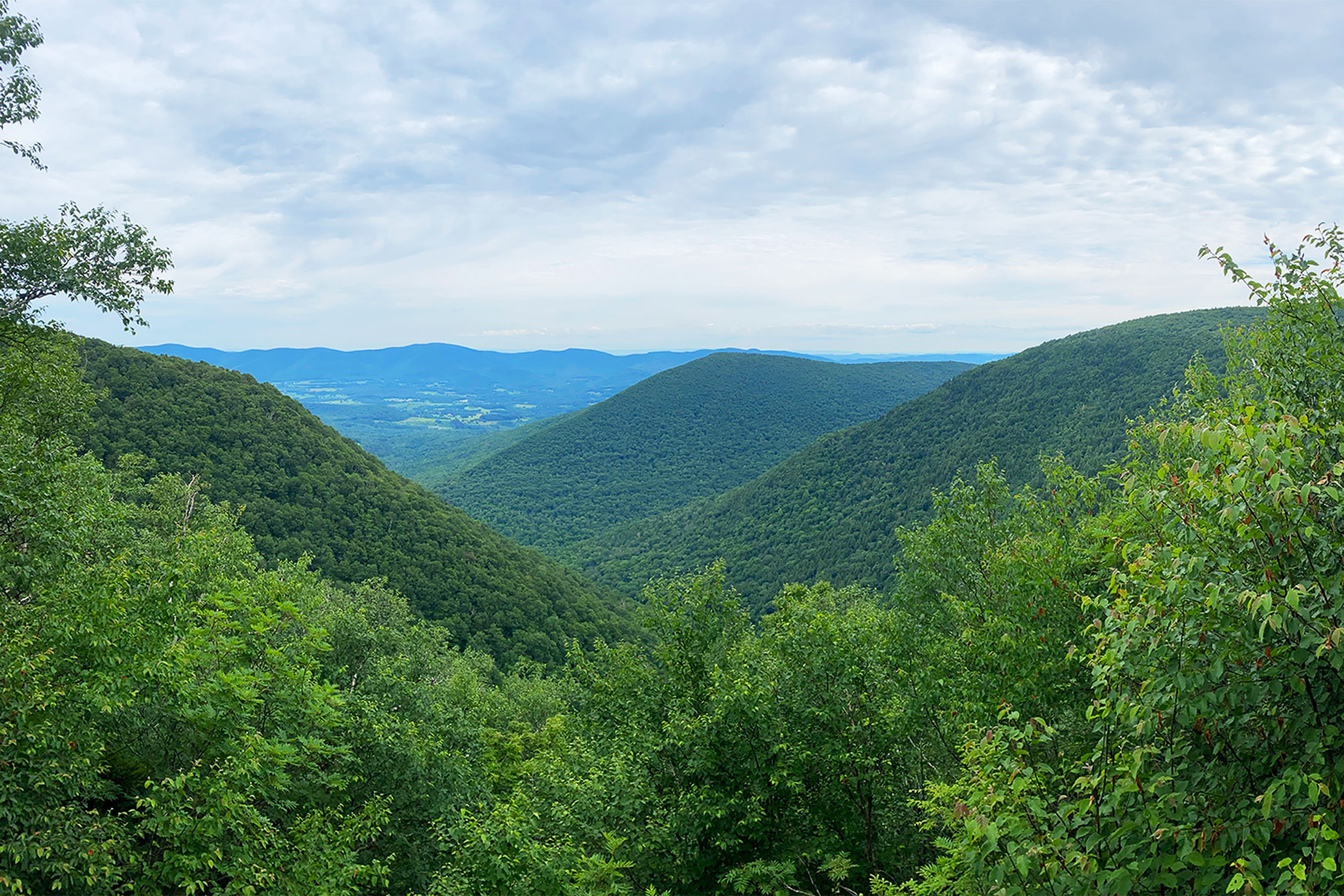
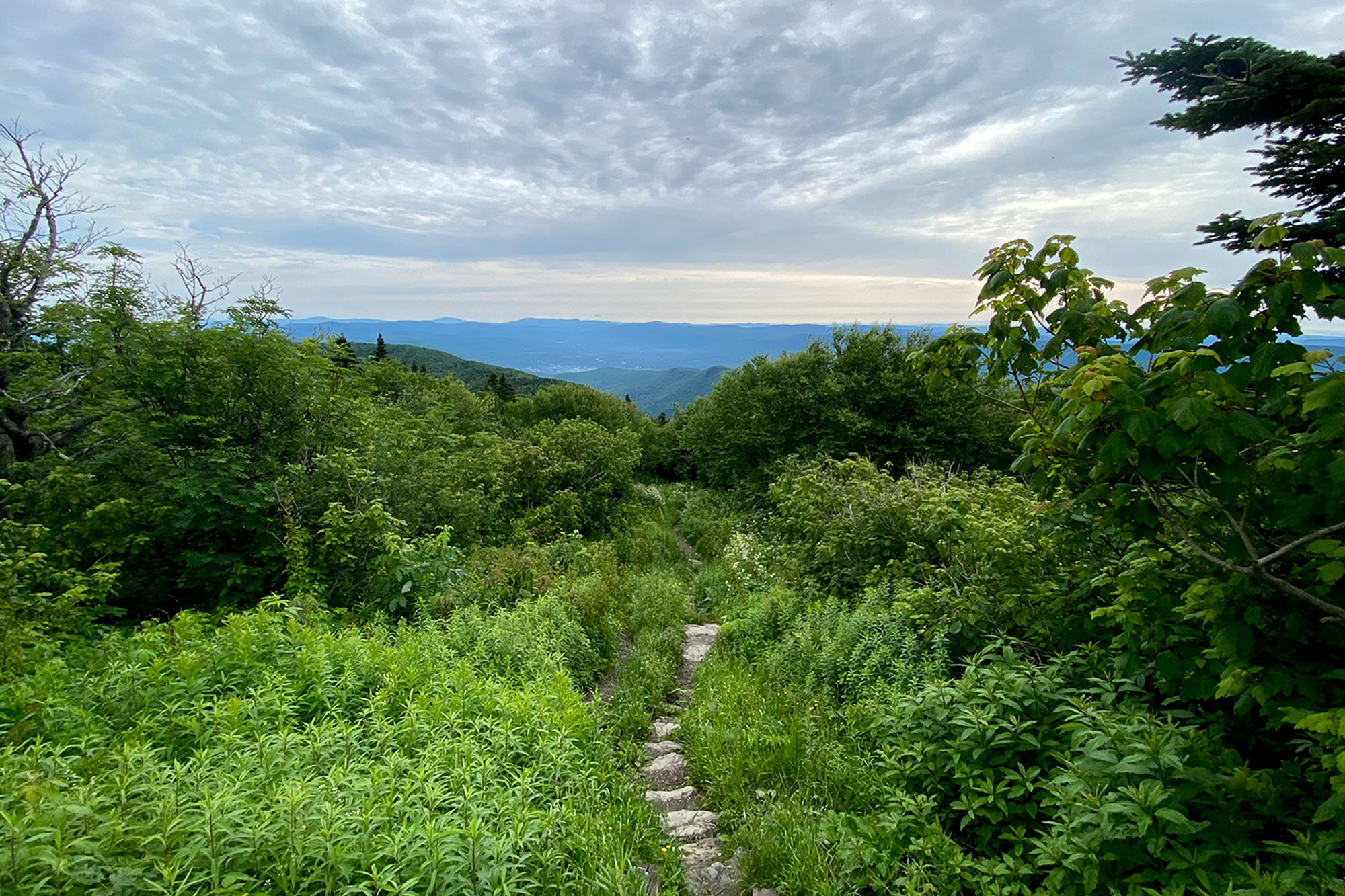
Having backtracked to Sperry Campground, take a left onto Sperry Road, continuing for 0.2 easy miles before the Hopper Trail departs to the left at 3.8 miles (42.6310, -73.1875). The moderate grade resumes as the Hopper Trail again turns left at a junction with the Deer Hill Trail (42.6300, -73.1852) and continues to climb until it reaches yet another junction with the Overlook Trail at 4.5 miles (42.6340, -73.1768). Bearing right and staying on the Hopper Trail will deliver you right to the summit, but the Overlook Trail—to the left—offers a rocky, rolling, and sometimes wet traverse around the summit to the west and your first view over the Hopper. Continue for 1.7 miles, crossing a road in the process, to the Overlook Trail’s terminus at the white-blazed Appalachian Trail, just below the summit (42.6369, -73.1681).
The 3,489-foot summit of Mount Greylock (42.6372, -73.1660) is marked by the Massachusetts Veterans War Memorial Tower and an open meadow with breathtaking panoramic views of the surrounding countryside. It’s developed, and accessible by an auto road, so be prepared for a crowd on a nice weekend day. Once you’ve had your fill, find the AT, and head north.
Robinson Point
Another worthwhile detour, the Robinson Point Trail affords those willing to add the mileage—and the gain—with an outstanding and dramatic view west across the Hopper. Bang a left at the signed junction just 0.4 miles past the summit (42.6420, -73.1626), gaining a short ridge before dropping back down and crossing Notch Road. From here descend, steeply, over rocky terrain for 0.25 more miles to the viewpoint proper (42.6453, -73.1651). Once you’ve taken it all in, retrace your steps all the way back up to the AT and continue on your way.
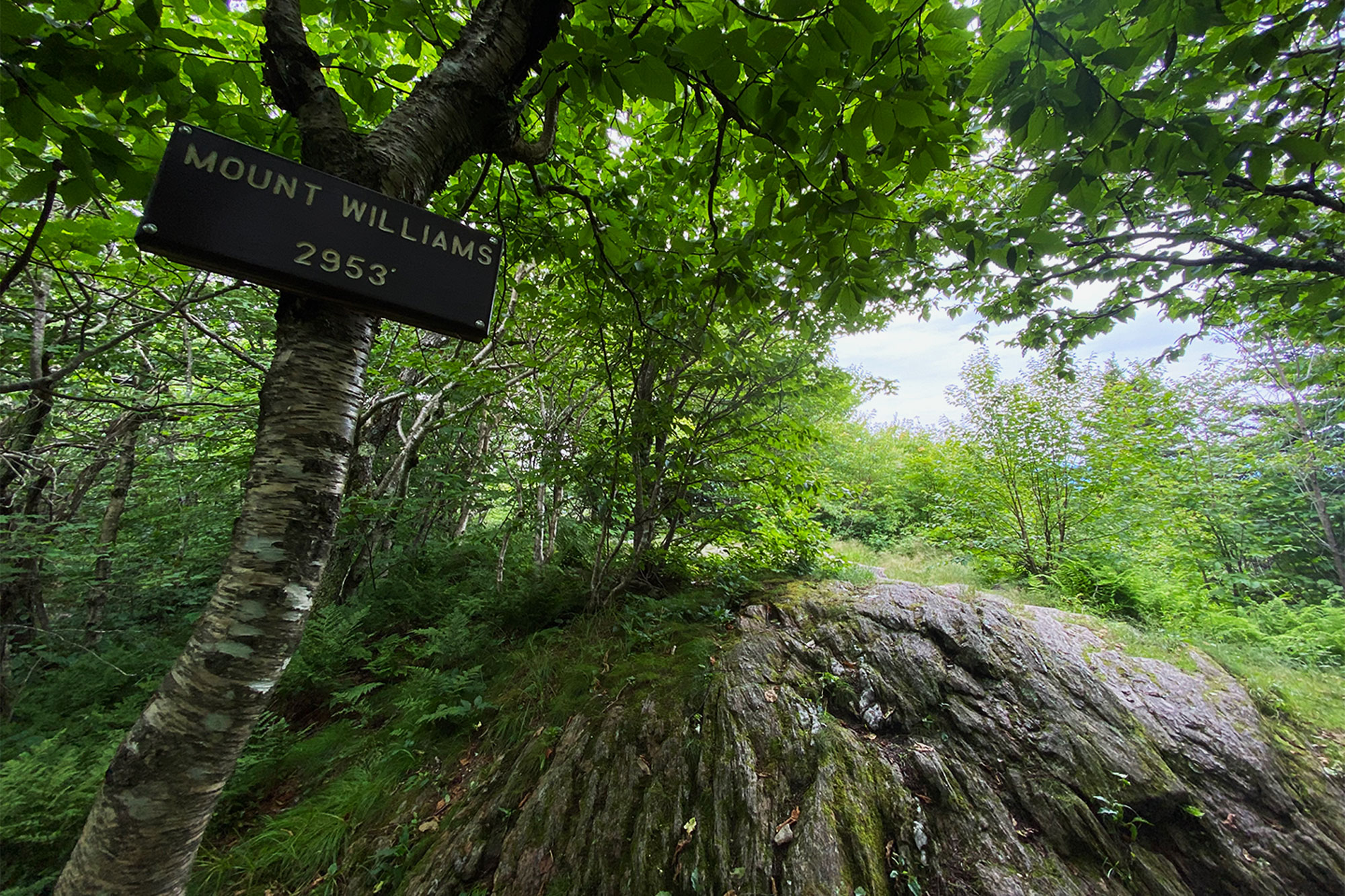
Mount Fitch and Mount Williams
The gentle, undulating course of the AT that runs north from Mount Greylock over Mounts Fitch and Williams is the respite your lungs were demanding on the way up. Easy, runnable terrain and gentle changes in elevation make this the fast—and inherently enjoyable—bit of trail you need to make up the time you may have lost taking in the summit views.
From the Robinson–Appalachian Trails junction, turn left onto the AT and head north along the ridge as the trail dips back into the woods and cruises over 3,110-foot Mount Fitch (42.6557, -73.1586) and 2,951-foot Mount Williams (42.6681, -73.1579). The signed summit of Mount Williams offers a partially-obstructed view to the northeast at 9.6 miles before the AT takes a hard left, descending to the west. Keep following the AT over easy ground for another mile to its junction with the Money Brook Trail (42.6696, -73.1717).
Money Brook Trail
As far as “home-stretches” go, it doesn’t get much better than this trip down the Money Brook Trail. Dropping over 1,000 feet in four miles, the Money Brook Trail follows its eponymous waterway through a beautiful mix of hardwood and coniferous forest back down into The Hopper, crossing the brook multiple times, with the bonus of a third—but very quick—worthwhile detour to the 80-foot Money Brook Falls.
The Money Brook Trail begins but turning left where the AT breaks right and continues the gentle descent, passing Wilbur’s Clearing campsite at 10.8 miles. The trail turns left before, after another 0.6 miles, reaching a switchback and the short spur trail to a view of Money Brook Falls. Continue straight on the spur trail to take in the falls (42.6627, -73.1679), which are really great in the early season or after a heavy rain.
Double-back to the Money Brook Trail proper and resume your descent into the Hopper. The grade alternates between gentle and moderate as the trail drops alongside the brook, and the terrain is cruiser. How much water was coming down the falls is likely a tell for how wet you’re going to get in the next part as the trail crosses the Money Brook twice (at 12.8 and 13.4 miles) before it merges with Hopper Brook. Negotiating the crossings can be tricky in high water so patience and creativity are necessary, and a pair trekking poles may be handy.
Keep on the Money Brook Trail as it follows the Hopper Brook now, for a flat mile to its terminus at the Hopper Trail. From there it’s just 0.3 familiar miles until you’re delivered to the trailhead and whatever celebratory libations you stashed in your car.
The Kit
- Outside of the Robinson Point spur, the terrain is generally runnable and perfect for a light, sturdy pair of trail runners like the Salomon Sense Ride 4 (men’s|women’s)
- All-in this route gains more than 3,500 feet, and though it’s never brutally steep, there are segments—water crossings included—that would certainly benefit from a pair of trekking poles like the Black Diamond Distance Carbon FLZ.
- Whether you’re hiking or running, a circuit of Mount Greylock’s west side is a big day out. A lightweight and packable shell jacket, like the Marmot PreCip Eco (men’s|women’s) is a must.
- Both March Cataract and Money Brook Falls drain into the Hopper, so it’s more likely than not that at least some of that water will find its way into your trail runners. With that in mind, consider how much difference just one extra pair of clean, dry Smartwool Phd Run Elite Micro Socks can make at the end of a long run.
- With capacity for up to 2.5 liters of water, attachment points for poles, and room to spare, look to the Salomon Agile 6 Set Hydration Pack to pack away everything you may need on Mount Greylock.

Keys to the Trip
- The state of Massachusetts’ Department of Conservation and Recreation manages the 12,500-acre Mount Greylock State Reservation and offers easy-to-read maps for free online and at the trailhead. Though all trails are well-signed and well-blazed, some spots—the summit in particular—can be tricky, and a wrong turn will add mileage to an already stout itinerary. Download the digital copy to your device and grab a print copy before you start, just in case.
- Mount Greylock served as both muse and setting for some of the most noteworthy American writers of the 19th-century, including Henry David Thoreau, Nathaniel Hawthorne, and Herman Melville. Perhaps chief among its contributions, however, was the mountain’s purported impact on Melville’s Moby Dick—it’s said that a snow-covered Greylock, as viewed from Melville’s home in nearby Pittsfield, served as the inspiration for the author’s description of the great white whale.
- Just northeast of Mount Greylock State Reservation, North Adams, Massachusetts is a little gem of a town, and well worth a weekend. Follow up your run with a rest day taking in some art MASS MoCA and maybe a couple of recovery beers at Bright Ideas Brewing Company.
Current Conditions
Have you done the entire loop or even a piece of it recently? Post your experience and the trail conditions (with the date of your hike) in the comments for others!
Related Posts


