

Most people associate Saratoga Springs with horse racing, summer concerts at SPAC, or the bustling downtown with its many pedestrians, shops, and eateries. But, you don’t have to leave the city to find a piece of nature and hit the trails.
The Saratoga area is home to a myriad of off-pavement routes with varying terrain and scenery, offering excellent trail running for beginners, more advanced folks looking for a technical challenge, and everyone in between. As you’re already in the city, you can grab some hard-earned food or drink downtown or on picturesque Saratoga Lake after your run!
1. Saratoga Spa State Park
~15 miles of trails
Terrain: Flat to rolling; a few short, moderate hills
Surface: Dirt, grass, pavement
Recommended Run: Five Mile Trail
Trailhead Parking: Plenty. You can easily access trails from almost anywhere in the park.
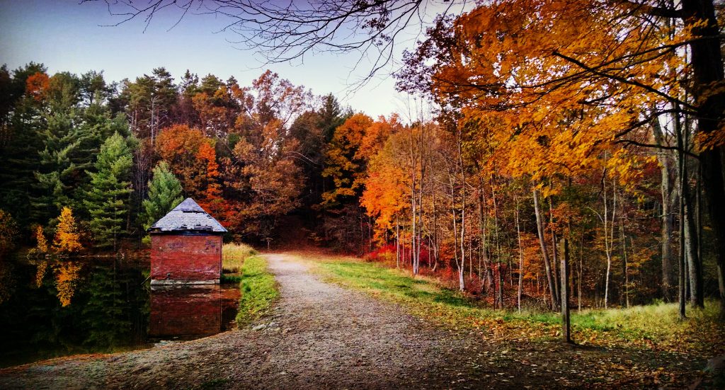
The Spa State Park may seem like an obvious place to enjoy the outdoors, but hidden beyond the towering pines are miles of dirt trails. With numerous trails, paths, and park roads, there’s something for everyone. As such, you can “choose your own adventure” based on your experience, mood, or the trail conditions.
The Five Mile Trail, designated by yellow markers, is a dirt loop with a few paved sections that doubles as an excellent tour of the park. You’ll often be in the woods but also see the areas of the park that attract its many visitors: a natural geyser, mineral springs, the historic Hall of Springs, Geyser Creek, wetlands, and the reflecting pool, to name a few.
For beginners or those who haven’t hit the trails in a while, the park is an ideal place to visit. Particularly, it offers many paved trails and roads providing options for shortening your route. Thus, it’s easy to jump off the trails if you need a break or if you encounter less-than-ideal conditions, such as ice or mud.
Bonus: Bathrooms (open in late spring through early fall) are present at the many picnic pavilions scattered throughout and have a few spigots to fill up your water supply. Make sure, however, it’s a spring and not a mineral water location.
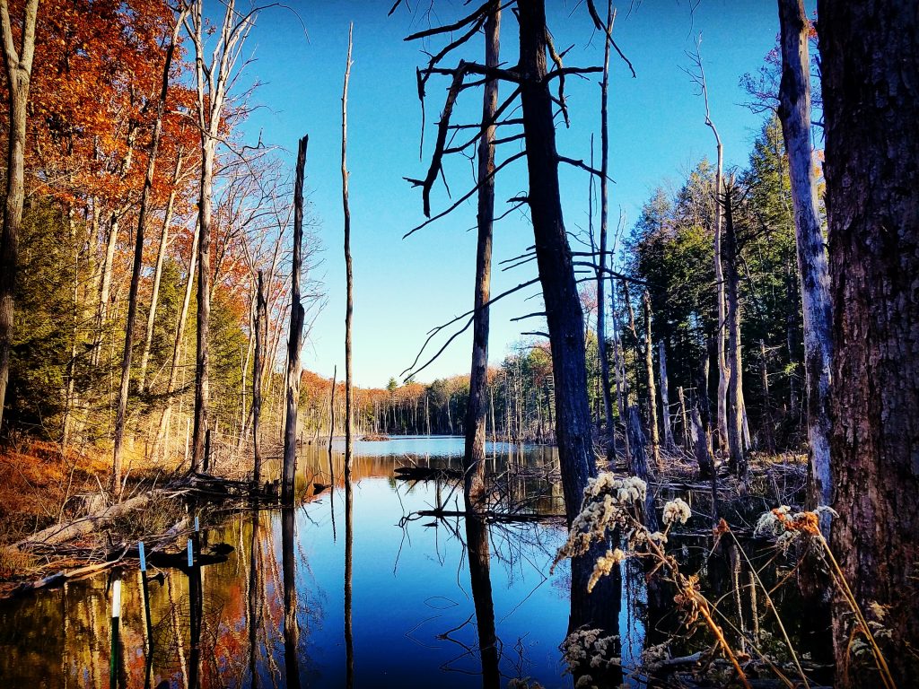
2. Hemlock and Karner Blue Butterfly Areas
~1.7 miles of Hemlock Trails and ~2 miles of trails in the Karner Area
Terrain: Flat
Surface: Dirt, sand, grass
Recommended Run: Combine these areas for a longer route.
Trailhead Parking: Designated dirt area off Crescent Avenue for the Hemlock Trail and a paved parking lot off Crescent Street for the Karner Blue Butterfly Area.
Although technically part of Saratoga Spa State Park (view a map), both of these routes are slightly removed from the main area, providing a more secluded experience. As a result, they’re a great place to escape when SPAC has a major concert or event and also offer unique biodiversity worth exploring.
The Hemlock area offers two trails, denoted by blue and green markers. While the former is easy to follow with four bridges traversing wet areas, the latter is less traveled and can become overgrown, so beware if you’re wearing shorts. As well, the Hemlock area is home to forested wetlands and the most expansive area of native forest in the State Park. Around you, you’ll see old-growth hemlock and rare perched swamp white oak trees.
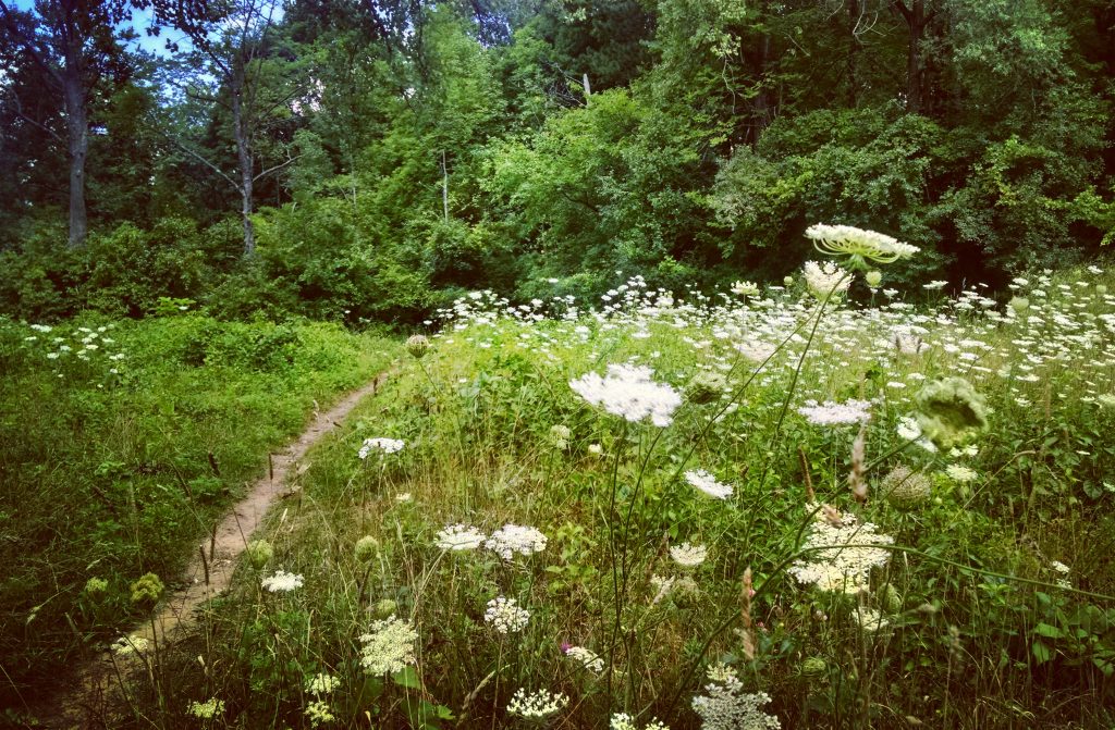
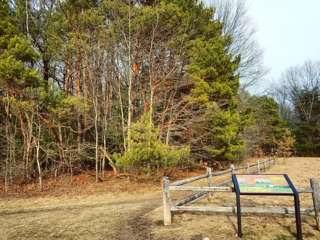
To extend your time outdoors, combine either of these with the Karner Blue Butterfly Area trails. Keep your eyes peeled for wild blue lupine and the endangered Karner blue butterfly, as the area recently underwent habitat restoration to help preserve the species.
Aside from stumbling across the occasional exposed tree root, you’ll find that sandy soils mostly comprise this path. Here, they’re needed for the butterfly habitat and also make for a cushy run.
3. Daniel’s Road State Forest Trails
~15 miles of trails over 523 acres
Terrain: Rolling to hilly; some short, steep inclines
Surface: Dirt, rock, roots (can be rugged)
Recommended Trails: Bee, Here to There
Trailhead Parking: On the north side of Daniels Road, at the intersection with Clinton Street
This area is popular with mountain bikers and is ideal for anyone looking for a fun and technically challenging trail run. Due to the rugged terrain, extensive trail system, and shared use, however, this route is recommended for intermediate to advanced trail runners who are comfortable on varied surfaces and have decent wayfinding skills.
The Carriage Road loop, which begins from the parking area, is wide, well-established, and easy to follow, albeit often rocky. Use it to get your feet wet (literally) and access the many other trails, like Bee. Bee is an enjoyable route that will have you feeling like a mountain goat while zigzagging up and over large rock outcrops, around trees, and over roots.
Bee ends at a junction with the Main Trail (denoted by red markers). From here, take a right (north) to access more winding trails, such as Ridgeline or Here to There. Or, take a left (south) to get back to the Carriage Road, and you’ll get treated to a pleasant view of a calm, swamp-like pond.
Because the trails can be hard to follow in certain areas, carrying a map is highly recommended. Also, since you may encounter mountain bikers and narrow passages, be sure to stay alert while running here.
4. Skidmore North Woods Trails
~3.5 miles of trails over 150 acres
Terrain: Rolling to hilly; some moderate hills
Surface: Dirt, rocks, roots, boardwalks
Recommended Run: Hit all the trails, and then, cool down with a stroll around campus
Trailhead Parking: Falstaff’s Parking Lot on the Skidmore campus
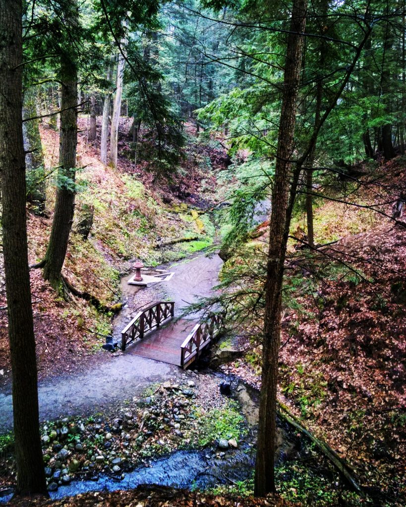
Skidmore College, a small private liberal arts school, is just a mile north of downtown Saratoga and maintains 150 acres of ecologically interesting woods. The North Woods are home to unique flora and fauna, and the school offers over 30 college courses related to them.
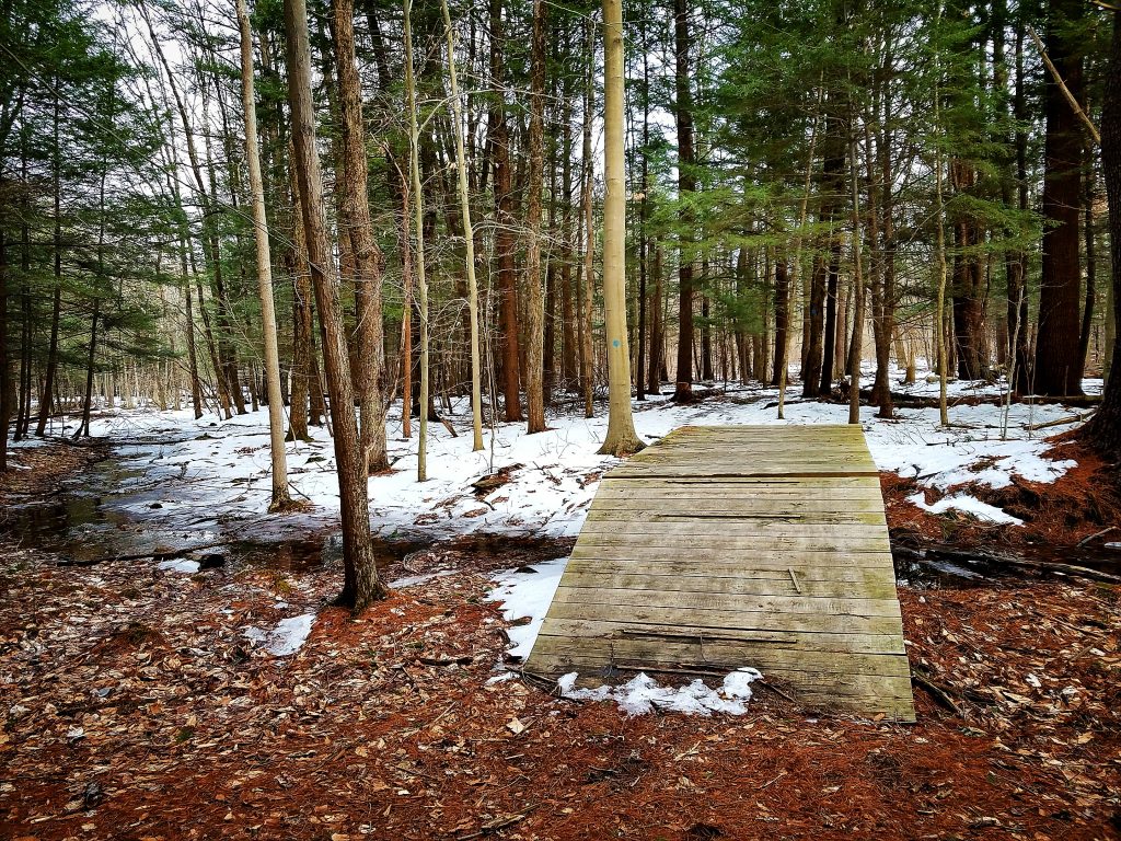
For trail running, red, blue, or orange markers indicate primary routes and a handful of connector trails. Thanks to the North Woods’ steward program, these are well-marked and maintained, although some can be quite rocky and root covered. In recent years, boardwalks have also been installed over chronically wet areas. As you move along, you’ll find a few moderate-to-steep hills that really get your heart pumping, and a small stream provides an attractive area to cool off.
If you’re looking to get into more challenging trail running, this is a good place to start. Compared to the State Park, the terrain here is more technical. But, the trails are wide and relatively short and feature stretches of easier ground and boardwalks.
5. Woods Hollow Nature Preserve
~3 miles of trails over 130 acres
Terrain: Flat to rolling; a few moderate-to-steep inclines
Surface: Dirt
Recommended Run: All of the trails! Get close to the lake on the red trail or overlook it from higher ground on a yellow trail.
Trailhead Parking: Off Northline Road, and various small, pull-off areas are along Rowland Street
Woods Hollow Nature Preserve is a wonderful hidden gem. Although it’s well trafficked, most likely haven’t heard of it.
Once you’re here, you’ll find wide, well-maintained primary trails based on old logging roads and narrower, more technical secondary loops. Out of both possibilities, the latter provides beginners and more advanced trail runners with appropriate ground.
As you go farther, you’ll come across a small, picturesque lake in the heart of the preserve that is a popular summertime fishing spot. Additionally adding to the diverse landscape are a smaller pond, meadows, lupine fields, a sand pit, wetlands, and new- and old-growth pines.
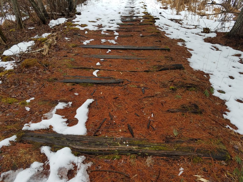
6. Bog Meadow Brook Nature Trail
2 miles, end to end
Terrain: Flat
Surface: Dirt, old wooden railroad ties, boardwalk
Trailhead Parking: Route 29 (Lake Avenue) to access from the north, or Meadowbrook Road to access from the south
The Bog Meadow Brook Nature Trail is a straightforward, two-mile route that runs along an abandoned railroad line. Given its linear design and long line of sight, the trail is easy to follow and offers many opportunities to take in the natural surroundings and let your mind wander.
The route includes just one intersection, a clearly labeled spur that climbs 0.2 miles steeply up to an adjacent residential neighborhood. As the trail traverses three distinct wetland systems, there’s much to observe, including an abundance of wild and plant life. To do so, various benches, interpretive signage, and handful of viewing platforms let you sit back and watch.
Related Posts


