


The Skyline Trail’s techy ascents and descents will test every runner’s mettle and make it the best trail run in Greater Boston.
Located just outside Boston, the Blue Hills Skyline Trail takes runners on a nine-mile traverse across the heart of the Blue Hills Reservation and offers metropolitan New Englanders a classic trail run. With approximately 2,000 feet of elevation gain and some of the region’s most technical up-and-down terrain, it’s a great test piece that’s well worth checking out.
Quick Facts
Distance: 2-ish hours
Time to Complete: Half-day
Difficulty: ★★★
Scenery: ★★★
Fees/Permits: None
Contact: Massachusetts Department of Conservation & Recreation
Turn by Turn
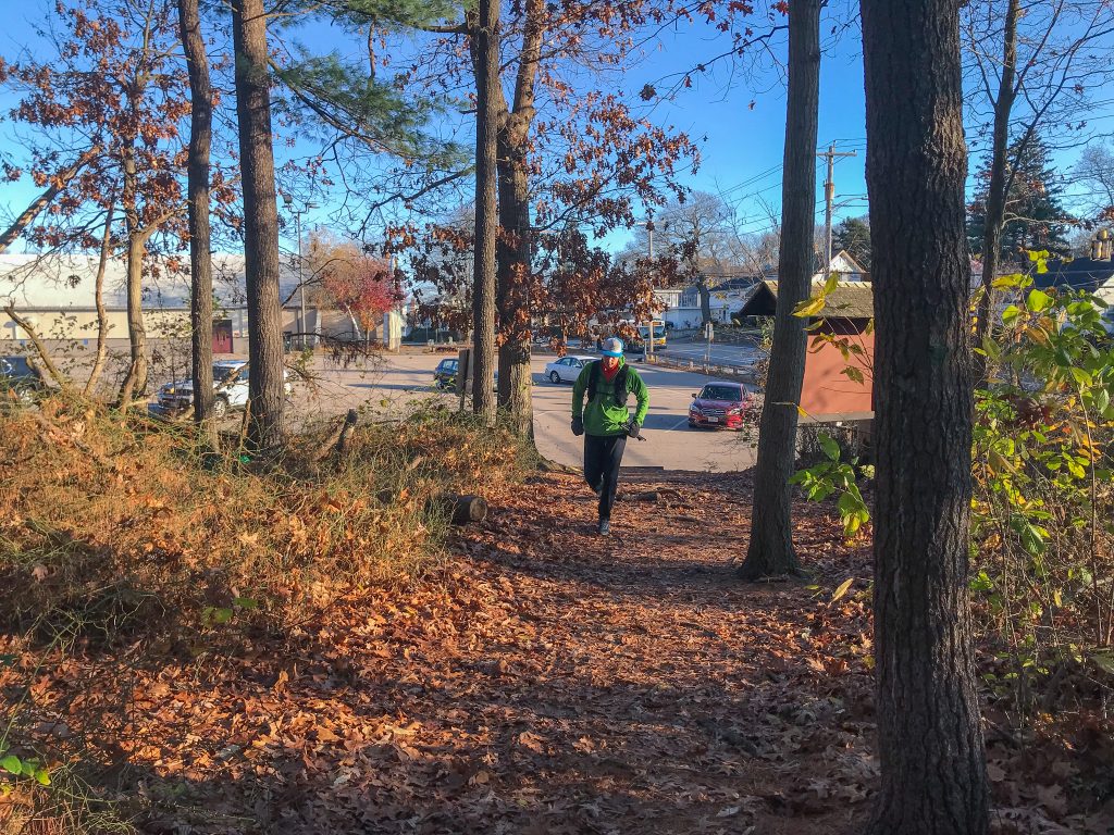
If you’re running the full traverse for the first time, it’s best to begin from the parking lot at Shea Rink in Quincy. From that trailhead, it’s easy to follow the Skyline’s rectangular blue blazes as it traverses east-to-west across the Blue Hills Reservation to an end-point near Royall Street in Canton. For those doing a one-way traverse, there is ample parking at the end of Royall Street as well as in the office park across the street.
Road crossings segment the Skyline into six distinct sections, letting you break it up into bite-sized chunks.
The Opening Salvo
The first section—between Shea Rink and Wampatuck Road—is so short that it barely warrants mention. Consider this mostly flat single and double track your warmup. After just a few minutes, you’ll breeze by St. Moritz Pond and be preparing to cross Wampatuck Road.
The second section begins as the Skyline makes a sharp, well-marked southwest turn just after the road crossing. From there, the trail climbs gradually on rocky but runnable terrain, weaving past an old quarry before ascending steeply up a sub-peak of Rattlesnake Hill. Here there’s an outstanding view of the route ahead as well as the Wampatuck, Nahanton, Fennon, and Chickatawbut Hills. The trail then quickly descends over some technical terrain (the trail is easier on runner’s right) before ascending up and over Wampatuck Hill to Chickatawbut Road.
The Crux
The next three sections put the meat on the Skyline’s bones.
To Chickatawbut Hill
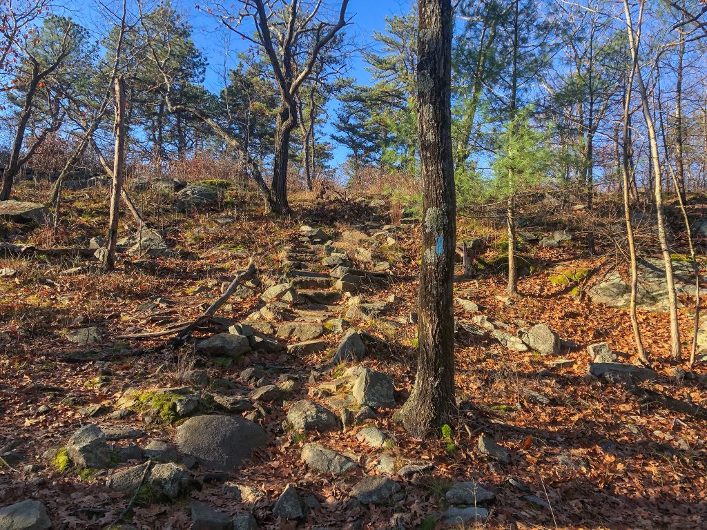
The first section traverses Nahanton, Kitchamkin, Fenno, and Chickatawbut Hills. Up to Chickatawbut Hill, a current Mass Audubon facility and former Nike missile facility, the trail is techy, with numerous short ups and downs. Throughout, you’ll almost immediately give back and then re-earn all that hard-won elevation.
After Chickatawbut Hill, the Skyline begins a lengthy descent to the Route 28 road crossing. On the way, there are several slabby sections that require careful route-finding. For easier options, look for herd paths in the woods on runner’s right. Eventually, the trail levels out, with a few minutes of flat running to the Skyline’s intersection with Route 28.
Ascending to the Best View
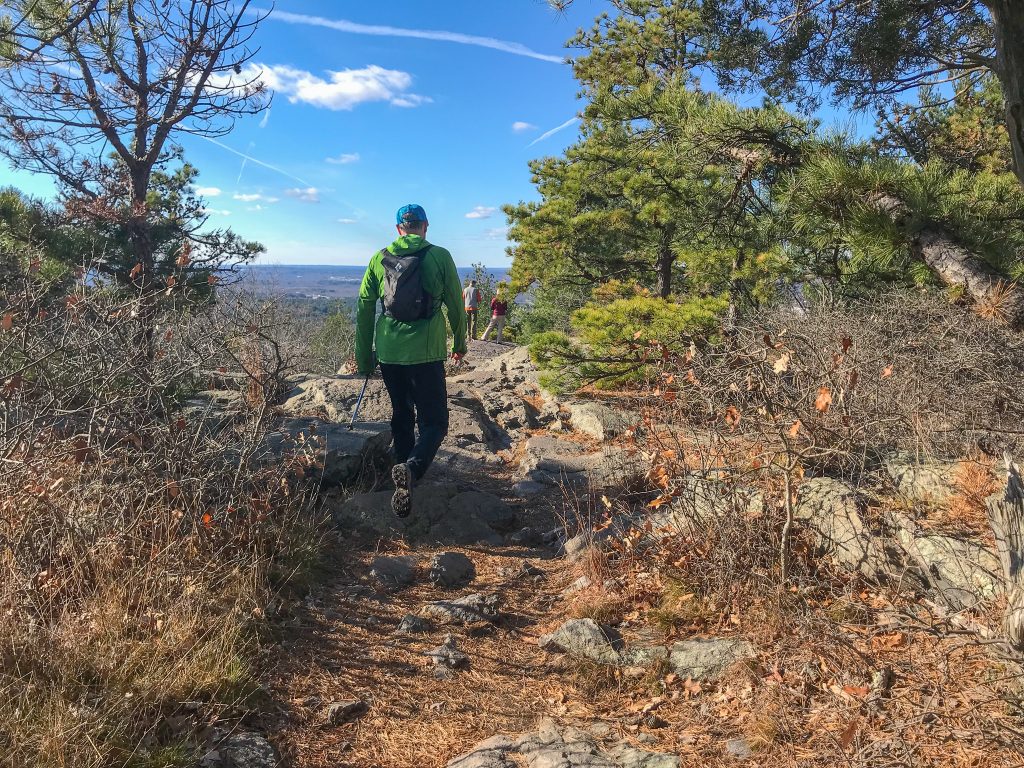
When traffic is busy, crossing Route 28 is tricky. Once across, runners encounter one of the Skyline’s steepest climbs: the ascent up Buck Hill. But the ascent is well worth it. Take time to pause on the open summit to appreciate the fantastic 360-degree view. In particular, the perspective of Boston Harbor and the city skyline is spectacular. On clear days, you can see the mountains of the Wapack Range in the distance to the northwest.
Once you’ve had your fill, run off Buck Hill, across North Boyce Hill, and up the steep Tucker Hill. This ascent marks the last hill in this section. From here, the trail descends (steeply at first) to Hillside Street and Reservation Headquarters.
Reservation Headquarters has a seasonal outdoor water fountain and, during business hours, an indoor public restroom. It is the only facility on the Skyline Trail.
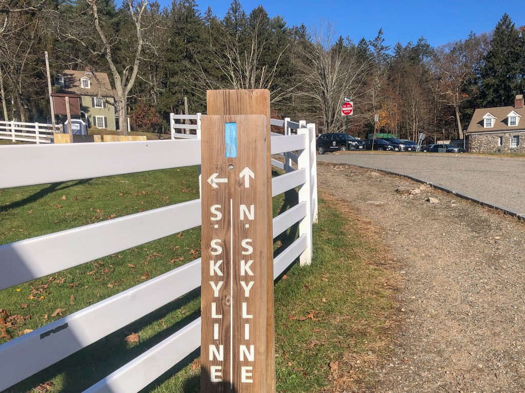
North and South Skyline
From Headquarters, the Skyline Trail temporarily splits into the North Skyline and the South Skyline, eventually rejoining near the summit of Great Blue Hill. Standing 635 feet tall, Great Blue Hill is the tallest point within 10 miles of the Atlantic Coast, south of Maine.
Of the two options, the North Skyline, with its traverse of Hancock, Hemenway, and Wolcott Hills, is a more aesthetically pleasing east-to-west route. It’s also the more technical of the two, with several short but steeper descents than you’d expect to find in Greater Boston.
Taking the North Skyline also allows you to run by the two most well-known attractions on Big Blue—the Eliot Tower and the Eliot Memorial Bridge—before the trail meets up with the South Skyline near the Blue Hill Meteorological Observatory. Both are named after Charles Eliot, the landscape architect who helped design many of Greater Boston’s parks. The Skyline then loops around the Observatory, the oldest continuously operating one in the country, before making a rocky descent to the Route 138 road crossing.
The Final Sprint
Assuming you have some energy left, the Skyline’s final section is a good place to push it and try to surpass a personal record. In no time, you’ll dispatch Little Blue Hill (this section’s only climb), cross a side street, and close in on the trail’s western terminus. And then it’s over, ending anticlimactically at an unmarked finish line near an Interstate 95 on-ramp. From here, backtrack a few minutes to a side trail on the right that will take you back to Royall Street.
The Kit for Running the Skyline Trail
Moving efficiently is de rigueur to putting in a good time on the Skyline Trail. Here are a few tips for dialing in your kit.
- The Skyline Trail is rocky! Prevent sharp rocks from poking your feet with a good pair of trail running shoes like the Salomon Speedcross 6 Trail Running Shoes (men’s/women’s).
- Tights are right on crisp fall and cold winter days on the Skyline. The EMS Trail Run Ascent Tights (men’s/women’s) are perfect for the job.
- Give yourself something to snack on as you hammer away the miles. A mix of Honey Stinger Energy Waffles and Energy Chews will help you avoid a mid-run bonk.
- The perfect size for trail runs of this distance, the Osprey Duro 6 Hydration Pack wears like a vest and will carry everything you need for the Skyline.
- Did we mention the Skyline Trail has some techy ascents and descents? A collapsible pole like the Black Diamond Distance Carbon FLZ Poles will keep you moving and balanced on the route’s many ups and downs.
Keys to Running the Skyline Trail
- If you don’t have time for the full traverse or only have one car, the Skyline Loop (3.5 miles, with 800 feet of elevation gain) is a great alternative. It starts on the North Skyline at the Reservation Headquarters on Hillside Street, traverses west across Hancock, Hemenway, and Wolcott Hills as described above, and then meets with the South Skyline on Great Blue Hill. The South Skyline brings you back east, eventually climbing Houghton Hill before dropping down to Hillside Street near Reservation Headquarters.
- While you can run the Skyline Trail in any month of the year, the rocky and slabby ascents and descents aren’t the most fun if the trails are icy.
- Running the Skyline is a great workout. Even better, it finishes near Trillium Brewing’s Taproom and Restaurant in Canton. You can’t go wrong with a wood-fired pizza paired with one of Trillium’s many award-winning brews.
- Forget a key piece of running gear at home or just want to check out the latest and greatest outdoor stuff? EMS’s conveniently located Canton store has you covered.
Related Posts


