It was supposed to be simple, a warm-up for the real climbing. But, one small navigational error, mixed with some consistently bad decision making, turned our supposedly easy journey into an epic that would be impossible to forget.
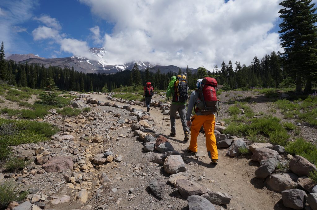
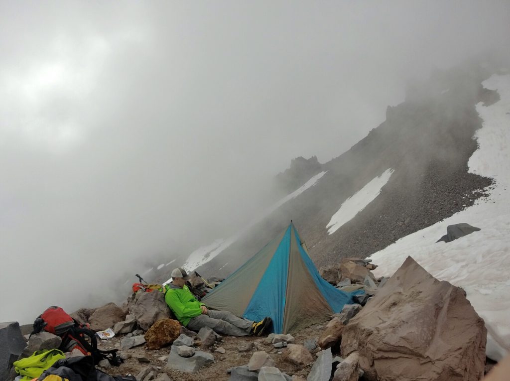
Two long-time friends, my wife, and I had hiked from Mount Shasta’s Bunny Flat trailhead to Lake Helen, where we set up camp, cooked dinner, and went to bed early in preparation for an alpine start and summit attempt. The following morning, the alarm came quickly, at a time most would consider more night than day. We slowly crawled from our sleeping bags and began to layer up, fill water bottles, and pack our bags for the big day. Our plan was to summit, return to camp, pack it up, and head back to the car at Bunny Flat. Over the course of the day, we would climb almost 4,000 feet and descend more than 7,000, all at an altitude unfamiliar to us four East Coasters.
The alarm came quickly, at a time most would consider more night than day.
We left Lake Helen around 1 a.m. and moved up Shasta’s icy, steep slope toward the day’s crux: the Red Banks. Passing through the Red Banks was our chosen route’s one real challenge, and climbers have two options: Attempt the steep-ish chimney that runs through the Red Banks, or hike around them. We had elected the former option. Roped up as a team of four, we made consistent upward progress through the early morning darkness, frequently stopping to check the GPS to ensure we were heading the right way. Here, however, is where we made our first mistake.
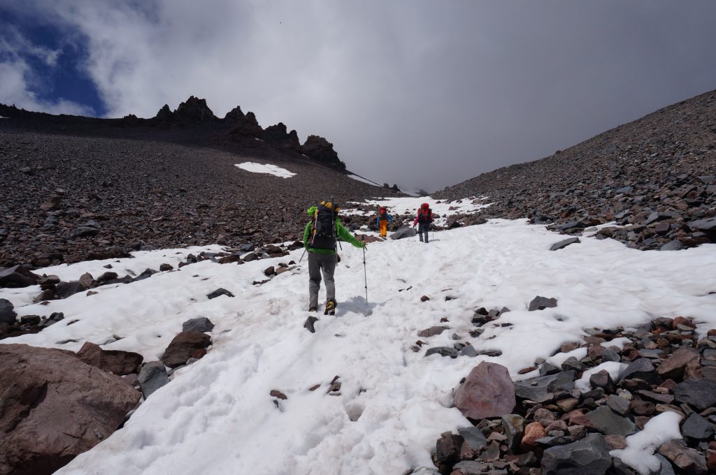
Two of us had previously climbed Mount Shasta’s Avalanche Gulch route, and despite what the GPS said, we both felt like we were being pulled too far right, away from the chimney and toward the end of the Red Banks. Arriving at a cliff band with the sun beginning to rise, we realized our mistake. In fact, we trended too far to the left, missed the chimney, and were facing three options: One, traverse the icy slope, locate the chimney, and continue up the mountain, taking a time and effort penalty for our navigational misstep; two, descend back to camp, cut our losses, and begin preparing for the climbs on Shasta’s north side, the real reason we came here; or, three, just go up!
The only way out was up.
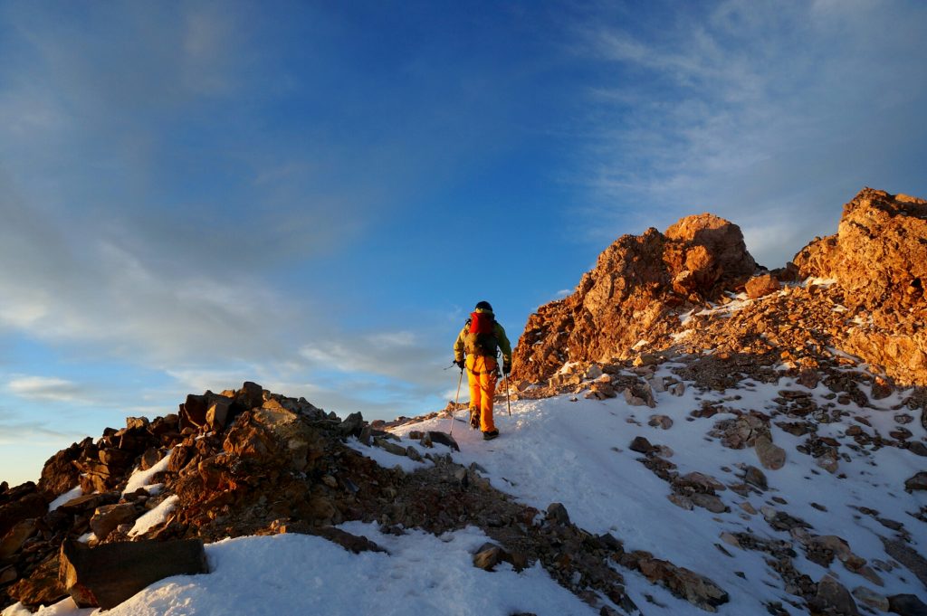
Going up sounded good. In theory, we could avoid any time lost from our mistake. After all, the climbing didn’t look that hard, and we would surely intersect with the Avalanche Gulch route farther up the mountain. But, whether blinded by ambition, overconfident, or just tired from traveling and the early start, this turned into our second mistake. Because of the route’s technical nature, we were no longer moving in unison; rather, one person would climb ahead and belay the other three up, significantly slowing our ascent and leaving us to nibble away at the 14,180 ft. mountain 200 feet at a time
Of course, nothing is ever as simple as it seems. After climbing one rope length, we discovered the cliff was bigger than we initially judged, leading to another rope length of technical climbing. After that, we ascended a steep snowfield, which brought us to a steep scree field, which further led us to another steep snowfield, all with bits of semi-technical climbing on crumbling volcanic rock (Type 2 Fun on its own) mixed in. At no time did we see or run into the Avalanche Gulch. It dawned on us pretty soon that we had climbed onto Casaval Ridge, one of the mountain’s more aesthetic lines and a far more challenging route.
The good news was that we knew where we were and knew that if we continued climbing, we would, in fact, intersect with Avalanche Gulch eventually. The bad news was that the climbing was slow, we had only packed food and water for a quick summit attempt, we’d been on the go for a long time, nerves were getting frayed, and there was no turning around. From our location, reversing our route would be much more challenging and time consuming. The only way out was up.
The early morning’s psych had worn off, and no one was having fun anymore. When we stopped to belay, there was nothing but silence, as everyone was locked into their personal bubbles of suffering and anxiety. Each time we reached the top of a snowfield or cliff band, there was a moment of anticipation, with everyone hoping that we’d finally get to familiar territory, but it was followed by disappointment when we realized we had yet another obstacle to overcome.
We’d been on the move for almost twelve hours when we encountered the crux of Casaval Ridge, The Catwalk. As the name implies, The Catwalk is a narrow section of rock and snow measuring between one- to two-feet wide, with a bulging wall of loose rock on your left and the abyss on your right. While not technically challenging, it is a heady bit of climbing, with dire consequences if you make a mistake, and not exactly the place you would want to be if your original plan had you cracking beers in the parking lot by now.
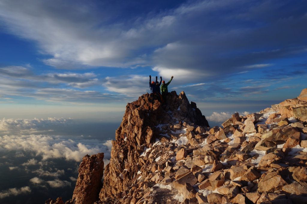
Never have people been so happy to see a place called Misery Hill.
Reluctantly, we climbed The Catwalk—what other choice did we have? It was also here where the day assuredly became Type 2 Fun, as a few tears were already shed. Luckily, after The Catwalk, the terrain became easier, and we could now clearly see Misery Hill, the place where Casaval Ridge and Avalanche Gulch join. Looking back, never have people been so happy to see a place called Misery Hill.
Below Misery Hill and off Casaval Ridge, we sat in the afternoon sun while nibbling on our remaining food and sipping the last of our water. With the summit in sight, two of us made a push for the top, but our hearts were no longer in it. A couple hundred feet shy of the summit, we turned around, picked up the other two, who were sulking at the base of Misery Hill, and descended Avalanche Gulch toward our camp at Lake Helen. There, we ate, drank, and packed up before hiking back to the car and the promise of hot meals, cold beers, and comfy beds in town.
After a day of relaxing, we went back and climbed Mount Shasta via Avalanche Gulch efficiently and without incident, summiting in the early morning with the peak to ourselves. But, we never did make it to Shasta’s north side. Over the course of our two trips, we only summited once, but got to experience two types of fun. I guess we should consider ourselves lucky we didn’t experience the third.
Related Posts