

Since 1957, the Appalachian Mountain Club (AMC) has encouraged hikers to visit all the summits over 4,000 feet in New Hampshire. The club maintains a list of the 48 peaks that meet its exacting criteria: the peak must be over 4,000 feet tall and rise 200 feet above any ridge connecting it to a higher neighboring summit. But those focused solely on summiting the 48 listed peaks have probably overlooked a handful of beautiful 4,000-footers, just because they lack sufficient prominence to be considered independent 4,000-footers and thus aren’t on the AMC’s list. Read on for a few off-list 4,000-footers that should be on your list this summer.
READ MORE: 10 Tips to Tackle the New Hampshire 48
South Peak
Located approximately a mile from the summit of Mount Moosilauke, the highest peak in the western Whites is the 4,523-foot summit of South Peak. Easily ticked by hikers as they traverse the ridge line toward Mount Moosilauke’s summit, it is accessed by a short spur trail near the junction of the Glencliff Trail and the Carriage Road.
Those making the 0.2-mile jaunt will be amply rewarded, as South Peak’s summit delivers a spectacular 270-degree view not all that different from the one found on Moosilauke’s summit. In fact, sit back, take in the quiet, and enjoy roughly the same view, along with a stellar perspective of Mount Moosilauke and the people crowding its summit.
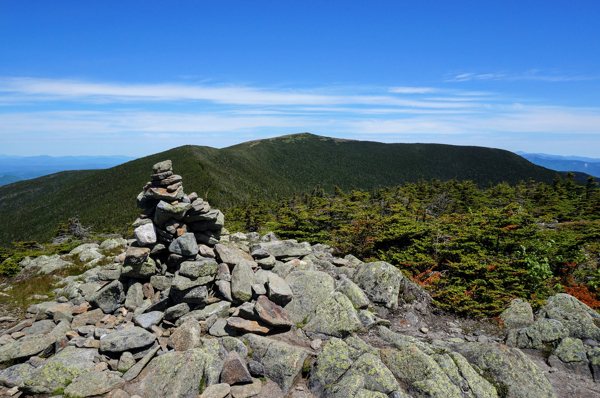
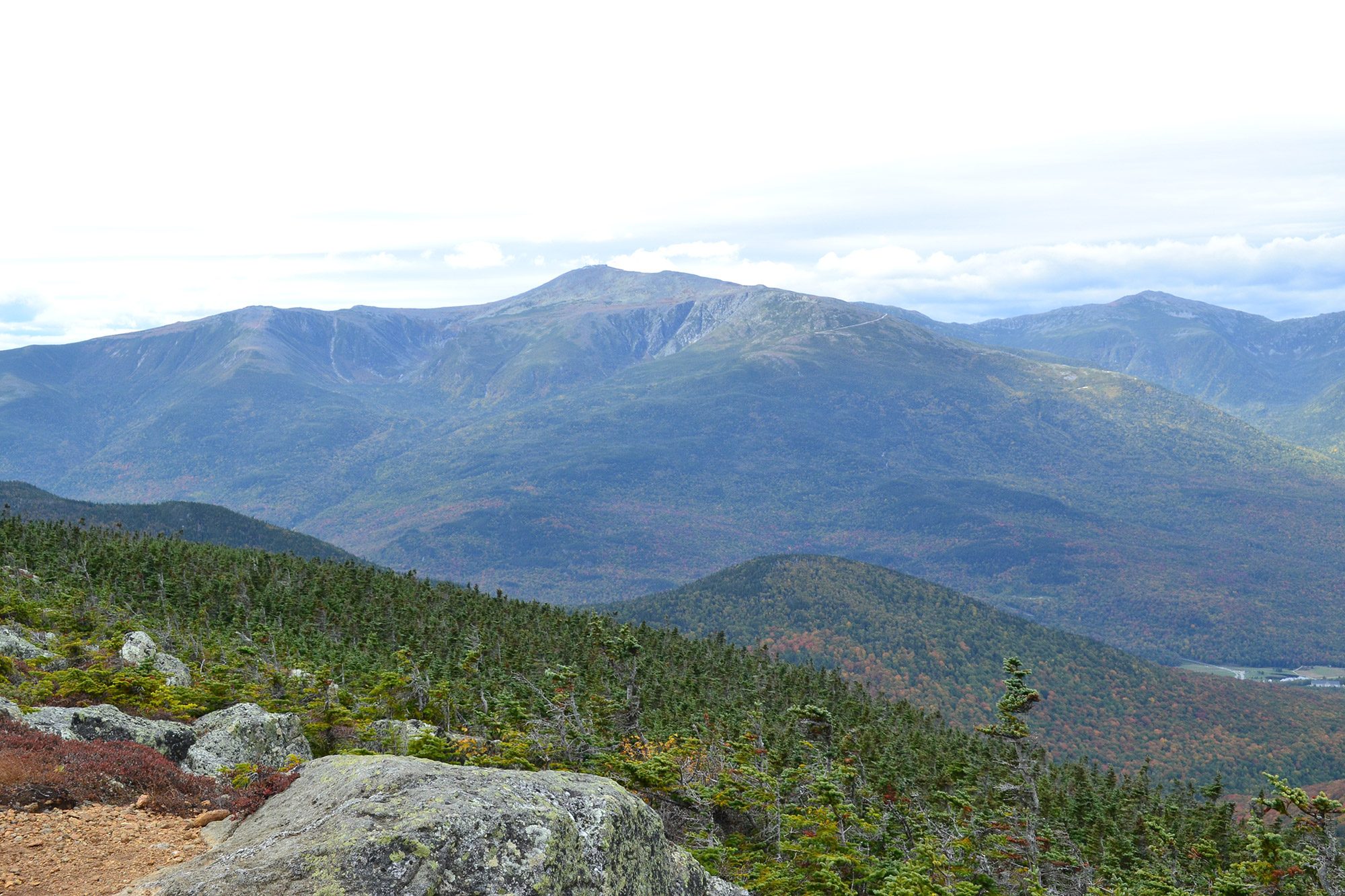
Little Haystack Mountain
Sandwiched between 4,459-foot Mount Liberty and 5,089-foot Mount Lafayette is 4,760-foot Haystack Mountain—or simply Little Haystack—the only 4,000-footer on the iconic Franconia Ridge that doesn’t count toward the NH48. The most straightforward way to Little Haystack’s summit is via the 3-mile Falling Waters trail, which leaves from the Lafayette Campground parking lot on the north side of Route 93.
Little Haystack is often climbed by hikers as part of a Franconia Ridge Traverse, but is a worthy objective in its own right. Located near the middle of Franconia Ridge, the summit affords a fantastic perspective of Liberty to the south and Lincoln and Lafayette to the North. To the west is the imposing rock face of Cannon Mountain and the Kinsmans while the Bonds are to the east with Mount Washington and the Presidentials on the horizon behind them.
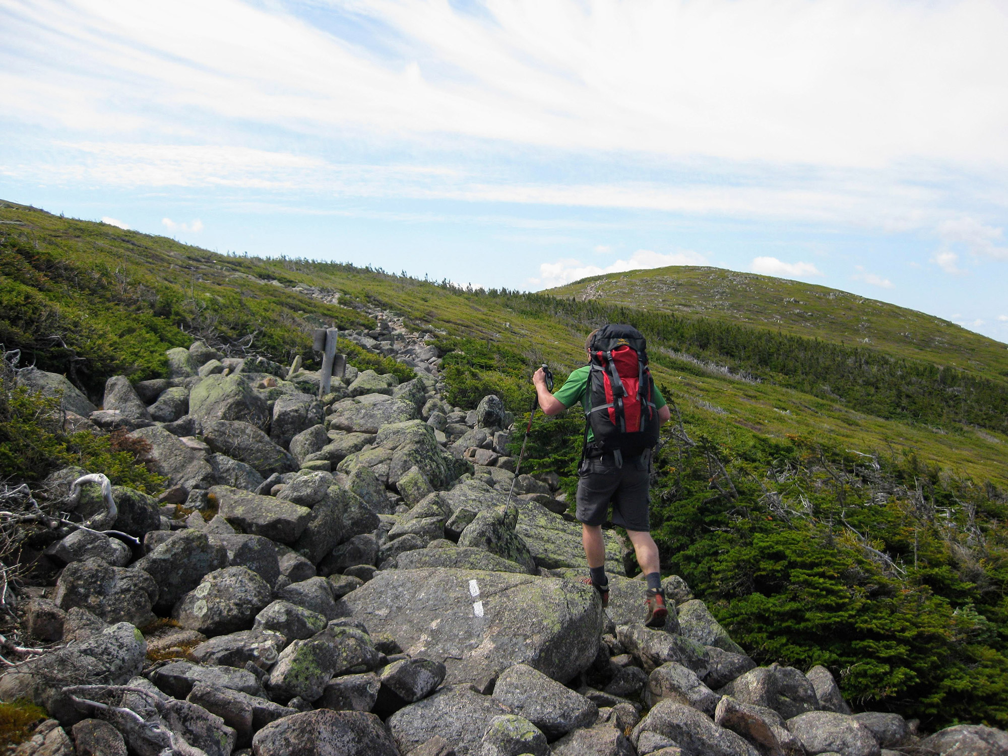
Mount Guyot
With the Twins to the north, the Bonds to the south, and Zealand to the east, the 4,580-foot Mount Guyot is surrounded by 4,000-footers. Despite being near so many peakbagger-provoking summits, Mount Guyot is one of the more difficult-to-access, non-counting 4,000-footers and is commonly summitted by hikers as part of longer trips that hit other peaks on the NH48, such as a Bond Traverse or Pemi Loop. In fact, it’s difficult to climb Guyot without summiting at least one 4,000-footer that counts toward the AMC’s list. The easiest route to Guyot’s summit is up and over Zealand Mountain—leaving the trailhead off of Zealand Road, hikers will follow the Zealand Trail for 2.5 miles before joining the Twinway for roughly 3 miles to the summit of Zealand Mountain, from there continuing another 1.3 miles to the summit of Mount Guyot.
Although Mount Guyot requires a lot of effort for a peak that doesn’t count on your list (for now, anyway), the effort is worth it and the seclusion and sights found there make it one of the best summits (it’s actually two bald domes separated by about a tenth of a mile—the southern dome boasts a cairn, but summit them both) in the White Mountains. Surrounded by stone and Krumholz on the summit, hikers are afforded a fantastic view of Franconia Ridge to the west, the Presidentials to the east, and the Bonds and the eastern portion of the Pemigewasset Wilderness sprawled in front of you. Go ahead and look for a sign of civilization—no roads or huts are visible from Guyot’s bald summit.
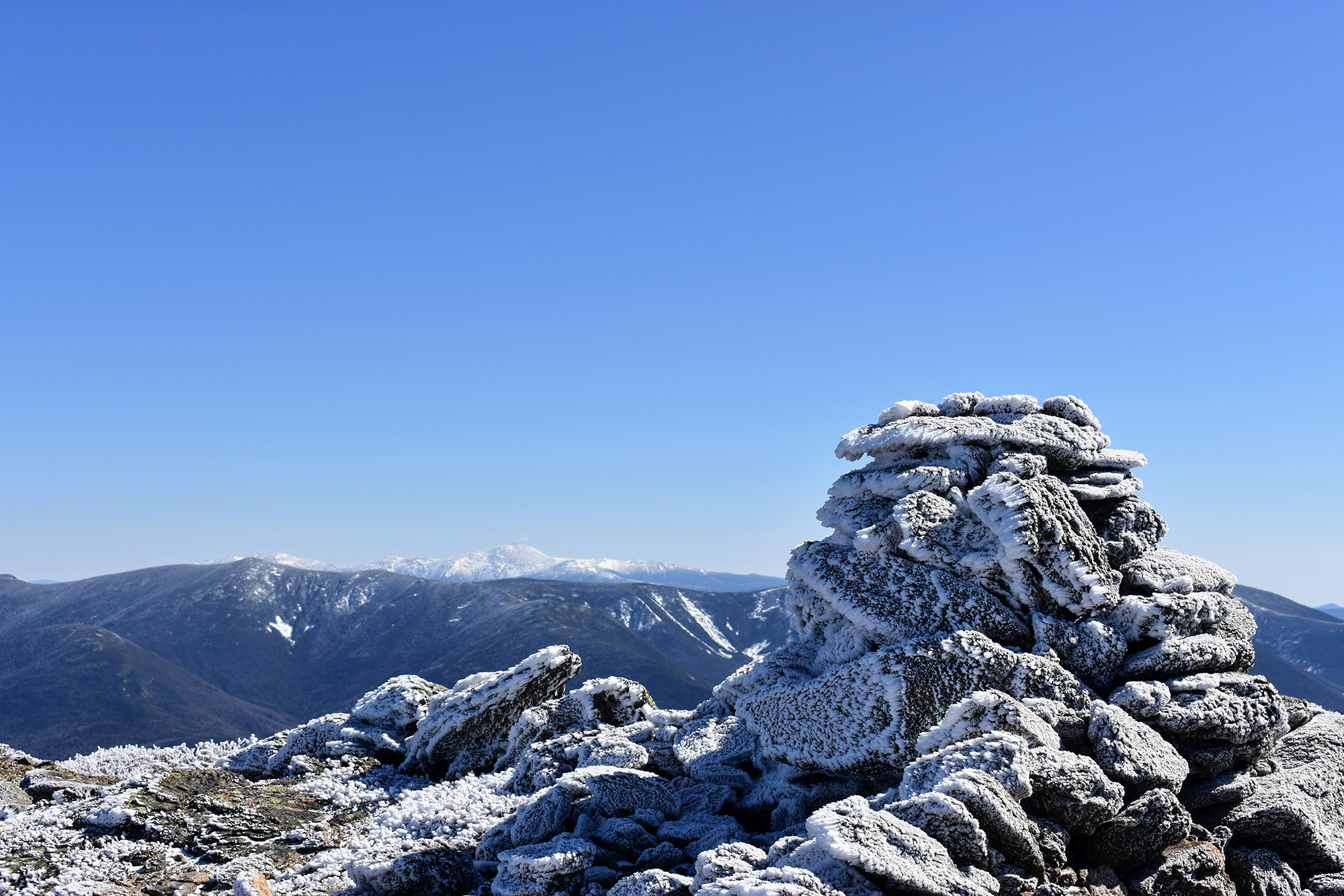
Mount Clay
Nestled in the Northern Presidentials between 5,712-foot Mount Jefferson and 6,288-foot Mount Washington is 5,533-foot Mount Clay. Like many of the other peaks on this list, Mount Clay is often an afterthought of hikers in the midst of more ambitious pursuits like a Presidential Traverse—although they will have to make a slight diversion which adds about a one-third of a mile onto the Mount Clay Loop. To hike Mount Clay directly, hikers leave on the Jewell Trail (the last trail discussed here) across the street from the Ammonoosuc Ravine Parking lot and follow it for 3.7 miles to the Mount Clay Loop which, after a little more than a half-mile, brings you to the summit of Mount Clay.
Above treeline and in the middle of one of the most rugged and beautiful sections of the White Mountains, the views from Mount Clay can be counted among the most spectacular in the Whites—presenting an awesome vantage point for viewing the Northern Presidentials, Mount Washington, and the Cog Railway. Watch your step and enjoy the peek into the Great Gulf (the largest glacial cirque in the White Mountains), which falls precipitously away from Clay’s summit.
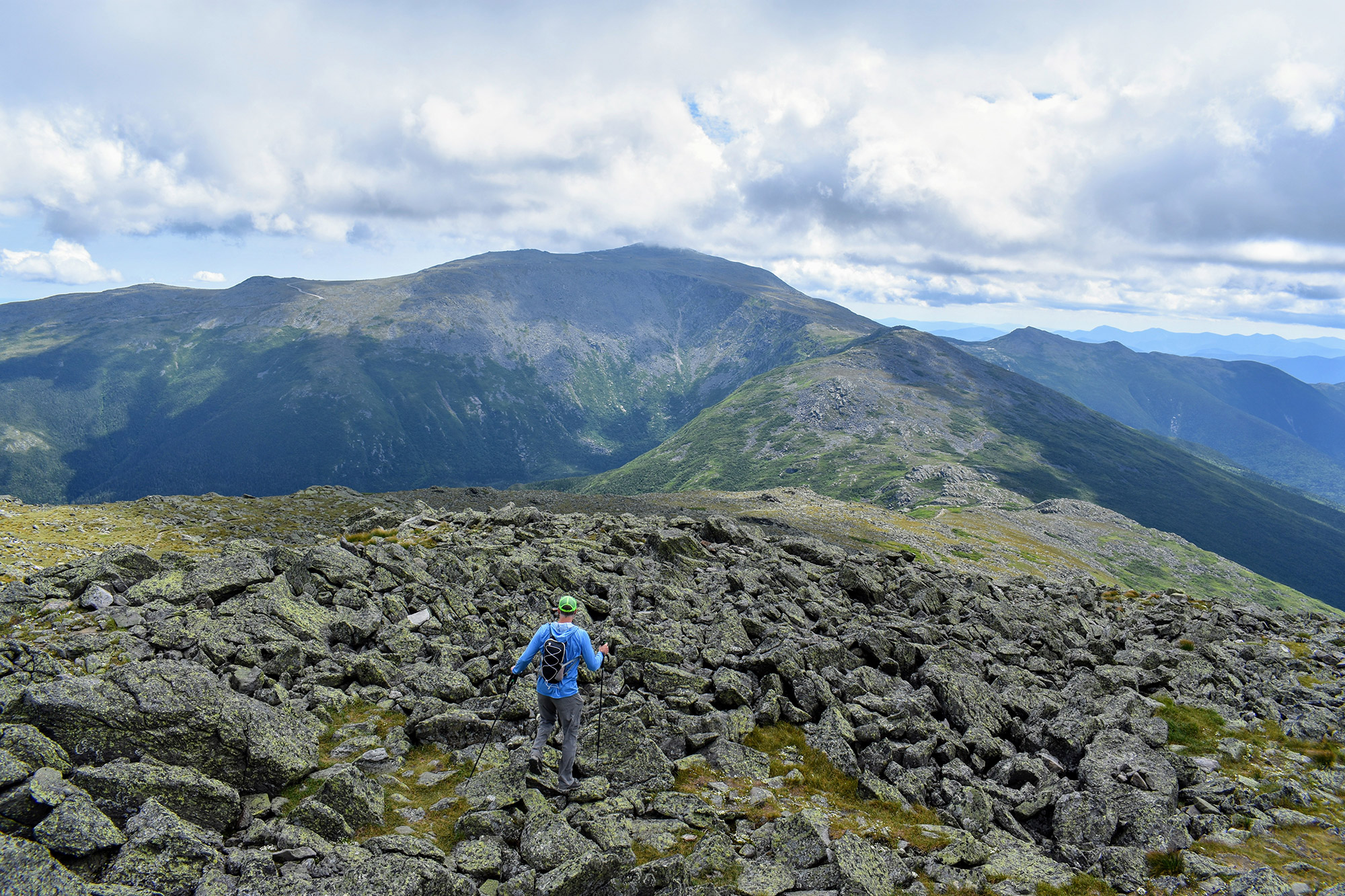
Mount Hight
Home to some of the best views in the Whites, the 4,675-foot summit of Mount Hight should be on every peakbagger’s list. Just a short detour away from the summit of Carter Dome, the alpine zone atop Hight offers fantastic 360-degree views of the Presidentials (including all the major ravines on Washington’s east side), the Carter Range, and the Wild River Wilderness. Whether you’re doing a day hike in the Carters or doing a full range traverse, don’t miss this awesome subpeak.
The easiest way to get to Mount Hight is to climb Carter Dome via the Nineteen Mile Brook and Carter Dome Trails. From the summit, backtrack down the Carter Dome Trail until the Appalachian Trail and its white rectangular blazes bear off right. Follow the AT for a short distance until it opens up to a beautiful alpine zone. While we recommend hanging out as long as possible in this awesome spot, when it’s time to go, continue north on the AT until it re-intersects with the Carter Dome Trail. Round trip, the hike clocks in at just over 10 miles.
Know of another spectacular sub-peak in the Whites that should be on every hikers’ list this summer? Tell us in the comments.
Related Posts


