


Steep, short, and scenic—a hike to Mount Greylock’s summit via the Thunderbolt Trail is the most direct way to the highest point in Massachusetts.
Hiking to the summit of Mount Greylock via the Thunderbolt Trail takes you through some of the East Coast’s most hallowed ski terrain and across the rugged Appalachian Trail, and is the steepest and shortest route to the highest point in Massachusetts.
Quick Facts
Distance: 4.8 miles, out-and-back
Time to Complete: Half day for most
Difficulty: ★★
Scenery:★★★★
Fees/Permits: None.
Contact: https://www.mass.gov/locations/mount-greylock-state-reservation
Turn-By-Turn
To access the Thunderbolt trailhead, hikers can park in nearly adjacent lots on Thiel Road and Gould Road in Adams, Massachusetts. To get there from North Adams, the major jumping-off point for anybody heading to Greylock, take Route 8 south for about two miles, and then, make a right onto Friend Street at a rotary. After a mile, Friend Street merges into Notch Road. About 0.5 miles later, turn right onto Gould Street, and then, either continue straight for side-of-the-road parking on Thiel Road or make a quick left into the signed hiker parking lot on Gould Road.
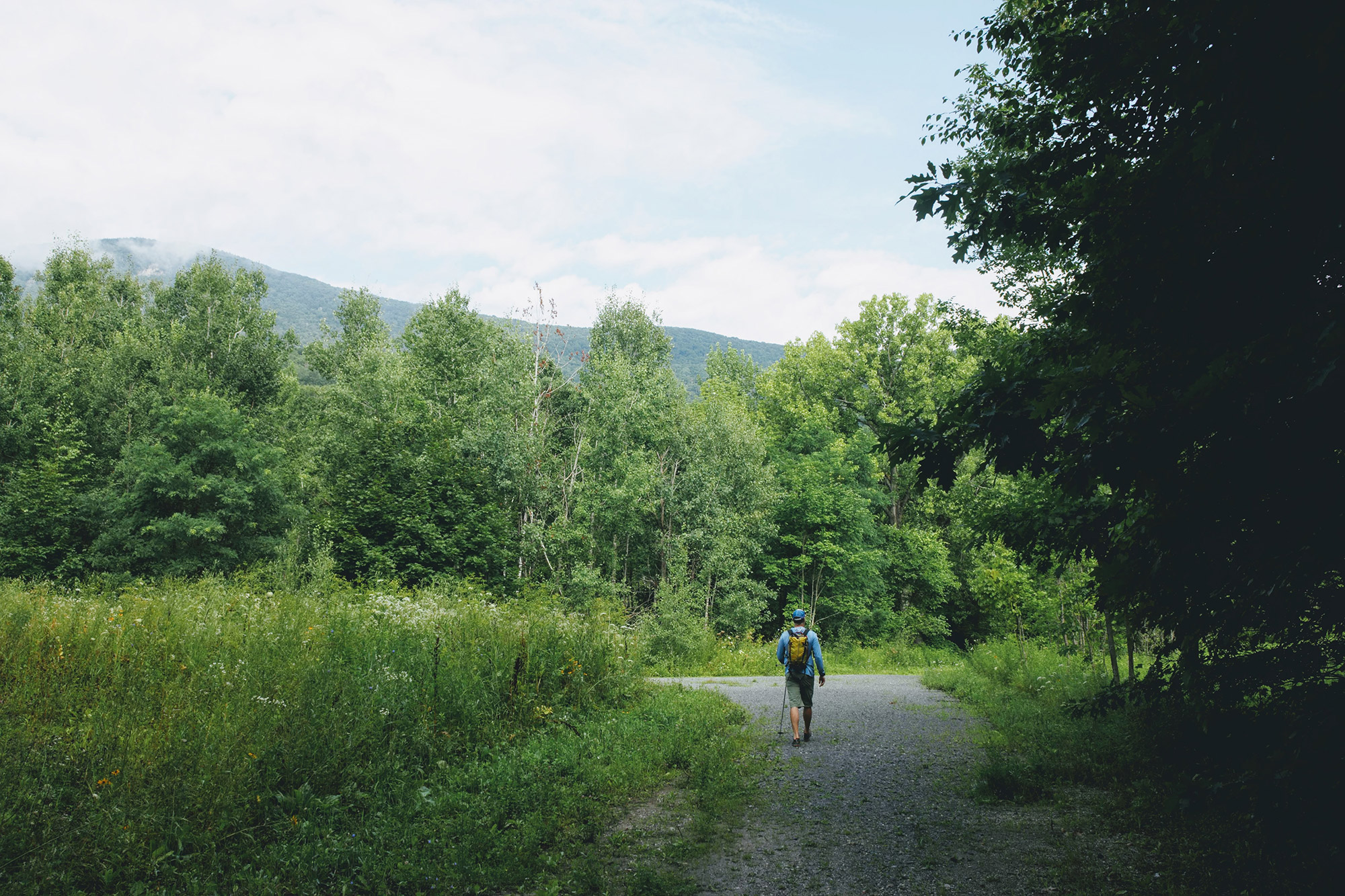
Into the Woods
From either lot, finding the right trail is tricky. There’s a maze of intersecting trails in and around the parking lots, and the way to Thunderbolt is not always clearly marked.
For the easiest route, hike for roughly 10 minutes up the closed (to vehicles) section of Thiel Road, first on pavement and then on a gravel path, until you come to a sign (42.627598, -73.137497) directing hikers to Thunderbolt.
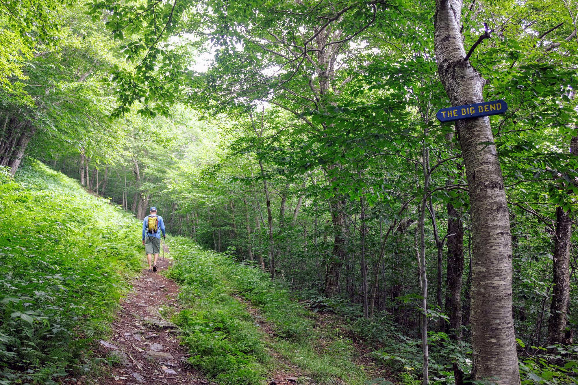
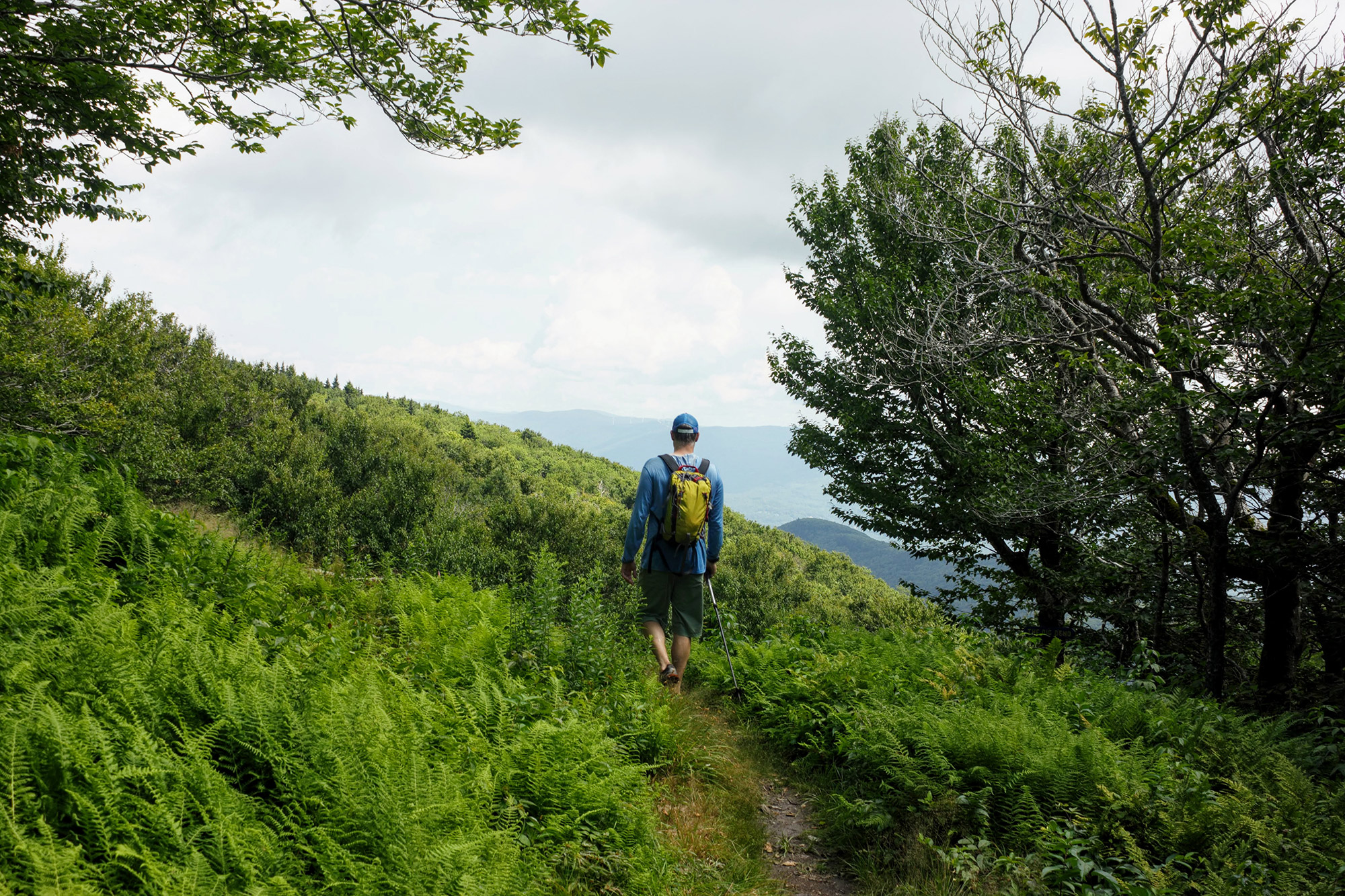
From the sign, navigation is still a bit strenuous, with the narrow trail winding through thick woods and dense ferns. Enjoy this short section, as it easily picks up elevation. You’ll soon approach the ski trail proper, (42.636150, -73.137497) where the trail opens up and the grade intensifies.
The Ski Trail
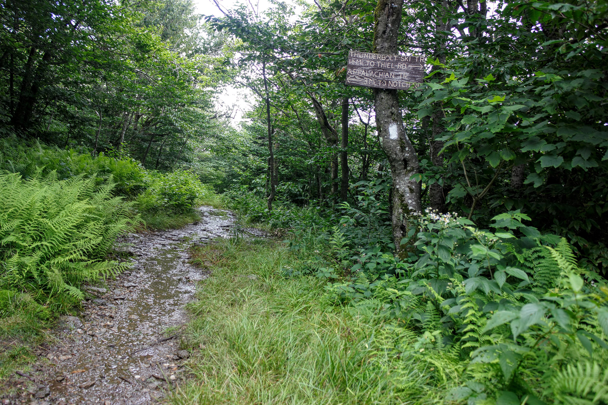
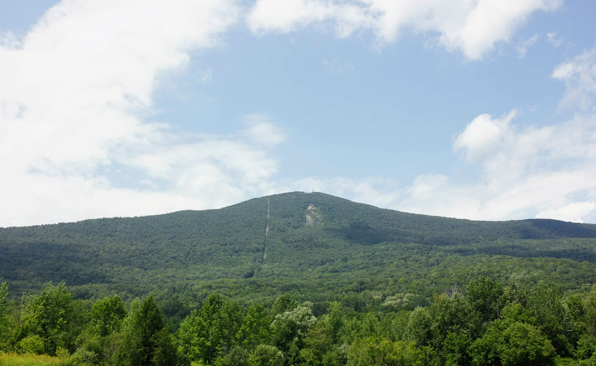
The Thunderbolt foot trail ascends along the side of the Thunderbolt Ski Trail, and it’s easy to know when you’ve reached its base. Here, the dense forest immediately transitions into a wide, open swath of green running straight up the mountain. The Thunderbolt Ski Trail climbs consistently, with few interruptions—among them, the juncture with the Bellows Pipe Trail (42.637295, -73.154152) and the intersection with the Appalachian Trail (42.642410, -73.161797).
That said, the footing is good, the path is easy to follow, and there are a good number of rest spots where the trail briefly levels out. When you need to catch your breath, make sure to turn around and enjoy the view back east, with Adams in the foreground and the Hoosac Range on the horizon.
Pro Tip: Although lots of trails intersect with the Thunderbolt trail and many of the junctions aren’t signed, knowing that you should be hugging the ski trail makes it harder to get off route.
Joining the AT
After one final steep section, Thunderbolt levels out briefly before intersecting with the Appalachian Trail. Before ascending to the junction, make sure to pause to appreciate the spectacular view to the northeast. You’ll know you’re there when you see the first aid cache in the woods to climber’s right.
At the junction, follow the Appalachian Trail’s white blazes south another half-mile to the summit. The going is easy and relaxed, with only a slight incline. After a few minutes, hikers will cross the auto road, and then, spill into one of Greylock’s tourist parking lots.
Upon entering the lot, look to the right for the Thunderbolt shelter (42.638737, -73.0145218), an impressive stone warming hut built by members of the Civilian Conservation Corps (CCC) in 1934. Originally intended as a place for ski racers to warm up and prepare for their run—remember, back then, racers had to get to the top of the run via their own power—the hut is dedicated to Rudolph Konieczny, a soldier killed in action while fighting with the 10th Mountain Division’s ski troop in northern Italy in 1945. Although, today, the shelter is primarily a tourist attraction and an emergency shelter for winter travelers, it is one of the summit’s several somber memorials.
The Summit
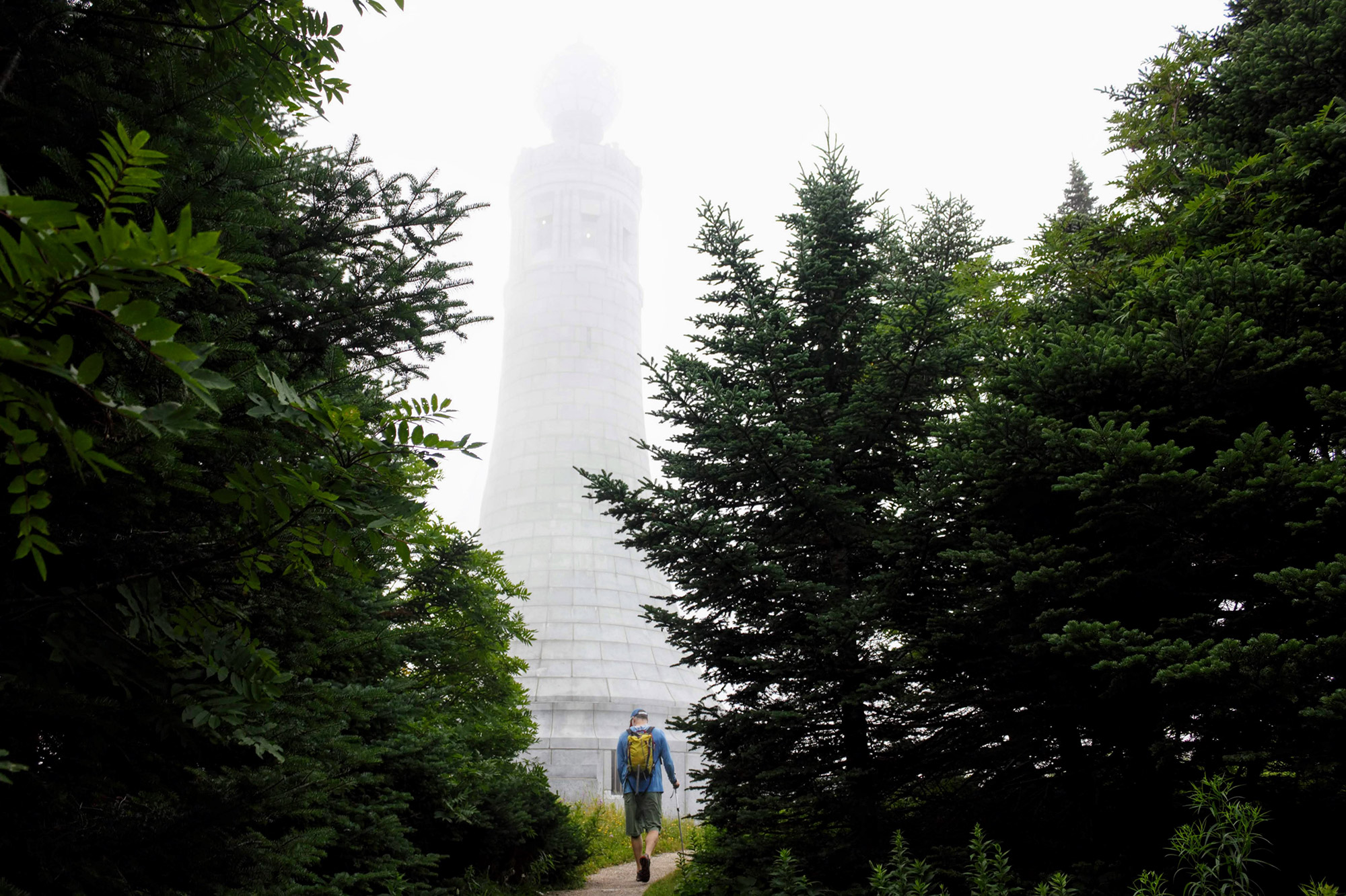
From the hut, the actual summit is only a short jaunt away. Simply rejoin the Appalachian Trail and follow the gravel, and then paved, path a bit farther south. Pretty soon, you’ll be on the summit proper (42.636898, -73.165527), which, in 1898, became the centerpiece of the first state park in Massachusetts.
As you approach the summit, Greylock’s 93-foot granite memorial to the Commonwealth’s war veterans—built by the CCC in the 1930s—looms overhead. If it’s open, make sure to go in to pay your respects. Then, climb the tower’s spiral staircase to a viewing observatory, which offers 360-degree views of the region. To the north, look for North Adams in the foreground and New York’s Adirondacks and Vermont’s Green Mountains in the distance. Looking east, mountains and hills are everywhere; try to pick out Mount Monadnock in southern New Hampshire. Turning south and west, you’ll see the Berkshires, the Catskills, and the Hudson River Valley.
There are a lot of other things to do on the summit. In addition to the Thunderbolt Ski Hut, there’s the Bascom Lodge. Perched nearly on Greylock’s summit, the lodge is another minute south on the AT. Made using local schist and red spruce, the lodge was built in the 1930s by the CCC to offer shelter to summit visitors. Today, it features a restaurant and cafe, provides seasonal accommodations, and is even available for weddings and private events. Whether you’re grabbing a meal inside or having a snack at the nearby picnic tables, the Bascom Lodge is the perfect place to linger on the summit.
Return
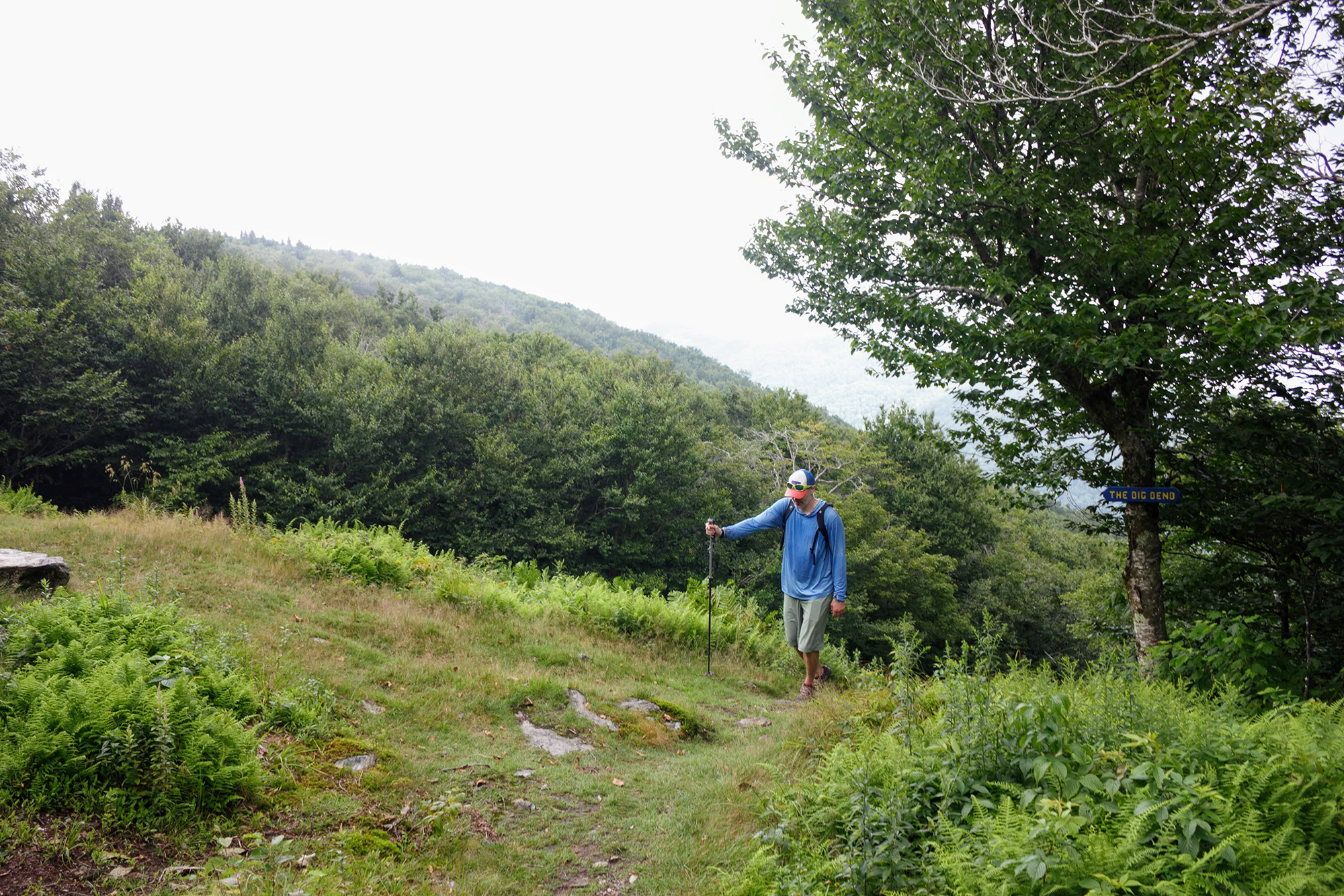
To return to your car from the summit, simply retrace your steps back down the way you came. Of course, as you pass by signs noting iconic sections of the Thunderbolt Ski Trail, such as Big Bend, Big Schuss, and The Bumps, try not to get too distracted thinking about how much more fun (and faster) it would be on skis.
If you didn’t know, the Thunderbolt Trail was originally built as a ski trail (also by the CCC) and is rich with New England ski history. For example, Dick Durrance, the 17-time national champion ski racer who won the first race held on the Thunderbolt Trail in 1935, descended in just two minutes and 48 seconds—a time that feels especially fast to hikers anxious to get back to their cars.
It’s also worth noting that, while the Thunderbolt Trail is open to hikers all year, winter hikers are encouraged to ascend where others already have to preserve the snow for skiers.
The Cheat Route
If you have someone who would like to experience Mount Greylock’s summit with you but is unable to ascend the approximately 2,200 feet of elevation over roughly 2.5 miles, have them meet you at the top. The Greylock auto road allows cars to drive to the summit from May through October. Just know there’s a small fee to park at the summit.
The Kit
- Saying the Thunderbolt Trail is steep feels like an understatement, especially considering that, at its steepest, the trail pitches to 38 degrees. Make ascending and descending a little bit easier by bringing a pair of trekking poles.
- Plan for your trip up and ensure you stay on track with the Mount Greylock Reservation Map. Mount Greylock State Reservation has over 12,000 acres and is home to roughly 50 miles of trails, so there’s plenty left to do after your successful summit.
- While the origins of the Greylock name are up for debate, one popular theory is, it refers to the mountain’s appearance. Often, it has a gray cloud—or lock of gray mist—overhead. This has certainly been our experience, so don’t forget to pack a raincoat (men’s/women’s) for the summit.
- 360-degree views and plenty of places to avoid inclement weather make for an unrushed experience on the summit. Treat yourself by bringing something warm to eat in the winter, or cool for the summer with a Hydro Flask Food Flask.
- With so many steep pitches ahead of you, having a good-fitting pair of performance socks is critical for avoiding blisters. Pick a pair made from a wicking material, such as merino wool, to keep your feet happy.
Keys to the Trip
- Before heading to the mountain, get some local knowledge at the staffed Visitors Center in Lanesborough, which is open all year.
- Spend the night at one of Mount Greylock’s 18 tent sites, or in one of the five lean-tos found on the mountain. Learn more here.
- Looking to grab a pint and absorb a little culture? Bright Ideas Brewing serves delicious brews and is located in the courtyard of the Mass Museum of Contemporary Art (Mass MoCA).
- Dogs are welcome to hike Mount Greylock’s trails, as long as they’re leashed and attended. However, if you had to leave Fido home and are missing man’s best friend, stop by the Museum of Dog (M.O.D.). Located just down the street from Mass MoCA, M.O.D. features more than 180 pieces from roughly 50 notable, dog-loving artists. Ironically, dogs are not allowed inside M.O.D.
- Visit the Thunderbolt Ski Museum in the Adams Visitor Center to learn more about the history of this storied ski run.
Current Conditions
Have you hiked Mount Greylock recently? Post your experience and the conditions (with the date of your climb) in the comments for others!
Related Posts


