

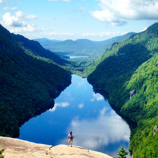
The Adirondacks see up to 10 million visitors annually. During the summer and fall, popular spots like Old Forge to the west and Lake George Village to the east become overrun with summer vacationers, and even more remote areas like Lake Placid and the surrounding High Peaks can feel mobbed by weekend warriors and day-trekkers. But, hidden down a four-mile trail that begins in the minuscule town of Saint Huberts is a hike to an overlook that offers some of the Adirondacks’ most stunning views—one that might make you believe you’ve been transported to northern Norway’s fjord country.
Getting There
The trailhead to Indian Head is actually part of the Adirondack Mountain Reserve, a tract of privately owned land on the High Peaks’ east side. The trails and signage are maintained by the Ausable Club, which owns the AMR, and they’ve posted strict rules, including no dogs, that hikers must follow. But, they otherwise allow hikers onto the land, which offers access to Indian Head and nine different High Peaks.
If you are coming up from the south, take I-87 to Exit 30 (Rt. 73) and head west toward Keene Valley and Lake Placid. Soon after Rt. 73 and Rt. 9 separate in a crazy intersection dubbed “Malfunction Junction,” look for signs to the Giant Mountain Primary Trailhead. You will see one for Roaring Brook Fall Trailhead on your right, and almost exactly across from that is Ausable Road, a narrow dirt path leading to a hikers’ parking lot just after the intersection. If you miss it, continue looking on your left, because it actually loops by the Ausable Club and spills back onto Rt. 73 further up the road.
Either way, take it to the parking lot designated for hikers only. Plan on arriving early during the summer or on holiday weekends, because the lot is small, and hikers are not permitted to park anywhere near the Ausable Club itself.
From the parking lot, walk a half mile down Ausable Road toward the clubhouse to reach Lake Road—a left turn between tennis courts. If you look back across the golf course, you’ll see the majestic Giant Mountain rising above Rt. 73.
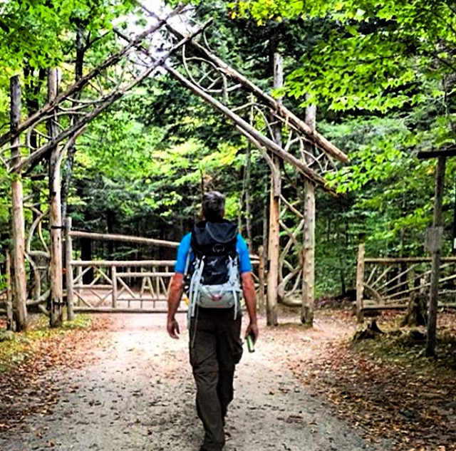
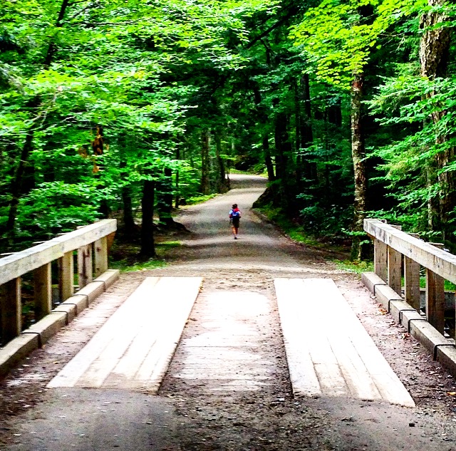
Once you turn onto the 3.3-mile Lake Road, you will see the beautiful AMR gate and the hiker registration station. After signing in, you will just walk along what everyone refers to as “the road,” from which trailheads branch off on both sides to various High Peaks.
The Hike
The hike to Indian Head is really a loop that can be done in either direction, but we always take the Gill Brook Trail on the left about two miles up. It follows the beautiful Gill Brook to offer closeup views of a dozen waterfalls along the way. This trail then ascends gradually for a mile, until the sign “To Indian Head” sends you up a more strenuous climb. There, you will scramble up the last 0.7 miles to the overlook.
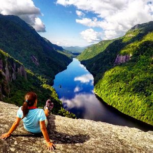
Just before reaching the rocky promontory, you will see a three-way split. The path to the left heads to Fish Hawk Cliffs—an overlook that also hangs over Ausable Lake and offers a sideways view of Indian Head, revealing its namesake likeness.
After visiting Indian Head, some continue onto these cliffs for another gorgeous view. Here, the right-hand path heads straight down to the end of Lake Road; for an alternative route, take this path on the way back instead of retracing your steps to the Gill Brook Trail.
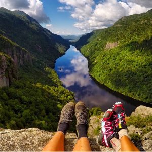
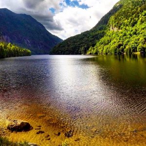
For now, continue straight ahead through this intersection to where it goes first to a higher rocky opening and then descends to the lower overhang. Each offers eye-popping, wide-open vistas of both Lower and Upper Ausable Lakes, with the Lower Great Range on one side and the Pinnacle Range on the other, both jutting out and dropping down into the water below.
Be sure to pack a picnic lunch and even a couple of craft beers or a bottle of wine to fully enjoy this unique spot. Note: There have been numerous reports of a mama bear with cubs roaming this spot in recent weeks, so explore at your own risk.
Returning
After you have your fill, head back to the intersection, and take the left-hand path 0.6 miles down to Lake Road and just walk the 3.3 miles back to the gate. Before you do, you might want to walk the short distance to the road’s end to see Lower Ausable from its shore—another stunning view. Straight across from where you come out onto the road is the bridge and path to Rainbow Falls, just a few hundred feet away and also well worth the short trip.
The walk out can be tedious, as is the additional 0.5-mile hike to your car, but this is a destination you will likely want to visit again…and again.
Indian Head is equally beautiful in any season, but the Ausable Lakes surrounded by the mantle of fall colors is a blow-your-mind vista. With another fall approaching, this might be the best time to take a road trip to the “fjords” of the Adirondacks.
Cover photo: Courtesy of Instagram’s @userwiththatnamealreadyexists.
Related Posts


