

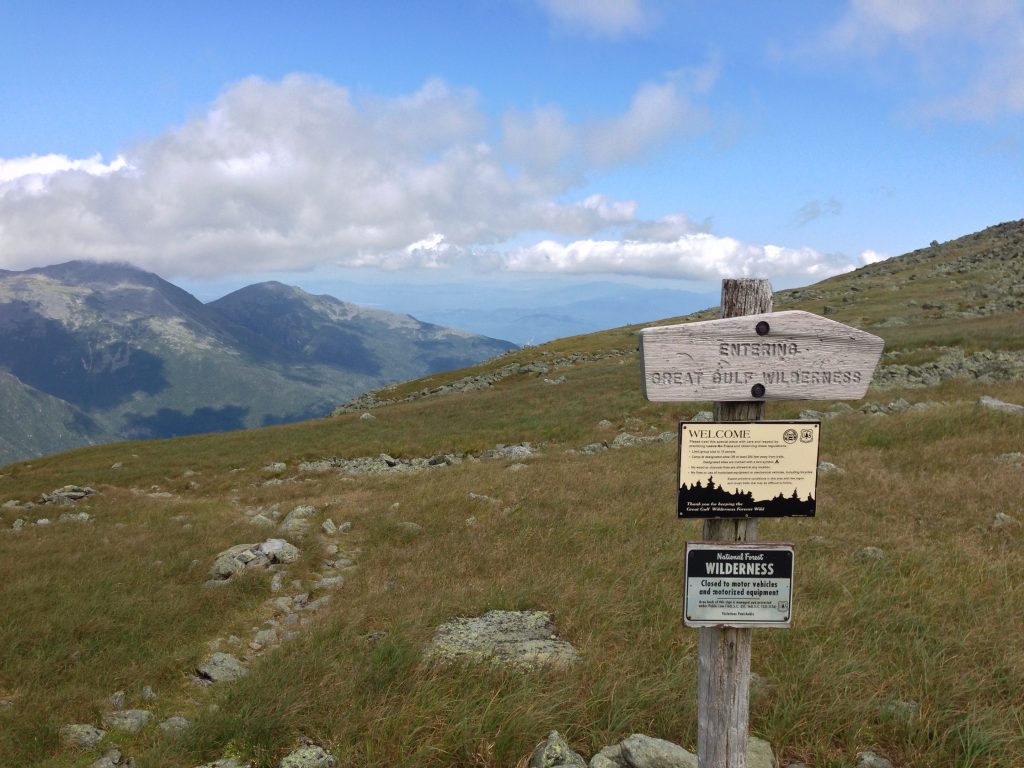
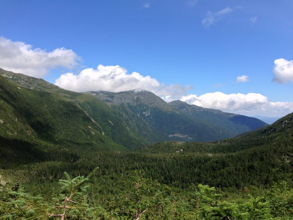
Called the Great Gulf, the massive ridge joining Mount Washington, Clay, Jefferson, Adams, and Madison forms the largest glacial cirque in the Presidential Range. The roar from Weetamoo Falls and the West Branch of the Peabody River echoes across the wilderness’ ridges and cliffs. Here, salient spurs descend each mountain to form small, remote ravines populated by moose and black bear.
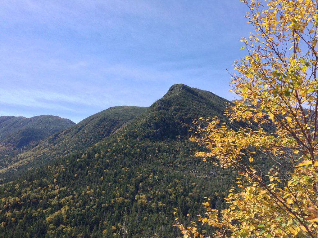
Few places in New England can match its grandeur. The glacially carved, boulder-strewn terrain rises over 2,000 feet from the Gulf’s floor to the peaks, making any visitor feel small and fragile.
The trail network in this region, perhaps the Whites’ most rugged and spectacular, provides hikers familiar with these mountains new vantages, challenges, and solitude. Each ascends a direct and arduous route over a steep ridge or up a wild ravine, making most Presidential Range trails feel tame by comparison.
In addition to ascending tremendous elevation over a modest distance, hikers must navigate all of the challenges nature can provide: house-sized boulders, major water crossings, and precipitous ledges.
History
The Edmands Path, Crawford Path, and Valley Way were constructed with a hiker’s comfort in mind, with grading and switch-backs. By contrast, The Great Gulf’s trails, built between 1908 and 1910, were at the mercy of the terrain. Specifically, trail builders used paths nature had already cleared: landslides, boulder fields, and talus. As a result, these trails follow painfully direct routes to the summits, which only strong hikers should attempt.
The Great Gulf Trail [7.4 miles, 4,650 feet of elevation]
Traveling 7.4 miles and ascending more than 4,500 feet from New Hampshire Route 16 to an area below the summit of Mount Washington, the Great Gulf Trail is the network’s artery. It is also perhaps the most demanding. After following the West Branch of the Peabody River for six miles, it passes Weetamoo Falls and eventually Spaulding Lake—a gorgeous glacial tarn—before ascending the massive boulders and landslides of the Great Gulf headwall.
Being in a wilderness area, the Great Gulf’s trails are maintained to a low standard. As such, hikers will encounter brook crossings, sharp boulders, standing water, and slippery river rocks.
Madison Gulf Trail [2.7 miles, 2,550 feet of elevation]
Approximately 2.5 miles from the Great Gulf trailhead, the Madison Gulf Trail climbs to the Adams-Madison Col. It is a gnarly journey, passing brooks and cascades with a steep and wet climb up exposed boulders before intersecting with the Parapet Trail. Keep in mind that the footing becomes dangerously slippery where the Madison Gulf Trail goes through the Parapet Brook and near the Madison Gulf headwall.
Chandler Brook Trail [0.9 miles, 1,350 feet of elevation]
Roughly one mile west of the Great Gulf Trail’s juncture with the Madison Gulf Trail, the Chandler Brook Trail climbs the ravine’s south side on rugged and slippery rock up Chandler Brook to the Mount Washington Auto Road.
Six Husbands Trail [2.3 miles, 2,550 feet of elevation]
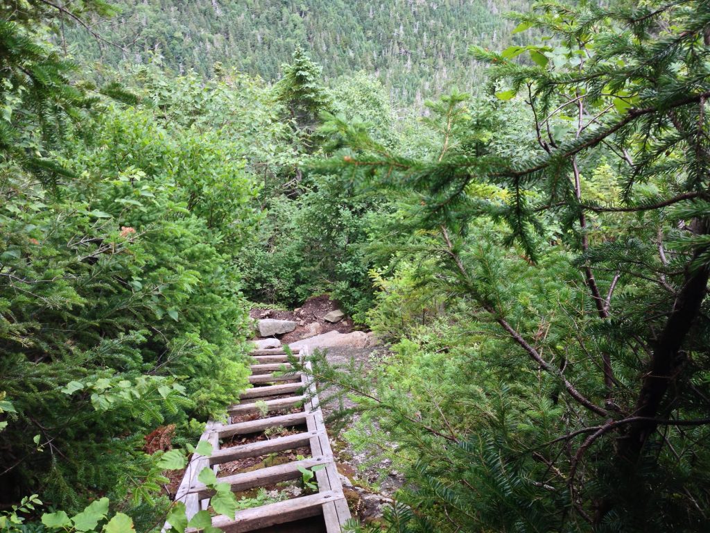
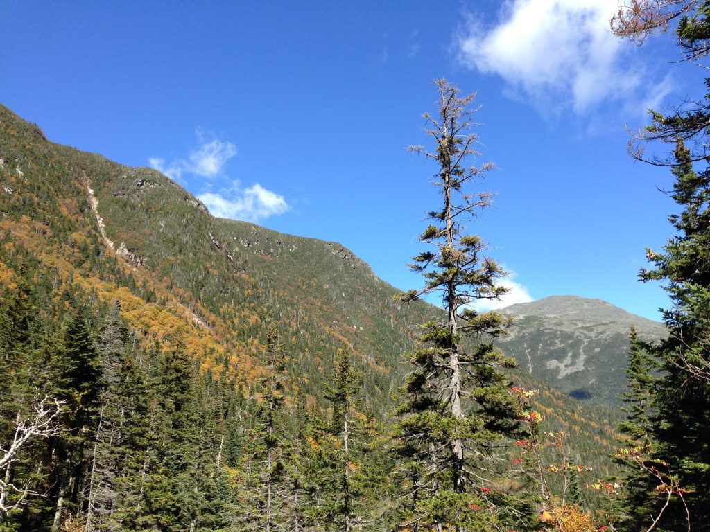
At 4.5 miles along the Great Gulf Trail, one of the White Mountains’ steepest paths diverges to ascend a wildly rugged ridge. Six Husbands Trail—named for the six husbands of Weetamoo, queen of the Wampanoag tribe during the 1600s—is among the forest’s most strenuous, demanding, and spectacular hiking trails. It is infamous for its series of wooden ladders that ascend the cliffs of a steep arête, called Jefferson’s North Knee. The Forest Service has secured, with bolts and cables, the ladders to huge outcroppings.
Ascent demands that adventurers suppress any fear of heights to climb painfully tight, cliff-like terrain. Above the ladders, the steep climb continues to the summit of Jefferson. Along the way, views of Adams, Washington, and the Carter Range leave an impression.
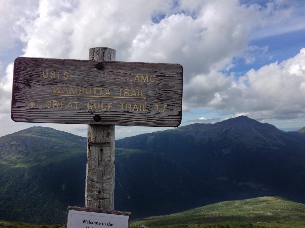
Wamsutta Trail [1.7 miles, 2,200 feet of elevation]
Traveling south from the Great Gulf Trail’s juncture with Six Husbands, the Wamsutta Trail ascends a northern spur of Chandler Ridge, going over outcroppings to the Mount Washington Auto Road and the Alpine Garden Trail. Its name references one of Weetamoo’s six husbands, Wamsutta.
After departing the Great Gulf Trail, the Wamsutta Trail makes a steep climb up a ledge and takes you through an exposed scramble of krumholtz and boulders. The view along this portion—sublime scenery of massive landslides on Adams, Jefferson’s knee-like ridges, and Madison’s sharp profile—is the reason to stop and stare in awe.
Buttress Trail [1.9 miles, 1,600 feet of elevation]
Where Six Husbands Trail meets Jefferson Brook, the Buttress Trail, named for the massive ridge that descends from the summit of Adams into the Great Gulf, begins a long journey to the Star Lake Trail. It is easier than the region’s other paths, which makes it helpful for descending.
However, despite a modest elevation gain, it is wild and strenuous. The Buttress Trail snakes uphill, in the path of an old landslide, and crosses a massive talus field with a dizzying view of the Great Gulf headwall, Jefferson Ravine, and Jefferson’s narrow North Knee.
As it heads into a quiet conifer forest, the Buttress Trail then becomes very steep. When reaching exposed terrain, it forces hikers to ascend boulders and squeeze between large rocks. The view here to the Carter Range and Madison is stunning and grand. From this point, the Buttress Trail rises above Madison Gulf’s precipitous headwall before connecting with the Star Lake Trail.
Sphinx Trail [1.1 miles, 1,350 feet of elevation]
Just over a mile southwest of the Six Husbands and Wamsutta Trails juncture, the Sphinx Trail climbs Sphinx Gulf to the col between Jefferson and Clay. For a little over a mile, this trail parallels and crosses the Sphinx Brook, and sometimes overlaps with it. Though slippery in sections and occasionally hard to follow, this trail is a fast trip that can also be used for descending if the brook hasn’t seen recent rainfall.
Day Hike Options
Amazing day hikes are possible using combinations of these spectacular trails.
Up Six Husbands Trail and down Buttress or Sphinx Trail (16 miles or 14.3 miles)
The combination of ascending Six Husbands Trail and descending via Buttress Trail requires significant stamina. Be mindful that, on your return, staying focused helps you avoid slipping. After you’ve reached the summit, use the Gulfside Trail to access Buttress or Sphinx from Jefferson.
Up Great Gulf Trail and down Sphinx Trail (17 miles)
Climbing the Great Gulf headwall is a long day, but well worth it for the view of the Northern Presidentials. For the descent, use the Gulfside Trail to access the Sphinx Trail.
Up Wamsutta Trail and down Sphinx Trail (12.2 miles)
Climbing Wamsutta Trail and descending the Sphinx Trail requires care when crossing the Auto Road and again when descending the slippery Sphinx Trail. Using Alpine Garden Trail, Nelson Crag Trail, and Gulfside Trail, you can connect the Wamsutta and Sphinx Trails.
Up Madison Gulf Trail and down Buttress Trail (11.6 miles)
This shorter option avoids the summits of Madison and Adams, opting for a gorgeous view from the Parapet and Buttress Trails.
For all Great Gulf trails, use care when descending. Steep and demanding, especially when compared to other hiking trails, these routes feature areas above treeline that are exposed over long distances. So, if weather turns bad, know your escape route and realize that, during your descent, these trails become potentially dangerous when wet.
For more assistance, refer to the AMC White Mountain Guide for regulations on camping and more detailed trail descriptions.
Related Posts


