

Camel’s Hump is a 4,083 ft. tall peak and a fairly well-recognized natural landmark in the state of Vermont, largely due to its obvious shape. It is located in Duxbury, and from the summit, you can see Lake Champlain and the Adirondacks to the west and the White Mountains in the east, if there aren’t any clouds. It is probably the one mountain in Vermont that, if you haven’t been to the top, you are really missing out on something special.
There are a few trails up to the peak. The Monroe Trail is my favorite, and one everyone should check off their list. It is about 6.8 miles round trip—not your easy jaunt in the woods. In the summer, it’s about a half-day hike, but in the snow, plan on a bit longer of a journey. You can find a trail map here.
Getting There
Getting to the mountain itself is fairly simple. If you’re coming from the Burlington area, take I-89 south to exit 11, then take VT Rt. 2 through Richmond to Jonesville, and turn right over the Winooski River bridge. Then, take Cochran Road from the bridge to the first left onto Duxbury Road. It changes its name to River Road at the Bolton-Duxbury town line, but continue following it for about 5.8 miles to the stop sign at the base of Camel’s Hump Road. There, turn right up Camel’s Hump Road, and go about 3.6 miles to the end at the parking areas. Here, there are two parking areas near each other.
Being Prepared
Camel’s Hump is one of my favorite mountains to climb in the winter. There are fewer people on the trail, my dog loves it, and the snowshoeing is fantastic! Somehow, this time of year, the snow on the paper birch trees and hemlock pines makes it majestic and much more appealing.
Snowshoeing is a great way to get out in the winter. It’s something that anyone can do and doesn’t require the coordination or technical skill of skiing or snowboarding, so it is very easy to get started. All this said, the first, and most important, thing you should know is that snowshoeing is still hard work! But, it will also be incredibly fun and rewarding. The journey up Camel’s Hump is strenuous, but worth every step.
Preparation is critical. Dressing appropriately can mean the difference between freezing your butt off or dripping in sweat (and then freezing your butt off because you’re soaked). It’s also important to plan out your trip. The mileage, elevation change, terrain, and weather all determine what kind of clothing, pack, and footwear you’ll need.
For Camel’s Hump, this is crucial because of the difference between the steep and physical hike up and the cold, windswept summit. In addition, weather in Vermont can change on a dime—warm and sunny one minute, and the next, it’s cold, blustering, and snowing.
Staying hydrated is also important. Snowshoeing is a lot of work, as you burn a bunch of calories and sweat, and many people make the mistake of not wanting to drink cold water. It’s crucial to keep hydrated at all times of the year—not just summer—and an occasional snack or two doesn’t hurt. Warming your water before you leave goes a long way to making it more appetizing.
The Monroe Trail
Camel’s Hump is barely over 4,000 feet, but don’t let that fool you into thinking it’s an easy summit to reach! The trail begins with a gentle climb, but quickly progresses into some seriously steep steps. For the Monroe Trail, follow the blue blazes on the trees, although it is most likely that someone has already been out with their snowshoes and blazed the path for you. I like to start mid-morning to guarantee that. If you’re in for a challenge, try going to the top first thing in the morning after it snows.
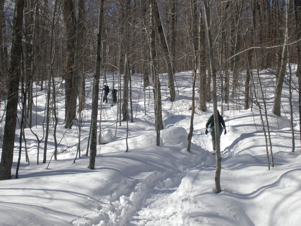
I like to break this trail into chunks, as, mentally, it helps me get to the top a little easier. From the parking lot, the first portion is what I call the wooded section, a fairly open hardwood forest of birch and maples. In winter, with its lack of leaves, you can see pretty far through it. During your journey, this will feel like the longest part.
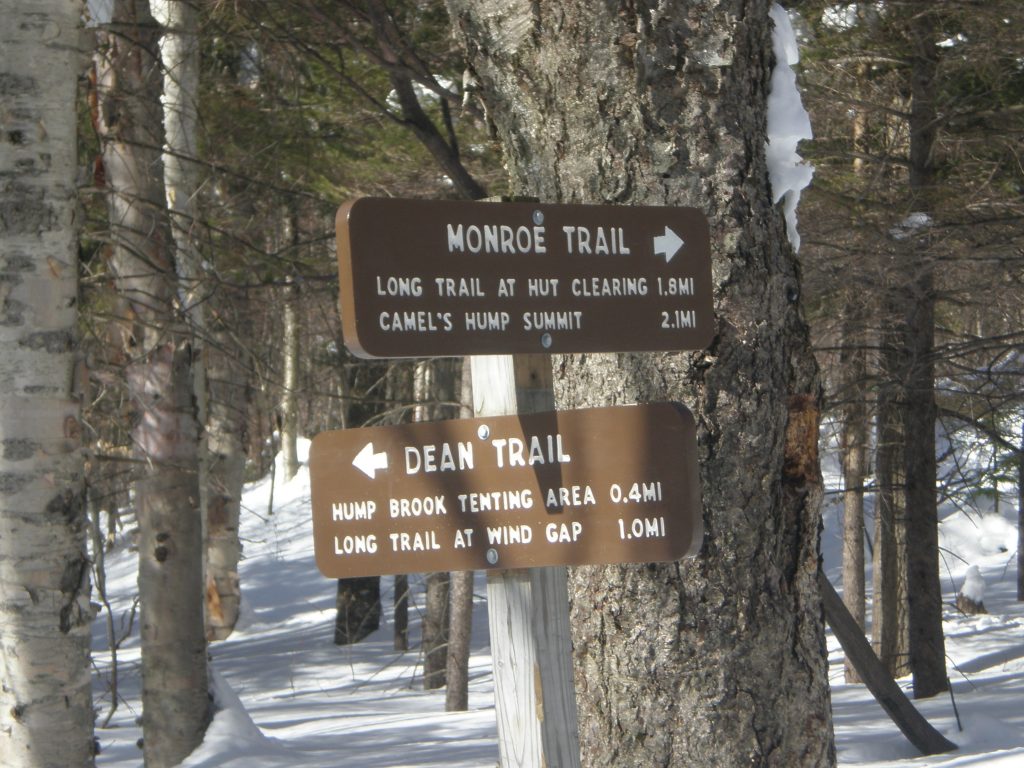
The wooded section eventually intersects with the Dean Trail, but continue on the Monroe Trail, until you notice the hardwoods becoming more dense and see pines emerging. This will be within a mile or so of the junction and completes the hike’s first portion.
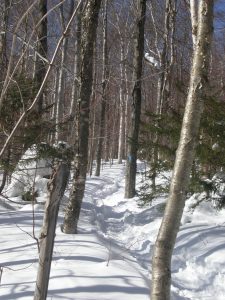
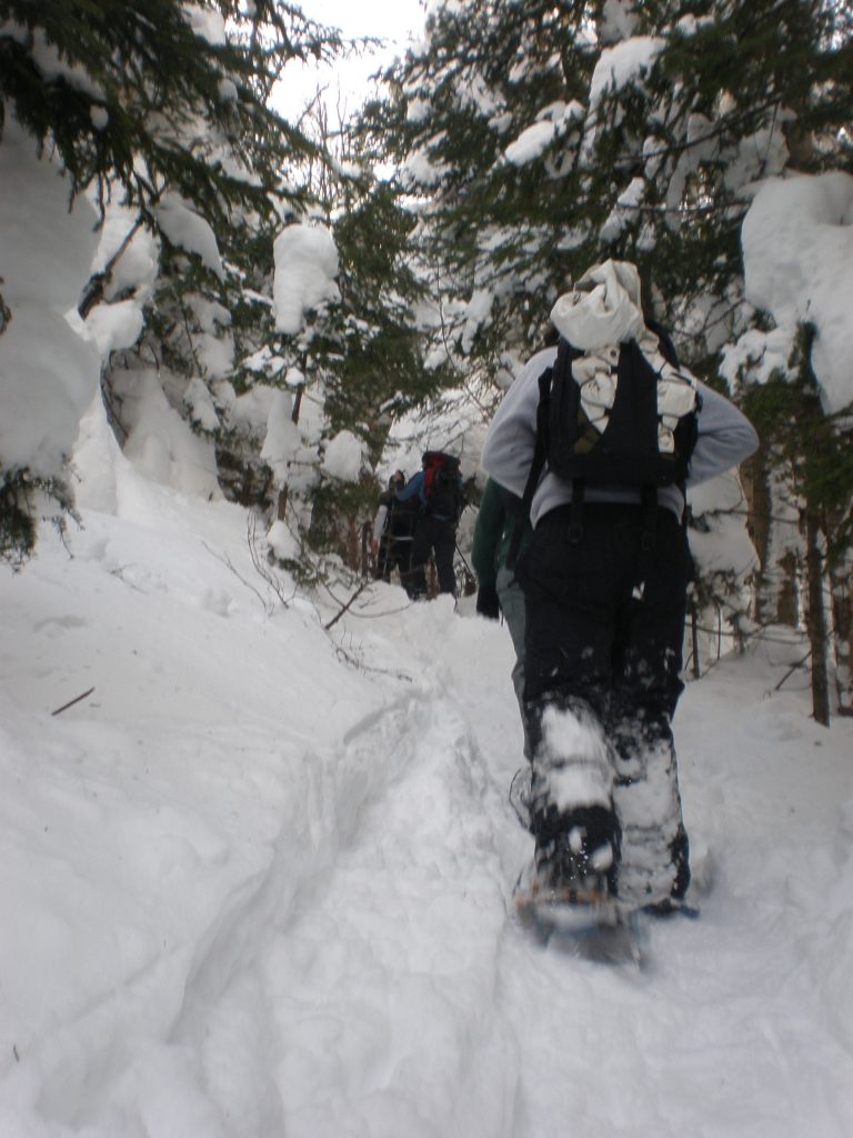
The second part—my favorite—goes through softwoods and pines. Here, the woods become very dense, and you are standing next to hemlocks that seem like they should be taller. And, they would be, if they weren’t buried under a couple feet of snow. While you’ll encounter another junction, this time with the Alpine Trail, stay on the well-marked Monroe Trail. This portion continues until the trail joins with the Long Trail.
The third portion begins after the two trails merge at a clearing that is sheltered from the wind. It’s a great place to take a break and grab a snack, or to add on extra layers before ascending.
Marking the last little climb to the top, it takes about 10 to 15 minutes, depending on the conditions. On its narrow and steep parts, your trekking poles will come in handy. Expect to come across ice near the top, especially if it hasn’t snowed recently or if it is on the warmer side, so be sure to pack MICROspikes, or some other form of traction.
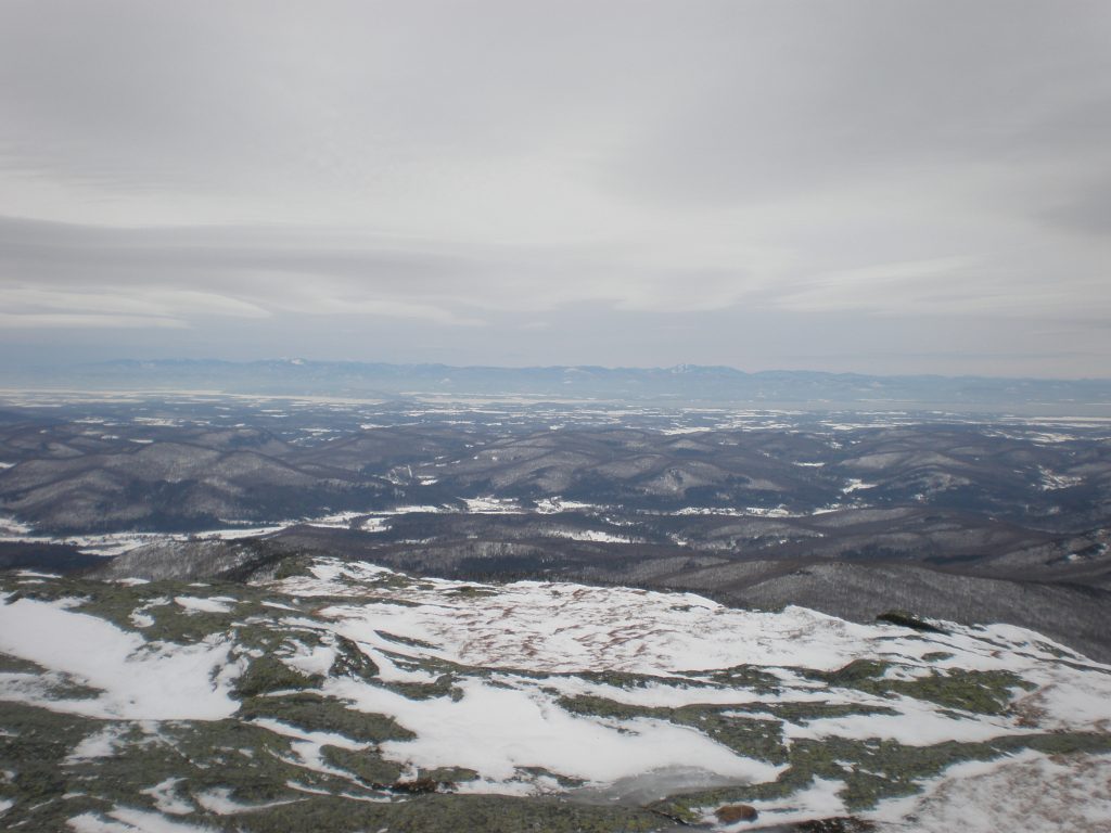
The top of Camel’s Hump is a fairly large area to explore. In the winter, you’ll find most of the fragile flora covered in snow.
To return to your car, just follow the Monroe Trail back down the same way you came up.
Après-Hike
My favorite place to go to after Camel’s Hump is the Prohibition Pig in Waterbury, VT, known for a large selection of local craft beer, including their own, and delicious food. I recommend the hush puppies served with maple butter, as well as the house burger with pimento cheese, fried green tomato, and applewood smoked bacon. Yum!
Related Posts


