


Go way east and take in one of Maine’s rugged coastal peaks during this staple Acadia hike.
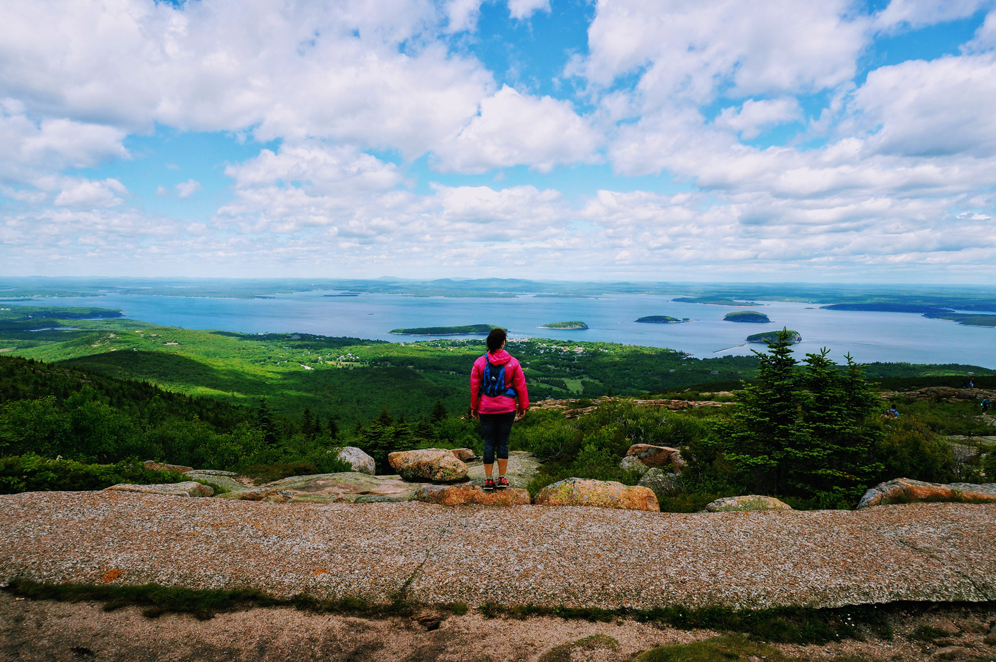
At 1,530 feet, Cadillac is the tallest mountain on the United States’ Atlantic coastline, offering incredible views of Maine’s rugged seashore from the top. If you want to be among the first people in the continental United States to see the sunrise, there is no better place to view it than from Cadillac’s summit, and as a must-do trip for every visitor to Acadia National Park, a 7.1-mile roundtrip hike via the South Ridge Trail gets you there.
Quick Facts
Distance: 7.1 miles, out-and-back
Time to Complete: 1 day
Difficulty: ★★
Scenery:★★★★
Fees/Permits: $25 park entrance fee per vehicle (May through October)
Contact: https://www.nps.gov/acad/index.htm
Turn-By-Turn
Depending on traffic, getting to the South Ridge Trail from downtown Bar Harbor is a breeze. Simply take Route 3 for a little over five miles before making a left onto Blackwoods Road. Then, look for the trail sign, which is visible from the road. Still lost? Blackwoods Campground is nearly adjacent to the trailhead.
The one tricky part about getting here is parking, since there is no dedicated lot for the South Ridge Trail. Instead, just park alongside the road near the trailhead.
Into the Woods
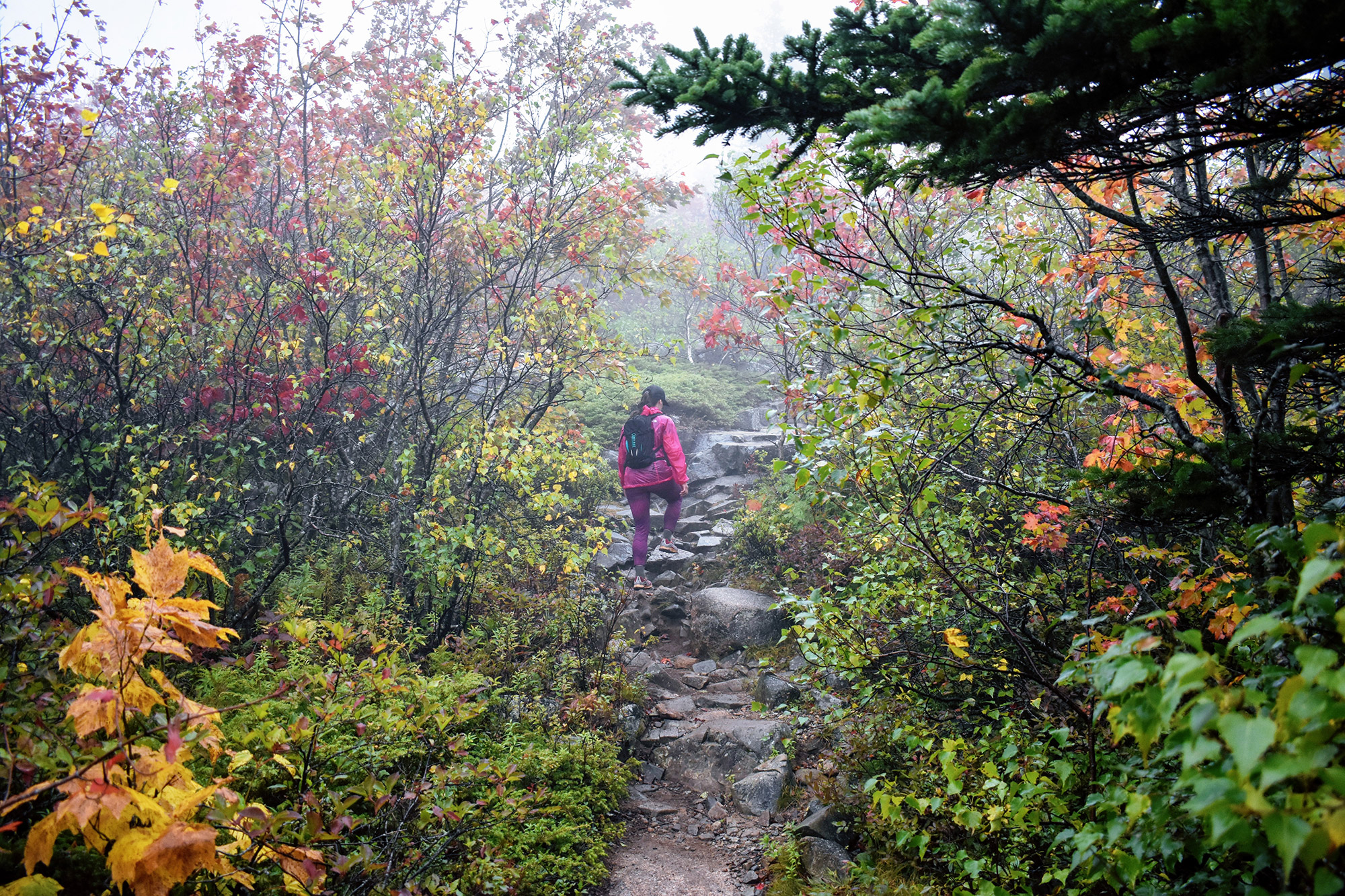
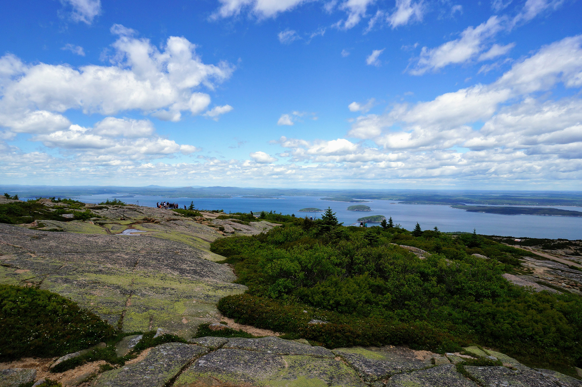
Hiking Cadillac Mountain is a fairly straightforward trip. The 3.5-mile stretch is well marked with blue blazes and cairns, and features very few connecting trails, thus minimizing the opportunity for wrong turns. Adding to the ease of navigation, approximately two-thirds of the trail is above treeline, enabling hikers on a clear day to see the route sprawl out ahead of them.
After parking across from Blackwoods Campground, hikers dip into the woods and follow the blue blazes as the trail gently ascends through the beautiful Maine forest. On the whole, the South Ridge Trail gains roughly 1,500 feet from the car to the summit, and although the change is gentle, hikers should not be lulled into thinking this trek is easy. The initial section is notoriously rocky and rough with roots, before giving way to slabby granite ledges.
Eagle Crag Cutoff
After roughly a mile, hikers are poised to encounter the first landmark of the day: the sign for the Eagle Crag cutoff (44.324177, -68.219193). Just 0.3 miles from here, the Crag features a long granite ledge that provides an excellent vantage point to take in views of the surrounding area. However, the 0.3-mile diversion leaves and then reconnects with the South Ridge, so, to give yourself the best chance at summiting, consider saving Eagle Crag for the return trip.
From the Eagle Crag cutoff, continue following the blue blazes as you climb out of the forest and into a blend of slabby rock and scrubby trees. As you get a little higher on the South Ridge Trail, the forest gives way to a rocky ridge, and there’s a chance you’ll get off the trail. Although this transition is well-marked, pay close attention to the cairns and blazes; otherwise, the well-traveled “footpaths” here lead you nowhere as you come out of the forest.
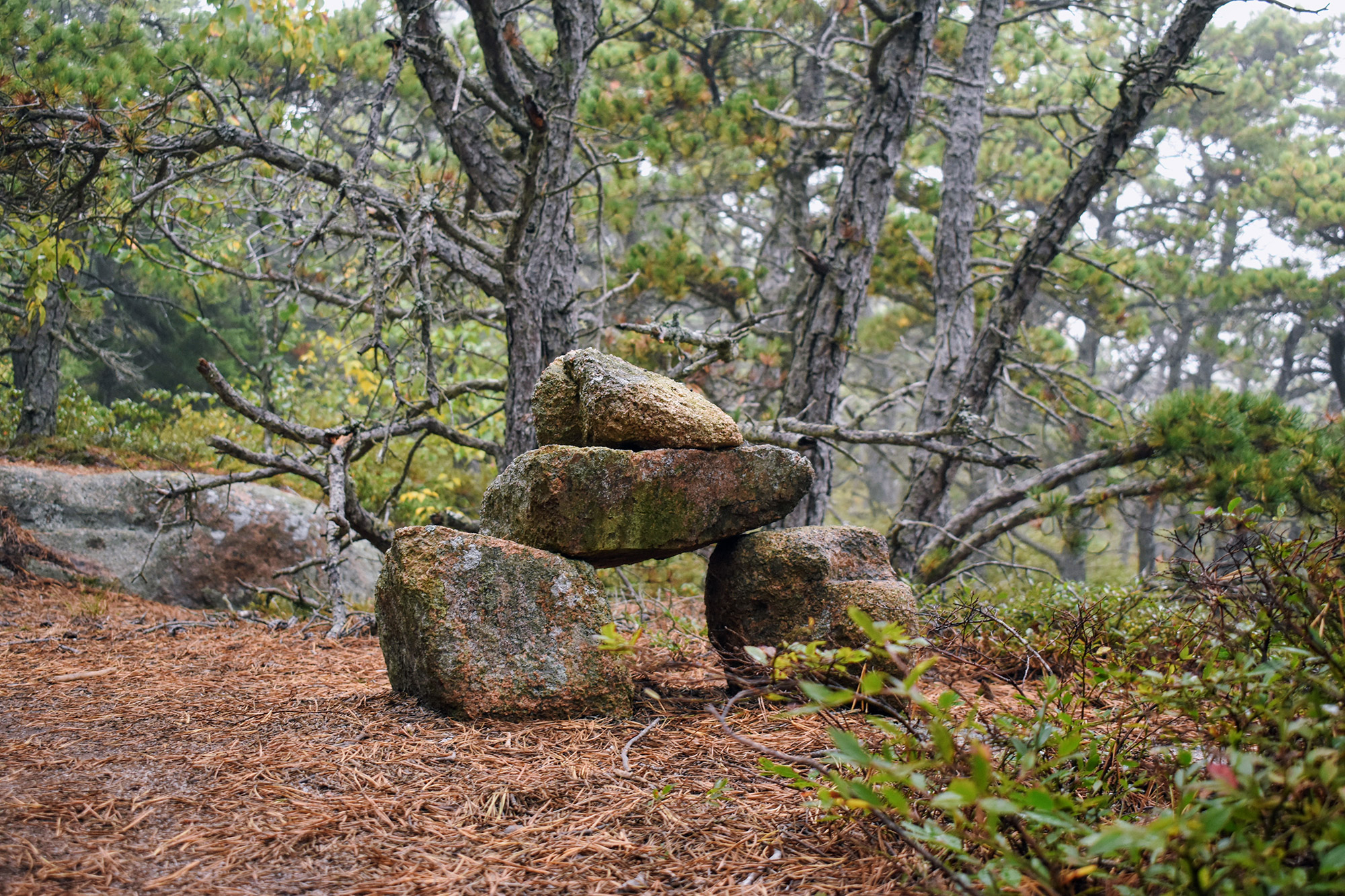
It’s also here that hikers will encounter something unique to Acadia National Park: the Bates Cairn. Named after Waldron Bates, a trail builder in Acadia during the early 1900s, the Bates Cairn features two large base stones that support a mantel stone with a pointer stone on top. Tampering in recent years has resulted in signs requesting visitors to both leave the existing cairns alone, including not adding rocks to them, and to refrain from building additional cairns. Help protect this special place by leaving the trail as you found it!
The Featherbed
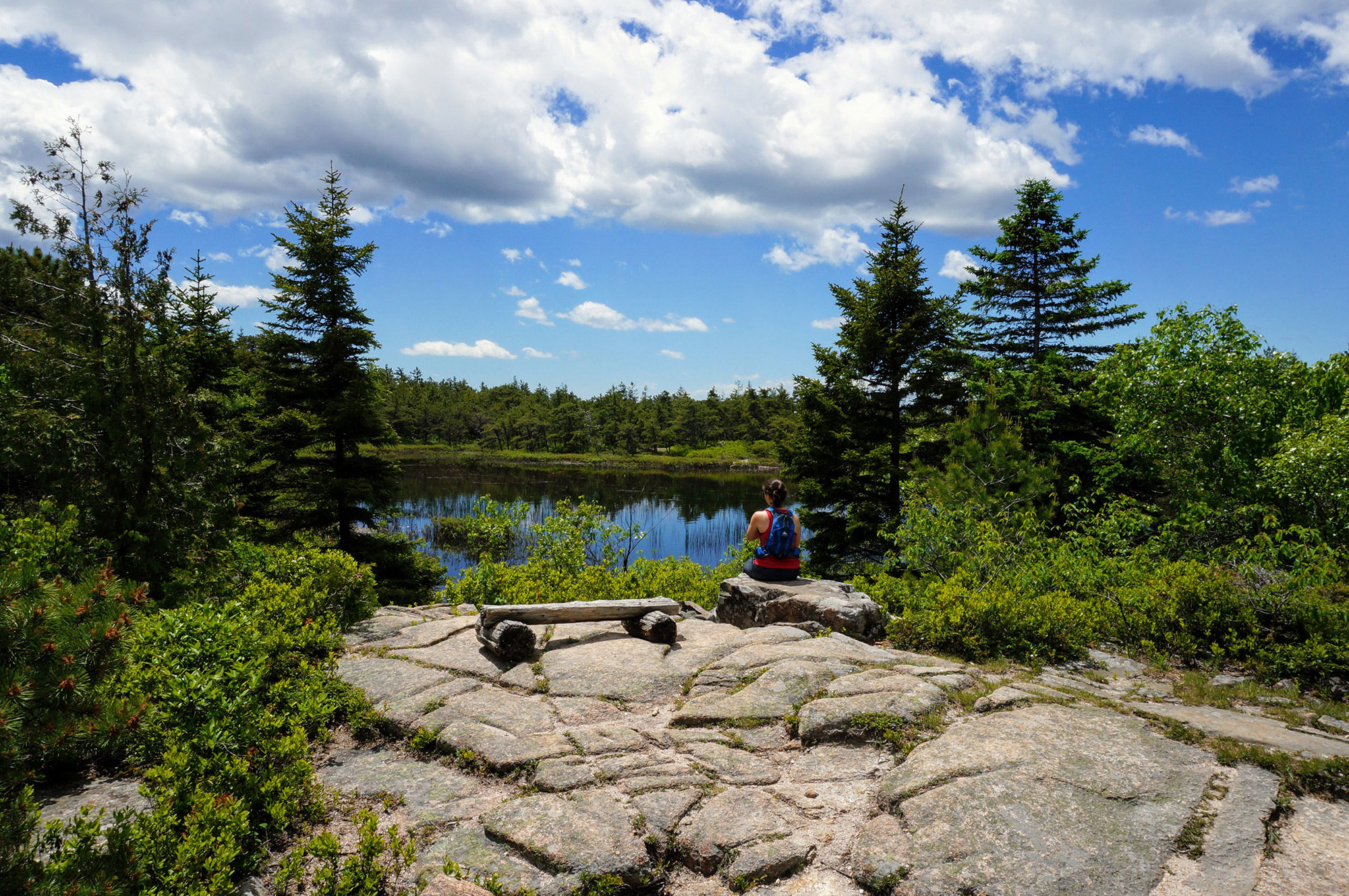
Nearly a mile up the trail from the Eagle Crag cutoff, hikers will encounter the trip’s second major landmark: a small glacial pond called The Featherbed. It is one of three in the park, with the others being The Bowl, located behind The Beehive, and Sargent Mountain Pond, between Penobscot and Sargent Mountains. Depending on the weather, sit for a moment to enjoy the uniqueness of its stunning scenery.
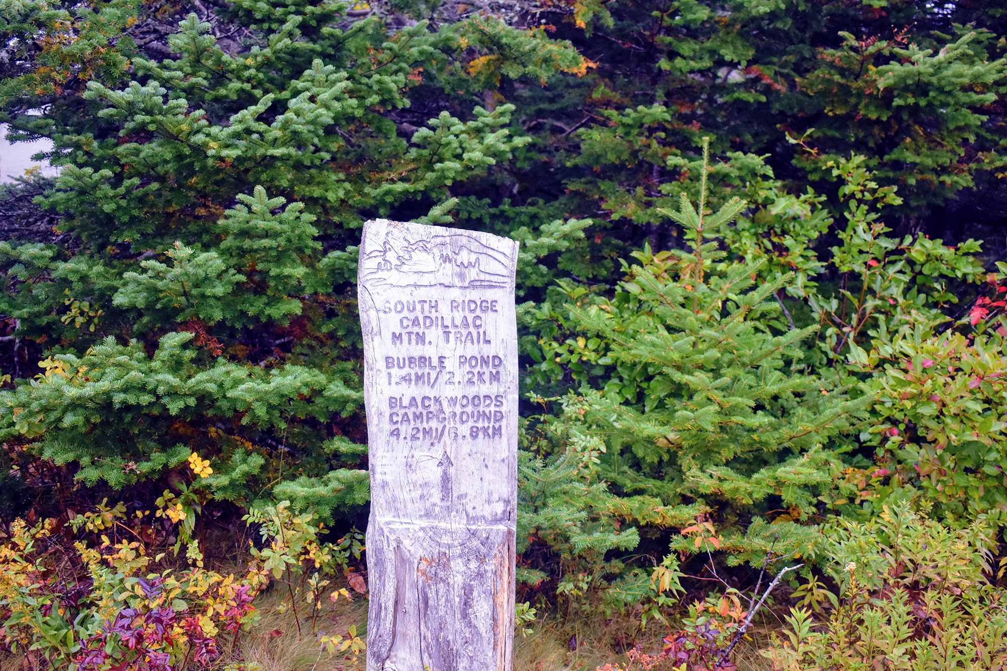
Shortly after departing The Featherbed, the South Ridge intersects with the Canon Brook Trail (44.338486, -68.219193). Here, take a quick look at the sign, make sure you’re pointed in the right direction, and continue following the blue blazes and rocky ridge toward the summit.
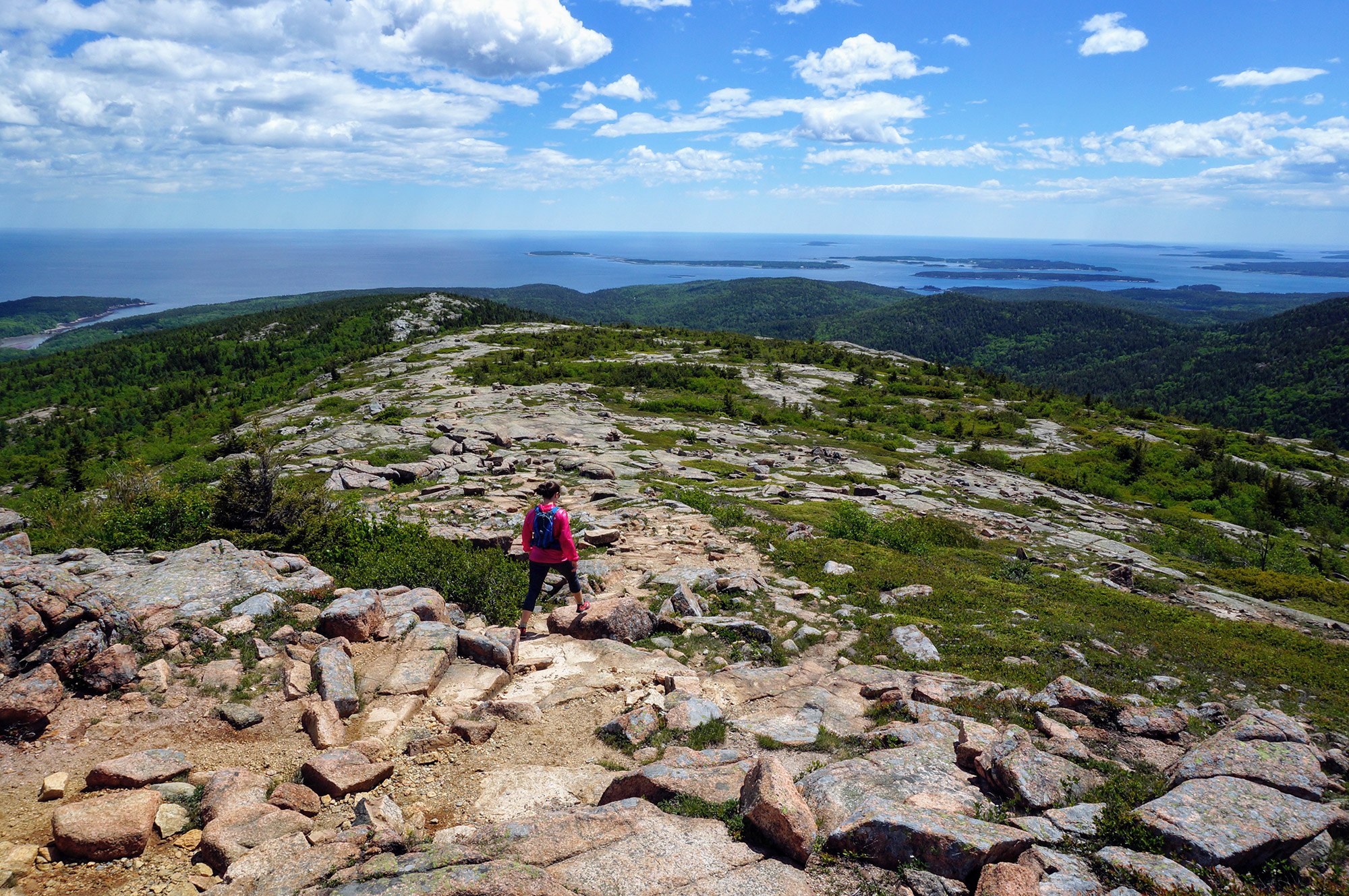
From here on out, the trail is largely unprotected by trees, exposing hikers to everything from intense sunlight to fierce winds. Consider keeping a sun shirt, wind shirt, or lightweight rain jacket accessible for this section, as you never know what type of weather you’ll encounter. And, if conditions are too fierce, don’t hesitate to call it a day and turn around.
From here, the South Ridge Trail ascends the park’s notorious pink granite steps and slabs for 0.7 miles to its intersection with the West Face Trail (44.346916, -68.229324). Well marked with a large sign, the intersection is a relief for hikers, indicating the summit isn’t too far off.
The Final Push
Hiking from the intersection with the West Face Trail, you’ll realize the impending encounter with civilization. Until this moment, hikers are immersed in nature, enveloped by the quiet of the forest and lost in the stunning views of the ocean and surrounding mountains. In the final push, however, the South Ridge Trail bumps up against the auto road and sees an increase in traffic, as people who have driven to the top explore the trails around the mountain’s summit. Strangely, it’s here that the trail might be the most challenging, as it features a few short-yet-steep sections that involve using iron rungs.
The Summit
Once you’re on top, look for the true summit, which is located along the gravel path and marked by two survey benchmarks established by the U.S. Coast and Geodetic Survey (44.35127,-68.22649).
After locating the two survey markers and tagging the true summit, head up past the gift shop (44.351997, -68.225945) and skirt along the parking lot to take in views not afforded by the South Ridge Trail. Looking down below, you’ll see the village of Bar Harbor and islands off the coast.
After you’ve had your fill of views, take a walk around the short loop path at the summit. Make sure to check out the interpretive signs about the history of Acadia National Park. Once you’re done, simply return the way you came, and follow the South Ridge Trail back to your car.

Sunrise Bonus Points
While it’s commonly assumed that Cadillac Mountain’s summit is the first place to see the sunrise on the East Coast, it’s only true for part of the year. Even if your trip doesn’t align with the first-to-see-sunrise dates—October 7 through March 6—a pre-sunrise hike is still a great way to experience a must-do Acadia activity, earns you extra cred from the people who drove up the auto road, and gives you an excuse to order a double stack of blueberry pancakes for breakfast when you get back to town. Want more info on sunrise ascents? Check out our guide to “Beating the Sunrise on Cadillac Mountain.”
The Kit
- A large percentage of the South Ridge Trail’s long, gradual ascent and descent occurs on exposed rock, minimizing the need for waterproofing and maximizing the need for traction. Trail runners like the Brooks Cascadia 12 or hiking shoes such as the Oboz Sawtooth Low are perfect for the terrain.
- Because so much of the trail consists of an exposed rocky ridge next to the coast, a wind shirt like the Mountain Hardwear Ghost Lite is a borderline necessity for blocking the ocean breeze.
- Pick up the National Geographic Trails Illustrated Acadia National Park Map before you go to get psyched, and bring it along on your hike just in case.
- Hikers unaccustomed to Maine’s rocky trails will appreciate a good pair of trekking poles, like the Black Diamond Trail Backs, for added stability and confidence in unfamiliar terrain.
- If the sunrise is on the agenda, consider adding a belay coat like the Outdoor Research Perch or a lightweight sleeping bag like the EMS Velocity 35 to your pack. Standing on a mountaintop in the dark next to the ocean can be pretty cold, even in mid-summer.
- Another sunrise must-have is a headlamp, like the Black Diamond Revolt, as you’re going to spend a considerable amount of time hiking in the dark.
Keys to the Trip
- Bring your wallet, and treat yourself to a cold drink, ice cream, or a whoopie pie at the summit’s gift shop.
- One of the best things about hiking to Cadillac’s summit for the sunrise is the excuse to eat a big breakfast. Jordan’s Restaurant is a Bar Harbor institution. Enjoy a stack of their wild blueberry pancakes—you’ve earned it!
- If you started later in the day and prefer your carbohydrates in liquid form, Bar Harbor Beerworks is right on the main drag and delivers outdoor seating options, while Finback Alehouse offers a more subdued setting.
- Planning on camping during your trip to Acadia? Sites book well in advance for popular summer and fall weekends, so make your reservations early. Don’t count on finding an open site when you get there.
- If camping isn’t your thing, book a small cottage with a kitchen just outside of town. They’re affordable and keep you from having to trek into town every time you want a meal. We’ve had luck staying at Hanscom’s over the years.
- Is there someone you would like to share the summit with but don’t think they’ll be able to make the hike? Arrange for them to drive up the road and meet you at the top! The drive up the auto road is free, provided you have paid the park’s entry fee.
- If you’re looking for other things to do while in Acadia, our “First-Timer’s Guide to Acadia National Park” has you covered. Make sure to check out the tide pools, the Beehive Trail, and Otter Cliffs.
Current Conditions
Have you climbed Cadillac recently? Post your experience and the trail conditions (with the date of your hike) in the comments for others!
Related Posts


