


You cannot find a more scenic backpacking trail than this coastal route in Northern Maine.
This quintessentially Maine hiking route will get you off the grid and into the woods. The trail bends up and down along the most northern seacoast of Maine, offering views of the ocean and hearty pines with every step. This out and back route could, of course, be done as a lengthy day hike, but backpacking it and catching the sun rise over Canada is not something you can afford to miss.
Quick Facts
Distance: 11.5 miles
Time to Complete: A Weekend
Difficulty: ★★★
Scenery:★★★★★
Fees/Permits: None
Contact: https://www.maine.gov/dacf/parks/camping/backcountry_camping.shtml
Turn-By-Turn
Miles away from the nearest hint of civilization, off ME 191 (44° 41.930’ N, 67° 9.478’ W), the trailhead parking lot is nestled into a thick stand of pines. It has plenty of spots, a trail map, and a well-maintained outhouse.
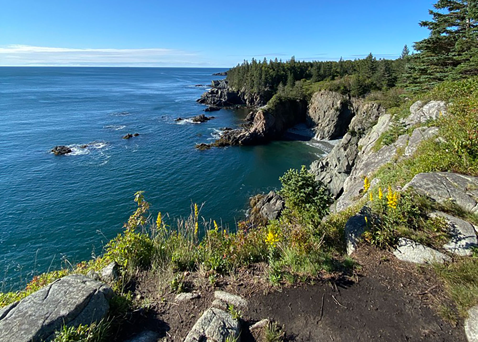
Cliff Walk
The first section of trail is spent working your way out of the woods and towards the coast. Even in the absence of recent rain, it was muddy to start, but the majority of sections have well placed rocks and raised wooden planks to steer you away from the standing water. As the trees thin, your eyes strain to catch a glimpse of the ocean but find only sky until you reach where the trail drops.
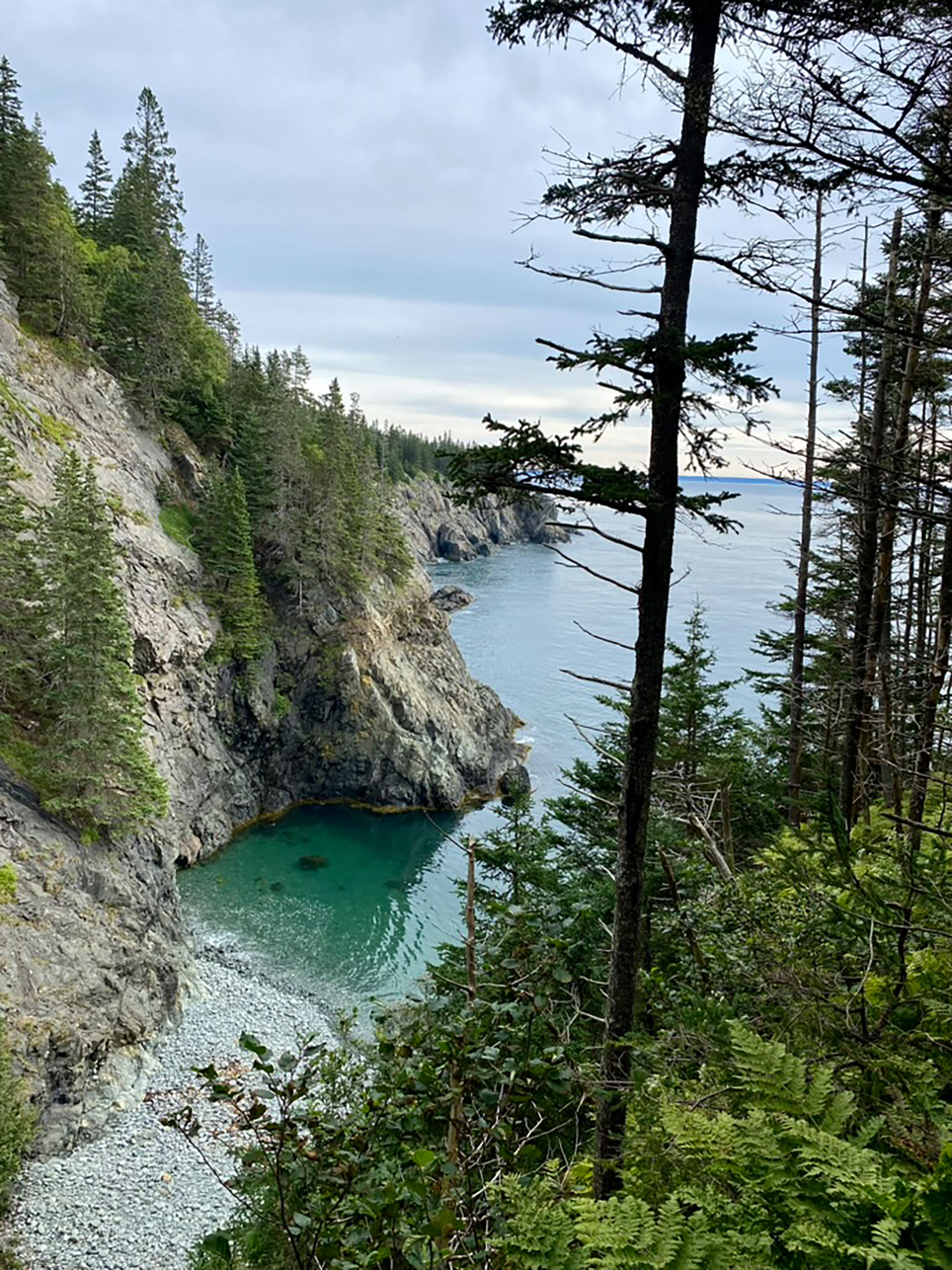
The first views of the ocean come as a scene of the waves breaking into a gap in the cliffs onto a rocky, pocket beach. From then on, you’ll hardly be without views of the water on your lefthand side. The cliff walk trail is wide enough, and never feels too close to the drop off to be treacherous. The ups and downs of the route are mild and the trail is mostly dirt; not impeded too drastically by roots and rocks.
Rocky Beach 1 to Camp Site
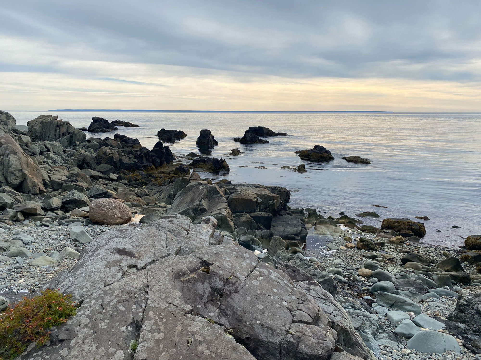
From your vantage point on the trail, you’ll spot the first rocky beach on Cutler Coast before the trail leads you down there. This rocky beach is not made of pebbles but rather shaggy rocks and boulders so it wasn’t feasible to use this for ocean access. At roughly three miles into your hike, this beach is important because the far side features the first source of flowing, fresh water which runs down to the ocean from the cliffs above. We stopped here to gather cooking water for our dinner later.
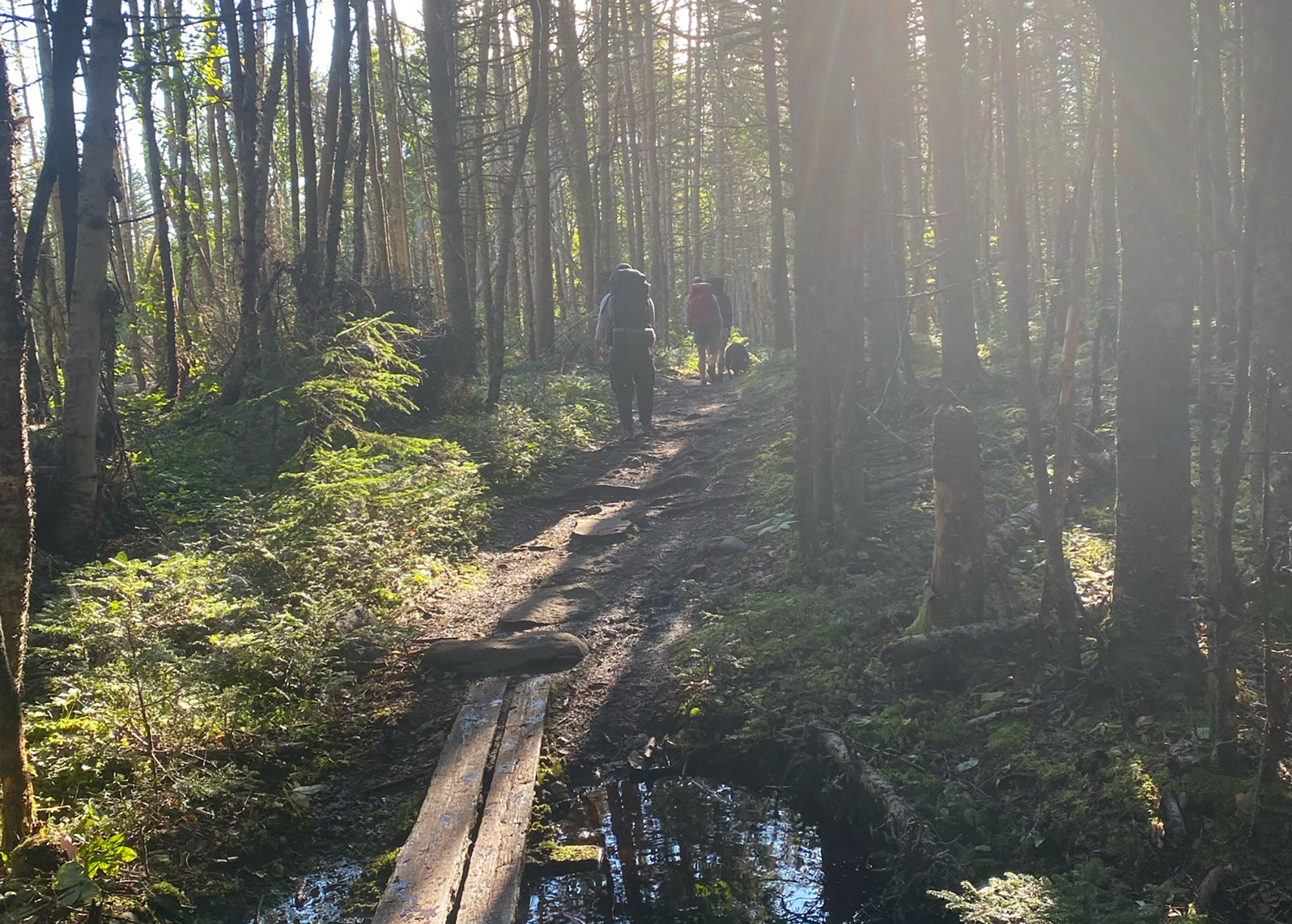
After the first rocky beach, the trail is a mix of cliff walks, woodsy terrain, as well as jaunts through high grass. The walks through the tall grass were aided by having raised boards to follow and keep you from needing to bushwhack too extensively although the grass did sometimes bend under its own weight and fall across the trail. Check for ticks when you exit these sections.
Camp Site & Rocky Beach 2
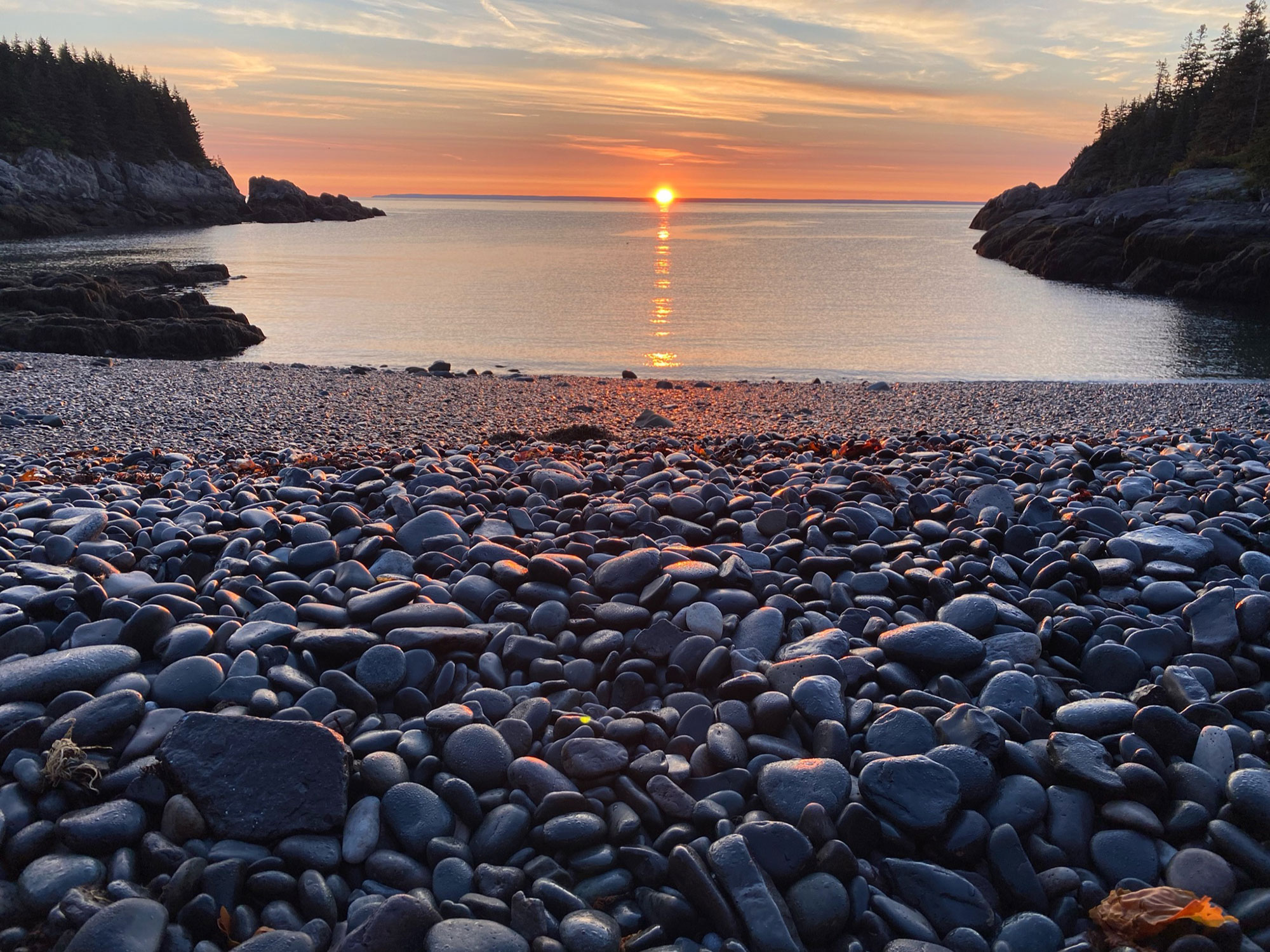
The first camp site is 4.5 miles into the hike and is a plot of four to five tent sites from right on top of the cliffs and extending further back into the woods. They’re advantageously situated right under some old growth pines so the forest floor is soft and bouncy from the old pine needles. These tent sites fill up fast so even if you plan on continuing down the trail, I suggest picking your site and claiming your spot before continuing on the hike. Folks who snagged the lucky cliff side spots also brought hammocks to setup to be able to take in the view right from their site. If you end up being situated further back in the woods though, don’t fret, the second rocky beach is just a one minute walk away. This is also where you may need to camp if all the sites are taken: finding other spots in the woods or on the trail is prohibited.
The pebble beach is a great place for a meal, a snack, soaking up the sun, or a quick swim, although even in the heat of the summer the north Atlantic is frigid. The beach is also the perfect place to catch the sunrise along the coast. It is perfectly eastward facing so the sun peaks out from below the horizon, in the center of the sky framed by the rocky cliffs. In its rise, it lights up the Canadian coast and reminds you how far north you are.
Beyond the second rocky beach there is about 1.25 miles left of the outbound section of the coastal hike. It is more up and down than the rest of the trail but it’s certainly worth trekking. The trail will dump you out onto the first section of the cliffs which are a rocky outcropping beyond the tree line where you can sit on a boulder and watch the waves below.
You can continue on this trail on your return trip and it will take you inland. It’s aptly named the Inland trail. It’s prone to bugginess and muddiness and void of ocean views so making the coastal trail an out and back is encouraged.
The Kit
- A water filtration system will be key as all the freshwater sources are limited and murky.
- Bringing ample layers (women’s, men’s )is important, especially if you’re backpacking in the fall since overnight temperatures can get low and campfire are strictly prohibited.
- Without the light of a campfire, you’ll want to consider bringing a lantern or headlamp to navigate your tent site after dark along the coast.
- Even though the northern Atlantic is chilly year round, you may not be able to resist taking a swim off of the pebble beach by the camp site. Just in case, pack a towel.
Keys to the Trip
- You’re surrounded by water but all of it is salty. You’ll pass one trickling stream mid way through so make sure you pack in enough water and fill up at that stream using a filtration system.
- There is a strict no camp fire policy on Cutler Coast so bring your lantern or headlamp to navigate around your tent site at night and sufficient layers for keeping warm.
- It’s the northern Atlantic so the water is freezing year round but you might not be able to resist a dip at your own private pebble beach. I suggest bringing a towel to dry off and sandals to navigate the rocks on your way down to the water.
- Keep your ears out in the tall grass sections. Visibility is low and you may run into hikers coming in the opposite direction.
- It is technically a loop trail, but the latter half will not feature ocean views so many make it an out and back
Related Posts


