


One of the Northeast’s great backpacking adventures proves that good things don’t come easy.
The Pemi Loop represents the ultimate goal for many New Hampshire peak baggers. It traverses the Franconia, Twin, and Bond ridgelines in one epic loop around the western half of the 45,000-acre Pemigewasset Wilderness. Crossing eight summits above 4,000 feet—with the potential to tick four more via minor detours—the Pemi Loop provides the possibility of summiting a quarter of the 48 4,000-footers, all while spending a significant chunk of time in New Hampshire’s largest wilderness area. More significantly, it offers huge views and amazing above-treeline stretches, and has the reputation for being one of the country’s hardest hikes.
Ultimately, completing the Pemi Loop is a feather in the hiker’s cap and undeniably one of New Hampshire’s best hikes.
Quick Facts
Distance: 28-mile loop
Time to complete: 2 to 3 days
Difficulty: ★★★★☆
Scenery: ★★★★★
Fees/Permits: $5/day for parking at the Lincoln Woods Trailhead
Contact: https://www.fs.usda.gov/whitemountain
Getting There
If you’re coming from Interstate 93, getting to the Lincoln Woods Trailhead is easy. Take Exit 32 and follow Route 112 East, better known as the Kancamagus Highway. After driving through the town of Lincoln and past Loon Mountain, look for the trailhead on your left.
If you’re coming from the North Conway side of the Whites, follow Route 16 to Route 112 (the Kanc) up and over Kancamagus Pass and past “the hairpin turn” at the Hancock Overlook Parking Area—the trailhead will be on your right side.
Turn-By-Turn
Although the Pemi Loop can be joined from a number of different feeder trails along the route, the most common place to start and end is the Lincoln Woods trailhead. From here, the Pemi Loop can be completed without adding significant mileage and elevation to an already big adventure.
The First Climb
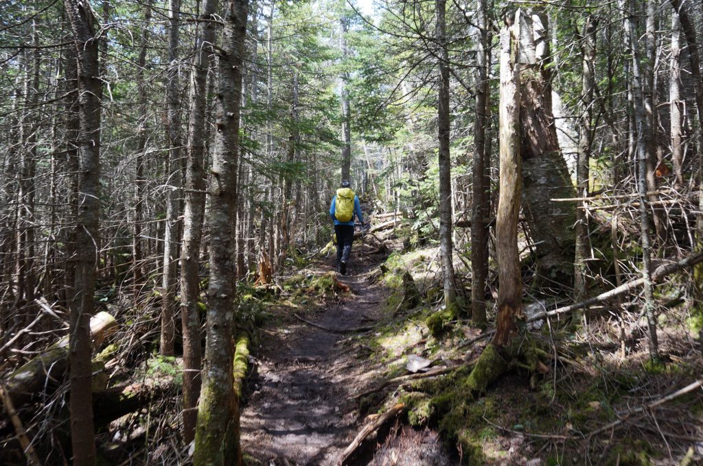
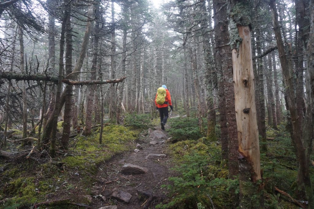
Leave the parking lot on the Lincoln Woods Trail and cross the East Branch of the Pemigewasset River on a suspension bridge. At the end of the bridge, the trail turns right, following an abandoned railroad bed for 1.4 miles to the Osseo Trail (44.082691, -71.581635). At the junction, turn left on the Osseo Trail, and follow the yellow rectangular blazes toward Mount Flume, the route’s first 4,000-footer.
At 4.1 miles long, the Osseo Trail gains elevation moderately for the first few miles before steepening, leading to a series of ladders, and eventually putting you on the Franconia Ridge Trail for a final, short push to the summit (44.108826, -71.628052). In total, you’ll ascend 3,100 feet on this climb, a significant chunk of the Pemi’s 10,000 feet of overall elevation gain.

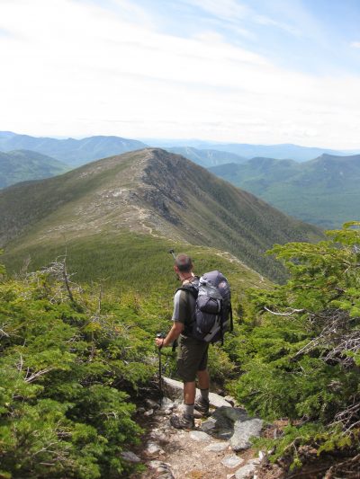
On the Ridge
Before dropping back below treeline on the Franconia Ridge Trail, take a moment on Mount Flume’s rocky summit to enjoy the view. The Kinsmans, Lincoln, and I-93 are to the south and west. Owl’s Head, the Pemi Wilderness, and the Bonds are to the east. Then, the next step on your itinerary—Franconia Ridge—is to the north. Try not to feel overwhelmed, and follow the yellow blazes as you travel the 1.5 miles to Mount Liberty’s summit.
The descent off Mount Flume and across to Mount Liberty is pretty relaxed. As you near the latter’s summit, you’ll encounter a few short scrambly sections. Although they might briefly slow you down, they also mean you’re getting close to the top of the second 4,000-footer of the day.
Mount Liberty’s stunning open summit (44.115730, -71.642097) is among the Whites’ best. However, while it’s tempting to linger here to take in the views of Loon Mountain, Cannon, and the Bonds, you still have a long way to go.
Above the Treeline
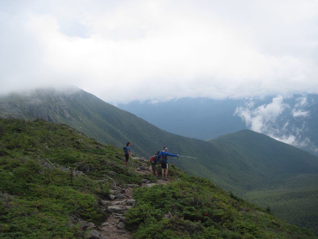
Next up on the Franconia Ridge Trail is the 1.8-mile trek to Little Haystack Mountain. To get there, the route drops back below treeline and joins the Appalachian Trail (AT) at the juncture of the Franconia Ridge and Liberty Springs Trails. Follow the white blazes of the AT as it traverses the ridgeline, culminating in a short, steep climb to the open summit.
On a typical weekend day, the crowds can be intense on top of Little Haystack (44.140476, -71.645905). Consider stopping on a rocky outcropping a little south of the summit proper before the junction of the Franconia Ridge and Falling Waters Trails to take in the view, get a snack, and avoid the masses.
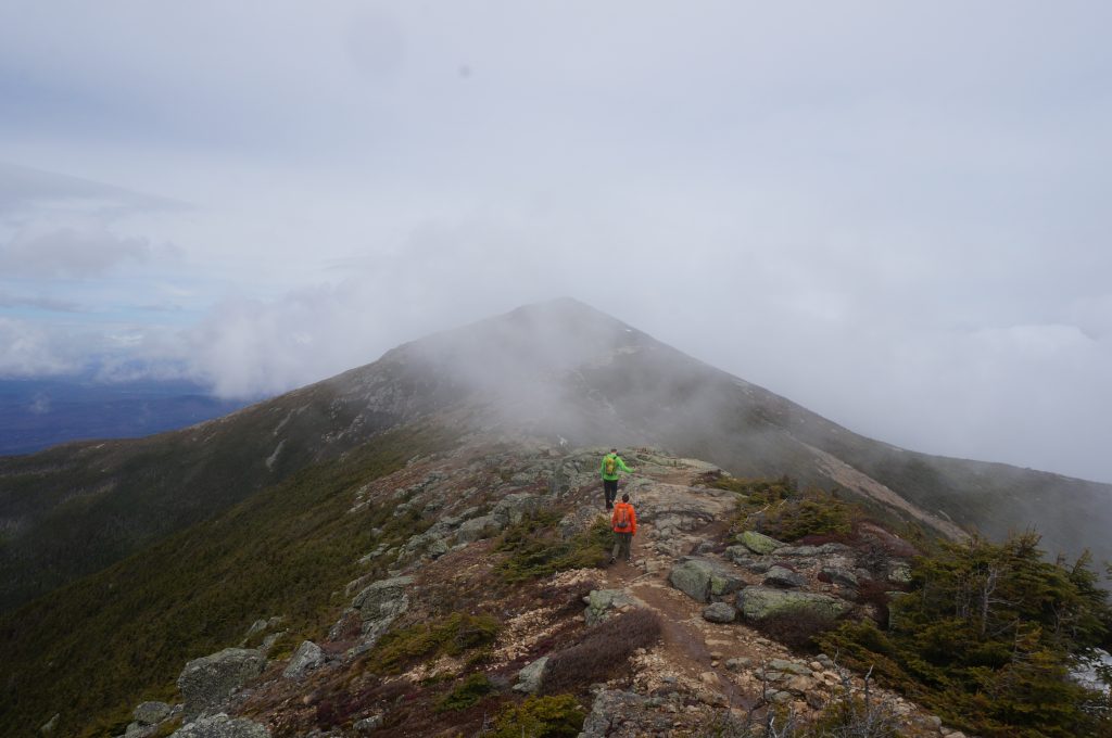
The Franconia Ridge Trail’s 1.7-mile stretch from Little Haystack’s summit to Mount Lafayette’s is among the White Mountains’ most iconic. It is entirely above treeline, with views in every direction. In two pushes, you’ll cross Mount Lincoln (44.148682, -71.644707) and Mount Lafayette (44.160717, -71.644470), the third and fourth 4,000-footers of the day.
Much like Little Haystack, the summit of Mount Lafayette is often crowded on a nice weekend day, with hikers doing the Franconia Ridge loop. Since you’ll be heading in a different direction from most after Lafayette, however, follow the Garfield Ridge Trail for a few minutes to find equally great views, without all the crowds. On a clear day, the view to the west—with Garfield in the foreground, followed by the Twins and the Bonds, and then the Presidentials in the distance—is fantastic.
The Crux
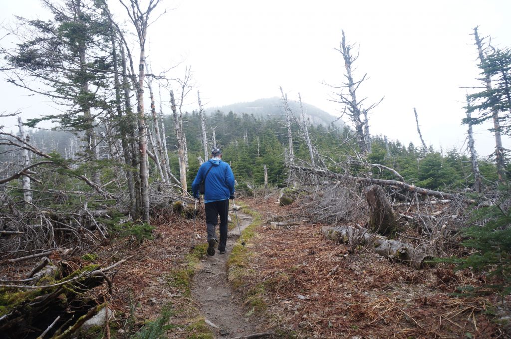
Although the beginning of the Garfield Ridge Trail closely resembles the Franconia Ridge Trail’s best stretches, this 3.7-mile section is the crux of the Pemi Loop’s first half. Dropping sharply before steeply climbing back up toward Mount Garfield’s summit, the trail is rough, and the elevation change is dramatic. Moreover, at this point, the miles are starting to add up—more than 13 so far—and you might be running low on water. Garfield Pond (44.187107, -71.619034), on your left, just before the trail starts heading up again on the final climb to Garfield’s summit, is the first on-route location since leaving Lincoln Woods to refill bottles.
Once you’ve made it to Mount Garfield (44.187298, -71.610764), pause on the open, rocky summit to savor your fifth 4,000-footer in the company of great views in every direction. Look right to admire your traverse across the entire Franconia Ridge. Then, look left to see how much farther there is left to go, with the Twins and Bonds before you. Turn around to admire the Pemi’s far edges and, on a clear day, you can see all the way to Stowe, Vermont.
Pro Tip: Bailing via the Garfield Trail to the trailhead at Gale River Loop Road is pretty straightforward from the col just east of Mount Garfield. That said, you’ll need a car shuttle because you are a long way from the Lincoln Woods trailhead.
Call it a Night
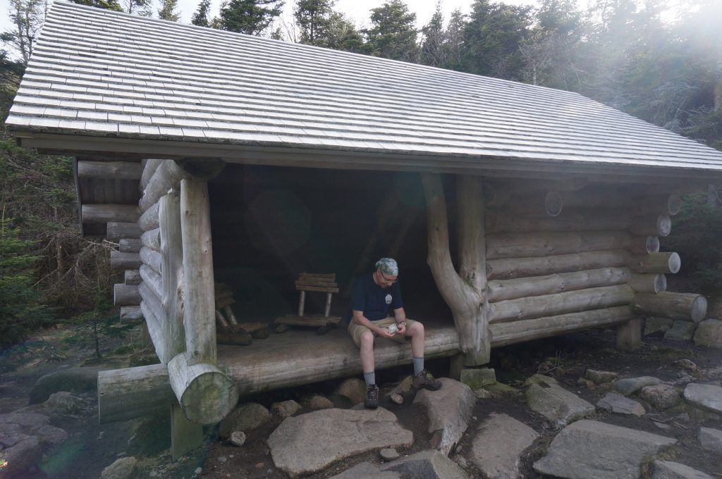
From Garfield’s summit, continue following the Garfield Ridge Trail downhill a short distance to the spur trail for the Garfield Shelter—a three-sided wooden lean-to—and tent site (44.190086, -71.607002) at mile 14.3. For backpackers planning on doing the Pemi Loop over three days, this is the logical place to spend the first night ($15 per person a night). The area is managed by the Appalachian Mountain Club, and space is available on a first-come, first-served basis. However, it tends to fill up on prime hiking weekends.
Even if you’re not staying at the Garfield Shelter, consider filling your water bottles at the spring located at the spur trail’s junction; it’s one of the easiest and best water sources on the whole Pemi Loop.
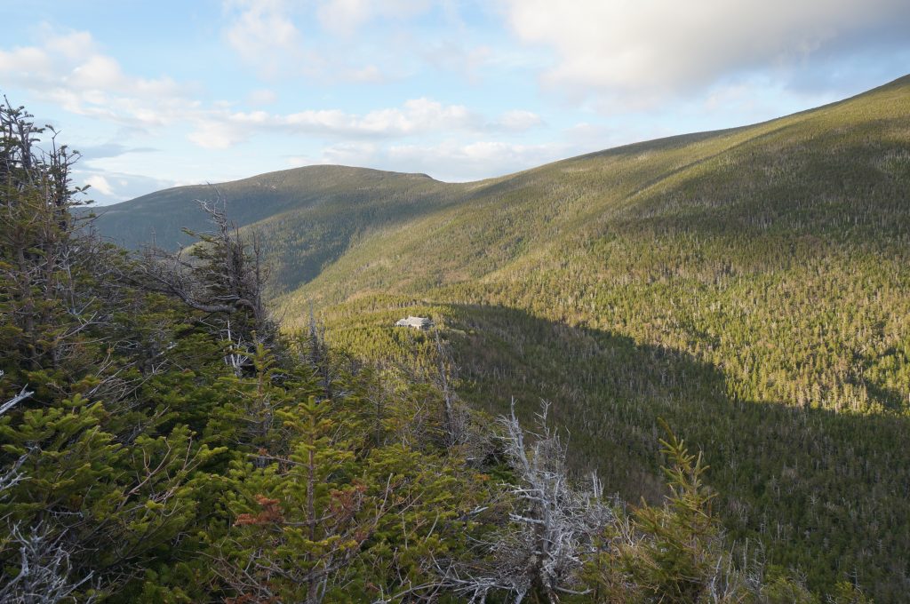
If you’re planning on completing the loop in just two days, push on toward Galehead Hut (44.187927, -71.568810), which is just under three more rugged miles from Garfield’s summit. Also managed by the AMC, this hut is a great option if you’re looking to go light. Although the hut is a more expensive overnight option, during prime hiking season, it comes with a multi-course dinner the night you arrive and a hearty breakfast the next morning. The bunks are comfortable, the food is top-notch, and the cost is considerably more than the shelter. It also has the only real bathroom you’ll see on the trip.
If camping is your preference, the route to Galehead Hut also has a handful of places that meet the White Mountains’ rules and restrictions to pitch a tent (no camping within a quarter mile of any trailhead, hut, or shelter). Don’t camp directly on the trail!
The Halfway Point
Regardless of where you end up staying, Galehead Hut is the trip’s halfway point and is near Galehead’s summit. To get there from the hut, follow the Galehead Spur Trail for 0.4 miles. The trail is quite moderate, especially compared to what you’ve been doing. While the summit (44.185150, -71.573586) is surrounded by trees and has no views, a great overlook near the top offers a spectacular view of the Pemi Wilderness, the Bonds, and Galehead Hut at South Twin’s western base.
The Twinway
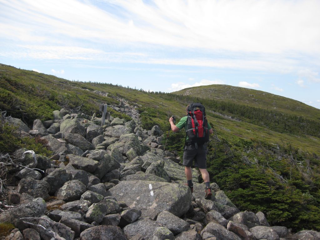
From Galehead Hut, follow the Twinway 0.8 miles to South Twin’s summit (44.187832, -71.554558), the loop’s seventh 4,000-footer. Don’t be lulled by the short mileage, however. This is the loop’s hardest ascent, and is slow-going, thanks to the elevation gain (1,200 feet) and the trail’s roughness. After a day of being above treeline, you’re about to hit some wooded summits—be sure to take a moment to enjoy the view from South Twin before pushing on.
If you’re doing the “full” Pemi, leave your pack just off South Twin’s summit, and take the North Twin Spur Trail, a 2.6-mile roundtrip hike with 750 feet of elevation gain, to the summit of North Twin (44.202591, -71.557816), your eighth 4,000-footer. The traverse to North Twin is fairly moderate, with a couple of rocky steps on the final climb. Once you get there, take a picture at the summit cairn—there’s not much of a view—and backtrack to South Twin.
Once you’ve returned to South Twin, follow the Twinway roughly two miles to the trail junction near Mount Guyot (44.168594, -71.535614). Still feeling ambitious? If so, drop your pack and continue along the Twinway for 1.3 relatively easy miles (2.6 round trip) to Zealand Mountain’s summit and “bag” the journey’s ninth 4,000-footer. Just don’t go to Zealand expecting a sight, as it’s home to one of the most unimpressive summits in the Whites.
The Bonds
If Zealand isn’t in the cards for you, take the Bondcliff Trail at the Guyot junction. From the junction, the trail is briefly above treeline, with fantastic views east into the Pemi, before dropping you at the spur trail for the Guyot Campsite (44.161049, -71.537468).
Guyot Campsite has a 12-person shelter, six four-person tent platforms, and a composting toilet. At 0.2 miles from the trailhead, Guyot is the logical second night for backpackers hiking the Pemi Loop as a three-day trip ($15 per person a night; first-come, first-served). Its spring, which is a little way down the spur trail, is also a reliable place to find water.
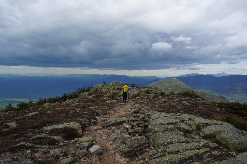
From the Guyot Campsite junction, continue on the Bondcliff Trail a short way to the West Bond Spur Trail (44.158905, -71.537270). This is the “must-do” of the optional summits, and perhaps the hike’s best, making you truly feel like you’re in the middle of the 45,000-acre Pemi Wilderness. So, drop your pack and make this one-mile roundtrip side hike. Ascending a mere 350 feet, West Bond (44.154804, -71.543610) nets you the tenth 4,000-footer of the Pemi Loop. From the summit, you can’t see a road or any signs of civilization, no matter which direction you look.
Back on the Bondcliff Trail, follow it uphill, mainly through the trees, for 0.5 miles before poking above treeline on Mount Bond’s summit (44.152889, -71.531250), the trip’s eleventh 4,000-footer. From Bond’s summit, you get a great view of what lies ahead, as the Bondcliff Trail winds toward the sheer walls of Bondcliff.
Bondcliff
Before leaving Mount Bond’s summit, get your hat, gloves, and windshirt ready. While the 1.2 miles between Mount Bond and Bondcliff are quite scenic (and among the Whites’ most beautiful), they are also either at or above treeline, leaving you exposed to wind and weather. Feeling warm and comfortable will allow you to enjoy the excellent views from the Bondcliff Trail as you approach the loop’s final summit, Bondcliff. No matter if you’re starting to get anxious for the hike to be over, or you don’t want the fun to stop, the numerous false summits on the way to the top can play mind games with even the most resilient of hikers.
On Bondcliff (44.140419, -71.541260), savor the loop’s twelfth (and final) summit—and one of the 48 4,000-footers’ most unique. Aptly named, Bondcliff features sheer cliffs, which make for incredible photos. From the summit, look back, and think about how far you have come, as the entirety of your trip is visible, from Flume to Bond.
Homestretch
You’d think that, with the last summit out of the way, the rest would be easy, but sadly, it isn’t so. From Bondcliff, you’ve got a lengthy 6.2-mile trek along the Bondcliff Trail back to the Lincoln Woods Trail. There’s usually water to be found in the streams along your descent, and if you find yourself running low, it might be a good time to fill up. While the rest is either downhill or on flat ground, it takes a deceptively long time.
The end of the Bondcliff Trail brings you to the Lincoln Woods Trail, the same route on which you started. From here, it’s 2.9 miles along an abandoned railroad. While your legs will enjoy the flat ground, the old ties can interrupt your stride enough to make this last bit harder than it needs to be. After 2.9 miles on the Lincoln Woods Trail, look for the suspension bridge where this wild journey began.
The Kit
- A Sawyer Mini Filter is a small investment for having easy access to potable drinking water.
- If you’re looking to go lightweight and keep your pack as small as possible, the small yet comfortable Exped Ultra 3R Sleeping Mat is a must-have.
- The old adage of “light is right” applies particularly to objectives like the Pemi Loop. The simple and cleanly designed Osprey Talon 44 and Tempest 40 packs both feature just enough space for everything you need with no room for “extras,” keeping your kit pared down and you moving fast.
- After a full day on the trail, you’ll be ready to eat anything, but the last thing you’ll want to do is fiddle with a stove. The MSR WindBurner is lightweight, packable, virtually unaffected by temperatures, and boils water quickly.
- A sun hoody is a perfect choice for hikes like the Pemi Loop, with extended, exposed sections above the treeline. A staple of our summer hiking kits, sun shirts provide simple UV protection, reduce the need for sunscreen and bug dope, and help keep you feeling fresh.
- A UV Buff is another excellent addition to any Pemi Loop gear list. It provides protection from the sun and wind on exposed ridges, and can double as a bandage in an emergency.
Keys to the Trip
- The Pemi Loop is committing and bailing off it can be difficult if you only have one car. From both Garfield and Galehead, it’s possible to drop down to Thirteen Falls in the middle of the Pemi, then hike back to the Lincoln Woods Trail via the Franconia Brook Trail. The trail is another former railroad bed, which provides relatively easy going for the 10+ miles back to your car.
- Although the Pemi Loop is an awesome goal and a great accomplishment, you don’t have to do the whole thing in one go. Break it into two trips by using the Franconia Brook Trail.
- While it’s tempting to soak in the numerous incredible summit views, those doing the hike in two days will want to keep their breaks short, as the days are long to begin with.
- You’ll pass numerous streams on the Bondcliff Trail’s final descent and the East Pemigewasset River on the Wilderness Trail. Those ahead of schedule will love the chance to dip their feet in the cool, refreshing water.
- Although the Wilderness Trail can be the trip’s most tedious part, spend it marveling that it was once part of the White Mountains’ largest logging railroad system.
- We love Wayne’s Market in Woodstock for post-hike sandwiches. Pro tip: Call your order in at (603) 745-8819 as soon as you get cell service, so it’ll be ready and waiting for you.
- If you’ve spent a couple of hot days on the trail, Lady’s Bathtub in Lincoln and Crystal Cascade in Woodstock are great places to take a dip.
- Remember to pack your camera! This is one of the most scenic trips in the Whites.
Pemigewasset Loop Current Conditions
Have you done the entire loop, or even a piece of it, recently? Post your experience and the trail conditions (with the date of your hike) in the comments for others!
Related Posts


Nice info. Thanks.
Instead of paying $3/day for parking, get an annual parking pass for the white mountain national forest for $20 or 2 for $25.
Question: What software did you use for the altitude to sync with the openstreetmaps? thanks.
MKsOrb
[…]very few websites that come about to become in depth beneath, from our point of view are undoubtedly nicely worth checking out[…]