


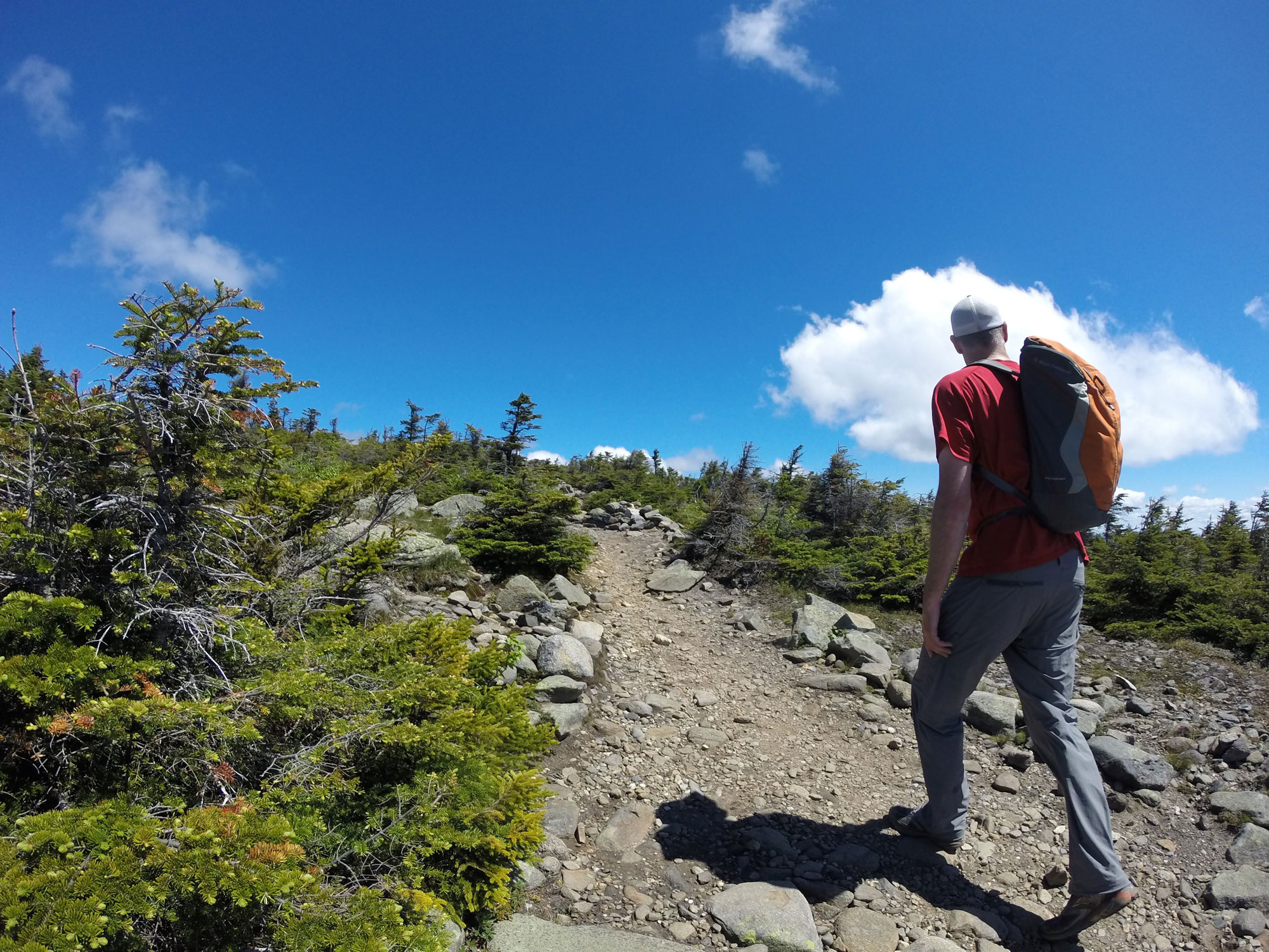
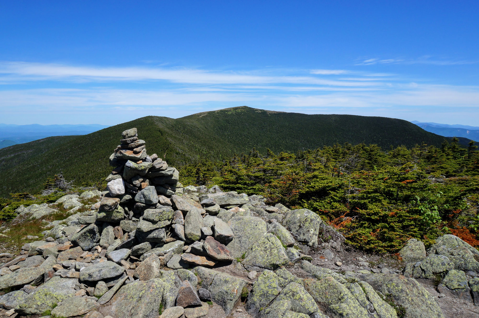
The treeless summit of New Hampshire’s tenth tallest mountain and westernmost 4,000-footer is a stunning and worth prize for peakbaggers.
Taking its name from the Abenaki language, Mount Moosilauke translates to “bald place.” No doubt named after its stunning, treeless, wind-swept summit cone, Moosilauke is a day hiker’s delight, offering a wide variety of trails that will challenge all types of hikers. No matter what direction you summit from, the reward is a stunning 360-degree view—so long as the weather is good.
Turn-By-Turn
Most of the day hikes on Mount Moosilauke leave from four trailheads: the Carriage Road Trailhead, the Ravine Lodge Trailhead, the Glencliff Trailhead, and Beaver Brook Trailhead.
The Carriage Road and Ravine Lodge trailheads are both located off NH Route 118, while the Beaver Brook Trailhead is on NH Route 112. All three are within 15-20 minutes of both Lincoln and Woodstock, New Hampshire.
Getting to the Glencliff Trailhead is a bit more complicated. First, get to NH Route 25 (which runs north-south west of Moosilauke), then turn onto Sanatorium Road. The trailhead is about a mile up the road on the right. A field and a White Mountain National Forest sign are two indicators that you’ve found the right parking lot.
Gorge Brook Trail
Distance: 7.4 miles, 2,450 feet, out-and-back
Time to Complete: Half-day
Difficulty:★★
Scenery:★★★★★
Fees/Permits: None
Contact: https://outdoors.dartmouth.edu/services/ravine_lodge/directions.html
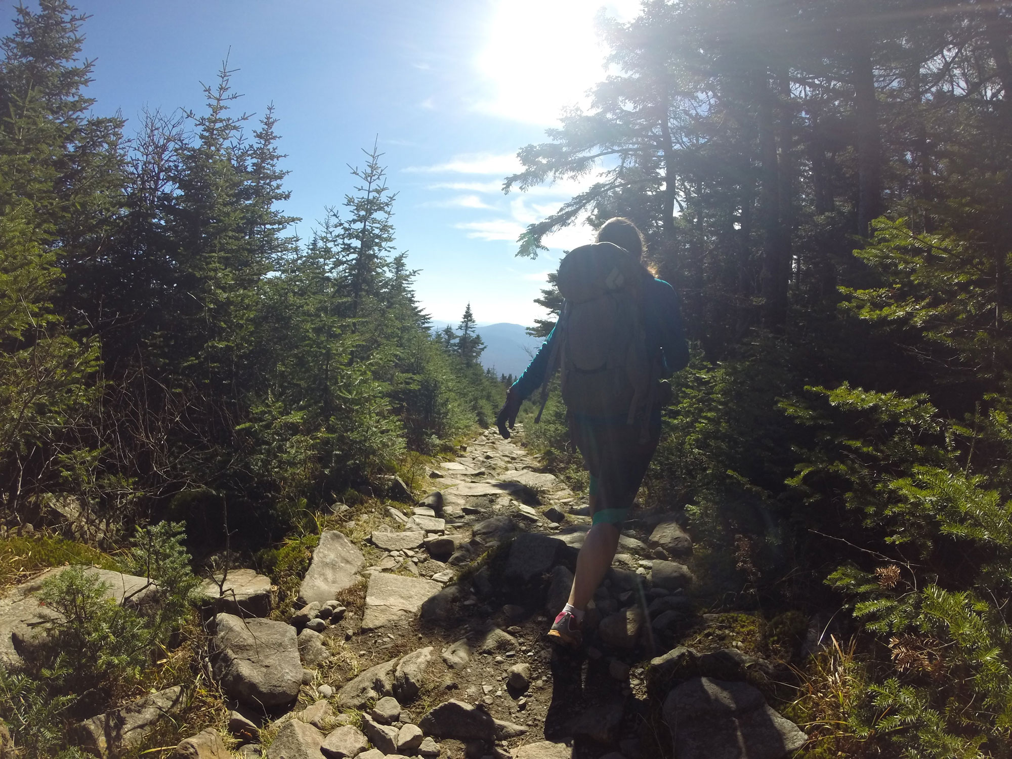
The shortest and most popular way to Moosilauke’s summit, the Gorge Brook Trail begins near Dartmouth College’s Ravine Lodge on Ravine Lodge Road. After crossing a brook on a hikers’ bridge, the trail turns left, then at a well-marked junction, starts climbing alongside Gorge Brook, crisscrossing the brook on a few occasions.
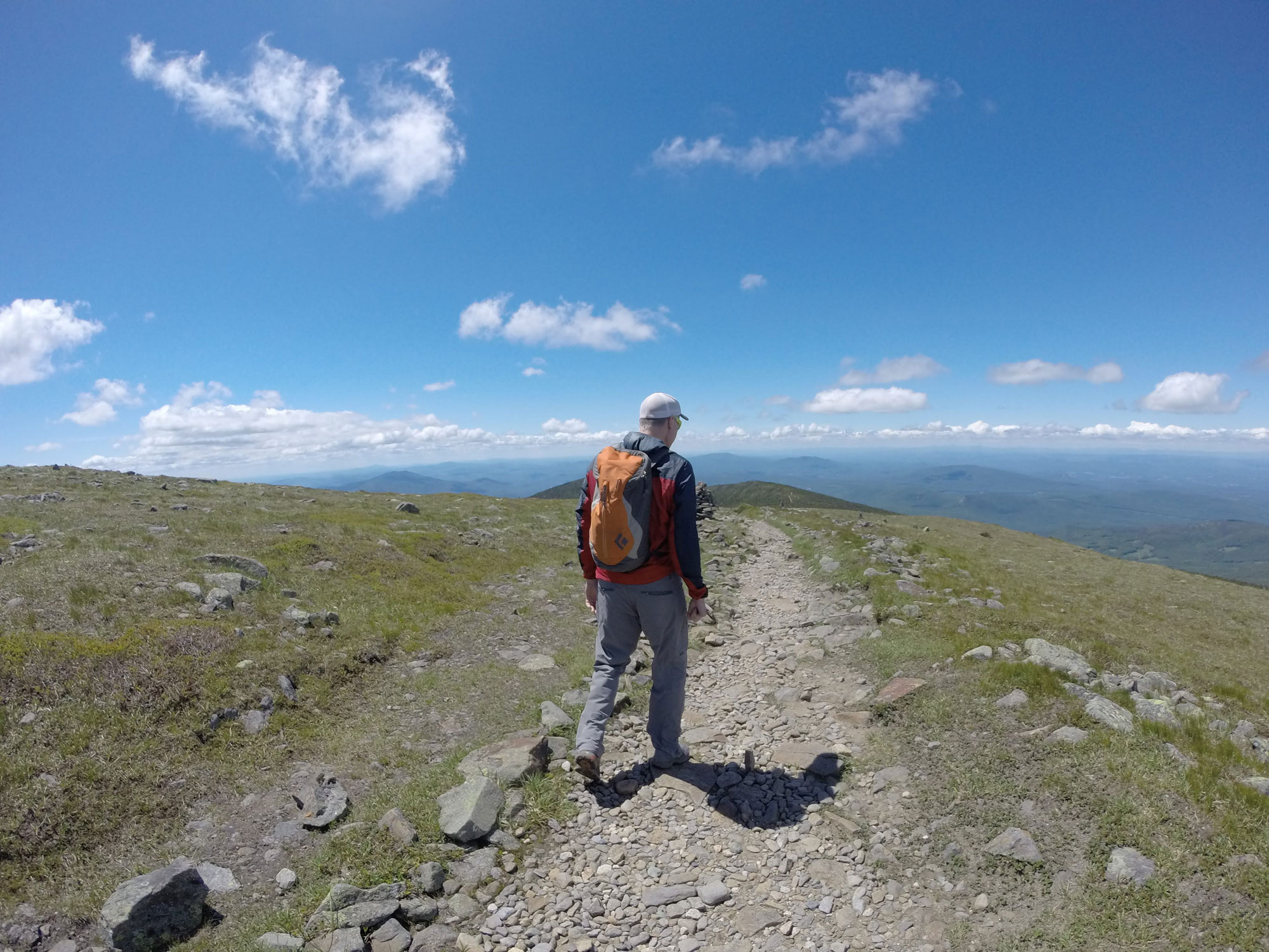
After about 1.5 miles, the trail diverges from the brook near a memorial for Ross McKenny, the Dartmouth Outing Club’s Woodcraft Advisor, and builder of the Ravine Lodge. From here, the trail begins to climb gradually up Moosilauke’s flank through beautiful forest, eventually passing a series of overlooks—one toward the Sandwich Range and then others with fantastic views of Lincoln, Franconia Ridge, and the Kancamagus Highway. Nearer the summit, the trail steeply ascends a series of switchbacks, eventually reaching an open area with excellent views. From here, the trail briefly drops back below tree line before beelining up the summit cone. A short-but-steep, open, and often windy hike across the alpine zone gets you up to the 360-degree views on Moosilauke’s rocky summit. Once you arrive, plop yourself behind one of the many windbreaks, grab a snack, enjoy the views, and relish the 3.7 miles and 2,400 feet of elevation gain that you’ve achieved.
To return to the base, either retrace your steps or, on nicer days, make a fantastic loop by descending via the Carriage Road to the Snapper Trail and back to Ravine Lodge Road. If you do the loop, tag Moosilauke’s South Peak on the way. It’s one of the best sub-peaks in the Whites!
Beaver Brook Trail
Distance: 7.6 miles, 3,100 feet, one way, out-and-back
Time to Complete: Full-day
Difficulty:★★★★
Scenery:★★★★★
Fees/Permits: White Mountain National Forest Recreation Pass ($5/day or $30/annual)
Contact: https://www.fs.usda.gov/recarea/whitemountain/recarea/?recid=74571
The Beaver Brook Trail is the steepest and most challenging trail to Moosilauke’s summit, and is also part of the iconic Appalachian Trail. Ascending 2,700 feet from Beaver Brook Trailhead to Mossilauke’s summit, the trail gains 3,100 cumulative feet in elevation—accounting for the trail’s various ups and downs—over just 3.8 miles.
Leaving the Beaver Brook Trailhead, the trail starts gently, weaving over roots and boulders, and crossing a few bridges before gaining the Beaver Brook Cascades. From here, the trail hugs the Beaver Brook Cascades for the next mile and delivers some of the steepest hiking in the Whites—hiking that is made even more challenging because it is often wet and slippery thanks to mist from the nearby falls. Many of the steepest sections feature wooden steps and iron rungs to aid in the ascent.
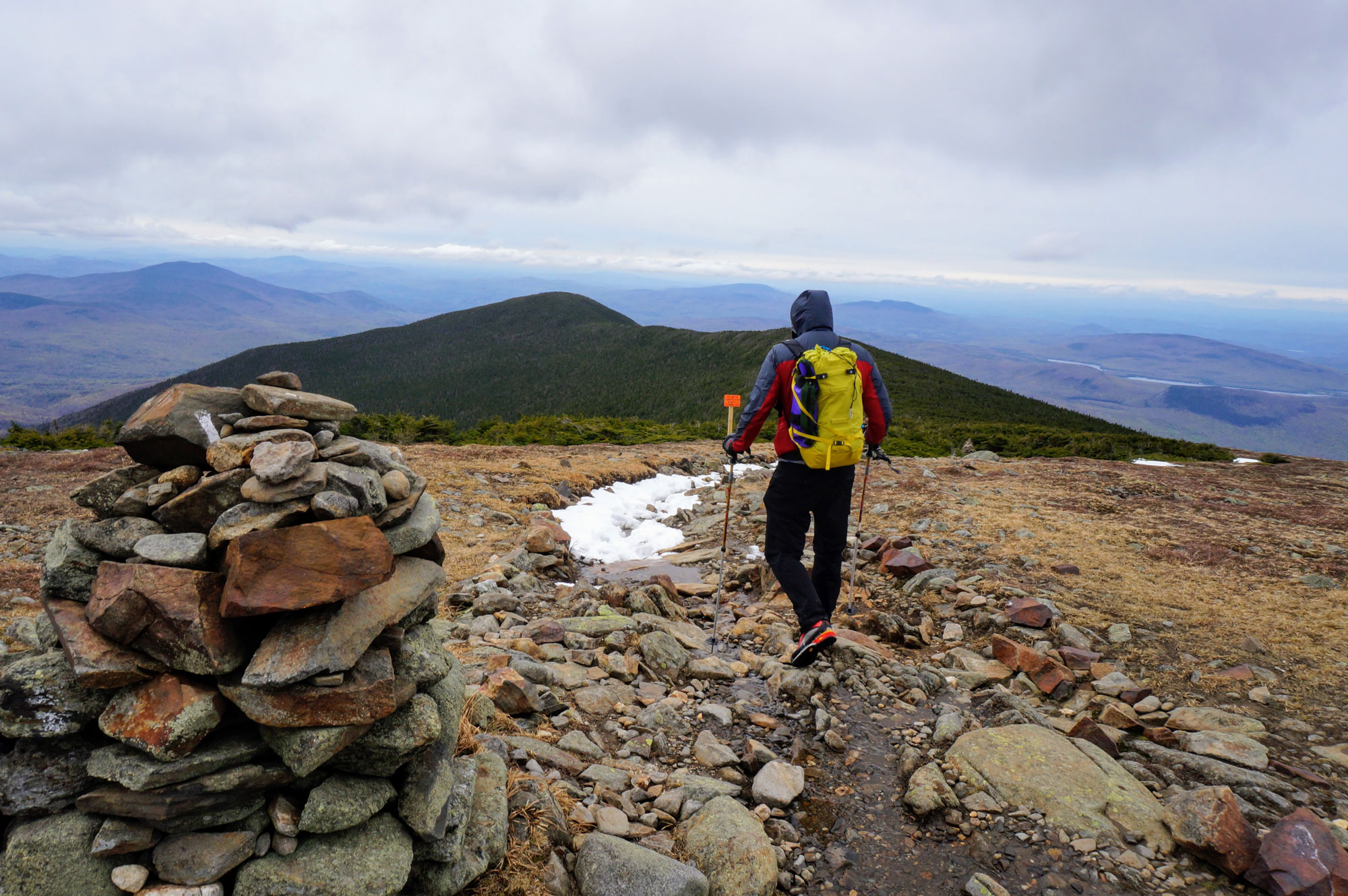
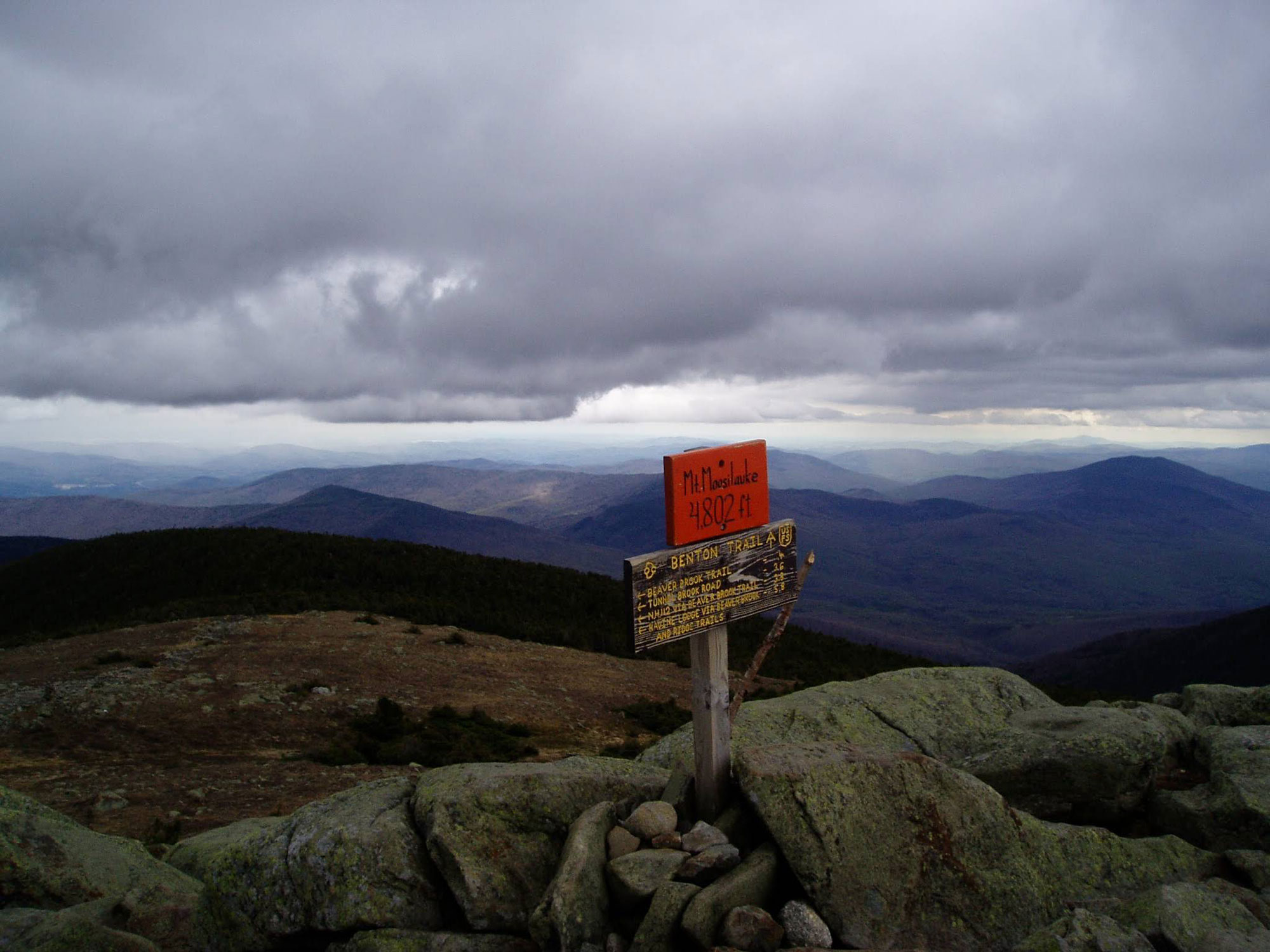
After about 1.5 miles on the Beaver Brook Trail, it intersects with a short spur trail leading to the Beaver Brook Shelter which marks the end of the steepest climbing. After another half-mile of hiking, the trail meets with the Asquam Ridge Trail; Bear right and continue on the Beaver Brook Trail for another 1.5 miles, passing under the summit of 4,529-foot Mount Blue (a non-counting New Hampshire 4,000-footer). From here, the trail converges with the Benton Trail for the final half-mile push across the alpine zone and past large cairns to the summit.
An ascent of Mount Moosilauke via the Beaver Brook Trail is most commonly an out-and-back affair. Use caution on the return trip, though—descending steep terrain on tired legs can be a recipe for disaster.
Carriage Road
Distance: 10.2, 3,100 feet, out-and-back
Time to Complete: Half-day
Difficulty:★★★
Scenery:★★★★★
Fees/Permits: None
Contact: https://www.fs.usda.gov/recarea/whitemountain/recarea/?recid=74571
Constructed in the 1800s, the Carriage Road was built as a means to get visitors to a hotel (the Prospect House, later known as the Tip Top House) that once stood on top of Mount Moosilauke. The Carriage Road is the longest and gentlest of the popular hiking routes to the mountain’s summit—it’s approximately 5 miles long and climbs 3,000 feet.
Hikers begin their journey on the Carriage Road at a small gravel lot on Breezy Point Road that’s notable for the numerous hotels that have stood there, including the Merrill Mountain Home, the Breezy Point House, and the Moosilauke Inn. Although none of the buildings remain today, curious hikers can find remnants of these old buildings with a little searching.
An ascent of the Carriage Road begins benignly. Over the first 1.25 miles, the trail slowly weaves through a low-elevation forest passing pines and birches and gradually picking up elevation then passing over the Baker River before intersecting with the Snapper Trail. Continuing on the Carriage Road, hikers will begin to notice the birches give way to smaller pines with occasional views to their right and at their back. Not long after meeting the Snapper Trail, the trail starts to steepen as it climbs 1.25 miles to its junction with the Glencliff Trail and a short (0.1 mile) spur trail leading to the 4,523-foot South Peak.
From here, it’s just under a mile to the summit with each step bringing you further into the alpine zone, and exposed to the elements, as the krumholz gives way to bare rock before ending at Moosilauke’s bright orange summit sign. Along the way, there are plenty of views, especially west toward Vermont’s Green Mountains—try to pick out Camel’s Hump and Mount Mansfield on the western horizon. It’s common for Carriage Road hikers to return the way the came, enjoying the width and gentle grade of the trail on the descent.
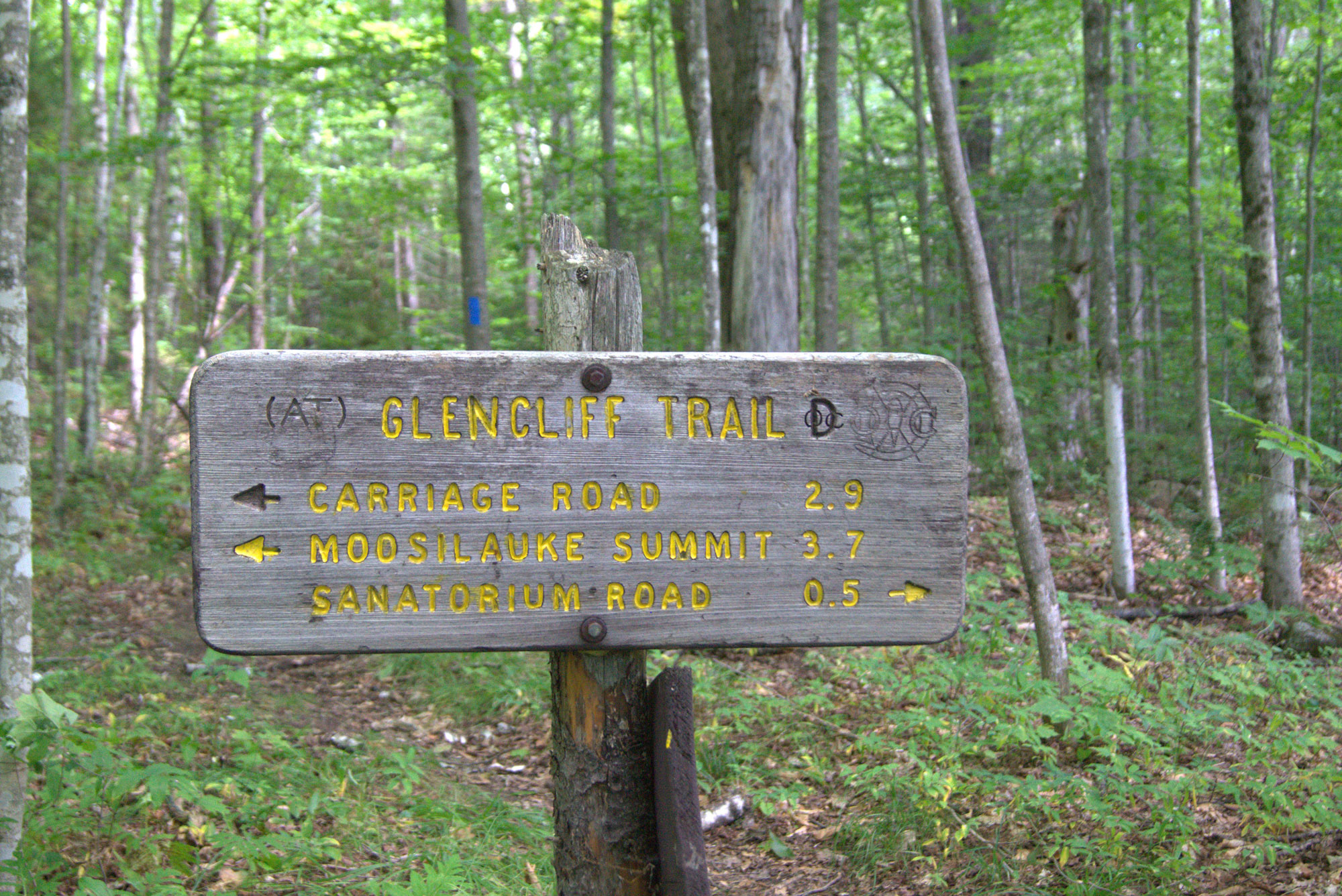
Glencliff Trail
Distance: 7.8 miles, 3,300 feet, out-and-back
Time to Complete: Half-day
Difficulty:★★★
Scenery:★★★★★
Fees/Permits: None
Contact: https://www.fs.usda.gov/recarea/whitemountain/recarea/?recid=74571
Just 4 miles long and gaining roughly 3,300 feet in elevation to Moosilauke’s summit, the Glencliff Trail is a fantastic way to explore the southwest side of Moosilauke. Beginning at a trailhead on Sanatorium Road, the trail is quite moderate for the first mile—starting through grassy fields before gradually ascending through forested terrain of yellow birches and hemlocks.
Thereafter, the trail begins to climb more steeply, while also becoming more rocky and rugged, as it approaches the ridge just below Moosilauke’s South Peak. Atop the ridge (around the 3-mile mark), the trail passes a short spur trail for South Peak—be sure to check it out if you have time—and then joins the Carriage Road almost immediately. From the junction with the Carriage Road, it is another mile up to the summit.
Ascending Moosilauke via the Glencliff Trail is typically done as an out-and-back. Because Glencliff is part of the Appalachian Trail, hikers may well spot some thru-hikers as they head north toward Maine’s Mt. Katahdin or southbound toward Georgia’s Springer Mountain.
Trails Less Traveled
If you’re looking for a bit more solitude on your hike up Moosilauke, consider one of these less-traveled trails.
Asquam Ridge Trail: Those looking for a longer hike from the Ravine Lodge Trailhead should check out the Asquam Ridge Trail. Running 5.8 miles to Moosilauke’s summit, the trail makes a gradual ascent up the northeastern side of the mountain. One highlight of the trail is that just before it connects with the Beaver Brook Trail (at mile 3.9), it passes near the summit of Mount Jim, which at 4,172 feet tall is one of the several non-counting 4,000-footers that surround Mount Moosilauke. Look for a short spur trail to check out Jim’s summit.
Benton Trail: Thanks to the out-of-the-way location of the Benton Trailhead—and some rerouting in the wake of Hurricane Irene—the Benton Tail sees much less traffic compared to Moosilauke’s more popular routes, despite being one of the easiest ways to the mountain’s summit. The 3.6-mile trail follows the route of an old bridle path, accounting for its modest terrain and moderate footing. Hikers on the Benton Trail are also afforded fantastic views of the Kinsmans and Little Tunnel Brook Ravine, before connecting with the Beaver Brook Trail/Appalachian Trail. From here, the trail continues for a half-mile through the alpine zone, guided by impressive cairns, to Moosilauke’s rocky summit.
Snapper Trail: The 1.1-mile long Snapper Trail is a popular connector for hikers looking to make a loop hike out of the Gorge Brook Trail and the Carriage Road. The most popular of these loops is to ascend Moosilauke via the Gorge Brook Trail and descend via Carriage Road, breaking off on to the Snapper Trail and reconnecting with the Gorge Brook Trail a little more than a half-mile before the Ravine Lodge.
Looking for another great way to explore Mount Moosilauke? Skinning up the Carriage Road to Moosilauke’s summit and descending on skis is a classic New Hampshire ski tour. Check it out after the next big winter storm.
The Kit
- Whether it’s spare layers or fuel for your Moosilauke adventure, carry it in comfort (and style) with an Osprey Talon/Tempest daypack.
- Sitting alone on the edge of the Whites and exposed to the full force of the elements, Mount Moosilauke’s summit is notoriously windy. The Black Diamond Alpine Start Hoody (men’s/women’s) offers lightweight and packable protection.
- Similarly, a puffy coat is often welcome on Moosilauke’s summit even during the dog days of summer. The Outdoor Research Ascendant (men’s/women’s) uses a breathable insulation that is perfect for days when you’re trying to stay warm on your scramble back down to treeline.
- Here are 10 great reasons to use trekking poles—and Black Diamond’s Trail Trekking Poles (men’s/women’s) offer the perfect blend of performance and durability.
- Stoke will only power you so far up the mountain. When it starts to wane, refuel with a Honey Stinger Cracker N’ Nut Butter Snack Bar (the peanut butter and milk chocolate ones are our favorite).
Keys to the Trip
- The Last Chair in Plymouth is a great place to stop for a pizza and pint if you’ve been hiking the Glencliff Trail, Carriage Road, or Gorge Brook. Beaver Brook Trail hikers can grab a burger and beer at J.L. Sullivans in Thornton.
- You don’t need to be a Dartmouth student to take advantage of the school’s Ravine Lodge—it’s open to everyone and offers easy access to the Gorge Brook Trail.
- Spend a night on the mountain at the Beaver Brook Shelter, located right off the Beaver Brook Trail. The shelter sleeps eight, and features one of the better privies in the Whites.
- With so many trails criss-crossing Moosilauke’s flanks, make sure you stay on course with map like this waterproof map of the White Mountains.
- Hunt for history and hike to the site of a 1942 plane crash below the Asquam Ridge Trail.
Related Posts


