

The most talked-about hikes in the Northeast share some common characteristics, namely big mileage, lots of elevation, and rough terrain. While mountains such as Washington, Mansfield, and Marcy get most of the glory, the Northeast is home to numerous hikes that might not match the classics in difficulty, but are their equals in history, views, and fun. If you’re looking for a five-star hike everyone in your party will like, look no further. Here are five mountains in the Northeast that anyone can enjoy.
Monument Mountain, Massachusetts
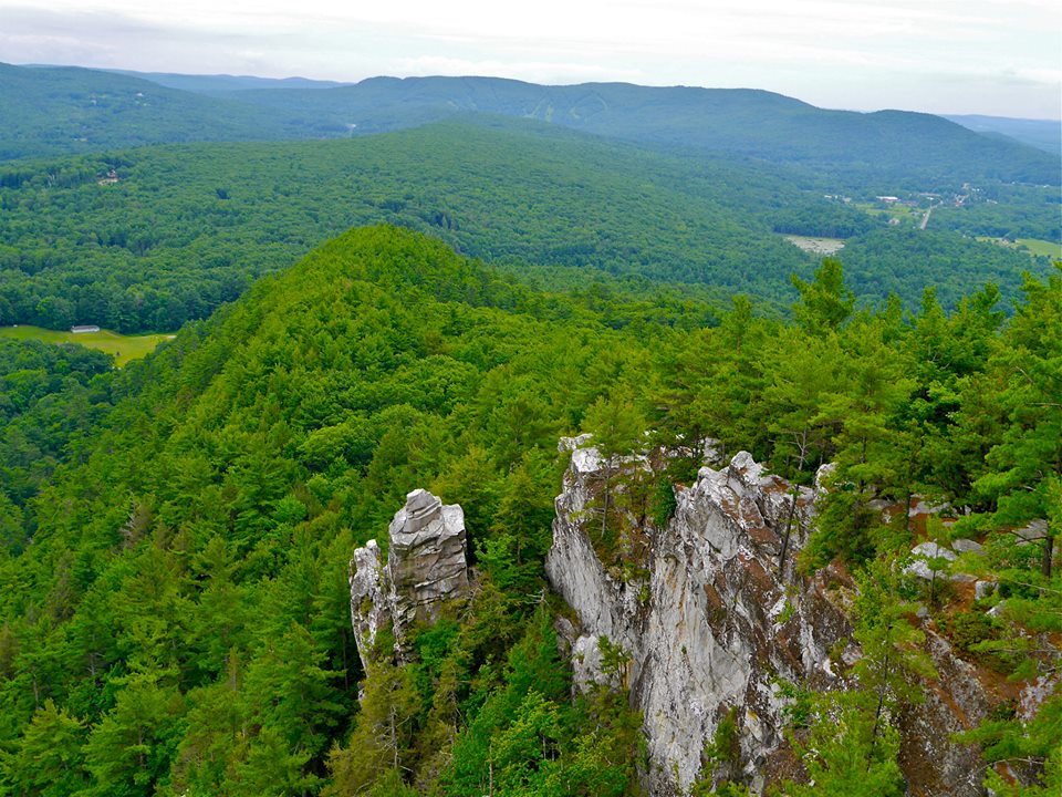
Packing fantastic views of the Housatonic River Valley, Mount Greylock, the Catskills, and Vermont into a roughly three-mile hike should be enough to put Monument Mountain in Great Barrington on any New England hiker’s tick list before even factoring in its fascinating history—it drew literary icons such as Herman Melville and Nathaniel Hawthorne, as well as William Cullen Bryant who wrote the famous poem, Monument Mountain. Bryant’s poem is based on the legend of a Mohican woman who chose to leap from the cliffs rather than marry a husband selected for her. A large pile of stones is piled on the mountain’s southern slope as a monument to her final resting place.
In spite of the grim story of the Mohican maiden, Monument Mountain is a fantastic trip for hikers of all abilities. Covering about three miles, hikers ascend the at-times-steep Hickey Trail, climbing a little over 700 feet through hemlock forests, past boulders, and gaining pale quartzite cliffs. For the best views, connect with the Squaw Peak Trail and follow it over steep cliffs and ledges to the 1,642-foot summit of Squaw Peak, then make the short five-minute walk to take in the view of Devil’s Pulpit, a unique rock formation. From the summit of Squaw Peak, hikers can take the Indian Monument Trail which follows an old carriage road for a mild descent, or continue on the Squaw Peak Trail to its connection further down with the Indian Monument Trail.
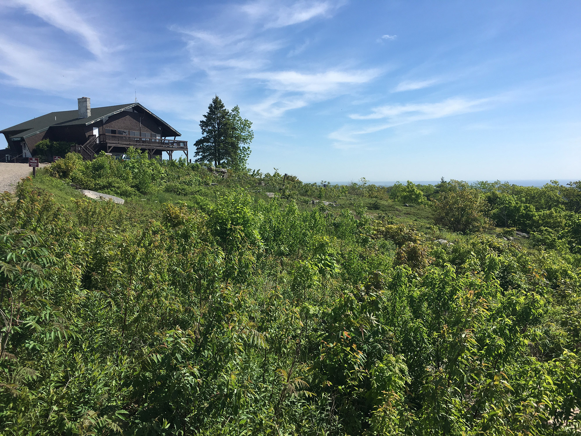
Bald Mountain and Artists Bluff, New Hampshire
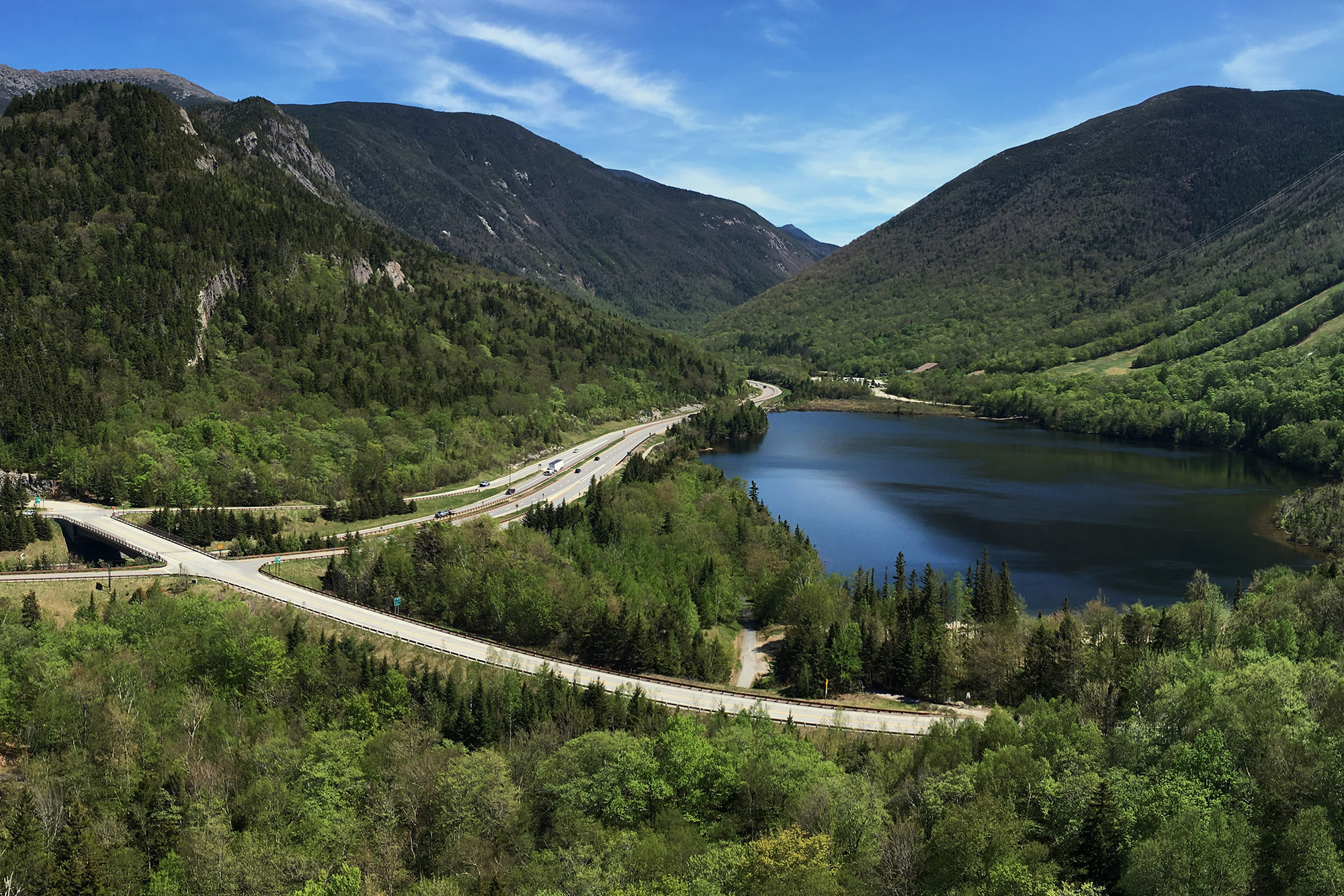
Don’t let the relatively slight 2,340-foot elevation of Bald Mountain and Artists Bluff dissuade you from this must-do hike—the views are huge. Situated at the northern end of Franconia Notch, a hike to the summit of Bald Mountain and Artists Bluff treats hikers with two of the White’s best viewpoints, both offering incredible perspectives of Franconia Ridge and the towering Mount Lafayette, Eagle Cliff, Cannon Mountain Ski Area, and Echo Lake.
At just under three-miles roundtrip, Bald Mountain and Artists Bluff is a popular trip for hikers of all abilities. However, don’t let the moderate mileage lull you into thinking this hike is easy; like many classic White Mountain hikes, sections of the trail are direct and rocky. Leaving from the parking lot adjacent to Cannon Mountain’s base lodge, take Artists Bluff Trail for about a quarter-of-a-mile, follow a short spur trail to the summit of Bald Mountain. After soaking in Bald Mountain’s impressive views, backtrack to the Artists Bluff Trail, continuing along on it to an open ledge and more best-in-the-White’s views. Once you’ve had your fill of the spectacular scenery, continue hiking on the Artists Bluff Trail. As you near the road, look for the Loop Trail which will bring you back to your car.
Mount Philo, Vermont
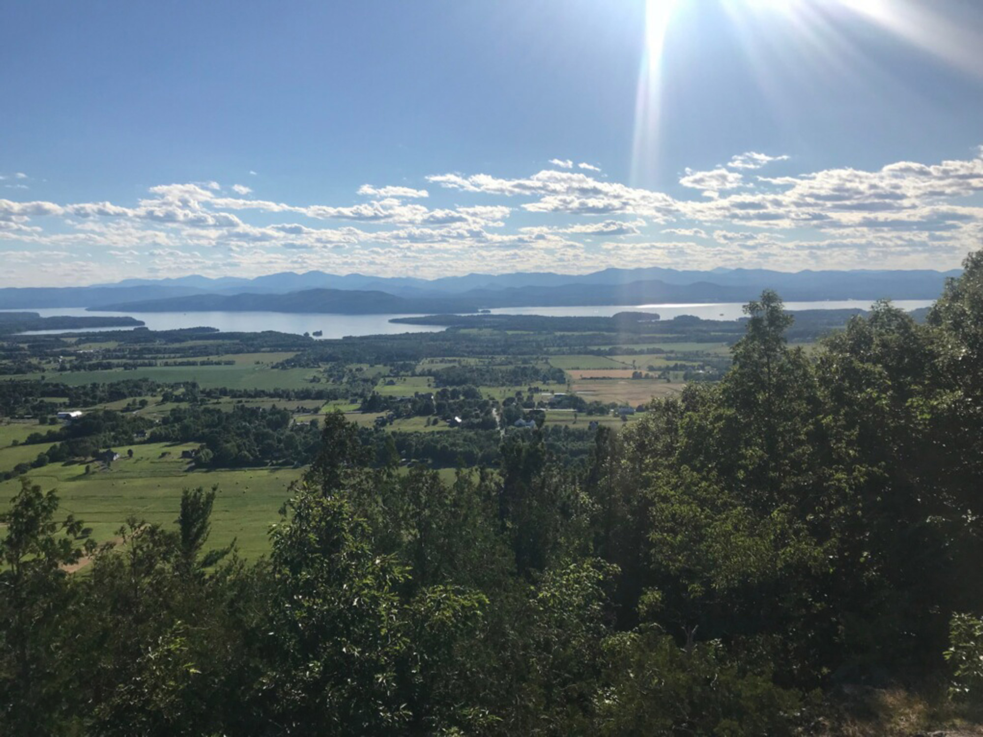
Standing at just 968 feet tall, Mount Philo is diminutive when compared to Green Mountain giants like Mount Mansfield and Camel’s Hump, but towers over the Champlain Valley. Like its bigger brethren, Mount Philo has been a popular recreational destination for over a century (Mount Philo State Park was Vermont’s first state park), and at one point, a carriage road wove its way to the top. Look closely and you’ll see traces of the old carriage road from today’s paved road to the summit. In fact, the paved road makes Mount Philo the perfect destination for groups of mixed ability; ambitious hikers can take the trail to the summit while non-hikers meet them on top by taking the road.
Hikers heading to the summit of Mount Philo should follow the blue blazes of the Mount Philo Trail. The twoish-mile round-trip hike gains approximately 600 feet in elevation as it winds through quintessential Vermont forest and exposed rocks. From the summit, hikers are treated to splendid views of Lake Champlain and the Adirondacks—including Mount Marcy—to the west while the peaks of the Mad River region (Mounts Abe and Ellen) dominate the view to the southeast. Fall is a favorite time to take a trip to Mount Philo, not only because it’s resplendent during foliage, but also to watch migrating raptors. Mount Philo holds the record for the most hawks seen in one day in Vermont (3,688).
Hadley Mountain, New York
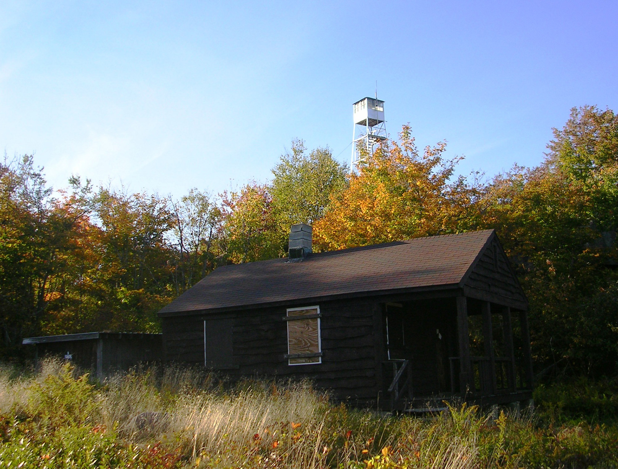
Take in the magnificent views of Sacandaga Lake, the Green Mountains, the Catskills, and the Adirondacks from the 2,675-foot summit of Hadley Mountain while ticking a tower off of your ADK Fire Tower Challenge. The 40-foot fire tower gracing Hadley Mountain’s summit was originally erected in 1917, but was closed in 1990 by the Department of Environmental Conservation. Shortly after the closure, the Hadley Mountain Fire Tower Committee was formed and began working on restoring the tower, as well as the observer’s cabin. Thanks to their efforts, hikers today can climb to the top of the fire tower and take in a view not all that different from the one had by the early observers 100 years ago.
Climbing roughly 1,500 feet while covering 3.6 miles, the trip to the summit of Hadley Mountain and back is short, but packs a punch. As straightforward as a trip gets, summit-bound hikers need only follow the red trail markers of the Hadley Mountain Trail to the summit and then return the way you came. The trail remains fairly steep for almost the entirety of the climb, but be sure to save some energy for climbing the stairs to the top of the tower—it’s worth it. If hiking Hadley Mountain in the summer, you’ll likely run into the summit steward who’s there to answer any questions you might have about the mountain and its history.
Mount Agamenticus, Maine
The confluence of mountains and ocean has led generations of adventurers to explore the rugged Maine coastline. Used as a landmark by mariners to aid in navigation for centuries, Mount Agamenticus’ earliest explorers were indigenous people—the name Agamenticus is derived from the Abenaki name for the York River. Legend has it that Saint Aspinquid, a local Indian chief, either a MicMak or Penobscot leader, converted to Christianity and spent his life spreading Christianity to different tribes. A cairn on the top of Mount Agamenticus was constructed as a tribute to Saint Aspinquid—it’s said that anyone adding a stone to the cairn is blessed with good luck.
Unlike most mountains, the best trail on Mount Agamenticus doesn’t lead to its summit, rather it runs around the mountain. The Turtle Loop is a twoish-mile loop circling the base of the remnants of the 220 million-year-old volcano that is Mount Agamenticus. Featuring 15 interpretive stations, hikers are able to educate themselves on the area’s natural, geologic, and cultural history. If you simply must tag the top of Mount Agamenticus, the approximately quarter-mile-long Blueberry Bluff Trail leads from the Turtle Loop to the summit where you’ll enjoy views of Cape Elizabeth, the Isles of Shoals, and the White Mountains—including Mount Washington.
Do you have a favorite hike that is ideal for hikers of all abilities? If so, let us know in the comments below so we can check it out.
Related Posts


